Boston Planners Begin Outreach for Mass. Ave. Upgrades In Dorchester
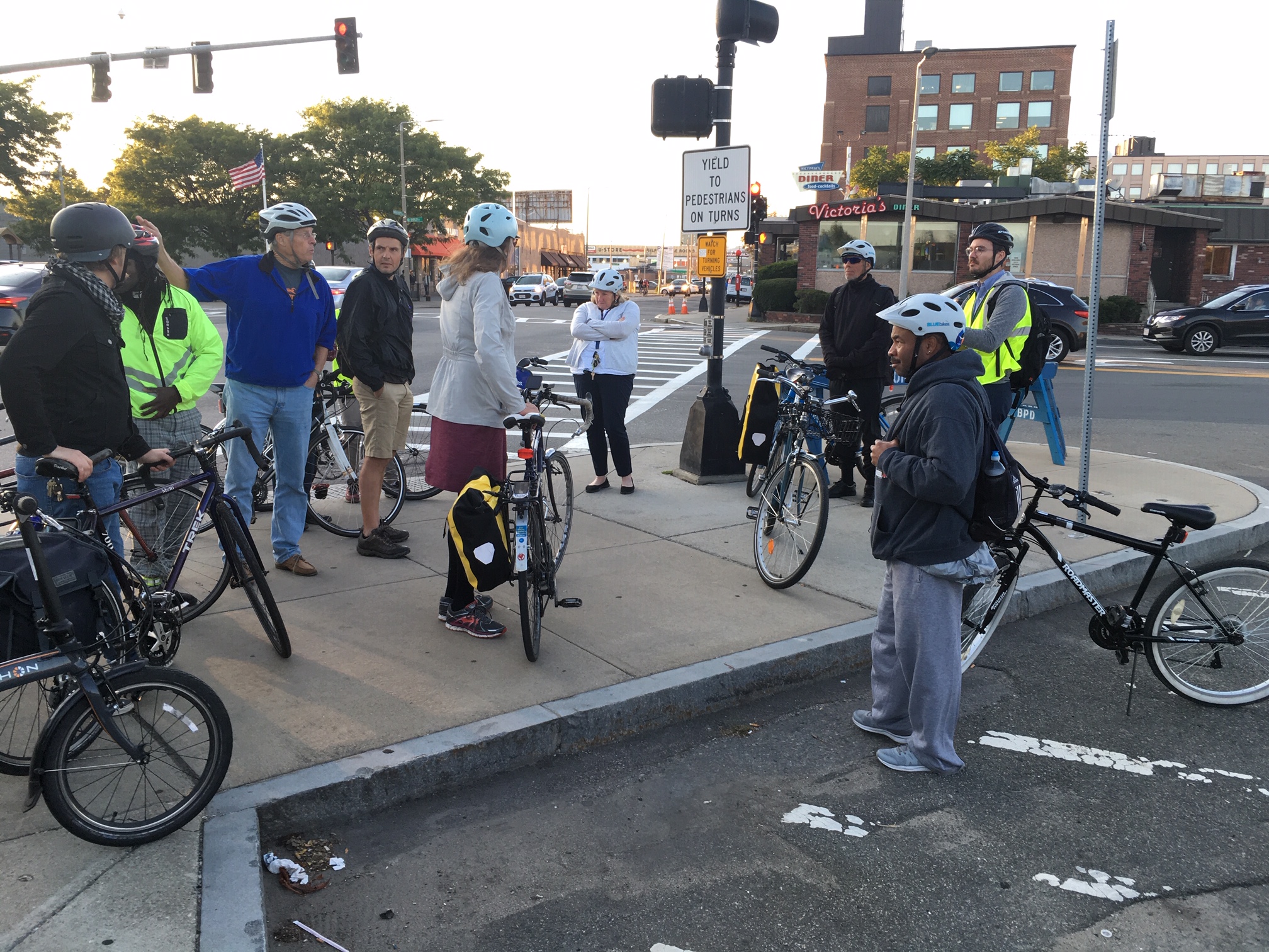
A group of bicycle users discuss the section of Massachusetts Avenue near the Newmarket MBTA station with City of Boston transportation planners during a group ride on Sept. 18, 2019.
On Saturday, the City of Boston will host its second community walk and bike ride with city transportation planners to discuss safety upgrades to Massachusetts Avenue between Melnea Cass Boulevard and Columbia Road at Edward Everett Square, a corridor that was identified as a top short-term priority for better bike lanes and crosswalks in the GoBoston 2030 plan.
The city's "Mass. Ave. South Better Bike Corridor" traverses a predominantly industrial district, with heavy volumes of truck traffic, between the South End and Dorchester. Near its midpoint, the corridor passes by the Newmarket station on the MBTA's Fairmount Line and a neighborhood of hundreds of new apartments that are being built at the South Bay Center shopping mall.
The feedback from these community walks and bike rides will ultimately inform future planning and design work led by private consultants under a contract that was put out to bid this summer (read our previous coverage on that contract here).
The city's "request for proposals" for that consulting work specifies that Massachusetts Avenue, along with several other corridors, should become “high-comfort” bike routes that “follow the principle of separating bicyclists from high-speed, high-volume vehicle traffic,” while also improving pedestrian access, safety, and comfort.
While most of Massachusetts Avenue in this area is very wide and offers plenty of space to install protected bikeways, there are two areas along the corridor where compromises may be necessary.
On the city's first outreach walk and bike ride, on the evening of September 18, about 20 bicyclists and pedestrians set out in separate groups to tour the corridor with members of the city's transportation planning staff, with a particular focus on those two areas.
The bicycling group's first stop was the Newmarket commuter rail station, where Massachusetts Avenue narrows to a tight four-lane cross-section to pass under the Fairmount Line. Adding a bikeway would likely require the removal of a motor vehicle travel lane under the viaduct.
Immediately to the north of the rail viaduct lies a broad intersection (pictured above) next to the commuter rail station entrance. There, careful intersection design will be required to protect the area's growing volumes of bike and pedestrian traffic from truck traffic bound to and from the warehouses around Newmarket Square.
The ride's biggest point of controversy, though, concerned the city's preliminary ideas to move northbound cyclists across the short one-way section of Massachusetts Avenue immediately south of Melnea Cass Boulevard, where northbound vehicles are detoured to Southampton Street via Theodore Glynn Way.
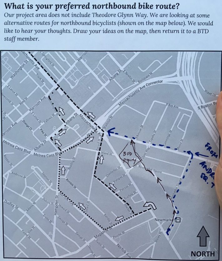
The city's planners on the ride stated that adding bicycling facilities on Theodore Glynn Way was "outside the scope" of the project. They also expressed doubt about the feasibility of installing a contraflow bike lane or a protected, two-way facility on the one-way section of Massachusetts Avenue, where there are several drive-through businesses and multiple curb cuts.
Planners handed out maps of the area (pictured above) and asked participants to evaluate alternative routes, but several riders expressed skepticism whether people would actually use those detours.
Eliza Parad, Director of Organizing for the Boston Cyclists' Union, who didn't attend the Sept. 18 ride but had a chance to review a copy of the city's handout on Thursday, also expressed disappointment about the city's proposed detours.
"It would be great to have additional facilities on other streets like Southampton, but the commitment from the city, as we understood it, was for bike facilities on Massachusetts Avenue," said Parad in a phone interview on Thursday. "It’s the most direct route, and the streets they’re talking about diverting cyclists to, there’s not a lot of foot traffic or eyes on the street. We've heard from a lot of people, especially women, who don’t feel safe being alone, whether they're walking or biking, on those industrial side streets."
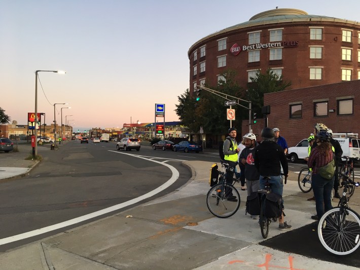
Ride participants also discussed the complex 5-way intersection of Melnea Cass Boulevard, Southampton Street and Massachusetts Avenue, which ranks as one of the city's most dangerous intersections and was the site of another pedestrian fatality this June.
While the "better bike corridor" project is several years from implementation, the city is taking small steps to improve safety at that intersection in the shorter term. In an email Thursday evening, the Boston Transportation Department reported that the city and MassDOT are currently partnering on upgrades to that intersection's curb ramps to make crosswalks accessible to wheelchair users, and installing new pedestrian crossing signals to enable safe crossings for the visually impaired.
The reconstruction of Melnea Cass Boulevard, which is now anticipated to begin next spring, is also expected to calm traffic and improve pedestrian safety on the southwestern approach to that intersection.
The city's contracted planning and design work for Massachusetts Avenue is anticipated to be complete by 2022.
Meeting information:
Mass. Ave. Community Walk and Bike Ride
Saturday, October 5, 2019, at 10:30 a.m. (rain date: Sunday, October 6, at 2:30 p.m.)
Meet at the corner of E. Cottage Street and Columbia Road, across from the pear sculpture in Edward Everett Square.
By transit: 0.5 miles west of the J.F.K./UMass Red Line station, or take buses 8 or 16.
Helmets will be required for participants in the bike ride. The city can provide bikes and helmets for participants who register with advance notice.
Stay in touch
Sign up for our free newsletter