The viaduct for the Somerville Community Path extension soars over the future Green Line tracks in Somerville’s Inner Belt neighborhood.
On Thursday, Governor Charlie Baker, Lieutenant Governor Karyn Polito, Transportation Secretary and MassDOT CEO Stephanie Pollack, MBTA General Manager Steve Poftak, and other state officials toured the Green Line Extension construction site and announced that the project was 50 percent complete, and on schedule to open by the end of 2021.
Meanwhile, your Streetsblog editor skipped the press event and instead took a bike ride to document what a half-finished light rail line looks like.
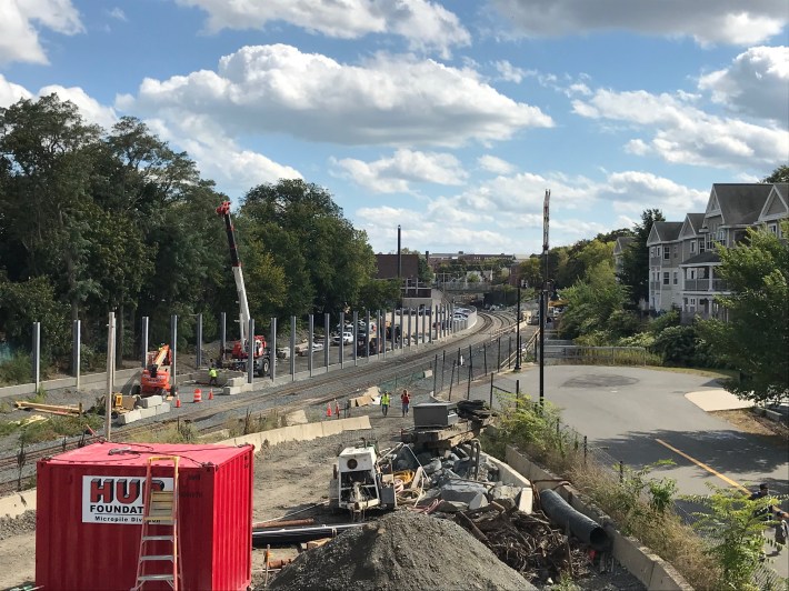
The Green Line Extension will eventually extend to College Avenue in Medford at the Tufts University Campus, but I started my tour at Ball Square, the penultimate stop, where the foundations are being laid for a new station just over the Medford city line. According to MBTA plans, one station entrance will descend from the Broadway overpass in Somerville, just to the right of this photograph's vantage point; a second access point will approach the platforms from Boston Avenue in Medford, visible on the left edge of this photo:
(click any photo in this post to enlarge)
The Ball Square Green Line station in the City of Medford, shown under construction on Oct. 1, 2020.The Ball Square Green Line station in the City of Medford, shown under construction on Oct. 1, 2020.
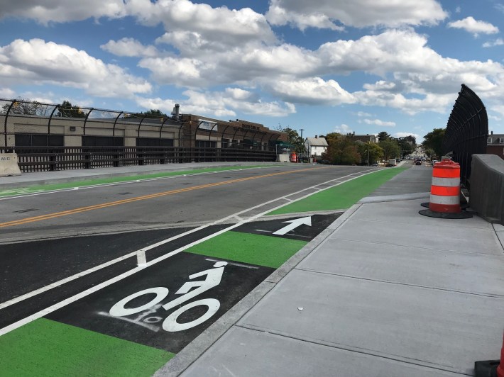
The Green Line's contractors also recently opened the new Broadway overpass, which carries a pair of new buffered bike lanes into Ball Square:
The new Broadway overpass in Ball Square is open to traffic, with buffered bike lanes.The new Broadway overpass in Ball Square is open to traffic, with buffered bike lanes.
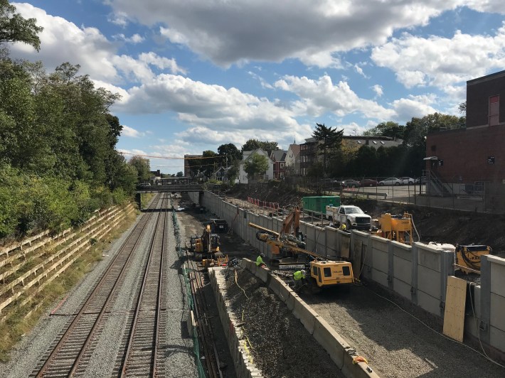
Continuing south, foundations are also being laid for the new Magoun Square station platforms, which will be accessed via an elevated walkway from the Lowell Street overpass. According to the MBTA's plans, the new Green Line tracks will straddle the station platform, visible below:
The Magoun Square station under construction, seen from Lowell Street, on Oct. 1, 2020.The Magoun Square station under construction, seen from Lowell Street, on Oct. 1, 2020.
Just east of Lowell Street and the Magoun Square station, the Somerville Communty Path, the local segment of the Mass. Central Rail Trail, meets the future Green Line.
As part of the Green Line Extension project, that path will be extended from Lowell Street to the new Lechmere station, where developers have already built another segment of pathway to the Charles River (more on that below).
A view east from the Lowell Street overpass next to the future Magoun Square station entrance, with the Central Street overpass visible in the distance. From here, the existing Community Path (at lower right) will be extended eastward along the future Green Line tracks.A view east from the Lowell Street overpass next to the future Magoun Square station entrance. From here, the existing Community Path (at lower right) will be extended eastward along the future Green Line tracks.
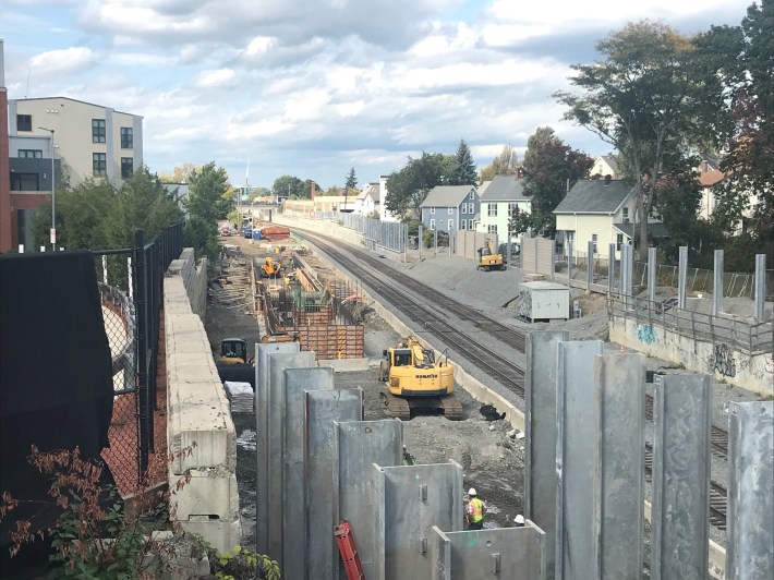
A view of the Green Line Extension under construction from the Central Street overpass, looking southeast. The new Community Path will cross Central Street here, and continue along the top of the retaining wall at right to cross both Sycamore Street and School Street, the two overpasses visible in the distance.A view of the Green Line Extension under construction from the Central Street overpass. The new Community Path will cross Central Street above the Green Line here, and continue along the top of the retaining wall visible at right to cross both Sycamore Street and School Street, the two overpasses visible in the distance.
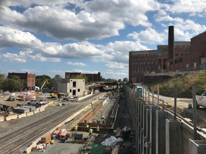
A view of the Gilman Square station under construction from the School Street overpass on Oct. 1, 2020. The concrete structure to the left of the tracks will be a power substation, and the Community Path will run along the embankment at the right of this photo.A view of the Gilman Square station under construction from the School Street overpass on Oct. 1, 2020. The concrete structure to the left of the tracks will be a power substation, and the Community Path will run along the embankment at the right of this photo.
At this point in my bike tour, it became considerably more difficult to follow the future Green Line Extension on my bike, because just east of Gilman Square, the future Green Line parallels the McGrath Highway, a major barrier to bike riders and pedestrians in East Somerville.
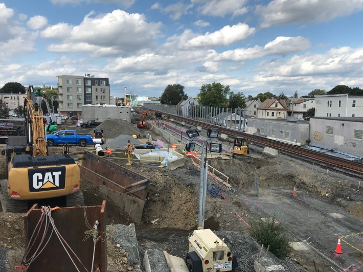
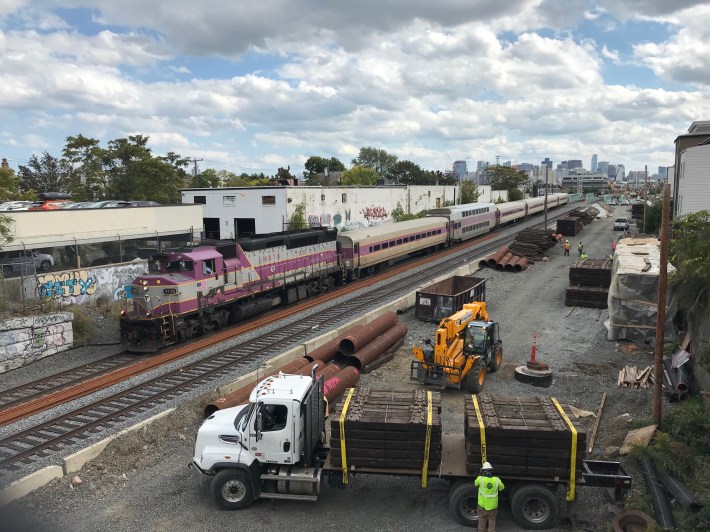
The Green Line Extension under construction next to a Lowell Line commuter rail train, seen from the Cross Street overpass in East Somerville on Oct. 1, 2020.The Green Line Extension under construction next to a Lowell Line commuter rail train, seen from the Cross Street overpass in East Somerville on Oct. 1, 2020.
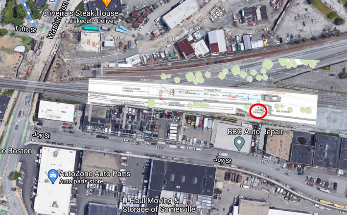
Without the Community Path, the station area is completely inaccessible, so, in lieu of a photograph, here's a photo mosaic of the station plans overlaid on a Google Map aerial view of the station area:
The planned East Somerville station, overlaid on a Google Map view of the Inner Belt. The station's lone entrance (circled in red) will be located 500 feet from Washington Street.The planned East Somerville station, overlaid on a Google Map view of the Inner Belt. The station's lone entrance (circled in red) will be located 500 feet from Washington Street.
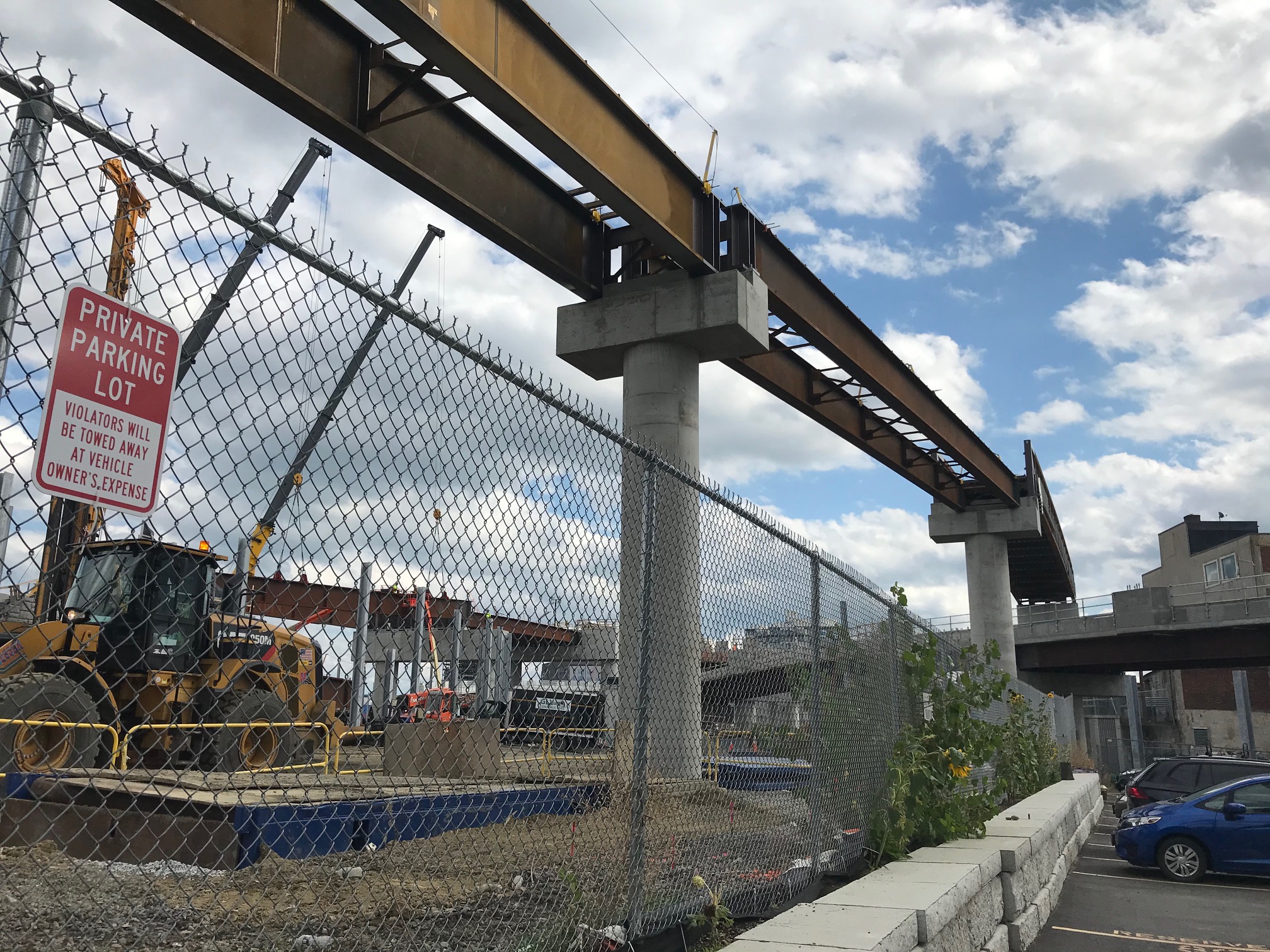
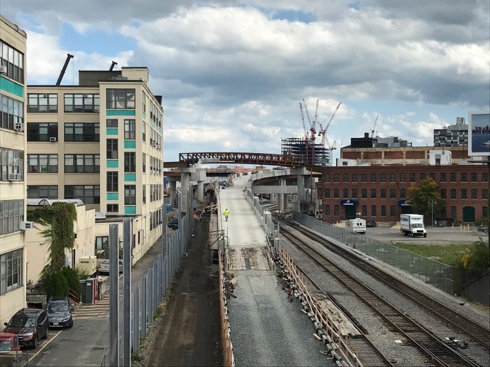
A few blocks to the east, another McGrath Highway overpass offers this view of the new Green Line's other branch, which will follow the Fitchburg Line commuter rail tracks to Union Square. Also visible here against the skyline is the high truss that will carry the Community Path over the tracks:
A view east from the McGrath Highway shows the future path of the Union Square branch of the Green Line extension (center, foreground) and the truss viaduct of the Community Path. In the background is the junction where the two branches of the Green Line extension will meet.A view east from the McGrath Highway shows the future path of the Union Square branch of the Green Line extension (center, foreground) and the truss viaduct of the Community Path. In the background is the junction where the two branches of the Green Line extension will meet.
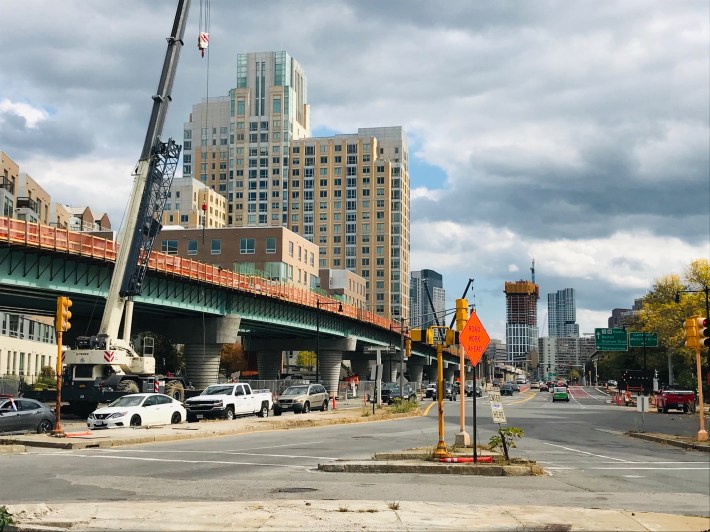
Crossing the city line into Cambridge, the two branches of the new Green Line will join together and run over a new Lechmere viaduct:
The new Lechmere Viaduct, looking towards the Charles River Dam. The new Lechmere Green Line station will be located on this viaduct, with public plazas and sheltered bike parking beneath.The new Lechmere Viaduct, looking towards the Charles River Dam. The new Lechmere Green Line station will be located on this viaduct, with public plazas and sheltered bike parking located beneath.
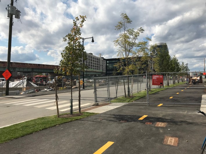
Nearby, I was pleasantly surprised to find that the developers of the Cambridge Crossing project have already built a significant section of the new Community Path, which is open for riding all the way from the future Lechmere station area to North Point Park on the Charles River waterfront:
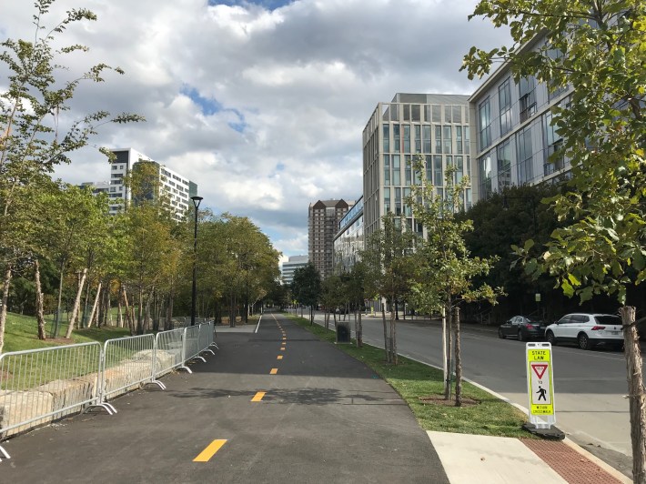
In the new Cambridge Crossing development, just north of the Lechmere viaduct, developers have already built a 300-meter section of the Community Path between North Point Park and First Street, next to the future Lechmere station. This photo shows the new path looking northwest, towards the yet-to-open viaduct.In the new Cambridge Crossing development, just north of the Lechmere viaduct, developers have already built a 300-meter section of the Community Path between North Point Park and First Street, next to the future Lechmere station. This photo shows the new path looking northwest, towards the yet-to-open viaduct.
The new Community Path through the Cambridge Crossing development traverses the edge of a new public park (at left) on its way to the Charles River at North Point Park.The new Community Path through the Cambridge Crossing development traverses the edge of a new public park (at left) on its way to North Point Park.
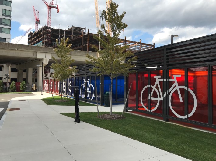
The new "Hult House" apartment building, located next to the Gilmore Bridge, includes two large sheds for secure bike storage, plus a public repair station, just a block away from the Community Path near North Point Park.The new "Hult House" apartment building, located next to the Gilmore Bridge, includes two large sheds for secure bike storage, plus a public repair station, just a block away from the Community Path near North Point Park.