The Morrissey Marshes: Where Boston’s Climate and Transportation Challenges Collide
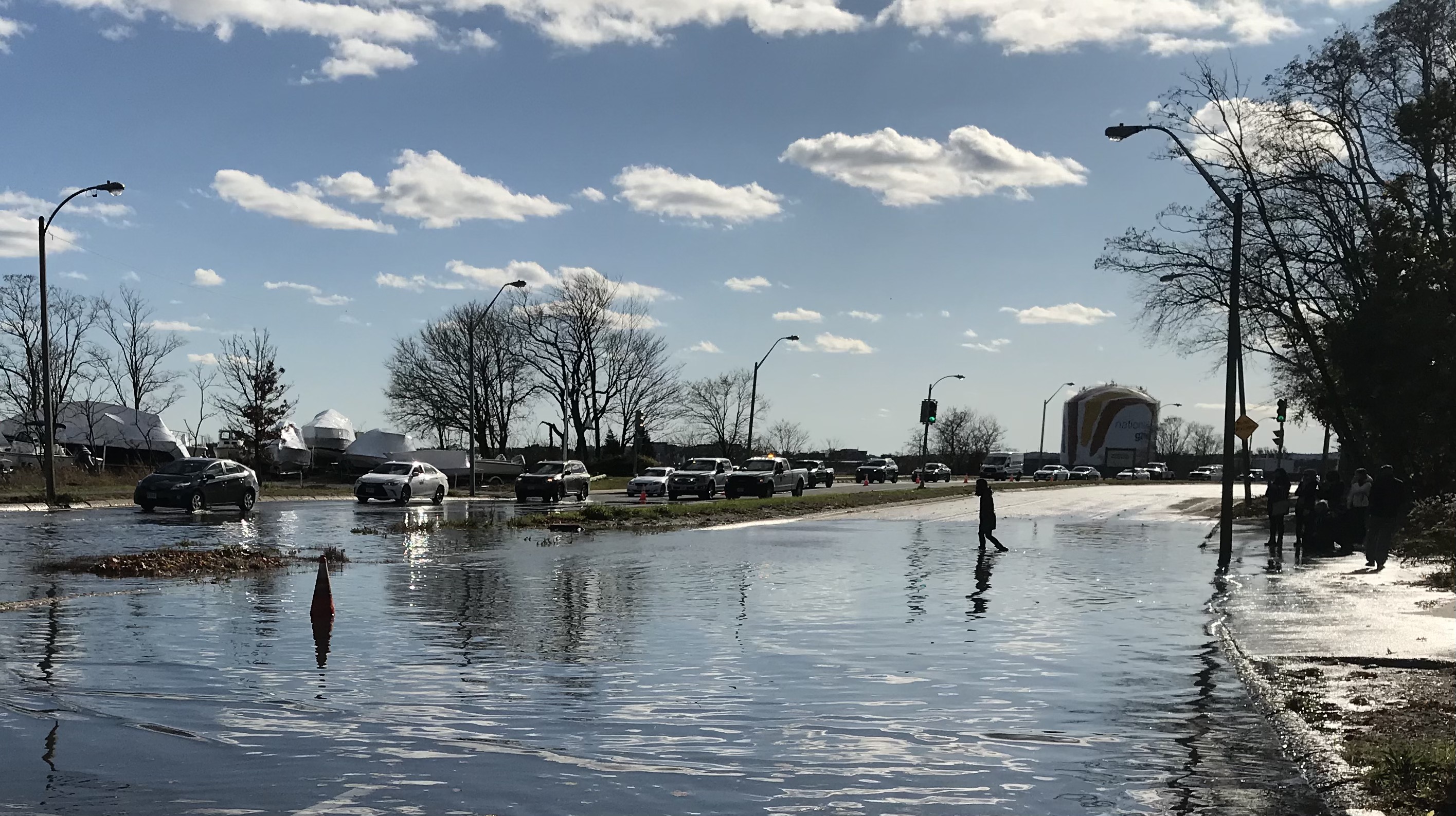
Mayor Michelle Wu wades across the southbound lanes of Morrissey Boulevard during a king tide on November 16, 2020, during her mayoral campaign.
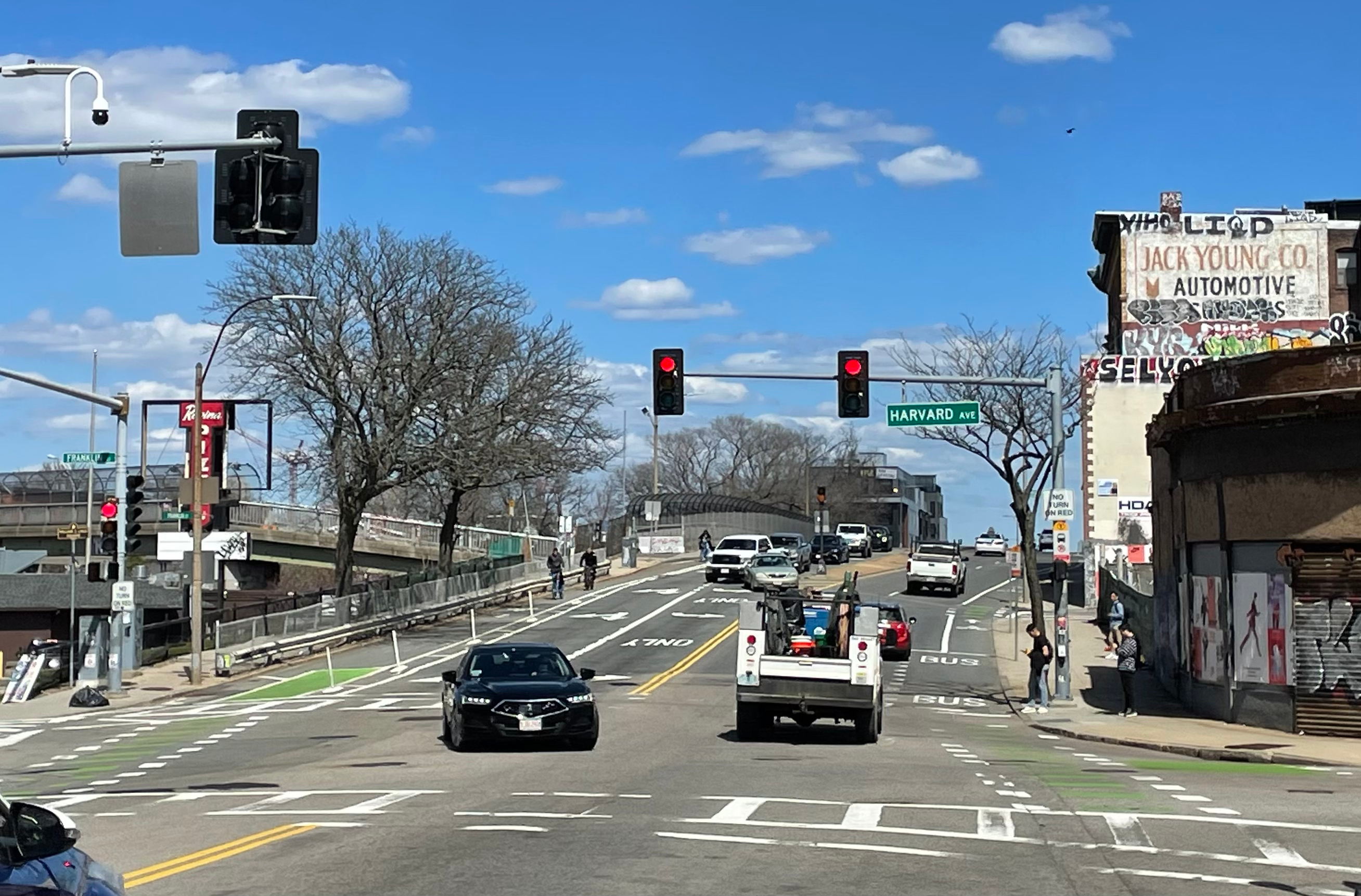
Boston's strategy to combat increasing flood risks from rising sea levels hinges on a state parks agency’s ability to plan for the future of Morrissey Boulevard, an aging highway that divides Dorchester neighborhoods from the Boston Harbor waterfront.
The Boulevard, which is managed by the Massachusetts Department of Conservation and Recreation (DCR), has been in the news on a regular lunar cycle for the "king tide" flooding that brings its traffic to a standstill several times a month.
On Monday, Boston City Councilor and mayoral candidate Michelle Wu scheduled a press conference on Morrissey Boulevard during another king tide to renew her call for a Green New Deal for Boston.
"This will be an increasingly regular sight in our city: flooding on a beautiful sunny day, from sea levels rising," said Wu. "We need urgent action on climate, we need leadership, and we need a Boston Green New Deal."
Wu stressed that the problem is urgent enough that the city can't afford to wait for action from Washington, D.C. "We need to take action now, at the city level."
In late October, the Walsh administration published a new "Climate Ready Dorchester" plan, a suite of strategies for protecting Dorchester's low-lying neighborhoods from sea level rise.
It's a great example of the kind of city-level climate advocacy that Wu's calling for - but because so many of the plan’s key strategies rely on cooperation from state agencies, which control Dorchester’s waterfront infrastructure, the city has limited agency to put the plan into action.
Higher seas aren’t the only big change coming to this part of Boston’s waterfront. Developers are also drawing up ambitious plans to transform the low-rise office buildings and parking lots that line Morrissey Boulevard today into a dense, transit-oriented district of high-rises.
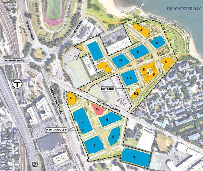
The largest proposal, Dorchester Bay City, envisions building 1,700 apartments plus 4 million square feet of office and lab space on the former Bayside Expo Center site at the northern end of Morrissey Boulevard.
Yet all of these plans hinge on a plan that doesn’t exist yet: how Morrissey Boulevard will be rebuilt for a future with higher sea levels and fewer motor vehicles.
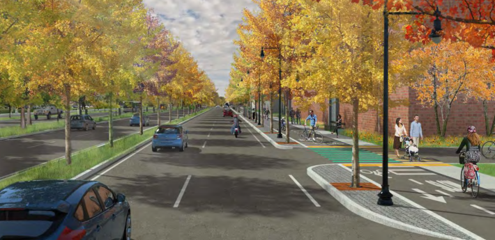
DCR did initiate a redesign study for Morrissey Boulevard in 2015, and shared early designs with the public in the summer of 2017. Those plans called for reducing the width and overall footprint of the roadway (generally reducing the highway's width from three lanes in each direction to two), adding curb-protected bikeways, and raising the elevation of the roadway's lowest areas to avoid tidal flooding:
The project website appears to have not been updated since early 2018, and on Monday afternoon, a DCR employee who was monitoring the tidal flooding near the Savin Hill Yacht Club said that the plan was "completely on hold."
Boston's Climate Ready Dorchester strategy suggests that the DCR's original 2017 plan, which called for elevating the roadway to an elevation of at least 10 feet*, probably won't be sufficient to avoid flooding later this century.
The Climate Ready plan assumes there will be over 3 feet of sea level rise within the next 50 years. At that sea level, a major storm surge could turn Morrissey Boulevard into a freeway for floodwaters to flow into surrounding low-lying neighborhoods.
The city’s resiliency strategy suggests that Morrissey Boulevard and its surroundings should be raised to an elevation of at least 16 feet in order to avoid expected flood risks, wave damage, and storm surges associated with higher sea levels.
The developers of the Dorchester Bay City project go even further than that: they plan to raise the ground level of their property to an elevation of 19.5 feet, over 10 feet higher than the current elevation of Morrissey Boulevard.
That project’s proponents, Accordia Partners, joined the Boston Planning and Development Agency (BPDA) for a public meeting on the project Monday evening, a few hours after the floodwaters receded from Morrissey Boulevard.
Richard Galvin, one of Accordia’s developers, was circumspect in his answer to a question about how his company’s plans related to the DCR’s planning for Morrissey Boulevard, but he did say that “conversations are happening with the right stakeholders.”
Joe Blankenship, a transportation planner with the BPDA, later suggested that the Dorchester Bay City development might also coordinate with several other future projects, including a possible redesign of MassDOT’s Kosciuszko Circle traffic rotary, and the Boston Parks Department’s plans for a redesigned, flood-resilient Moakley Park.
“Major projects like this will have to do a really concerted job with coordinating with us, the state, and the city,” said Blankenship. “What happens with Kosciuszko Circle and Day Boulevard (in Moakley Park) all relate to redesigning Morrissey,” said Blankenship. “The city, state and other stakeholders are beginning on an effort to look at all those projects holistically.”
*Technical note: elevations in this article are relative to the North American Vertical Datum of 1988, an international standard that was based on the mean sea level in Rimouski, Quebec, in 1988. Due to sea level rise and regional variations in mean sea level, this datum is not the mean sea level in Boston Harbor at the present day.
Stay in touch
Sign up for our free newsletter