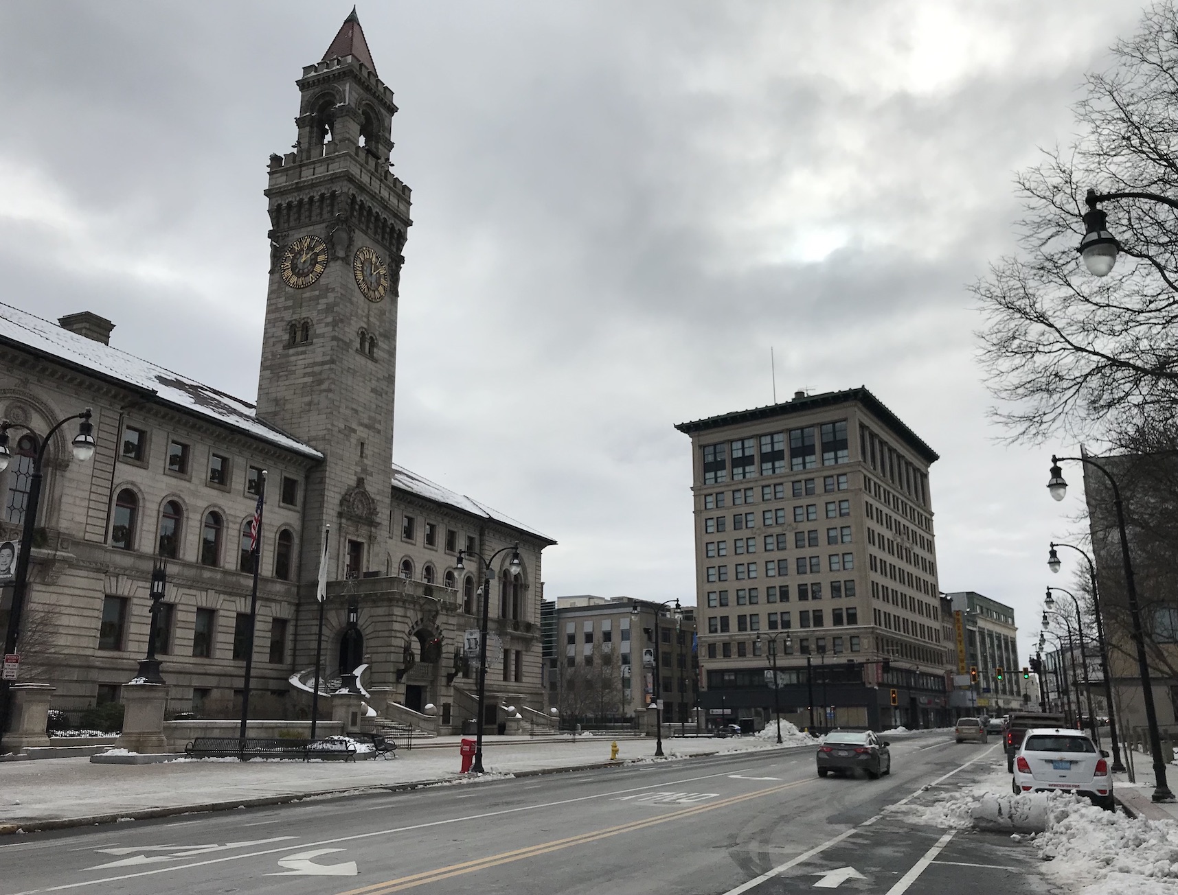
Worcester City Hall and the newly rebuilt Main Street, pictured in December 2020.
We're focusing our coverage this week on Worcester, New England's second-biggest city.
After decades of destructive urban renewal schemes, Worcester can be a challenging place to get around for people who don't own a car. Compared to the rest of Massachusetts, Worcester has higher-than-average rates of injury-causing crashes, and lower rates of transit ridership.
Which is ironic, because historically, Worcester owes its existence to railroads: its population more than quadrupled in the 20-year period between 1830 and 1850, when new railway links to Boston and Providence turned the city into a manufacturing and transportation hub.
Worcester continued to grow, and reached its peak population in the 1950 Census with just over 200,000 residents. Then, as in innumerable other cities, civic leaders began demolishing their own city in order to build new highways through densely-populated neighborhoods.
Construction of the Worcester Expressway – now known as Interstate 290 – began in the 1950s and demolished hundreds of industrial buildings and triple-decker homes in in the densely populated Shrewsbury Street and Green Island neighborhoods south and east of downtown Worcester.
As we detail in the story below, those 20th-century highways continue to divide Worcester to this day, with wide roads that promote reckless driving and suppress foot traffic.
But Worcester's origins as a walkable, transit-oriented city haven't been completely destroyed. Its 19th-century industrial boom helped finance dozens of large institutions, – including nine colleges and universities and two major hospitals – that have helped keep the city's center vibrant in spite of the highway builders' destruction.
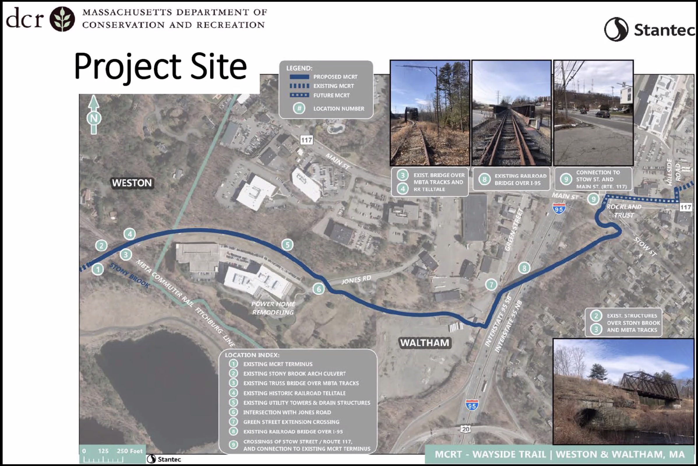
And it remains an important hub for freight railroads, with a major CSX railyard east of downtown that helps deliver goods all over New England. Some defunct rail lines in the region are being examined as potential routes in the proposed cross-state Massachusetts Central Rail Trail:
In small, significant steps, Worcester is beginning to remake its streets and transit systems to embrace a more walkable, transit-oriented future.
Late last year, the city finished a "complete streets" project that transformed Main Street from a multi-lane speedway for cars into a calmer, slower street with bike lanes, improved crosswalks, and widened sidewalks.
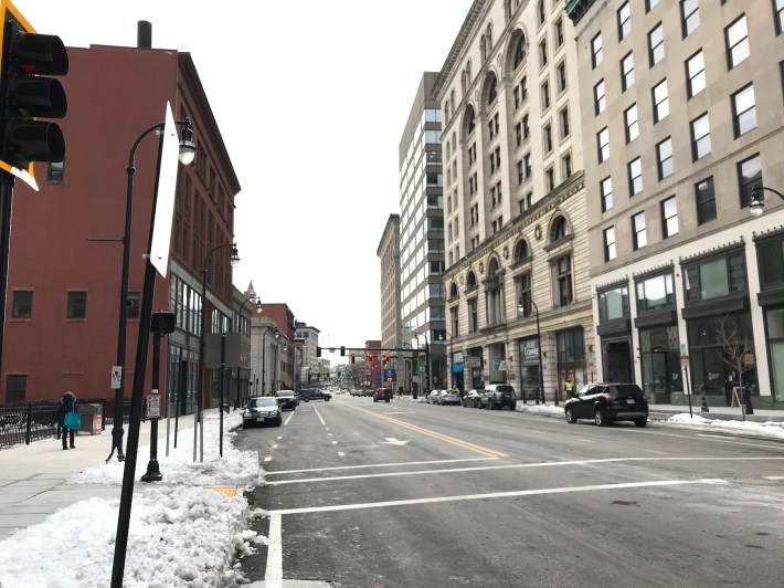
In spite of the pandemic, the city's changes to Main Street – designed to prioritize foot traffic over car traffic – are already attracting investors who are fixing up long-vacant buildings.
Meanwhile, just south of downtown, in the Green Island neighborhood, the city hopes that Polar Park, a new baseball stadium for the Worcester Red Sox, can anchor a new tourism district of hotels and small businesses in a former industrial zone that's only a 15 minute walk from Worcester's Union Station.
Finally, the city's also become a leader in fare-free transit activism: elected officials, the Chamber of Commerce, and bus riders are all working together to try and make the Worcester Regional Transit Authority (WRTA) the Commonwealth's first fully fare-free bus system.
We hope that our coverage this week will attract more regular Streetsblog readers from central Massachusetts, and add to the region's momentum for better transit services and safer streets, both in the city of Worcester and in its suburbs. Thanks for reading!
Read More:
Stay in touch
Sign up for our free newsletter