New Plan Plots a Course for Cross-State Trail Through Central Massachusetts
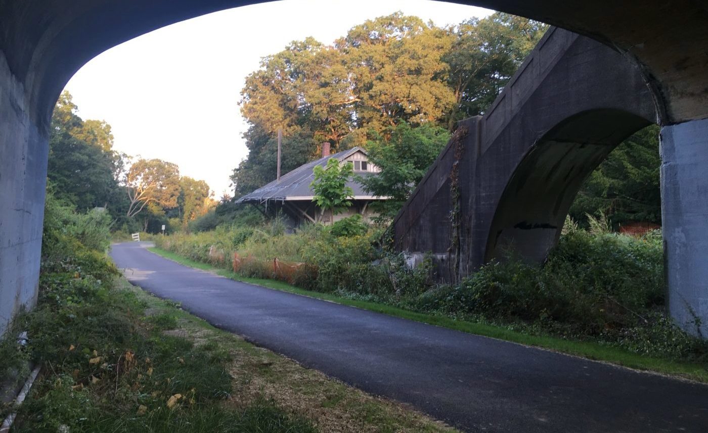
The Wayside Trail, part of the Massachusetts Central Rail Trail, passes an abandoned trail station at the Church Street underpass in Weston.
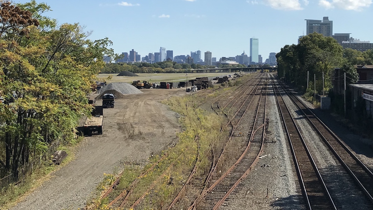
A newly-released feasibility study gives the state a detailed plan for finishing the Massachusetts Central Rail Trail (MCRT), a proposed 104-mile pathway from Northampton to downtown Boston that would largely follow the railbed of the abandoned Massachusetts Central Railroad.
About one third of the trail's length has already been developed for bike and pedestrian traffic – including the 11-mile Norwottock Rail Trail that extends eastward from downtown Northampton to Belchertown, and a 5-mile segment of the Wayside Rail Trail in Weston (pictured above).
Several other key sections – including an extension of Somerville's Community Path that's being built as part of the Green Line Extension project – are in the works.
But connecting the MCRT through the central part of the state, through the hills of Worcester County, will be a more challenging project.
Large segments of the historic rail corridor have been obliterated under suburban sprawl. One crucial segment along the north shore of the Wachussett Reservoir is still an active and busy freight railway.
Even where the corridor is still intact and potentially available for trail development, its condition varies considerably.
In spite of those challenges, about 20 miles' worth of the MCRT through this region have been built with support and advocacy from Wachusett Greenways, a regional trails organization.
Now, a new study from MassDOT and the Department of Conservation and Recreation (DCR) offers a game plan for connecting the remaining gaps.
The new MCRT Feasibility Study, published earlier this year, conducted a detailed analysis of 68.5 miles' worth of the former railway between Belchertown and Berlin to take a detailed inventory of the corridor's condition, evaluate alternative routes through public lands nearby, and recommend future projects that would create a continuous trail through central Massachusetts.
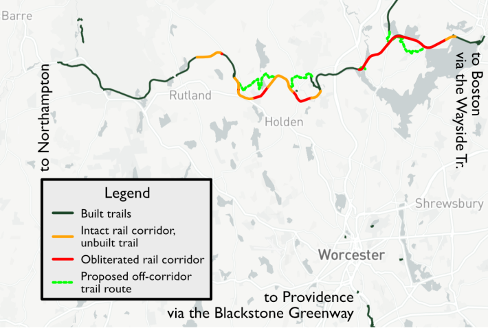
In Holden, where the historic railbed has been lost to development, the plan recommends alternative routes through nearby DCR-owned conservation lands.
And to avoid the active rail line north of the Wachusett Reservoir, the feasibility study recommends routing the MCRT along lightly-used forest roads.
Still unresolved: how to connect the city of Worcester, and its 190,000 residents, to the future MCRT. That connection wouldn't merely connect the MCRT to the state's second-biggest city; it would also connect to the Blackstone River Greenway, a partially-built trail that would eventually extend from downtown Worcester to Providence, Rhode Island.
"It is our goal to have the complete East Coast Greenway connecting through Worcester from the Blackstone Greenway to MCRT," says Kristine Keeney, New England Greenway Coordinator for the East Coast Greenway Alliance. "The key issue is there’s no identified corridor to make that connection. The completed Blackstone starts in the southern part of Worcester, but there’s nothing in the pipeline to connect it north towards the MCRT."
Read More:
Stay in touch
Sign up for our free newsletter