Meet the New Chief: StreetsblogMASS Interviews Jascha Franklin-Hodge
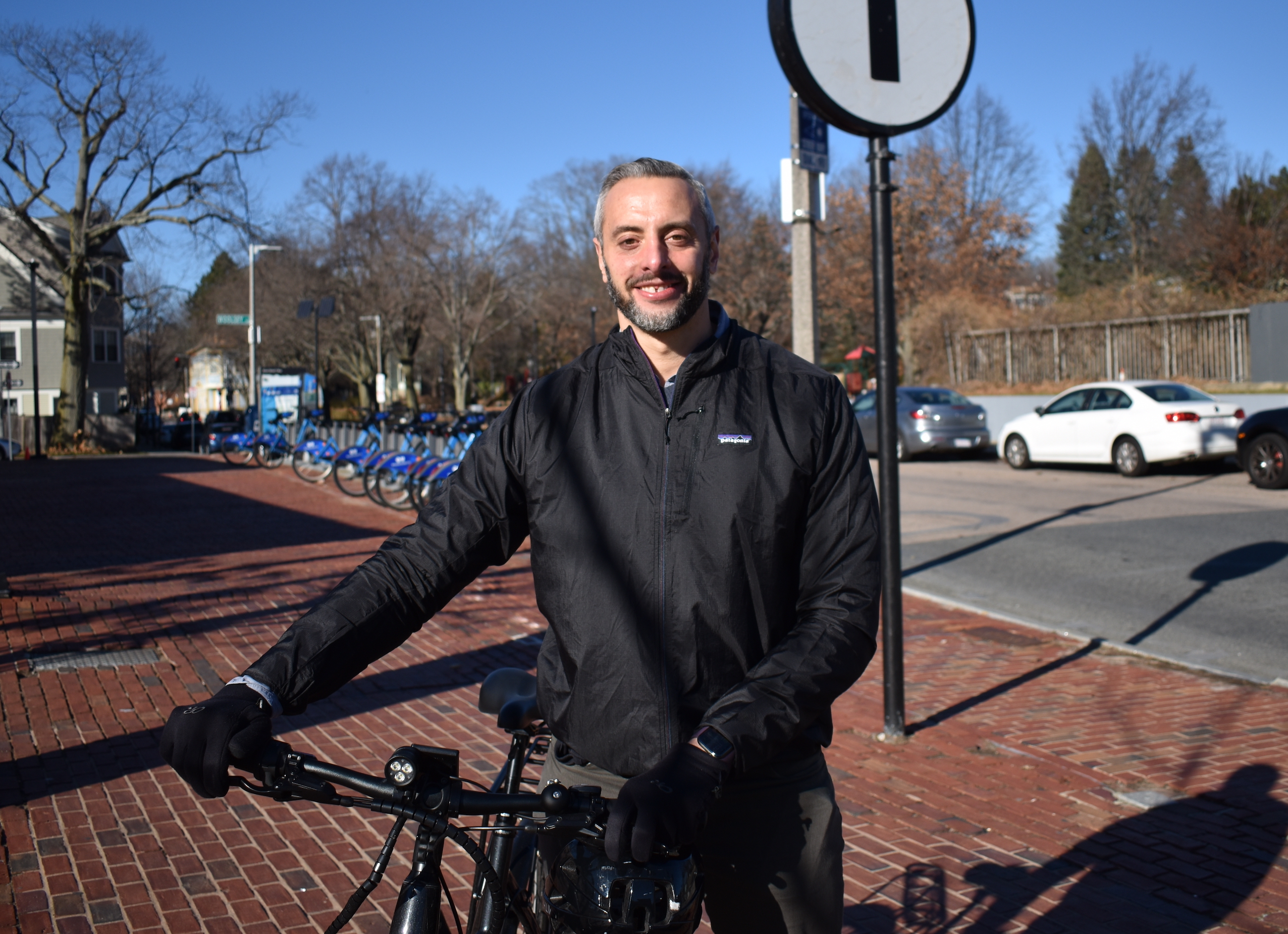
Jascha Franklin-Hodge, photographed at the Green Street Orange Line station in December 2021.

Last Friday, StreetsblogMASS editor Christian MilNeil sat down with Jascha Franklin-Hodge, Mayor Wu's pick to be Boston's next Chief of Streets, for a conversation about transportation policy, housing, and how human-centered design can improve websites and infrastructure.
Franklin-Hodge is no stranger to Boston's City Hall: he had been the city's Chief Information Officer during the administration of Mayor Marty Walsh. He left city government in 2018 to lead the Open Mobility Foundation, an organization dedicated to promoting data standards and open-source software for cities and shared mobility providers, like bikesharing systems. He's also a board member of the LivableStreets Alliance, and a small donor to StreetsblogMASS.
Franklin-Hodge isn't officially starting his new job until January, but he's already doing lots of preparation. When we met on Friday, he had just ridden his pedal-assist e-bike across the city from a meeting with Joe Barr, Director of Traffic, Parking, and Transportation for the City of Cambridge.
The following is an edited transcript of that conversation.
You previously worked under Mayor Marty Walsh as the city’s chief information officer. What were some of your proudest accomplishments from that position, and how do you think that work will inform your new role?
One of the big things we did was launch a citywide analytics team, a group of folks with data science, data engineering, and project management expertise to work with a lot of different city departments to help them get more value out of the data that they have, find new sources of data that are useful to them, and make that a tool for management and operations. That’s something where we did a lot of work with the transportation teams, and the Public Works Department.
On the Public Works side, it was a lot of helping them optimize various operational processes: whether snow removal, or trash pickup, helping them get a better sense of where they were hitting targets in terms of responding to constituent requests, where they weren’t, and giving managers tools and dashboards to keep track.
On the transportation side, we did a bunch of interesting projects thinking about different operational models for the street. We were one of the first cities that were able to get data from Waze, which offered us this really detailed, fine-grained look at vehicle flow and speeds – mostly cars, but we used that in conjunction with some operational experiments.
So for example, we helped the city re-time traffic lights to improve transit signal priority on Washington Ave. where the Silver Line runs, then use MBTA data to understand how that improved the performance of the bus, and use the Waze data to understand if and how that affected vehicular traffic on the adjacent cross-streets. So there are interesting new tools that allow for more rapid experimentation and learning.
We also rebuilt the city website, Boston.gov. Part of that was also building a brand identity for the city, but it also made us ask ‘How do we bring human-centered design practices into the delivery of digital services?’
So often the way that the city approached digital was to say, ‘we have this process that exists in the physical world, let’s just put it online.’ An example of that would be to just post a PDF version of the old paper forms we’ve always been accustomed to using.
A more human-centered approach would ask where people are coming from, what do they know, what are their questions and assumptions, to try and create digital experiences that meet them where they are, and deliver something that feels warm and inviting and helpful.
I’m curious about how that human-centered design approach might apply to designing streets?
I’d answer in two ways: first, just recognizing that streets are for humans, not just for vehicles. So it’s starting to re-think some of the priorities that are embedded in the way we design and build and operate our streetscape, and making sure we’re listening to, and talking to, and building for people who walk, people who bike, people who take the bus.
There’s a lot of traffic engineering that’s very data-driven, but it’s often data-driven in ways that are focused on vehicular movements and speeds and capacity, with metrics like ‘level of service’ that tend to drive design decisions.
And sometimes that comes at the expense of asking, ‘What’s it like for a person who’s walking to the bus, and waiting on the corner for that bus?’ We don’t have metrics for that.
It’s really easy when you have a data-oriented profession, as traffic engineering tends to be, to overlook the things that aren’t easily measured. But those human experiences, whether or not they can be quantified, ultimately have to be the basis of how we build our streets for everyone, whether they’re in a car or not.
There’s some work to think about how to use data where we have it, and let it help tell us a more complete story. But we also need to be really wary of where data misses the human side.
The other thing is that there’s a transportation lens on streets – they’re a way we get from one place to another – but they’re also a space that we inhabit, with places where we socialize, see our neighbors, and window shop. Streets create our sense of place in the city. So we need to be thoughtful about how to not just focus on the transportation aspects of our streets but also invest in the design and activation of streets that can make our public spaces really delightful, and places that neighbors feel good about.
So there’s a lot in there about placemaking, and the role of public art, and thinking about day-to-day experiences: is it loud and noisy? Do you feel like you’re breathing bad air from idling vehicles? Is there a place to sit? Is there greenery? Does it feel inviting? Those questions are also a big piece of the human-centered design approach.
Have you met with your predecessor, Chris Osgood?
Oh yeah. He lives in my neighborhood; I worked very closely with Chris on a whole bunch of stuff when I was in my previous role.
Did he have any good advice for you?
A lot of what we’re doing right now is just downloading project status, big things that are going on. He and I walked three laps around Jamaica Pond when I was thinking about taking on this role, just to get his take on the job, and all the opportunities and challenges in front of us. He’s been exceptional in helping me get up to speed so I can hit the ground running.
A big part of the BTD’s overarching agenda is outlined in the GoBoston 2030 plan. They’ve gotten some criticism for being behind schedule on some of the projects in that plan, and it’s almost 5 years old now. Do you think it might be time for an update?
It’s something we’ll look at. I think what has really held up in that plan are some of the big, overarching goals: really looking at the need for mode shift, for a more equitable transportation system, the role that streets play in economic development, the need to invest in resiliency in our streets and thinking about the broader role that streets play.
What I appreciate, and feels durable to me in the GoBoston 2030 plan, is the lens on what the big goals should be. The actual projects, and the pace at which we implement them and what comes first – there are some things happening that weren’t in GoBoston 2030 but are great projects, and there are things that were in there that haven’t started yet. I think we do want to take a look at that project matrix. And ask whether there are aspects of the goals that need revisions too but broadly I think it’s a good directional roadmap for us, and I expect we’ll continue to rely on it pretty heavily.
The Mayor has also talked about abolishing BPDA, and there’s a growing recognition that land uses – where people are allowed to live, and where they can afford to live – are a huge piece of the transportation challenge here in the city and in the broader region. I’m curious whether you have ideas about working with the BPDA or zoning reform?
I’m not going to lead the charge on zoning reform but I’m excited to work with the folks who are rethinking some of our approaches to land use.
There are a couple interesting things that have recently happened. They just completed the adjustment to the zoning code to recognize that affordable housing should not be subject to parking minimums. It’s a relatively small thing in the grand scheme of things, but I think it starts to get at a really explicit acknowledgement that the choices we make in the development process about transportation and parking in particular have huge impacts on affordability.
It can cost north of $100,000 to build a single underground parking space and that gets tacked onto the price, whether it’s rent or purchase price. When you’re building surface parking, or above-ground garages, it also comes at the cost of using that space for other things. That’s housing you’re not building, or potential retail space.
So there are huge intersections there, and thinking broadly through the lens of mode shift, we need to be making sure that we’re building buildings for the city we’re trying to become, not for the city we were in the past.
Thinking for example of the Dorchester Ave. corridor, where there’s a ton of new development envisioned over the next few years – what can you do at the district level, or the corridor level, to encourage less car dependency and ownership as that new construction happens? Some of that will be building by building, but there are things the city can do to encourage change across that general area.
And ultimately it has to be looked at also through an equity lens, because there are very real and legitimate concerns about gentrification, and how investments in a neighborhood can inadvertently be a harbinger of displacement.
It shouldn't be a choice between high-quality transportation options and affordability. We need to think about how we invest in making our neighborhoods great places to travel to and from, and to be in, while also preserving affordability. There are no easy answers to that, but it has to be front and center.
That’s already emerging as a concern about Blue Hill Avenue: there’s excitement about the possibilities of new bus lanes, and the free bus pilot, but there’s also justified wariness around the fact that if the city makes it much easier to get to and travel along Blue Hill Avenue, then more people are going to want to move there.
Part of it is just starting from a place of humility and listening to the neighborhood about what their transportation needs and goals are. We can not accept a world in which you have to choose between affordability and high-quality transportation. That is fundamentally inequitable and unfair to people who live in neighborhoods that are poorly served by transportation and bear the costs of that, in their time and their dollars.
So I don’t think we can accept the status quo, but I also don’t think we in City Hall can say we have all the answers, and tell people if we build this thing your lives will get better. There’s a lot of listening that has to happen in order to make these projects something that actually feels like and is addressing the core needs and challenges of the neighborhoods… How do you build a street that is for the community that is there, and feels that way, not something that’s for someone else who might come in later?
We’re already starting to see some of these questions come up. There’s the Fairmount Line with a station at Blue Hill Ave. that’s already seeing new transit-oriented development. There’s going to be a lot of work in partnership with the Dept. of Neighborhood Development and BPDA and other organizations to ask, when we’re making investments that have the potential to increase the attractiveness of a neighborhood to development, how do we make sure that we are also making parallel investments in housing stability, and make sure new development has a strong affordability component?
Obviously a lot of transportation decisions in the city are determined at the state level, whether with MassDOT or the MBTA or DCR. Any thoughts on working with those agencies?
It’s going to be a partnership. The MBTA is and should be the backbone of our transportation system and that means we’ll work very closely with them. There are areas where the city has a lot that it can do to help the T and help it function better.
The new bus lanes that just went in on Columbus Ave. are a great example of that. There are lots of places around the city where you have opportunities for similar interventions of center-running bus lanes and higher-quality stops and just improving the rider experience to make the bus a more attractive option.
There’s also a lot of smaller in-the-weeds things that the city can do. Many people don’t know that there is transit-signal priority on Washington Street for the Silver Line, but it’s historically been set up to only activate when the bus is running behind schedule. There’s no reason why we can’t revisit those kinds of things by changing the schedule and giving the Silver Line green lights all the time, not only when it’s running late.
All the things that the city can do to reduce the amount of congestion that buses face improves the experience for everyone riding that bus line, and it means that you’re increasing the overall reliability of the bus system.
Fare-free transit is something we’re really excited about. We hope to use these two years (of an expanded fare-free bus pilot) to learn how making transit free can affect peoples’ travel decisions, the performance of the bus itself, and the knock-on effects for riders and the communities along these routes. And also use these two years to develop the longer-term funding opportunities that are going to be necessary to continue this in the future.
There are some things that the city can’t do: we can’t maintain the tracks or the vehicles themselves that the T uses and we want to encourage continued and hopefully increased investment in those capital needs of the system.
There are also big state-funded projects, like the Rutherford Ave. reconstruction that we’re working closely with MassDOT on. DCR controls some of the critical parkways and roadways in the city and we have a lot of skin in the game for the decisions that they make. The Arborway is a great example of that; DCR announced earlier this week that they’re going to be presenting a new design next month. It’s a critical link in the Emerald Necklace, a crucial part of our safe low-stress bike network that we want to create, it is the pathway between two of the most iconic city greenspaces, Jamaica Pond and Franklin Park, so we believe that the city has a big role to play in bringing to DCR the perspectives and needs of the City of Boston.
DCR is also involved with potential projects on Morrissey Boulevard, and Day Blvd. by Moakley Park, which could potentially involve closing a waterfront roadway. These will all require a lot of careful collaboration with the state. So we’re looking forward to it.
It’s a small project in the grand scheme of things, although I’ve used it multiple times in the past week, but look at what happened on the Mass. Ave. Bridge: in a relatively short period of time, the City of Boston, City of Cambridge, and MassDOT came together to make a really transformational change to the roadway. I was riding across it this morning and marveling that the speed detector signs were showing speeds of 24, 23 mph. I’ve never seen numbers that low there, but traffic was moving smoothly, bikes were safe. It’s an example of how we can work together.
Our neighboring communities are also an important part of this. I always found it funny when I worked at City Hall to see maps where Boston is kind of an island with a weird rectangular gap where Brookline is. We don’t control our neighboring municipalities but we can work with them. I just came from Cambridge to have coffee with Joe Barr (Director of Traffic, Parking, and Transportation for the City of Cambridge). It’s an important part of the work to build those bridges, literally and figuratively, to make sure we’re coordinated.
Any other thoughts you’d like to share with Streetsblog readers?
The only thing we haven’t talked about which is a critical part of this job, if not the most critical part, is just how many essential city services are part of this work.
Something the Mayor says a lot is ‘do the big things by getting the little things right.’ My take on that is, if we want (and we must) to make change in the transportation system, we need to do that on the foundation of trust. And that trust is anchored in the ability to provide high-quality core services like waste management and reduction, like snow management, clean and safe streets, and streetlights that work.
As much as we talk about what the future will look like, it’s important to recognize there’s a lot of places where the city does an exceptional job now on those core services. There’s things we can do to improve, but our city government is there every day working for people.
Even as we think big about the future, we’re going to make sure that the daily quality of services we all rely on are front and center.
Follow Jascha Franklin-Hodge on Twitter: twitter.com/jfh.
Read More:
Stay in touch
Sign up for our free newsletter