New Walking City Trail Links Together Boston’s Best Walks In A 25-Mile Urban Hike
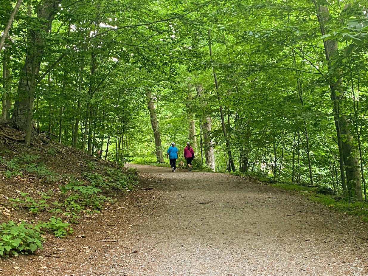
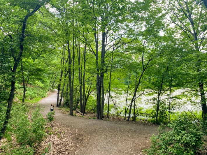
Two women walking their dog near Wards Pond on the Emerald Necklace.
For Miles Howard, what started as a way to cope during the hardest months of the pandemic has turned into a personal project to piece together various urban hikes into one comprehensive Walking City Trail for Boston.
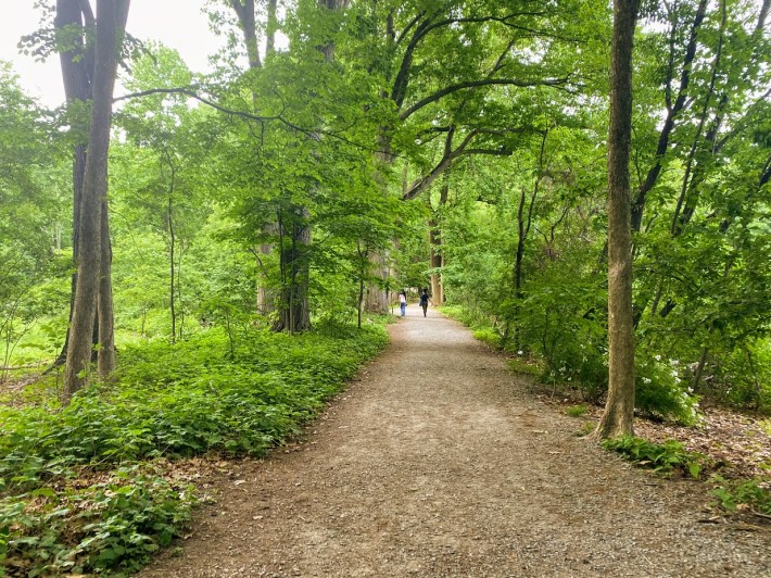
We met with Miles earlier this month during one of those perfect evenings when the weather is not too hot, not too cold and there’s a slight breeze every so often. Starting at Jamaica Pond, he guided us through section 3 of this 25-mile-long trail through various green spaces and neighborhoods.
We started our urban hike and chatted about how this idea for a Walking City Trail came about.
“I've been a hiker for most of my life and much of that has been spent in the back country and hitting the usual trails most people think of when they think of going hiking," said Howard. "But during the first few months of the pandemic, like many others confined to their neighborhoods, I got really into taking local walks around Boston as a means of alleviating stress, you know, finding distractions and these walks became really long. I would do circuits of Parker and Fort Hill.”
“I went to Stony Brook Reservation, and I was kind of blown away by just the breadth of parks and green spaces we have right here in the city. But the idea of doing a singular hike through all of those green spaces, or at least some of the best ones, didn't hit me until 2021 when I read about this trail in San Francisco called The Cross Town Trail. It’s basically this approach to trail building within a city where these people in San Francisco looked at a map and found all of these interesting pre-existing paths in the city's parks and urban green spaces... They created maps for this whole trail and put them on a website and just encouraged people to hike it.”
As we walked along the pond, Miles talked about visiting the Cross Town Trail earlier this year, and the impact the experience had on him.
“It felt like the satisfaction you feel when you pass through, you know, a completely new environment in the back country on a long hike- it was the same thing, but in the city, basically.“
He left with an idea he couldn’t stop thinking about: establishing a similar trail in Boston.
“The Walking City Trail is basically a 25 mile showcase of Boston's most immersive parks, urban wilds and other green spaces where you can really feel like you're going for a genuine hike in the middle of a city where you kind of stop and look around and are like, how am I in a city right now?” he said.
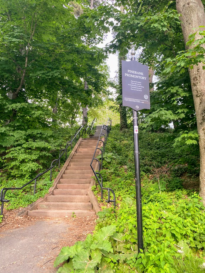
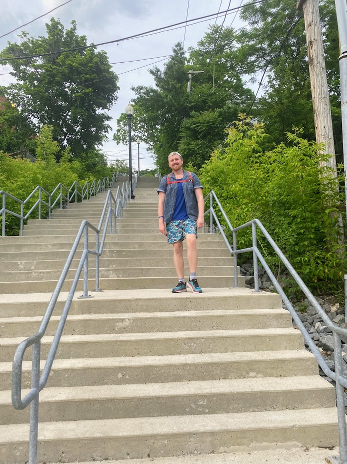
By this point on our hike, we were rounding a corner of the path and Miles pointed toward the stairway that would lead us to our next destination. I laughed and embarrassingly shared how even after walking this path many times, this was the first time I was seeing these stairs. I asked Miles if his project was all about making what’s most of what’s already there.
“The idea is that instead of just going to all these (parks) piecemeal, you can stitch them together with interesting street walks to make for a long, epic hiking route through an urban environment that will leave people feeling, you know, as exhilarated and maybe even as inspired as a trek through Crawford Notch or the Stowe mountains.”
He continued, “Because as much as I love going to the backcountry, the demand is growing and it means more cars on the road. It means more competition for parking spots, campsite reservations... I don't think it has to be an either or thing, but especially also for thinking about the barriers of access to traditional hiking, like having access to a vehicle or just having the time to drive three hours north to Vermont or Maine. I think that the idea that you can hike in a densely populated urban area is going to become more ascendant in the coming years, hopefully.”
As we continued our hike I began to wonder about the difference between an ‘urban hike’ versus a walk. I asked Miles what was different about these two terms for him.
He explained, “I think that's a great question and one that I think you're bound to run into when it comes to advocating for urban hiking as a form of recreation. I mean, for me, I think that the way I separate the two is that a walk is a very vague and amorphous term that can be applied to anything from going shopping for groceries to walking over to a friend's house or, you know, simply just going out kind of aimlessly and seeing what's happening around your neighborhood.”
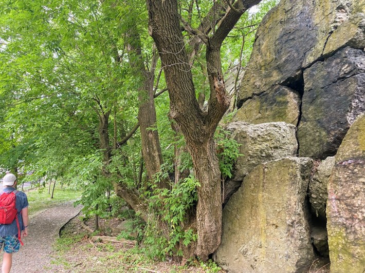
“And I think that a hike has a slightly more intentional and even rigorous kind of quality to it… I think of an urban hike as a similar kind of journey where you have a fixed start and end point. You're doing this trail because you know that it's going to take you past things that are really interesting, strange and beautiful. In the backcountry, it could be a peak or a waterfall or a swamp. And here in Boston, it could be weird railroad infrastructure; it could be a giant rock nestled in the side of Parker Hill, which we’re actually going to see pretty soon.”
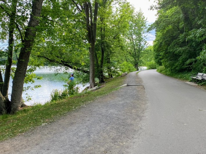
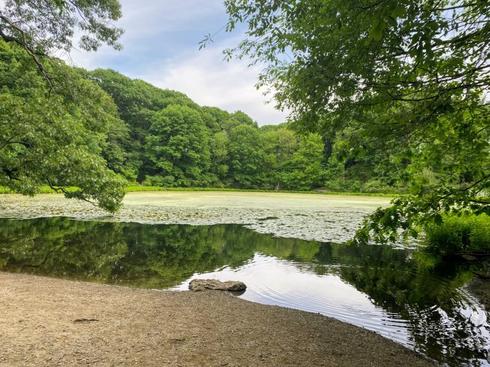
As we crossed Perkins Street to go to the other side of the park where a set of steps leads right to Wards Pond, Miles went into more detail about how he chose the different trail sections.
“As far as making a route, you're sort of looking at it with different criteria. You know, an urban hike isn't necessarily going for the most convenient or the most logical way to kind of walk from point A to point B. You're kind of looking at it as like, what's the most curious, interesting and scenically varied way that I could walk here?”
“I was kind of torn between two ideas because I think to make any urban trail across town or walk to the city, you need to start with a thematic concept at the heart of it. I was sort of wrestling with like, you know, when I get back from San Francisco, do I map a trail through Boston that showcases every neighborhood in Boston and all the parks here or do I do something more specific? And I found that working with that original idea, all the trail designs I came up with were over 50 miles in length,” he added.
Lucky for most of us, he kept the distance manageable and instead focused on piecing together a trail that could give people what he calls “that feeling of being so overwhelmed by the greenery that you're incredulous that you're in a city.”
By now we had passed Wards Pond and were walking the trail that follows Willow Pond Meadow, where it’s easy to forget you’re sandwiched between two busy roads, Pond Avenue and Jamaicaway.
“A lot of the parks that you go through on this hike are managed by the DCR (Department of Conservation and Recreation) and the City of Boston. And the level of attention that a lot of these trails receive when it comes to cleaning up stuff like broken glass or you know, keeping some of the vegetation from overgrowing; it varies tremendously,” said Howard.
Miles hopes that his project will encourage more folks to explore the trail and bring more attention to the importance of their upkeep.
“I'd say the loftiest hope that I have for what happens after the trail launches is for more people to become involved in not only hiking it, but promoting it and maybe, you know, taking some sort of stewardship role in it,” he said.
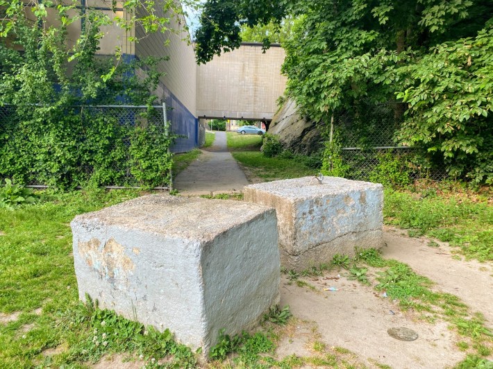
The Walking City Trail includes neighborhood streets to connect the various green spaces together. Continuing our segment, we left the Emerald Necklace and climbed up Bynner Street to make our way to our next stop- an urban wild tucked in the hillside near the Jamaica Plain Veterans Affairs Medical Center.
After a few minutes of walking, we turned the corner at Arcola Street to reach Nira Rock, a place Miles said he found completely by accident a few years back after he made a wrong turn on his way to catch a bus.
“This is one of Boston's urban wilds. I don't think they're really that well known as sort of a general concept, but this is probably one of the more dramatic ones I think that we have here,” shared Miles as we neared the entrance.
We climbed a set of wooden logs to the top.
"This is actually probably the most sustained climbing in any one place on the trail right here. I think at one point there were orchard trees up here of some kind like apple and pear," said Miles.
We hiked along the border of the urban wild which runs parallel to some of the neighbors backyards. "The other thing that's cool and you'll see it coming down here is these urban wilds give you a lot of nice views of peoples' backyards which also have a lot of interesting features," said Miles.
As we made our way to the other side of Nira Rock, we spotted a porta potty, which raised an important practical consideration for the trail’s users.
“Unfortunately, it's sort of harder to relieve yourself in the middle of the city than in the backcountry. I think that is one challenge that, you know, it would be nice if we had more public restrooms in some of the parks around here, too,” said Howard.
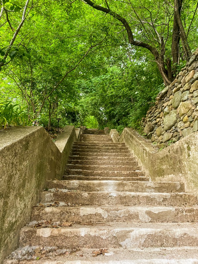
We left Nira Rock and began making our way into the Mission Hill neighborhood through various walkways and stairs. Stone stairways surrounded by thick greenery and narrow paths reminded me of Alice and Wonderland. Miles had other thoughts: he compared the spot to the scene in Fellowship of the Ring where Frodo’s on the road and sees the riders coming down.
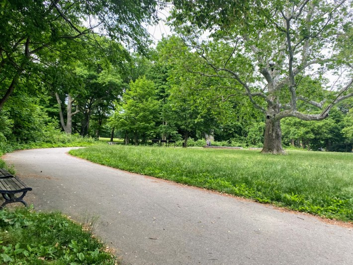
The path opened up to this field where people could be seen enjoying the evening with their dogs and just spending time together with friends.
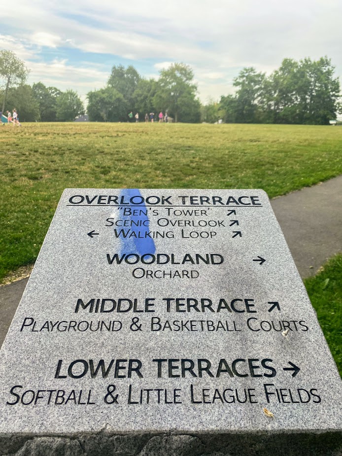
We left the large field and used Judge Street Path, a short dirt and gravel path nested between homes, to make our way through the neighborhood and reach our final destination, Kevin Fitzgerald Park.
As we walked the three or so blocks, Miles pointed out, “It really does feel like you’re descending into the core metropolis. I sort of feel like there are three parts of the trip that give you that feeling at different distances. The first one is when you get out of Stony Brook Reservation. The second one is at the top of Peters Hill at the arboretum.”
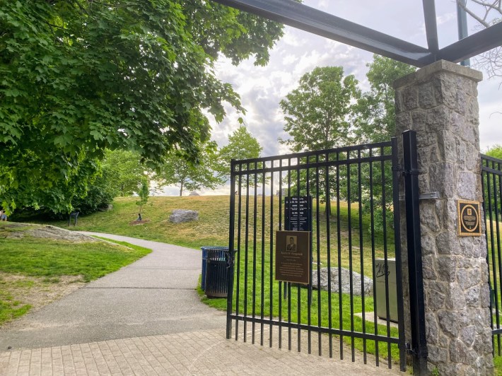
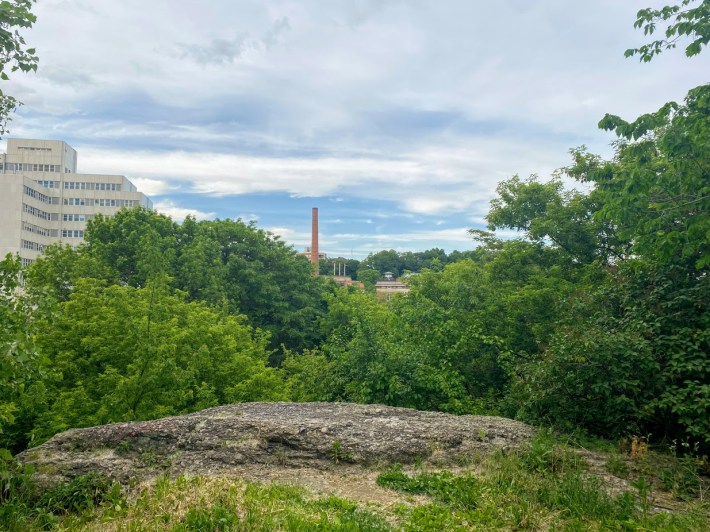
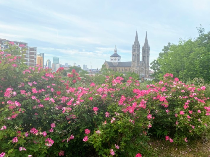
And the third one is here: the top of Kevin Fitzgerald Park overlooking the Boston skyline.
If you like the idea of the Walking City trail, you’ll be happy to learn that Howard will be hosting some 5 to 6 mile guided hikes this summer. Learn more and explore the maps at bostontrails.org
Read More:
Stay in touch
Sign up for our free newsletter