On Tuesday evening, officials from the City of Boston and the MBTA officially kicked off a planning effort that will ultimately redesign Huntington and South Huntington Avenues in Boston's Mission Hill neighborhood.
The project will likely eliminate the last segment of the Green Line where trains share a lane with – and frequently get stuck behind – motor vehicle traffic.
The reconstruction of the redesigned streets will need to be complete by 2027 so that the E branch can accommodate the T's new "Type 10" light rail vehicles.
To meet that deadline, the City of Boston and MBTA will need to agree on a new design for these streets and its new Green Line stations by the end of this year.
The most dangerous stops on the T
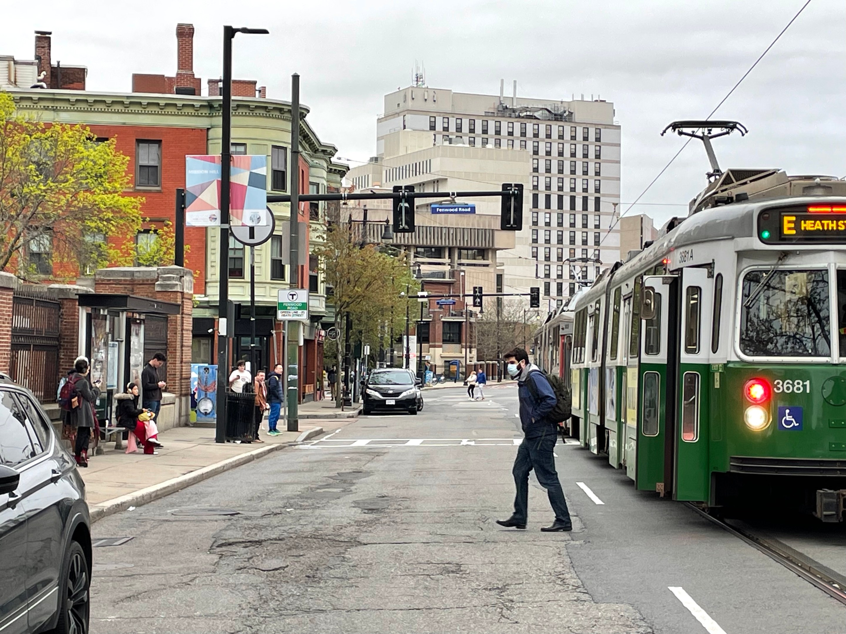
The end of the Green Line's E branch, between the Heath Street and Brigham Circle stations, is the only part of the MBTA's rapid transit system where trains share a lane of traffic with motor vehicles, a legacy of the streetcar era.
Trains run in the middle lanes of Huntington and South Huntington Avenue, which forces passengers to board and disembark in the middle of a busy street.
Under Massachusetts state law, drivers in adjacent travel lanes are required to stop when passengers are disembarking from a Green Line train. But in practice, that doesn't always happen.
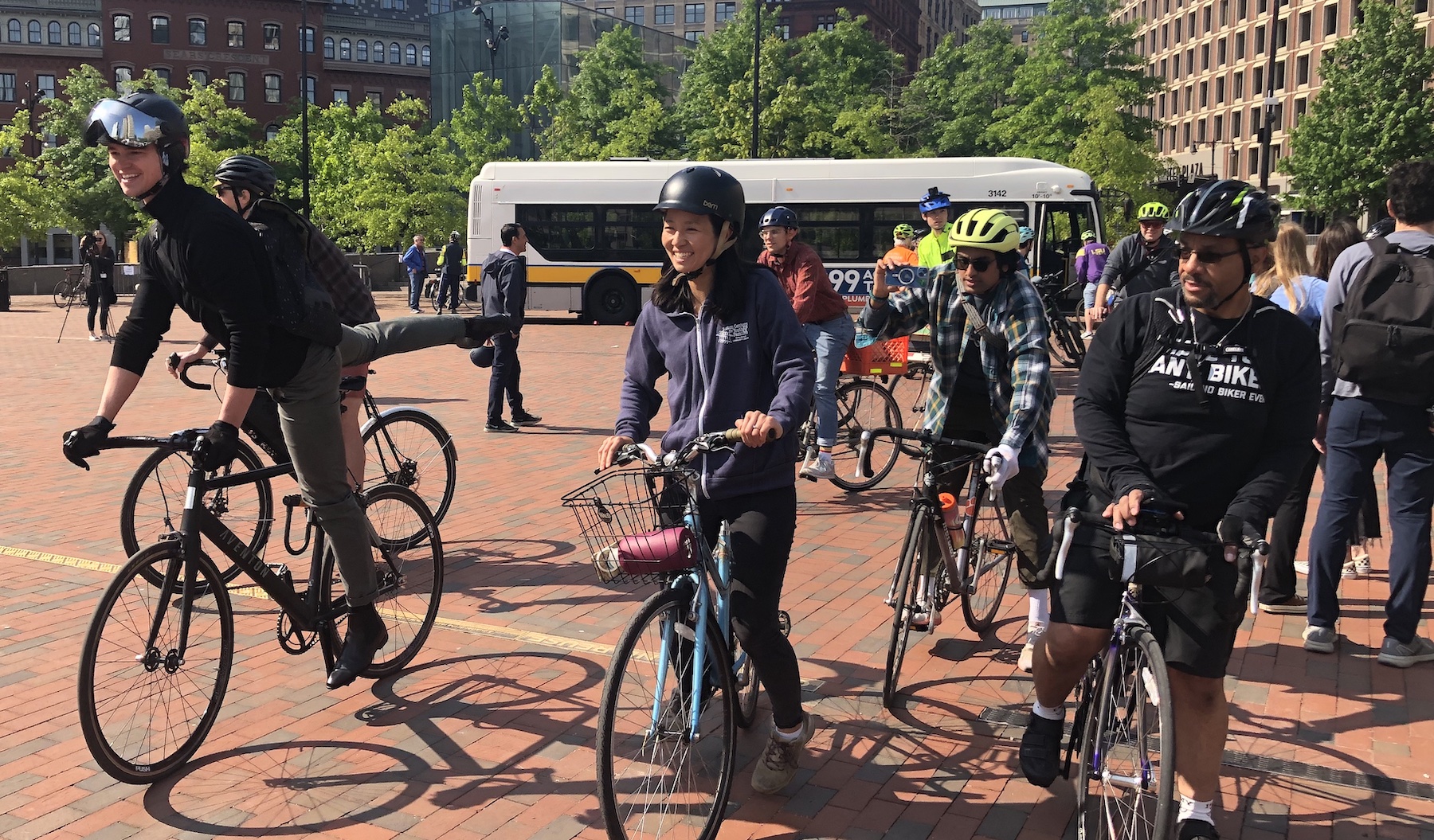
"Sometimes when the train stops and passengers are trying to board, the cars will just continue to drive through. The train operator will blow the horn, and you hear it constantly in this neighborhood," Stacy Dimapelis, a Green Line rider, told StreetsblogMASS. "The drivers really don't care. They're just trying to beat the train, it's really frustrating."
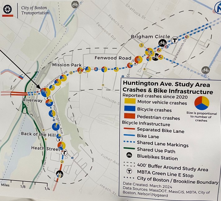
Boston's crash records indicate that these Green Line stops are hot-spots for crashes that involve pedestrians, and both Huntington and South Huntington Avenue have been highlighted as high-crash streets under the city's Vision Zero policy.
New trains will need dedicated transitway, new platforms
The MBTA's new "Type 10" Green Line trains are expected to enter service in 2027, and they'll require the T to upgrade all of their stations to be fully accessible under the requirements of the Americans with Disabilities Act.
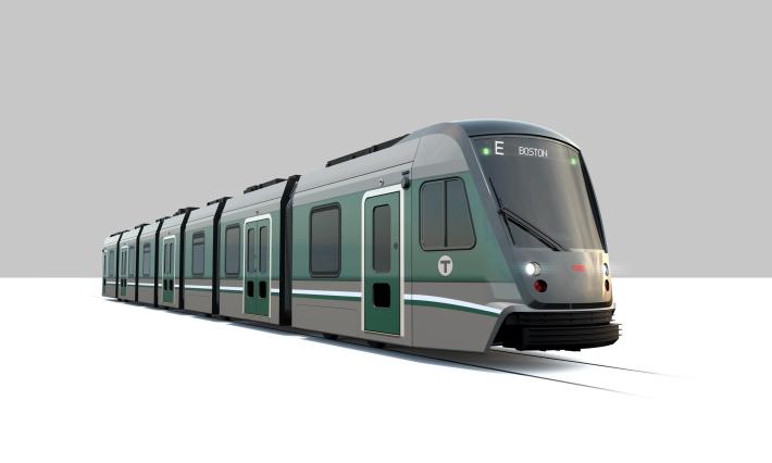
Type 10 trains are longer than existing trains, and they'll require elevated platforms at stations – similar to the platforms that the T built along the new Green Line extension.
That means the middle-of-the-road stops like the one at Fenwood Road (pictured at the top of this article) will need to go.
It also means that the City of Boston and MBTA are looking to create a dedicated transitway between Brigham Circle and Heath Street to eliminate the last portion of the MBTA network where trains have to share a lane with car traffic.
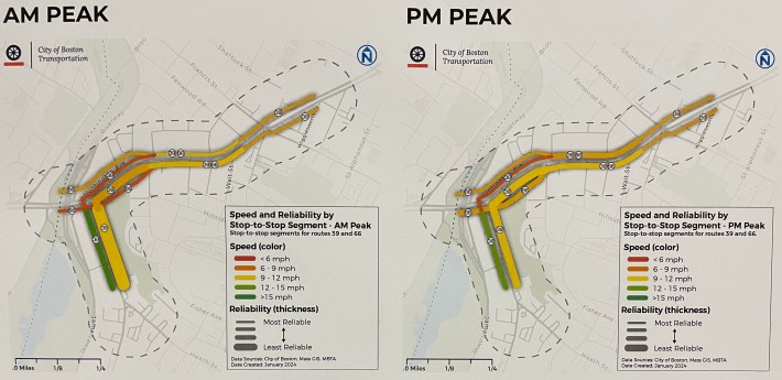
According to Ben Weinstein, an MBTA project manager at Tuesday's open house, such a transitway would also be designed so that the T's frequent-service 39 and 66 buses could also bypass traffic.
The 39 bus already has dedicated bus lanes to the east, and the 66 will soon get dedicated bus lanes to the west, in Brookline.
Fitting it all together
In addition to a dedicated transitway, bicycle users would also like to see a safer connection to new protected bike lanes on South Huntington Avenue in Jamaica Plain.
Those lanes, completed in early 2023, currently end abruptly just south of the Heath Street Green Line station. In a bike network expansion announcement made in fall 2022, Mayor Wu's administration had initially suggested that the South Huntington bike facility would extend all the way to the end of South Huntington Avenue to connect to the Riverway bike paths.
Making that happen, while also making space for a Green Line transitway and new Green Line stations, would almost certainly require the removal of on-street parking, or re-routing vehicle traffic to parallel streets like the Jamaicaway.
At Tuesday's open house, participants tried to puzzle together different possibilities for the new street configuration using a magnetic board, which quickly made clear the tradeoffs that are involved with such a limited right-of-way:
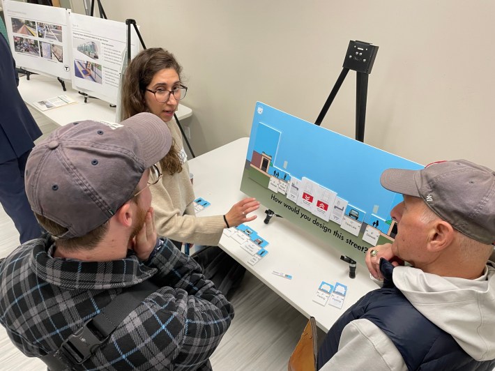
The current street layout for both Huntington and South Huntington Avenue includes four lanes for moving traffic (with trains in the middle two lanes) and two lanes of on-street parking.
South Huntington is about 55 feet wide from curb to curb.
From the Riverway to Brigham Circle, Huntington Avenue is slightly wider: about 60 feet from curb to curb.
The City of Boston and MBTA will hold a virtual open house on their E Branch Accessibility project on Thursday evening, starting at 6:30 p.m. Register here.