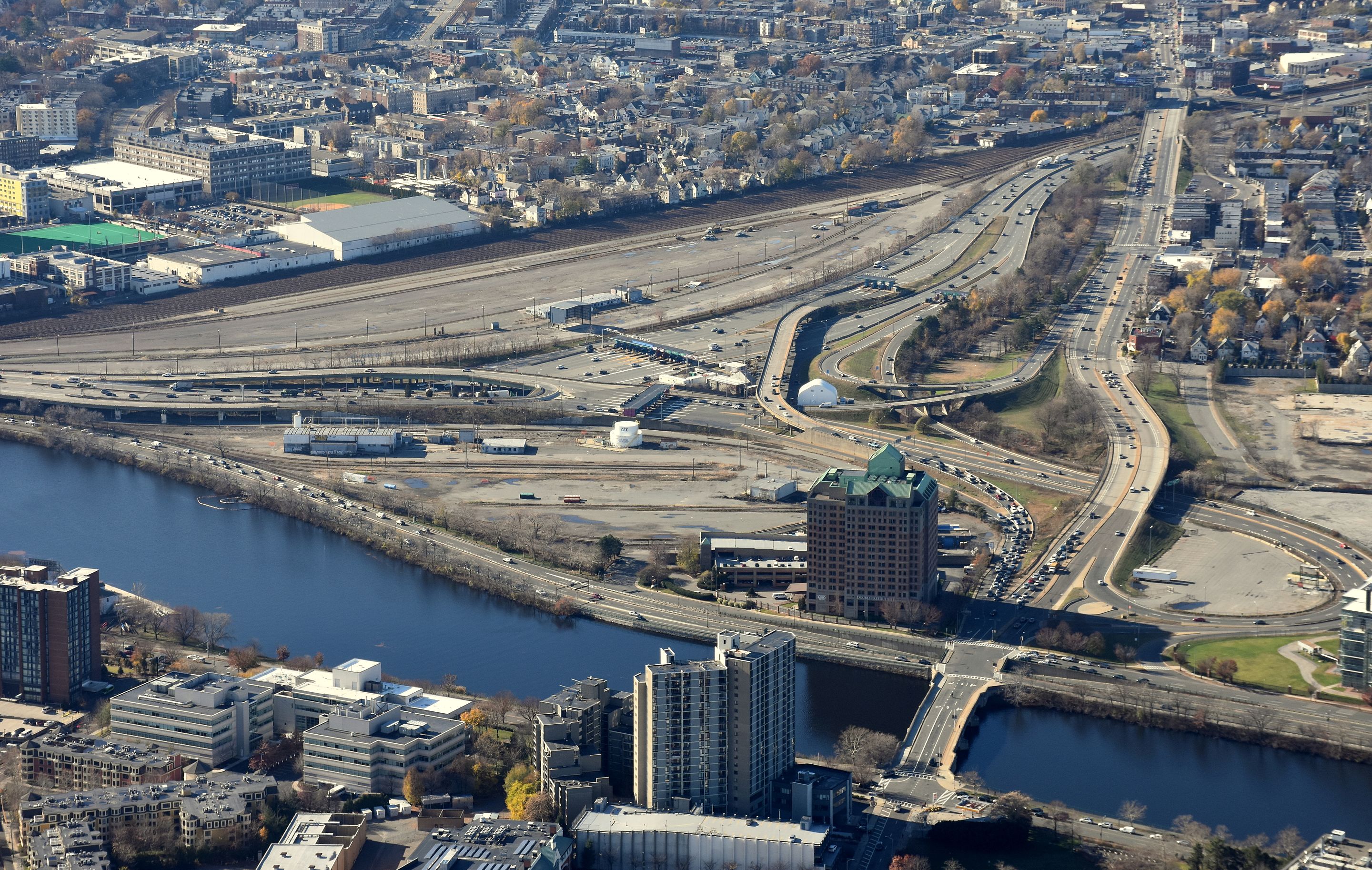
At a board meeting on Monday afternoon, MassDOT Secretary Stephanie Pollack presented a yet another plan for rebuilding the Massachusetts Turnpike along the narrow riverfront corridor where 12 highway lanes and the Worcester/Framingham commuter rail line squeeze between the Boston University campus and the Charles River in the Allston neighborhood of Boston.
The new plan allegedly avoids environmental impacts to the Charles River during a complicated construction process that could last for up to a decade.
But it also bears a striking resemblance to the Turnpike's present-day layout, a relic of discredited midcentury highway planning.
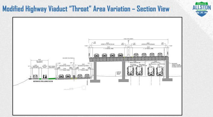
The latest proposal would rebuild much of the massive, eight-lane-wide viaduct that has loomed over putative parkland on Allston's riverfront since the mid-1960s.
Critics, including several members of a public oversight task force, are expressing concerns that MassDOT is grasping at straws, and operating in denial of the Commonwealth's long-range goals to reduce traffic congestion and greenhouse gas pollution from motor vehicles.
Related:
A Rough Guide To Boston’s Allston/I-90 Megaproject
For the past year, MassDOT engineers had been planning a different scheme, which would have stacked Soldiers Field Road on a smaller viaduct above the Turnpike – an alignment recommended by an independent review team in late 2018.
While that plan had broad support, MassDOT's construction plans, which would have relocated Soldiers Field Road onto a "temporary" bypass road in the middle of the Charles River for most of the project's decade-long construction period, ran into serious opposition.
In October, project manager Mike O'Dowd told MassDOT's board of directors that the idea of a mid-river bypass road had "been well-received, surprisingly enough" by river advocates. But when they were allowed to speak for themselves, environmental groups panned the agency's construction plans.
More recently, Massachusetts Energy and Environmental Affairs Secretary Katie Theoharides informed MassDOT that "any alternative that contains impacts on the Charles River, even temporary, is not only difficult to permit, but should be discounted in favor of alternatives with no temporary or permanent impact."
That prompted the project team to reconsider their approach. While the previous design is still on the table, project managers now seem to be leaning towards a design that more closely resembles the current layout:
During a scheduled task force meeting for the project on Monday evening, many stakeholders expressed disappointment over MassDOT's new scheme.
"Putting the Turnpike up on an elevated viaduct just creates more noise and pollution for the surrounding neighborhood," said Allston resident and task force member Harry Mattison during a phone interview Tuesday morning. "So many people have volunteered their time to creating better walking and biking connections to a greatly improved riverfront park. This is just an insult."
Last Friday, over a dozen individuals and organizations with ties to the project – including Mattison and eight other official members of the project's public oversight task force – co-signed a letter that asked MassDOT to evaluate other alternatives, including options with fewer highway lanes.
That letter noted that current construction plans would already reduce I-90 to a 6-lane configuration for most of the project's decade-long construction period – the same decade in which Boston, Cambridge, and Somerville have all committed to making major reductions in motor vehicle traffic in order to meet greenhouse gas reduction goals.
"Because reducing I-90 to 6 lanes for several years of construction is feasible, study is needed to consider why I-90 capacity should be increased by one-third when construction is completed (in the 2030s)," asserts the letter. "A 9 or 8-lane cross section would likely allow the riverbank restoration and (riverfront bike and walking) paths without any encroachment into the river."
During Monday's MassDOT board meeting, though, Sec. Pollack. dismissed the idea that large numbers of commuters could shift to commuter rail and other alternatives.
“The Worcester/Framingham commuter rail is a critically important part of this project, but note that even if we could, say, double the ridership of the line – which would take considerable investment in triple-tracking the line, and potentially electrification – the 20,000 additional passengers would constitute a relatively small proportion of the combined traffic of I-90 and Soldiers Field Road,” said Pollack.
The project is in the early stages of its federal environmental review, when these design alternatives (and possibly others) will be formally evaluated for their environmental and social impacts.
