In Newton, the Massachusetts Department of Conservation and Recreation (DCR) is planning another transformation of one of its car-centric "parkways" to create space for pedestrians and people on bikes.
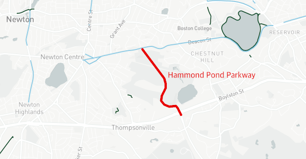
Hammond Pond Parkway is currently a four-lane highway running between Beacon Street in Newton to Horace James Circle in Brookline. For most of its length, it passes through forested conservation lands, except near Boylston Street (Route 9), where it passes through a high-density suburb of strip malls and large apartment complexes surrounding the Chestnut Hill mall.
For most of its length, the Parkway has four lanes of high-speed traffic and no sidewalks – just a pair of well-worn dirt pathways along its curbs.
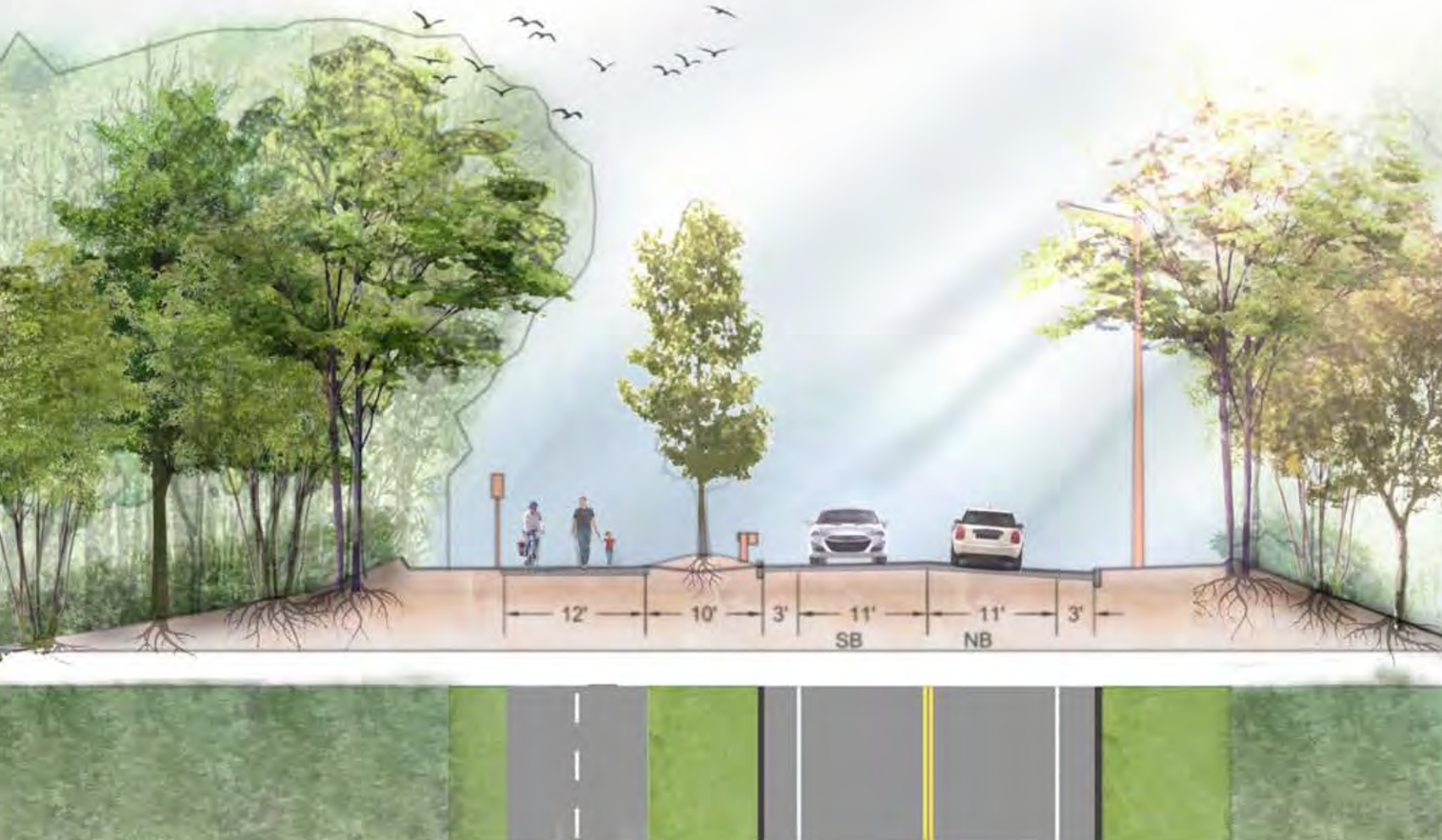
But in a virtual public hearing on Thursday evening, DCR officials shared a presentation of design plans for a project that would rebuild the northern half of the parkway in Newton, between Route 9 and its northern terminus at Beacon Street, to make the street significantly more accessible for bike riders and pedestrians.
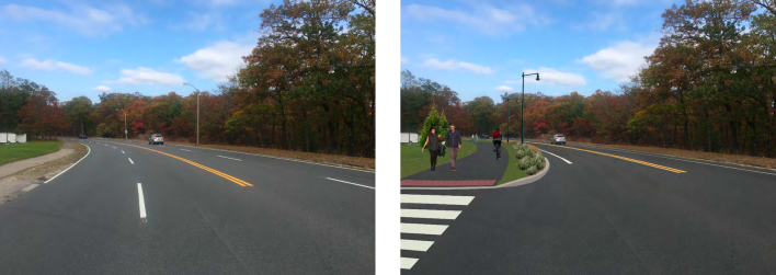
The project, which is scheduled to begin construction in 2022 for completion by the fall of 2023, proposes to carve up the roadway's western lanes to create a 12-foot-wide bike and pedestrian pathway, with additional greenspace between the new trail and the narrowed street:
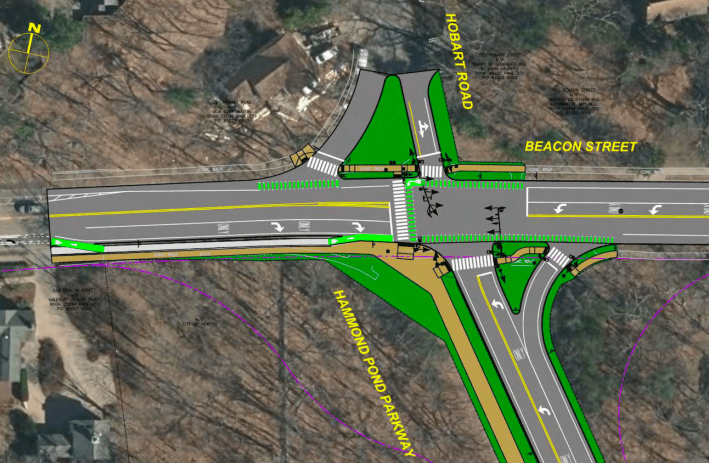
The project would also shrink the intersection of Beacon Street and Hammond Pond Parkway, and add greater protection for the Beacon Street bike lanes through the intersection:
Newton City Councilor Alicia Bowman, a former president of the Bike Newton advocacy group, says that Hammond Pond Parkway has been on the agenda of local safe streets advocates for years, and that there's strong local support for the proposed improvements.
"This will make it safe for our neighbors to walk along there. For people who live nearby, they'll have the option to walk to trails in the Webster Woods conservation area, instead of getting in their cars and driving there," said Bowman in a phone conversation on Friday.
The project would end just north of the Boylston Street/Route 9 interchange, without making any significant changes to that intersection. That location is by far the most dangerous area on Hammond Pond Parkway: according to state crash data, there have been 19 injury-causing crashes near the junction of Route 9 and Hammond Pond Parkway since 2018.
However, DCR officials are reportedly considering additional changes to that intersection and to the southern section of the Parkway, between Boylston Street and Horace James Circle in Brookline, for a future "phase two" project.
The Hammond Pond Parkway project is the second major parkway transformation that the DCR has proposed this year. The agency is also working on plans to reduce roadway width and increase park space on the Arborway in Boston's Jamaica Plain neighborhood.
