New Trails We Can Look Forward to in Central and Western Mass. This Year
There are so many new trail projects in the works across Massachusetts that we had to split up our annual preview of new trails into two articles. Yesterday we offered a rundown of five new off-street multi-use pathways that are expected to open to traffic in eastern Massachusetts later this year. Today, we’re looking at five more projects opening in Central and Western Massachusetts.
Twin Cities Rail Trail, Leominster and Fitchburg
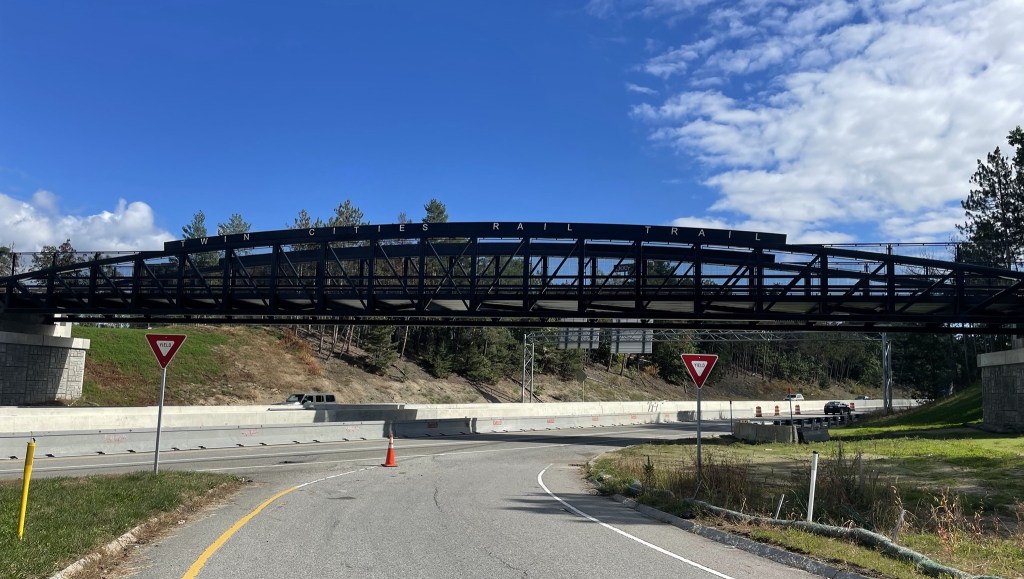
In terms of terms of opening up car-free travel options for neighborhoods that previously didn’t have all that many, this may be one of the most impactful trail projects opening in 2022. The Twin Cities Rail Trail will travel 4.5 miles from the eastern edge of downtown Fitchburg to the northern edge of downtown Leominster, connecting several densely-populated residential neighborhoods, industrial areas, parks, and shopping centers along its route.
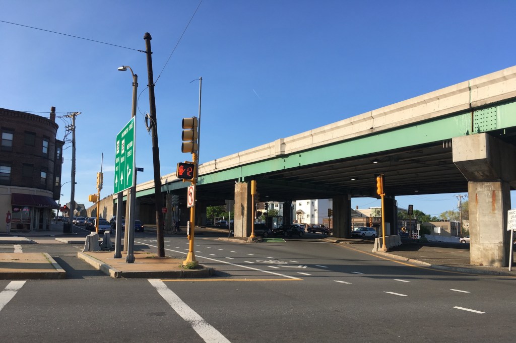
The trail runs roughly parallel to Route 12 (known as North Main Street in Leominster and Water Street in Fitchburg), which is the main roadway that connects the two cities. At the northern terminus, the trail will end within sight of the Fitchburg MBTA station, but the Nashua River and railroad tracks still block direct access to the train station for now. Instead, trail users connecting to the T will need to take a longer route using the two bridges on Water Street. A future project aims to close that gap with a dedicated bike and pedestrian bridge to the station.
One of the most prominent features of the new trail is its new bridge (pictured above) that spans Route 2, a multilane expressway that divides the two cities. While there are currently only a handful of ways to get across Route 2, the Twin Cities Rail Trail will soon provide a safe, protected route for people to travel between the two cities without a car.
Mohawk Trail, Williamstown
In the northwestern corner of the Commonwealth, Williamstown will open a 2.3-mile segment of the Mohawk Trail later this year. The new trail will skirt the northern edge of the Williams College campus and connect Route 7, the main route to Vermont, to the town’s Main Street near the boundary with North Adams.
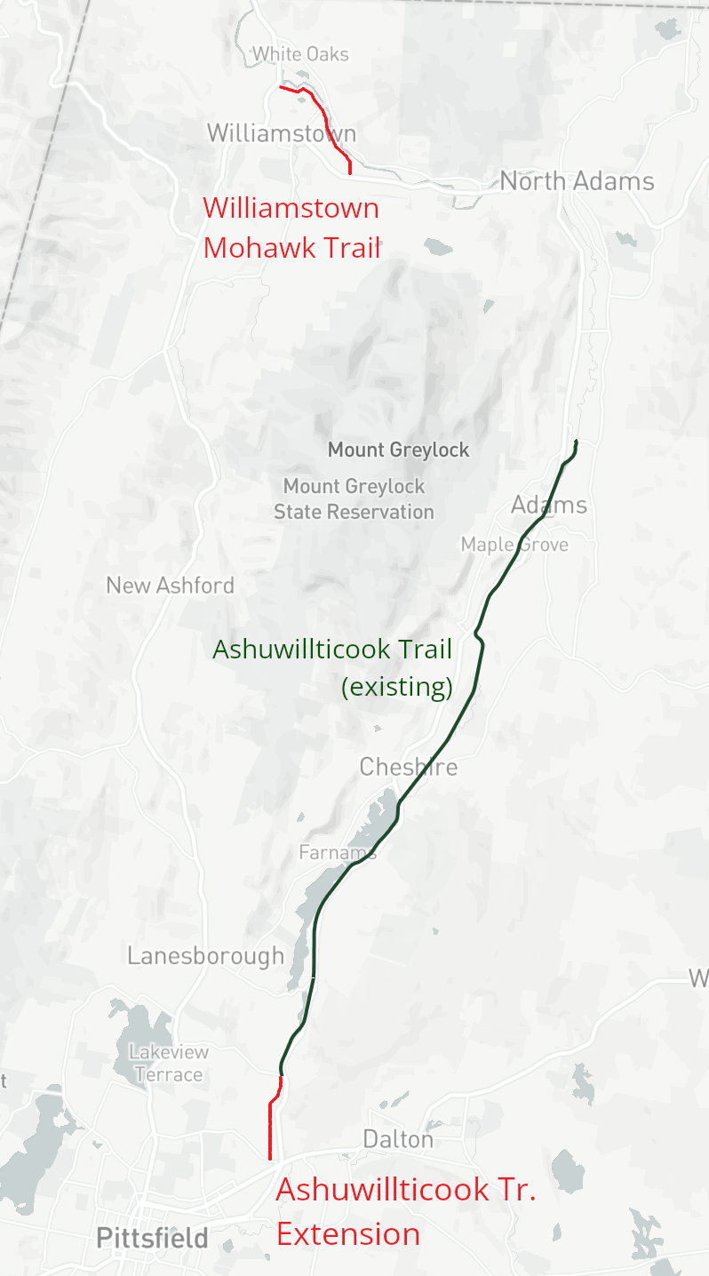
The long-range plan is for the Mohawk Trail to extend north into Vermont, and east to North Adams, where it will join a future northern extension of the Ashuwillticook Rail Trail. In 2021, MassDOT also published a feasibility study for trail options that could extend the Williamstown trail east along the Hoosic River to downtown North Adams, where Mass MoCA recently incorporated a bike tunnel into a renovation of one of its waterfront mill buildings.
Ashuwillticook Rail Trail extension, Pittsfield
Further upstream on the Hoosic River, the existing Ashuwillticook Rail Trail extends 12 miles through the towns of Adams and Cheshire. Later this year, a new segment will bring the trail 1.5 miles further south to Crane Avenue at the eastern outskirts of Pittsfield, Berkshire County’s largest city.
Unfortunately, the southern terminus of the new trail segment will put bike riders and pedestrians in the middle of a district of strip malls and dangerous four-lane roadways about 3 miles away from Pittsfield’s more walkable downtown, but plans are in the works to extend the trail further into the city.
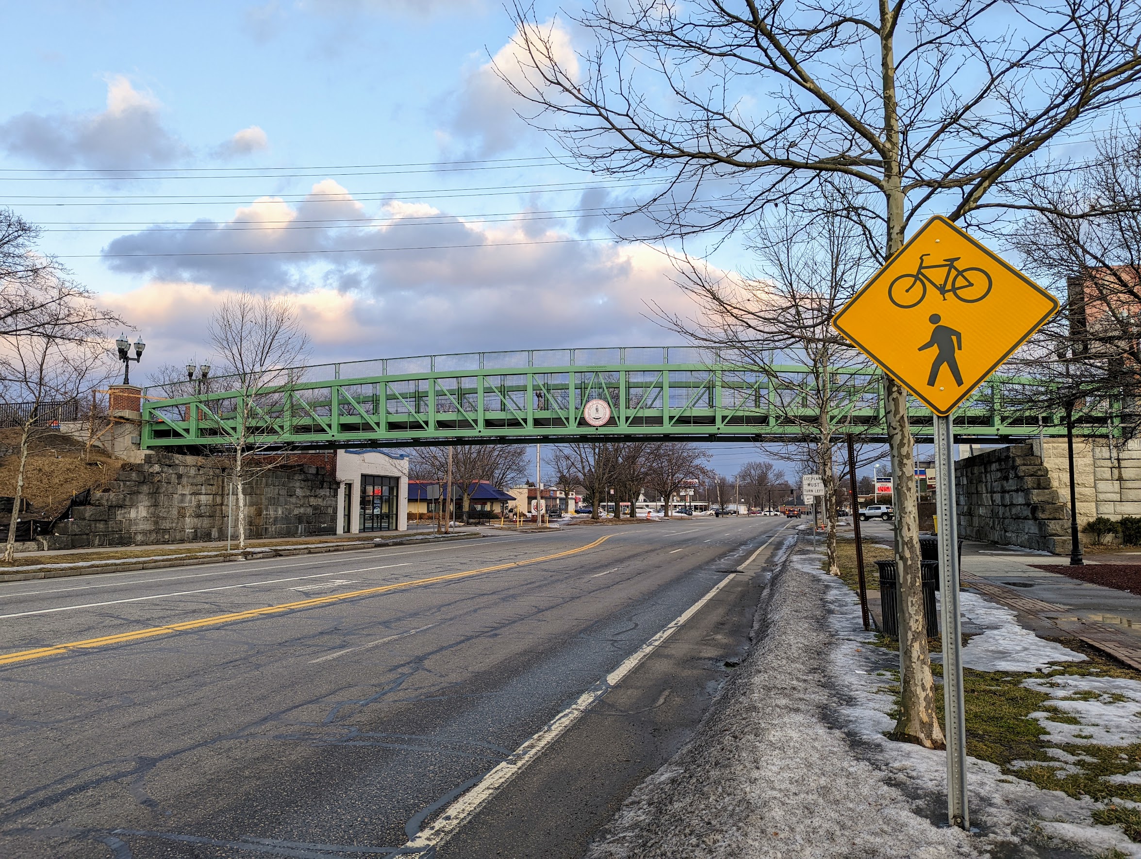
Columbia Greenway downtown extension, Westfield
After some construction delays, Westfield will open a new downtown segment of its Columbia Greenway, which will extend the interstate rail trail to a riverfront park on the Westfield River.
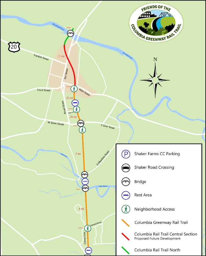
The current Columbia Greenway in Westfield, along with the Southwick Rail Trail in the neighboring town of Southwick, extends 8.5 miles from Westfield’s Main Street to the Connecticut border. There, the rail trail continues south across the entire state of Connecticut as the Farmington Canal Heritage Trail, which provides an almost-continuous off-street path all the way to New Haven.
For now, Westfield’s Columbia Greenway ends on the north bank of the Westfield River; beyond that, the rail corridor is still active with freight traffic. The city is currently studying options to extend the trail through the northern part of Westfield, while the neighboring town of Southampton is making moves to purchase its section of the rail line for future trail use.
MassDOT is also planning a future reconstruction of Southampton Route/Route 202, and the state’s design plans include a new 2.9-mile shared-use pathway on the west side of the the state highway between the Massachusetts Turnpike and North Road.
Together, all those projects could eventually link the Columbia Greenway with the popular Manhan Rail Trail and Mass. Central Rail Trail network in Easthampton and Northampton.
Connecticut Riverwalk, Chicopee
Chicopee’s new riverfront trail, like its counterpart in Springfield, is being built on top of a flood control levee on the banks of the Connecticut River. The new path will extend 2.4 miles around the edge of Chicopee’s Willimansett neighborhood, from the city’s water treatment plant to Nash Field, a city park located about a mile from the bridge to Holyoke.
Longer-range plans call for extending the Riverwalk east to connect to Chicopee’s downtown, located across the mouth of the Chicopee River, and then south to link to the Springfield Riverwalk, about 2.5 miles away.
Read the companion to this article:
This story was corrected on Wednesday Feb. 9 to specify that the northern end of the Twin Cities Rail Trail is near the Fitchburg MBTA station. Because of the editor’s error, a previous version had incorrectly stated that the trail ended at the Leominster station.

Read More:
Streetsblog has migrated to a new comment system. New commenters can register directly in the comments section of any article. Returning commenters: your previous comments and display name have been preserved, but you'll need to reclaim your account by clicking "Forgot your password?" on the sign-in form, entering your email, and following the verification link to set a new password — this is required because passwords could not be carried over during the migration. For questions, contact tips@streetsblog.org.