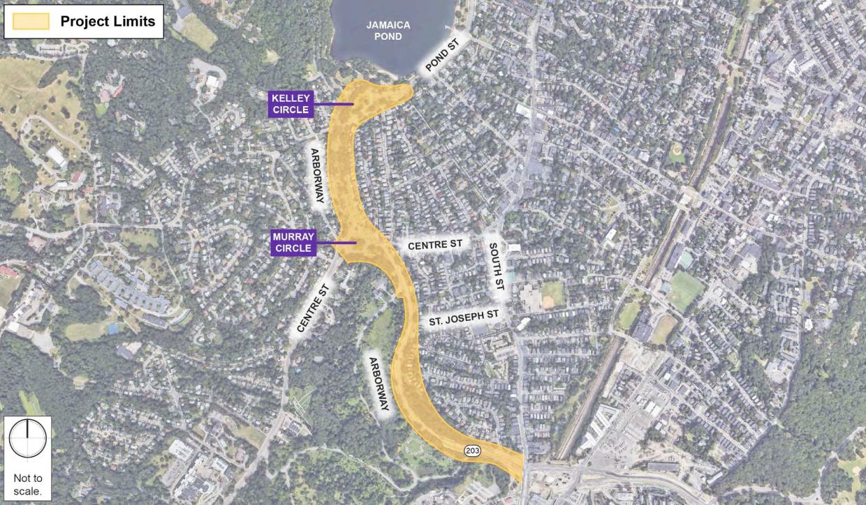
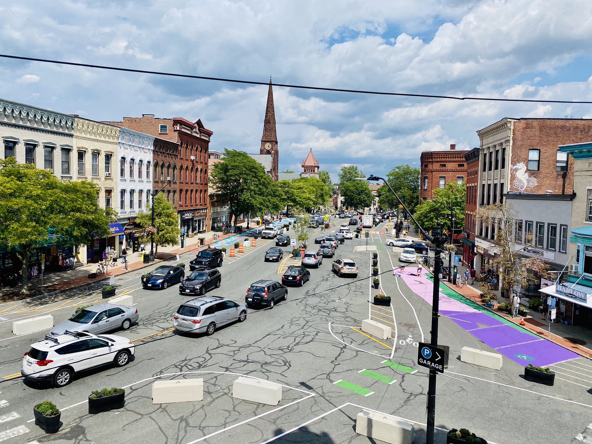
The Massachusetts Department of Conservation and Recreation (DCR) is hosting one more round of public input for a major renovation of the Arborway in Jamaica Plain that would convert multiple motor vehicle lanes to parkland and fill a missing link in the Emerald Necklace with new bicycle and pedestrian paths.
It's a project that has been in the works for two years now, and judging by the updates from a recent online public hearing, it's hard to tell whether the project is actually moving forward, or just going around in circles like a car stuck on one of the Arborway's notorious rotaries.
The last public hearing on the Arborway Improvements Project, which we covered in October 2020, outlined three alternative designs, which all strive to preserve trees and reduce the Arborway’s paved footprint while adding new bike paths, sidewalks, crosswalks, and greenspace.
At that meeting, DCR officials told the public that they hoped to finalize a design by the spring of 2021, and begin construction shortly thereafter.
But at a virtual public hearing on January 20, DCR confirmed that they had not yet settled on a preferred design. In fact, instead of narrowing down the options, they've added a fourth alternative (pictured below), and are asking the public to weigh in one more time on all the alternatives.

The four alternatives share some common elements – like a continuous dedicated bike path that would extend from Jamaica Pond to the Forest Hills Orange Line Station, and lane reductions that would tear up asphalt to create more accessible parkland. But the details of the four designs vary considerably.
Public comments on the four alternatives, and an online survey, will be open through Thursday, February 17th (note that parts of the project website still say that the deadline for public comments is Feb. 10, but DCR extended that deadline one week because it took them longer than expected to post the meeting's presentation and recording).
Sarah Freeman, who lives on the Arborway and has long advocated for traffic-calming improvements to the park, told StreetsblogMASS that "I see a lot of pros and cons (to each design), and to tell you the truth, it would be a lot easier if there were one preferred alternative that we could critique. When you have four locations with four potential designs – there's a lot to keep track of."
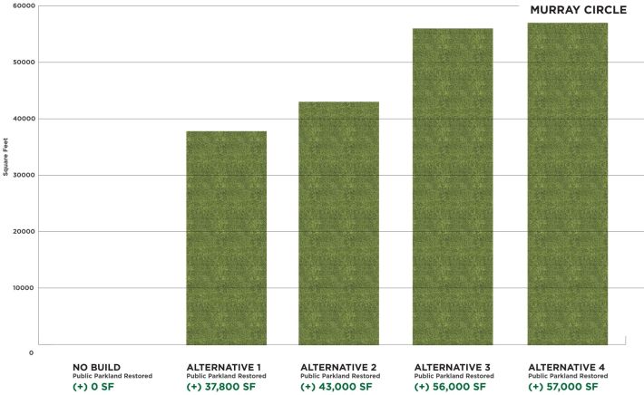
Freeman says that some of her neighbors – like the Jamaica Pond Association – support roundabouts at Kelley and Murray Circles. But other advocates – like the Boston Cyclists Union – favor designs that would replace the traffic circles with signalized intersections.
"Because it is not safe or comfortable for people walking and biking to cross multiple lanes of moving cars (in a roundabout), the final design needs to be signalized," wrote the Cyclists' Union in a detailed blog post about the four alternatives.
Ultimately, though, Freeman believes that all four options would be large improvements over the status quo.
"Everyone acknowledges that we need to do something and is supportive of moving forward. Let's have DCR process all the comments and encourage them to move forward so this doesn't just end up on a shelf," she says.
While the redesign project remains in the planning stages, there have been some modest changes made to the Arborway in the past year. Last summer, DCR did implement some short-term improvements to fix the Arborway's sidewalks, and also painted new striping patterns to implement a road diet on the outer "carriageway" roads between Kelley and Murray Circles.
On Monday, a DCR spokesperson told StreetsblogMASS that a timeline for implementing bigger changes hasn't yet been determined.
"Once we choose the preferred alternative, based on public input, then we'll come up with a construction plan and timeline," said Carolyn Assa, DCR's Director of Communications.
The DCR has churned through several leaders in the past two years, which could be one reason the Arborway project hasn't made much progress. Former DCR Commissioner Jim Montgomery, who took over the agency in early 2020, resigned in November.
At the January public hearing, DCR's new Acting Commissioner, Stephanie Cooper, promised that the Arborway project would be a "top priority" for her agency.
