Safety Advocates Set Their Sights On Medford’s Mystic Mess
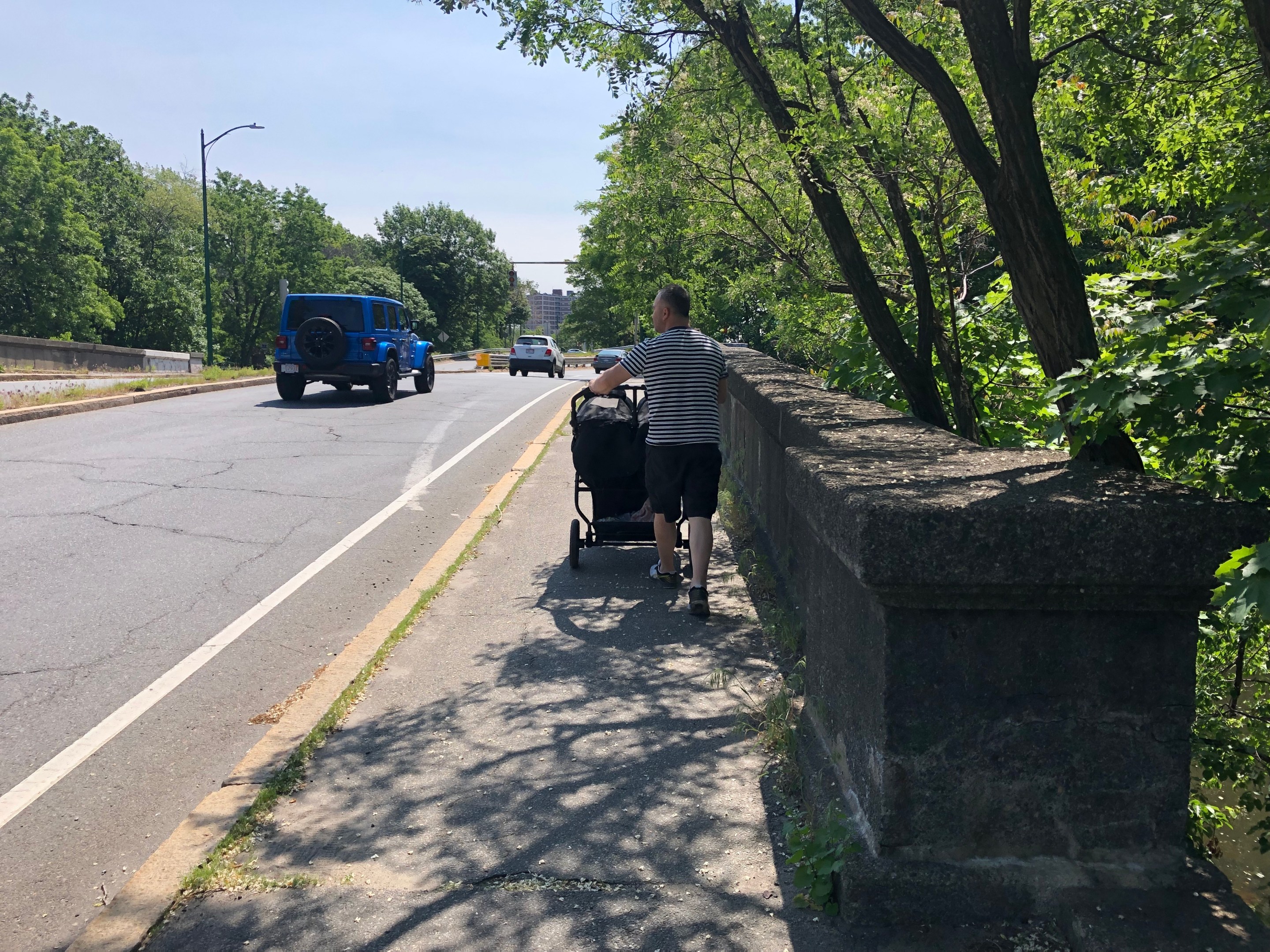
A Mystic Valley Parkway bridges over the Mystic River near downtown Medford (the Riverside Towers housing complex is visible in the distance). Though this bridge links downtown Medford to the Mystic River pathways, it features narrow sidewalks next to excessively wide motor vehicle lanes that encourage speeding. Photo courtesy of Ellery Klein.
On Wednesday evening, street safety advocates from WalkMedford will host their State House delegation for a "Walk and Talk" event along the Mystic Valley Parkway to discuss ways to reclaim their riverfront parkland from the fields of asphalt that have paved over acres of the city's riverfront.
Organizers envision the walk as a companion event to last year's Somerville Alliance for Safe Streets event on the Alewife Brook Parkway, which intersects with the Mystic Valley Parkway in a treacherous rotary near the Medford-Somerville border. Both roadways are owned by the Department of Conservation and Recreation (DCR), a state agency that's notorious for slow-walking safety improvements for the multi-lane highways that run through its "parks."
"Members of WalkMedford are on the Somerville Alliance for Safe Streets Route 16 coalition," Ellery Klein, a WalkMedford organizer, told StreetsblogMASS. "We want DCR to think holistically, and prioritize walking and biking along this whole corridor. It’s hard to get any responsiveness from DCR as a single municipality, so we hope that joining with Somerville, and pushing together, we can get more vision and funding and reform to make DCR treat these riverfront lands not as a road, but as a park."
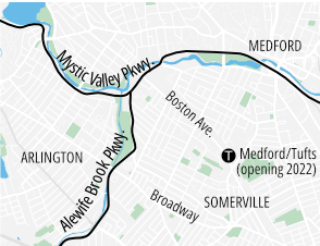
The Mystic Valley Parkway in Medford begins on its west end as a four-lane roadway, much like the Alewife Brook Parkway in Somerville, in a closely-spaced pair of T-shaped intersections on either side of the Mystic River:
This junction is one of the safety hazards that WalkMedford wants the DCR to address. Although Parkway itself narrows down to two lanes just east of this intersection, it suddenly widens to a 4-lane cross-section through the intersection itself, with wide corners and slip lanes that encourage high-speed traffic.
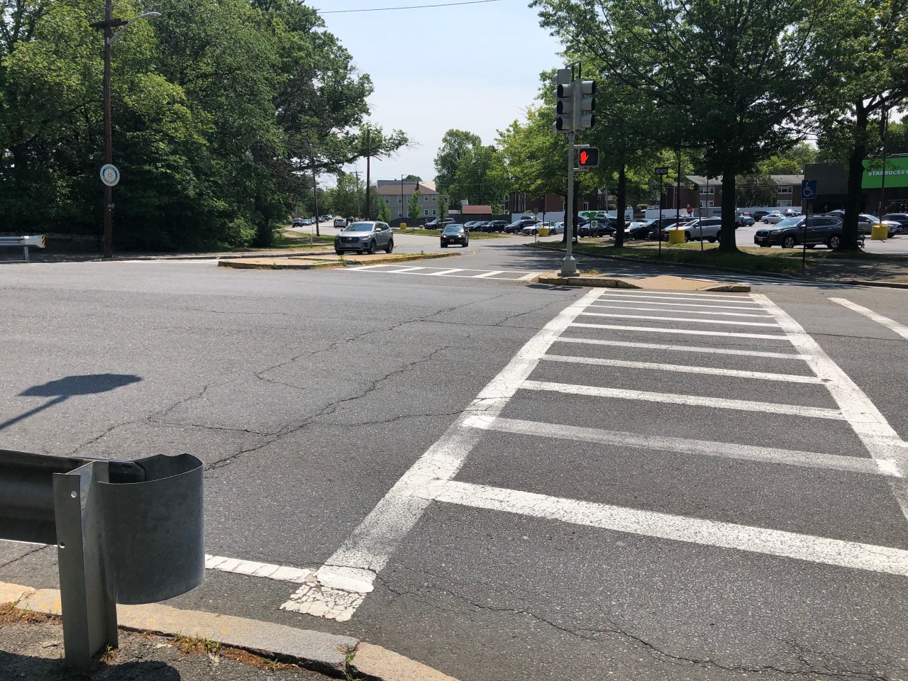
Another major threat to pedestrian traffic lies at the parkway's eastern end, on the edge of downtown Medford, where the Mystic Valley Parkway essentially turns into an on- and off-ramp to Interstate 93.
That makes it a major barrier in the Mystic River path network. For instance, pedestrians who are crossing the river from downtown Medford and want to continue westward through Medford's riverfront Veterans Memorial Park must brave this crosswalk, near the John D. Hand footbridge, where two freeway lanes merge together:
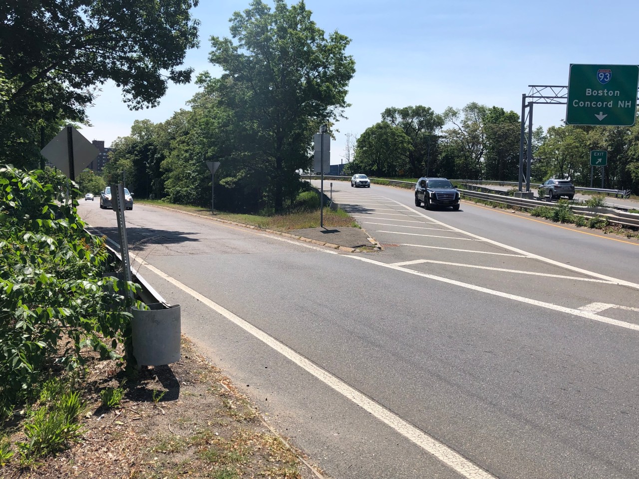
Klein notes that an upcoming DCR trail project, the Clippership Connector, will bring additional foot and bike traffic through this intersection.
Tonight's Walk and Talk event will begin at 5 p.m., and depart from the community gardens near the intersection of Winthrop Street and Mystic River Parkway. RSVP here.
Stay in touch
Sign up for our free newsletter