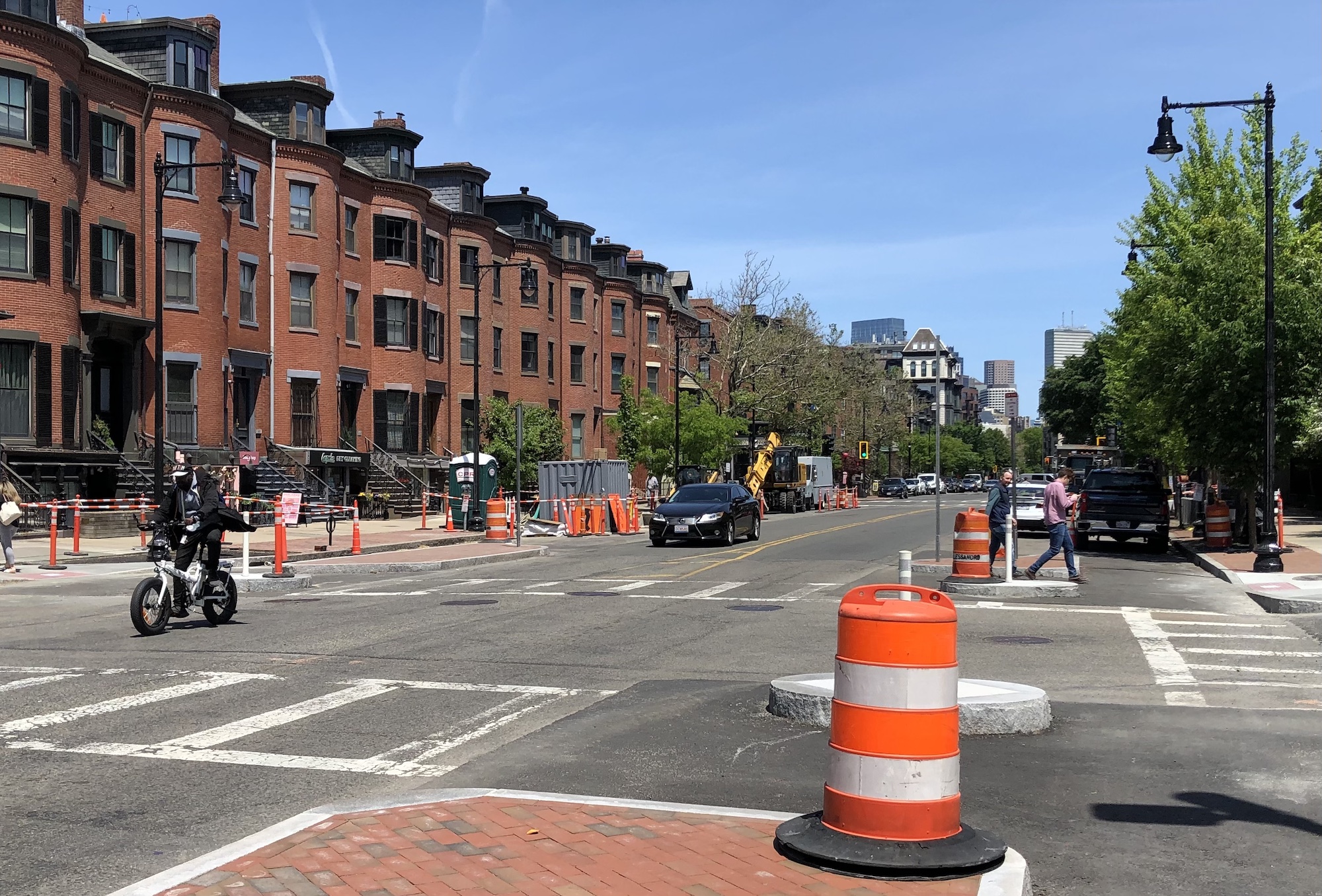
There has been a dramatic reduction in serious crashes along Tremont Street through the South End this year as a construction project installs new protected bike lanes between Massachusetts Avenue and Herald Street.
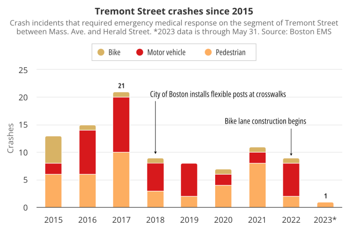
According to the City of Boston's EMS call data, before the pandemic, this segment of Tremont Street saw, on average, over a dozen 911 calls related to crashes each year.
But during the first five months of 2023, there's only been one crash that required emergency responders on the same street segment:
Tremont Street has been a busy construction site for the past year, as crews build new raised crosswalks and install curbed islands that will separate traffic from new protected bike lanes.
Even though that safety infrastructure isn't finished yet, the construction work has already delivered one major safety benefit.
Until late in 2022, reckless drivers could take advantage of four lanes on Tremont Street to swerve around slower-moving traffic:
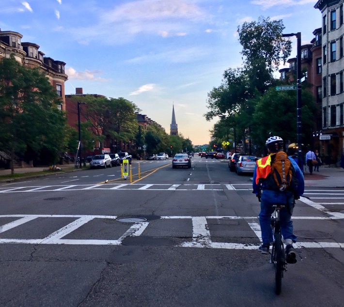
The four-lane configuration was particularly hazardous at the street's "double-threat" crosswalks: one car might yield to let someone cross the street, but passing cars in the other lane were then less likely to see, or stop for, the pedestrian in the crosswalk.
The construction work has all but eliminated that threat. Over the course of 2022, construction gradually constricted more and more of Tremont Street, such that in 2023, the street has effectively been reduced to two lanes through most of the South End.
That means that vehicles (including bikes, which don't yet have access to the new bike lanes) have been traversing the street in a single file, at slower, safer speeds.
The Boston Transportation Department (BTD) had identified Tremont Street as a priority under the city's "Vision Zero" policy after motorists killed pedestrians there in November 2015 and again in May 2017.
The number of crashes also declined in 2018, the year the city installed new flexible-post bollards and "yield to pedestrians" signage at crosswalks to give people a better chance of making it across the street's four lanes alive (see photo above).
Note on methodology: the crash data discussed in this story comes from the City of Boston's Vision Zero crash database, which is derived from 911 dispatch data. It includes crashes recorded between Jan. 1, 2015 and May 31, 2023, whose locations were pinpointed within 20 meters of the centerline of Tremont Street. These do not include crashes at the intersections of Tremont Street with Herald Ave. or Massachusetts Ave., which are beyond the scope of the current construction project.
