Skip to Content
Streetsblog Massachusetts home
Log In
Trails

Eyes On the Street: Two New Path Connections In Fenway

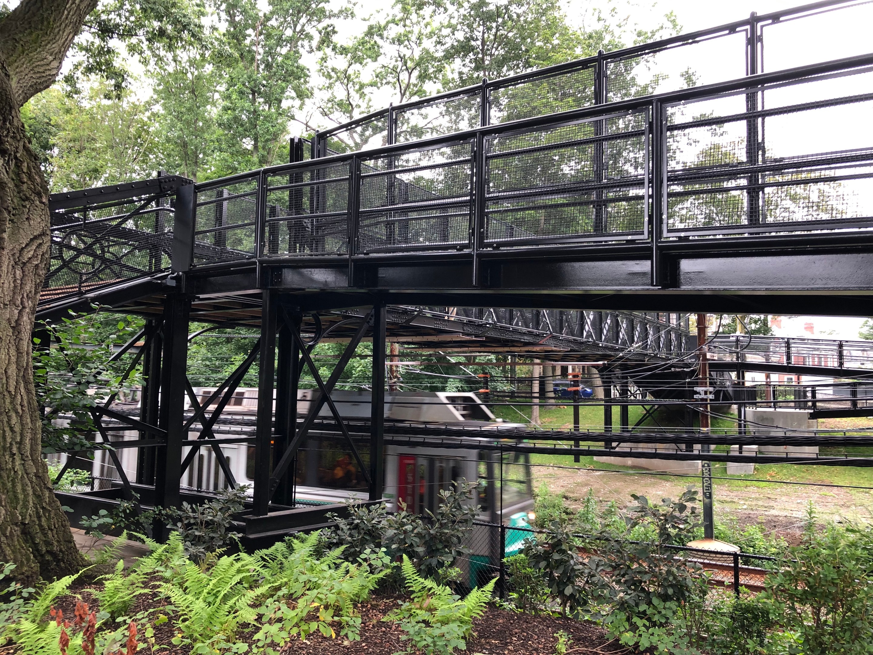
A Green Line train passes under a black metal bridge in a forest. A few brick houses are visible in the distance on the other side of the bridge.

A Green Line train passes under the Carlton Street footbridge on Aug. 16, 2023.

This summer, two short path connections in the Fenway neighborhood are finally open after years of work.

Near the Lansdowne MBTA station, a new one-block extension of the Fenway Path opened earlier this summer:
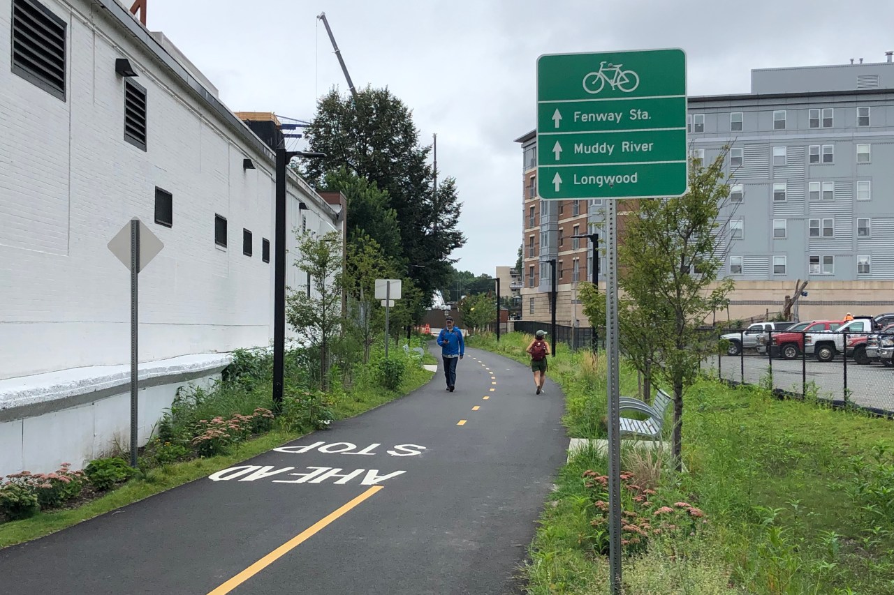
A paved asphalt bike and pedestrian path winds behind a single-story cinder block building on the left and a parking lot on the right. A green wayfinding sign shows three destinations, listed next to arrows that point straight down the path: Fenway Sta., Muddy River, and Longwood. In the middle distance two people walking are passing each other on the path, and further on in the distance is a crane at a construction site behind a multi-story apartment building.
The new segment of the Fenway Path, looking southwest from Overland Street.

The new segment runs one block from Maitland and Overland Streets to Miner Street, where it connects to another path segment that runs behind the Landmark Center complex and opened in 2021.

Critical connection under Park Drive still in limbo

In the longer term, the City of Boston hopes to continue the path a short distance westward to complete a car-free connection to the Riverway under the Park Drive overpass.

That short connection, all on publicly-owned land, would let trail users avoid dangerous crossings on Park Drive and the Riverway, and it would create a safer, faster walking route between the Longwood Medical Area and the MBTA's regional rail system.

But, as we reported in 2019, MBTA officials are reluctant to allow public access to that area because the T sometimes uses the area under the Park Drive overpass as a staging area for Green Line track maintenance.
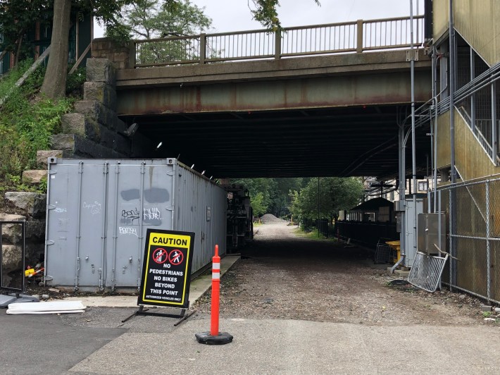
A gravel area underneath a roadway bridge. In the distance on the other side of the bridge trees are visible. To the right a staircase leads from the ground level to the bridge. In the foreground a sign says "Caution no pedestrians no bikes beyond this point - authorized vehicles only"
MassDOT hopes to extend the Fenway path through this MBTA-owned property under Park Drive to connect it to the Riverway, which is visible in the distance on the other side. But for now, pedestrian access is officially prohibited.

New Carlton St. Footbridge connects Emerald Necklace to Brookline, B.U. Bridge

A short distance to the west, the Town of Brookline recently completed its rehabilitation of the historic Carlton Street footbridge, which spans the Green Line tracks to connect residential neighborhoods of eastern Brookline to the Fenway area.
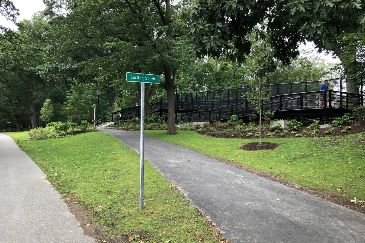
Two paved paths diverge in a green woodland. A green street sign pointing right indicates that the right path leads to Carlton St. At the top of that path, a stairway and a wheelchair ramp made of black metal lead over the Green Line tracks.
The Riverway entrance to the Carlton Street footbridge.

The short link considerably upgrades a well-used, north-south bike route between Cambridge and the Longwood Medical Area.

Carlton, Ivy, and Essex Streets (indicated by the dotted green line in the map above) are all low-traffic routes with contraflow bike lanes to connect bike traffic to the Boston University Bridge into Cambridge to the north.

In addition to wheelchair-accessible ramps, the stairs up to the bridge also include bike channels, which are intended to let bicycle users roll their bikes next to them as they climb up or down:
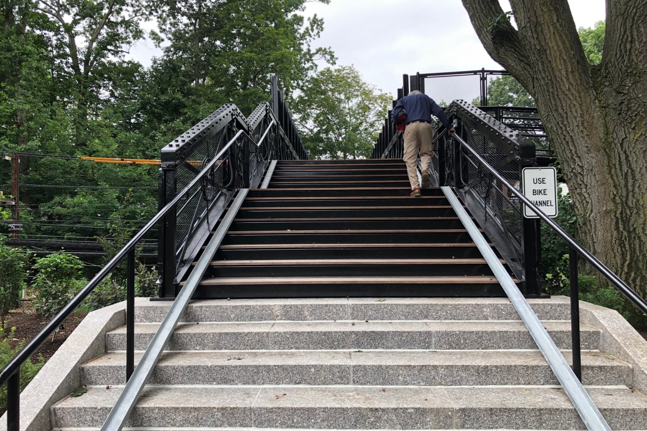
A man in khaki pants climbs a staircase surrounded by trees. At the edges of the stairs, near the base of the railings, are two metal gutters, roughly 6 inches wide, which are ramps designed to let people roll their bikes up and down the steps. A sign to the right reads "USE BIKE CHANNEL"
The Carlton Street stairs over the Green Line. The metal gutters next to the railings are intended to let bicycle users roll their bikes up and down the stairs.

As a practical matter, though, the channels have been anchored too close to the railing to be useful. When we visited on Wednesday, your editor found that it was impossible to use the bike channels without the bike's handlebars and pedals getting caught on the adjacent railing.

StreetsblogMASS reader Ken Carlson, who visited the bridge when it opened last weekend, told us that he was able to point out the problem to an engineer on the site. That engineer reportedly expressed a willingness to fix the problem by adding more clearance between it and the railings.
Stay in touch

Sign up for our free newsletter

More from Streetsblog Massachusetts

State Officials Say Work to Improve Safety at Lethal Memorial Drive Crash Site Will Begin On Monday

The state's parks agency will reduce Memorial Drive's speed limit and create more space for the area's busy bike and pedestrian traffic.

October 4, 2024

Red Line’s Braintree Branch Reopens With 37 Fewer Slow Zones

By eliminating dozens of slow zones, the T expects the typical round-trip on this segment of the Red Line to run 24 minutes faster than it did a month ago.

September 30, 2024
See all posts