DCR Plans Confirm There Will Be Less Space for Bikes In the Arborway’s Most Dangerous Intersection
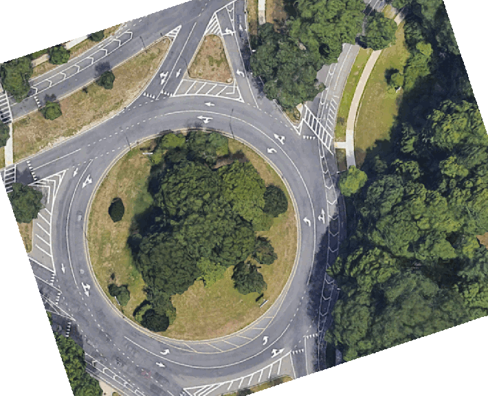
In an updated traffic advisory issued Thursday, the state’s Department of Conservation and Recreation finally released details about its plans to re-stripe a segment of the Arborway in Jamaica Plain to provide additional space for motorists to sit in traffic jams in the Murray Circle rotary.
The striping plans confirm that the agency will maintain a bike lane, which the agency had initially painted through the traffic circle in 2020, next to the newly-painted car lane.
But in order to accommodate that additional lane for cars, the agency will considerably reduce the width of a protective buffer between the bike lane and moving motor vehicle traffic inside the traffic circle – which is already a hot spot for violent driver behavior.
According to the City of Boston’s Vision Zero crash map, drivers have struck and injured people riding bikes on the southern side of Murray Circle on four separate occasions since the beginning of 2019.
DCR’s plan to add an additional lane at this location will also increase the risk of bodily injury for pedestrians attempting to cross the Arborway at this location by creating a new “double-threat” crosswalk – a dangerous crosswalk design that the City of Boston is taking pains to eliminate elsewhere.
The new second motor vehicle lane will continue for about 500 feet beyond the traffic circle, and then motorists will be expected to merge into a single lane of traffic about 200 hundred feet north of the Arboretum driveway.
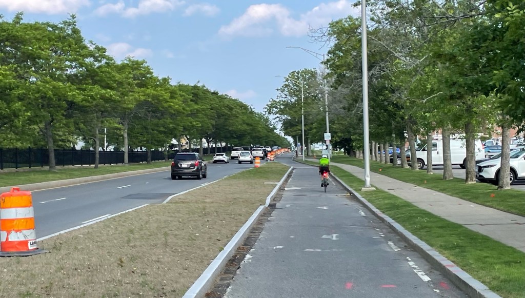
In that segment, DCR’s plans would maintain its buffered bike lane by eliminating on-street parking, and moving the bike lane to the curbside.
DCR’s latest press release continues to assert that painting a new lane for motor vehicles will “alleviate congestion within the rotary at Murray Circle and the Arborway, and on surrounding streets,” but fails to elaborate how the new paint job will encourage more people to leave their cars at home.
Streetsblog has migrated to a new comment system. New commenters can register directly in the comments section of any article. Returning commenters: your previous comments and display name have been preserved, but you'll need to reclaim your account by clicking "Forgot your password?" on the sign-in form, entering your email, and following the verification link to set a new password — this is required because passwords could not be carried over during the migration. For questions, contact tips@streetsblog.org.