The MBTA appears to be moving ahead with plans to replace a major drawbridge next to North Station without a long-planned bike and pedestrian path that would have connected riverfront parks in Boston and Cambridge.
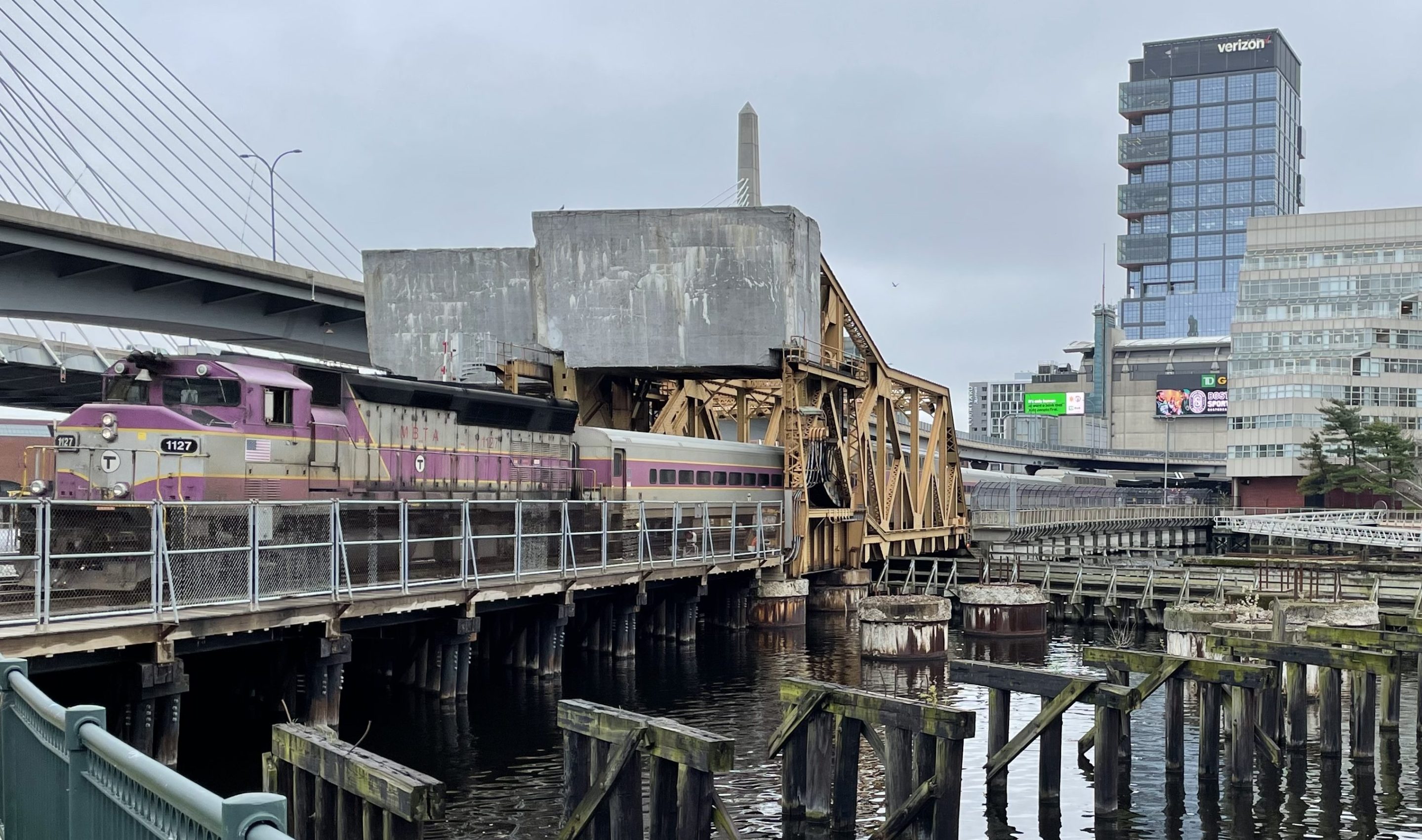
The MBTA is close to finishing its designs to completely replace its century-old Draw One railroad bridge over the Charles River (the existing bridge is pictured above; a rendering of the proposed new bridge is below).
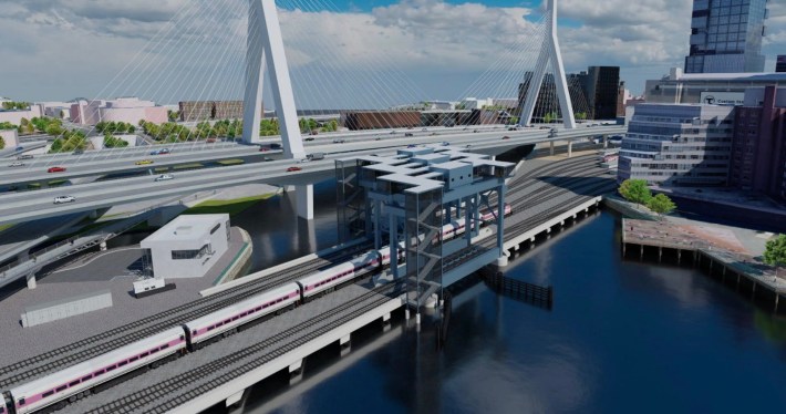
The $1.2 billion replacement would also build a new control tower, upgrade train signals, and expand the capacity of North Station by opening up access to two tracks that are currently out of service.
The MBTA will host a virtual public meeting about the project on Thursday evening – find details here.
The dream of the 90s
There is, however, one notable omission from the MBTA's current plans: they don't include a separate pathway for bike and pedestrian traffic, a connection that the state's parks agency is supposed to build as part of the state's mitigation for the Big Dig highway expansion project.
In 1995, the Metropolitan District Commission, the predecessor to today's state Department of Conservation and Recreation (DCR), published the "New Charles River Basin Master Plan."
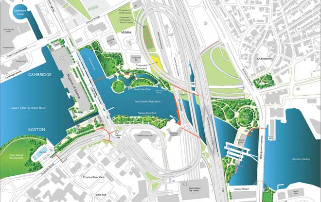
This plan was part of the state's required mitigation for the Central Artery and Tunnel project, more commonly known as the "Big Dig."
To compensate for that project's maze of massive highway overpasses that put this section of the Charles in a permanent shadow, the New Charles River Basin plan envisioned a string of new riverfront parks and trail connections.
With Big Dig mitigation funds, the state DCR implemented key elements of that plan, including Paul Revere Park, which opened in 1999, Nashua Street Park, which opened in 2003, and the North Bank Park and bridge, which opened in 2012.
But several key elements of the 1995 plan remain unfinished – including its recommendation for a new pedestrian crossing alongside the MBTA drawbridge to connect North Bank Park in Cambridge to Nashua Street Park in Boston.
Funding exists; interagency coordination does not
According to a February 2019 presentation to a New Charles River Basin Citizens Advisory Committee, the DCR still had $30.5 million in Big Dig mitigation funds available to complete five projects in the area, one of which was a "Draw One Walkway."
At the time, DCR estimated that the walkway would cost $3.3 million.
The meeting also alluded to an Interagency Service Agreement – a sort of contract between government agencies – that obligated the DCR to use those funds to complete the walkway.
Earlier this week, a DCR spokesperson confirmed with StreetsblogMASS that the agency has not been involved in the MBTA's bridge replacement plans.
Under the MBTA's current capital budget, the project has enough funding to finish its design phase, but the T would still need to cobble together at least $815 million in additional funding before they can begin construction.
A federal grant application that the T submitted last year was not successful, but T spokesperson Joe Pesaturo told StreetsblogMASS that the agency is trying again this year.
