MassDOT Makes More Space for Bikes and Pedestrians In Revised Designs for Medford Main Street
Nearly a year after their last public information meeting, the Massachusetts Department of Transportation (MassDOT) shared a new draft design for Main Street in Medford at a public hearing on April 23rd.
As a refresher, there are a number of high-crash intersections in downtown Medford where Main Street intersects with the eastbound on- and off-ramps to Route 16.
In fact, the intersection of Main Street with South Street and the Route 16 eastbound on-and-off ramps has been the site of 78 reported collisions between 2017 and 2019, the state’s 38th-highest crash location.
It also happens that this is one of the only ways for pedestrians and bikes to access Medford Square from the southern side of the Mystic River.

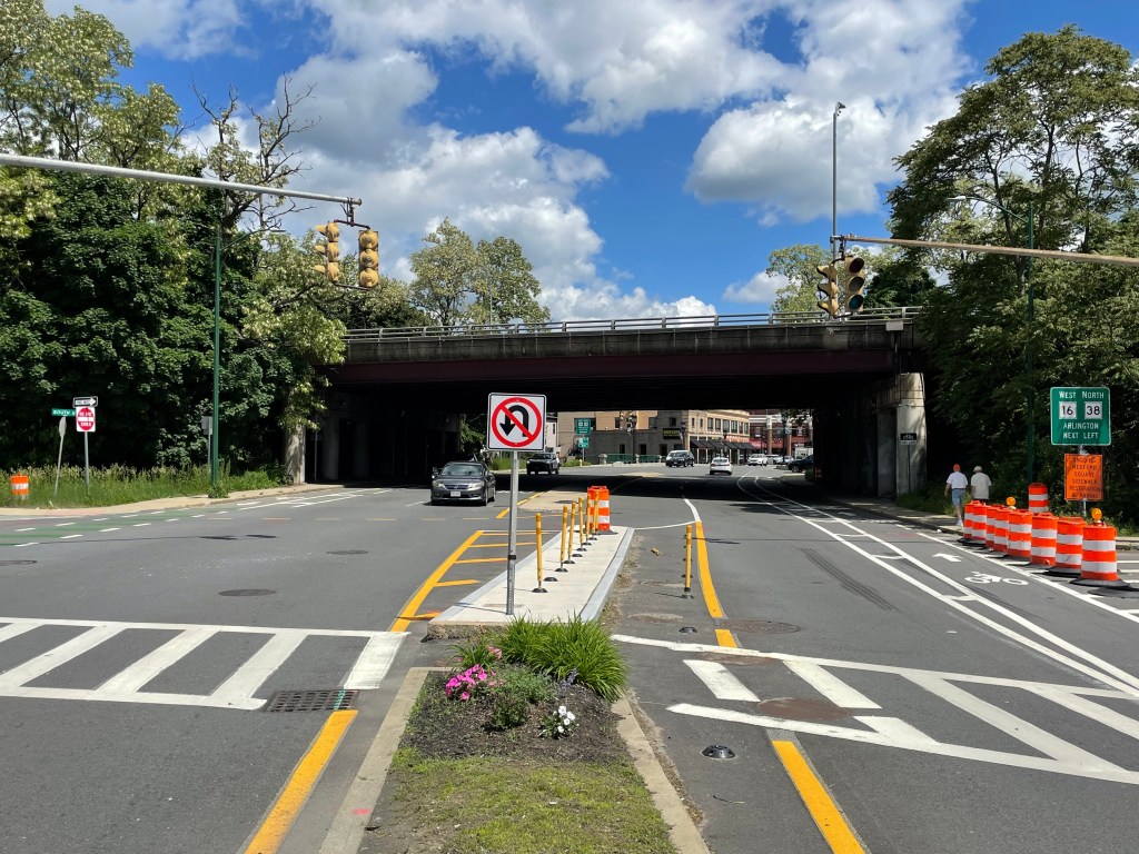
MassDOT installed interim improvements, like repainted lane markings and temporary barricades at the intersection of Main and South Streets, in 2021 – but now, MassDOT and the City of Medford are taking on longer-term improvements for the community.
The project aims to reconstruct the high-crash intersections of where Main Street meets the Route 16 westbound ramps, the Route 16 eastbound ramps, and the intersection with Mystic Avenue and Emerson Street.
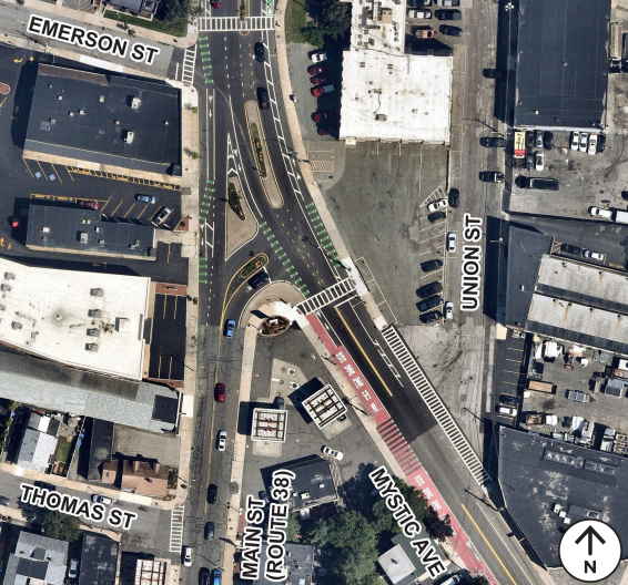
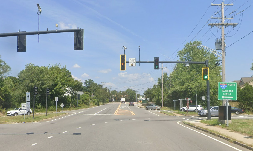
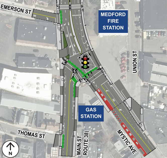
Left: the current state of Main Street at Mystic Avenue and Emerson Street
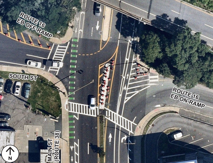
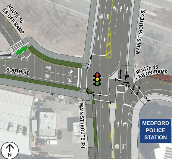
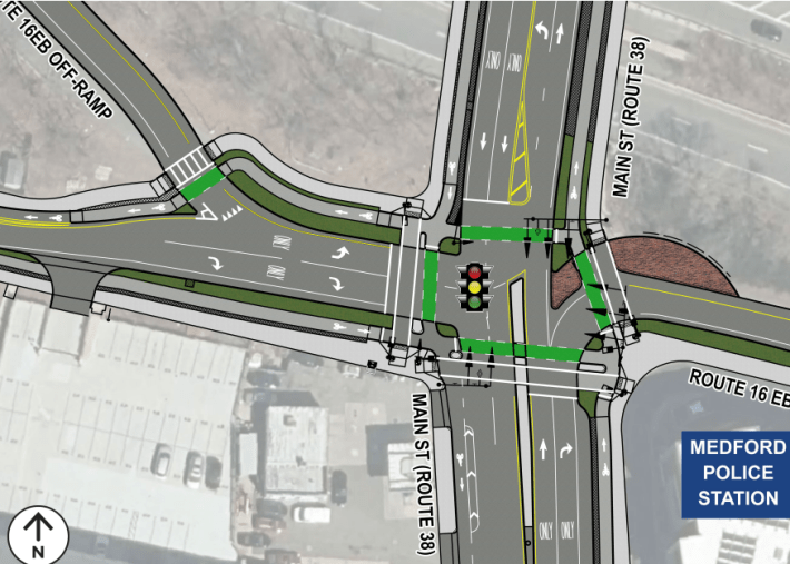
Right: the current state of Main Street at South Street/Route 16 Eastbound Ramps
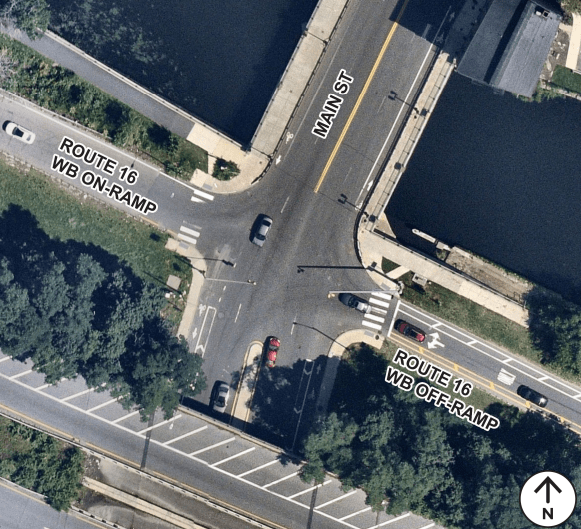
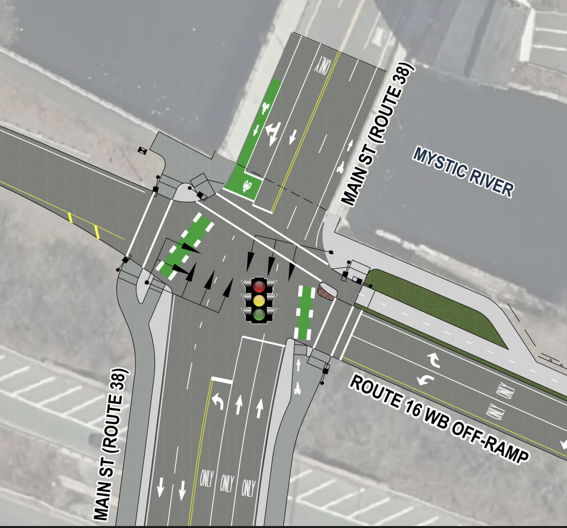
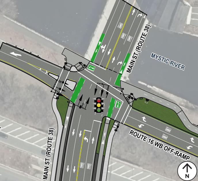
Left: the current state of Main Street at Route 16 Westbound Ramps
Plans also include realigning the roadway to encourage safe speeds and improve pedestrian and bike visibility, resurfacing and restriping the roadway, reconstructing sidewalks and curb ramps, and creating separated and buffered bike lanes for cyclist safety.
The project would also connect Main Street to a planned Department of Conservation and Recreation path along the southern bank of the Mystic River.
The ultimate goals of the project are to improve safety for people walking, biking, and driving in this area, improve intersection connections for people walking and biking, and maintain acceptable traffic operations.
MassDOT’s new design
Following original ideas to reconstruct the area while keeping the The Mystic Valley Parkway highway overpass over Main Street and community pushback, the newly drafted design proposals are in.
First, looking at Main Street and the westbound ramps on the Mystic riverbank, the original proposal included a five-lane roadway cross-section under the Mystic Valley Parkway overpass, 11-foot travel lanes, and shared-use paths on both sides of the roadway.
Now, the new proposal features a four-lane roadway cross section under the overpass, narrower, 10.5-foot travel lanes, and raised bike lanes separated from pedestrian sidewalks.
South of the overpass, at the intersection with South Street and the eastbound Mystic Valley Parkway ramps, the 2024 proposal featured a “Green-Tee” (a specialized intersection design for three-way/T-shaped intersections), shared-use paths on both sides of the roadway, and a zigzagging, multi-stage crosswalk across Main Street.
After community input and advocacy, the new proposal calls for a full 3-way signalized intersection, completely separate pedestrian sidewalks and bicycle lanes, direct crosswalks across Main Street, and a center island pedestrian refuge.
As for the intersection with Mystic Avenue and Emerson Street, the project proposal calls for buffered bike lanes, a new crosswalk, widened sidewalks, a new left-turn lane on the northbound side of Mystic Avenue, and a new refuge island on Union Street.
The design of these intersections has not substantively changed compared to the proposal MassDOT presented in 2024:
Community Input
Ellery Klein of WalkMedford expressed appreciation that the design had evolved with better prioritization of more vulnerable road users, including people walking and biking.
Advocates were “dismayed” by the first plan, she said, feeling as though the agency was just trying to expand the roadways and push everyone else to the edges on a “shared” 10-foot-wide sidewalk.
“People are walking dogs, and they’re getting in the way of the bikes. And people have children and e-bikes, and pedestrians don’t want to be sharing their space.”
Klein also commended the raising of bike lanes, tightening of some intersections, and narrowing the corner of the intersection.
She also praised the acknowledgement and need for equity in these plans.
“I don’t want anyone to feel like they can’t walk because of who they are or what they look like. It’s just nice to see MassDOT maintaining their diversity statement in a political climate where the federal government is discouraging [that].”
As for the future impact on the area, Klein notes that the 96 bus route, as part of the bus network redesign, will be running at a higher frequency, connecting Malden Station to Tufts Station to Davis Square. But she wonders if transit was adequately considered in this road redesign.
She also advocated for a more “top-down” approach to planning, where transit, parks, and highway agencies would work together to encourage increased biking, walking, and safer driving, as well as opening up more space along the Mystic River.
But ultimately, she thinks the work is meeting the needs of the road users.
“We’ve all been in meetings where they’re like, ‘We listened to what you had to say, and we don’t care.’ And it really did feel like they really did listen and change a lot of stuff,” Klein reflected.
“Lots of good things are happening.”

The project still has a number of steps ahead, including a Local Traffic Commission Meeting this summer, finalizing the design, and advertising the project for construction in late Spring of next year.
The full presentation can be found here.
Stakeholders may submit comments on the proposed project to MassDOTProjectManagement@dot.state.ma.us with the subject line “Attention: PROJECT MANAGEMENT, PROJECT FILE NO. 611974”.

Streetsblog has migrated to a new comment system. New commenters can register directly in the comments section of any article. Returning commenters: your previous comments and display name have been preserved, but you'll need to reclaim your account by clicking "Forgot your password?" on the sign-in form, entering your email, and following the verification link to set a new password — this is required because passwords could not be carried over during the migration. For questions, contact tips@streetsblog.org.