Westfield Breaks Ground On Downtown Traffic-Calming Project
The western Massachusetts city of Westfield has broken ground on a traffic-calming project that will create more space and visibility for pedestrians to address serious safety hazards in several of its downtown crosswalks.
The city’s project will repave and reconfigure several downtown blocks of Franklin Street between Shepard Street and Elm Street. Franklin Street is also part of U.S. Route 20, and Elm Street is the heart of Westfield’s downtown commercial district.
“There has been a history of crashes between vehicles and pedestrians along this corridor which spurred this project,” Randy Brown, Westfield’s City Engineer, explained to StreetsblogMASS.
Since the beginning of 2022, the 0.4-mile stretch of Franklin Street between Shepard and Elm have recorded 46 injury-causing crashes, according to MassDOT’s IMPACT crash database. 10 of those crashes injured one or more “vulnerable users” – i.e., pedestrians and people riding bikes.
There has also been one homicide crash on this part of Franklin Street. In September 2024, a driver struck and killed a 76-year-old man in a wheelchair who had been attempting to cross Franklin Street in the marked crosswalk at the Kellogg Street intersection.
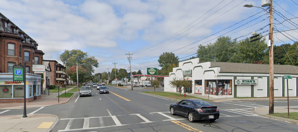
Until recently, the two blocks of Franklin Street closest to Elm Street had been four lanes wide, a design that created a “double-threat” hazard to pedestrians attempting to cross all four lanes in downtown crosswalks:
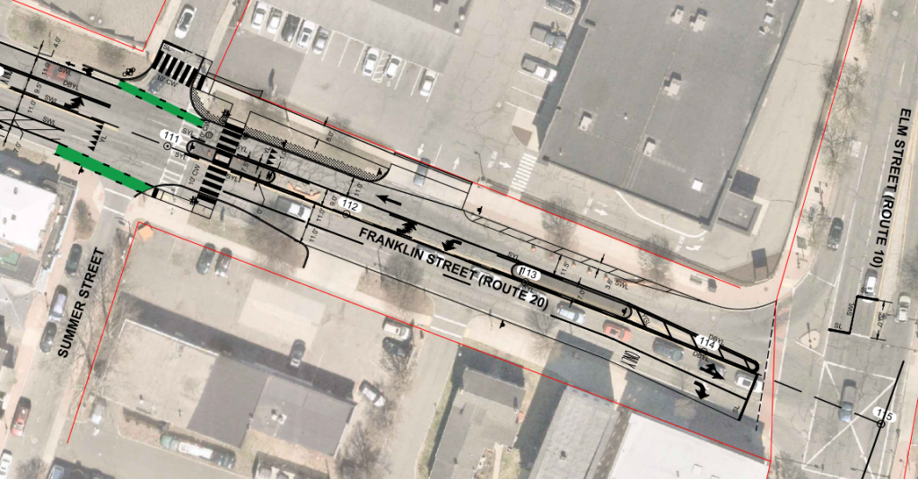
In the current traffic-calming project, Westfield is narrowing this segment of Franklin Street with concrete median islands and curb extensions (see plan above) to reduce the roadway width from four to three lanes. The changes aim to improve visibility and redesign the crosswalk so that pedestrians will only need to cross one lane at a time.
The project will also install several new “Rectangular Rapid Flashing Beacon” (RRFB) crosswalk warning signs, upgraded curb ramps, and additional refuge islands at other intersections.
The western portion of Franklin Street has had painted curbside bike lanes for several years, but those bike lanes petered out as Franklin approached downtown Westfield in order to provide more space for additional motor vehicle lanes.
Under the new design, those bike lanes will get a little more space, and they’ll also be extended further east, to the Summer Street intersection (pictured above).

Read More:
Streetsblog has migrated to a new comment system. New commenters can register directly in the comments section of any article. Returning commenters: your previous comments and display name have been preserved, but you'll need to reclaim your account by clicking "Forgot your password?" on the sign-in form, entering your email, and following the verification link to set a new password — this is required because passwords could not be carried over during the migration. For questions, contact tips@streetsblog.org.