gis
News topics:
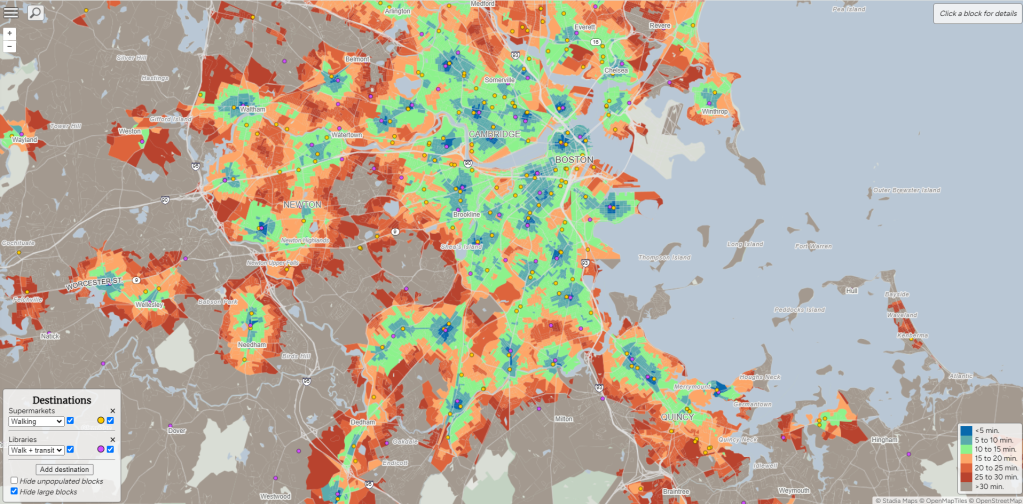
Close.City Maps Illustrate Inequalities of Access to Vital Services Across the Boston Region
On Friday April 5th, Nat Henry (@NatMakesMaps), Director and founder of Henry Spatial Analysis, launched “Close”, an interactive map that shows walkable, bikeable, and transit-friendly neighborhoods across every block in the United States.
April 19, 2024