Boston has officially released the details of its new "healthy streets" initiative, which will make tactical changes to city streets to provide more room for safe physical distancing for pedestrians, bike riders, small businesses, and bus riders.
The initial plans include a network of new protected bike lanes across downtown Boston and around the Public Garden, expanded bus stop waiting areas, and processes to let restaurants expand their outdoor seating areas on sidewalks and on-street parking lanes.
City officials discussed the overall strategy at a City Council hearing earlier this month, where elected officials expressed strong support for these concepts.
“Ensuring the safety and health of all residents is our first priority in Boston,” said Mayor Martin J. Walsh in a press release accompanying the announcement this afternoon. “These innovative streets programs focus on what residents need: safe, reliable transportation if they must travel in Boston, access to fresh air and open spaces, and building social and physical distancing into everyday life. As we continue to carefully plan for reopening in Boston, we will continue our work to create streets and transportation that work for all.”
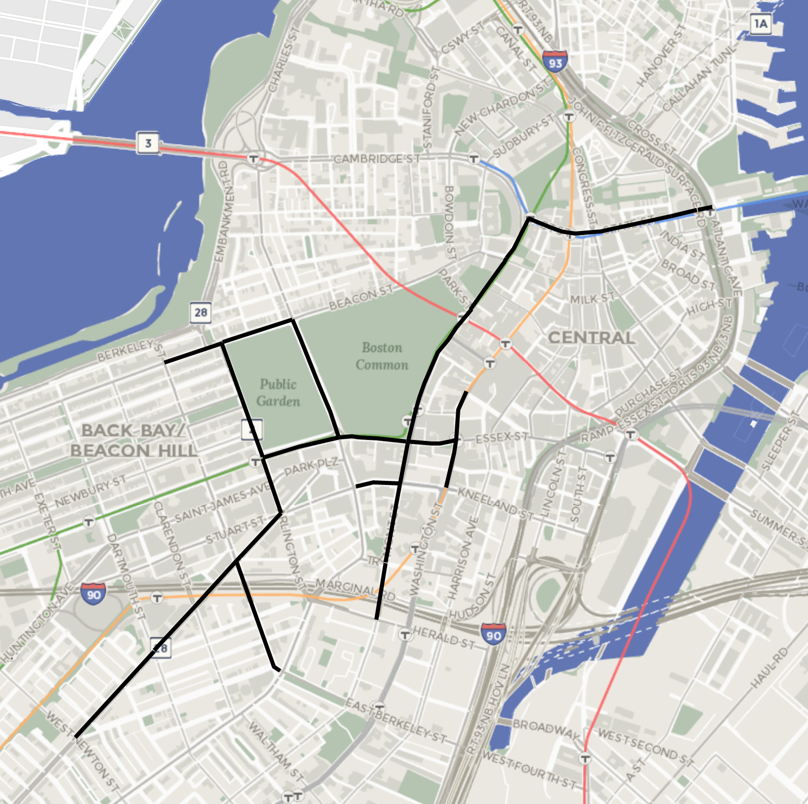
One of the more prominent aspects of the initiative is a new network of bike routes across downtown that will be designed as "high-comfort protected lanes" so that new riders can feel safe while riding on downtown's wide streets. These quick-build bike lanes will be installed on:
- Arlington St (Beacon to Stuart)
- Beacon St (Charles to Berkeley)
- Boylston St (Arlington to Washington)
- Charles St (Boylston to Beacon)
- Columbus Ave (W Newton to Stuart)
- Court St (Congress to Tremont)
- State St (Atlantic to Congress)
- Tremont St (Court to Shawmut)
The proposed network of bikeways shares many streets in common with the city's "Connect Downtown" planning initiative, which had otherwise been put on pause when the pandemic delayed a series of public meetings that had been scheduled for March.
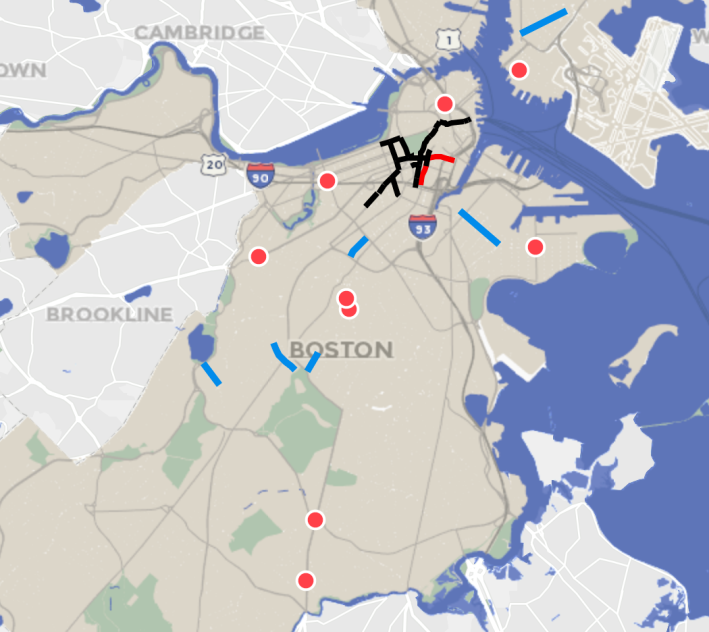
Under a previously planned project, the city is also installing a new bus-only lane for Silver Line buses plus a protected bike lane on Washington Street leading into Downtown Crossing. The city will also refresh the existing Silver Line bus lane on Essex Street towards South Station.
The initiative will also give bus riders more space to physically distance by expanding waiting areas at several high-use bus stops, including bus transfer points at Haymarket, Maverick, and Hynes stations. Three other bus stop expansions will happen along Blue Hill Ave. and Warren Street, corridors where bus ridership has remained relatively high through the pandemic. These bus stop expansions will be implemented during the week of June 1.
Related:
Cambridge (Finally) Announces Citywide Shared Streets Network to Facilitate Safe Physical Distancing
The broad outlines of the city's initiative were inadvertently leaked earlier this week, when the draft website for the initiative briefly went live. That draft proposal included a number of designated "shared streets" where through-traffic would have been restricted, while still allowing local traffic, parking, and deliveries.
Saratoga Street in East Boston, Eliot Street in Jamaica Plain, and Harold Street in Roxbury were among the streets identified for "shared street" designations in the draft plan, but today's official announcement makes no mention of shared streets.
However, the city's announcement does suggest that a shared streets program might still be in the works.
"Temporary street closures with barriers and signs will also be explored as part of the outdoor seating work, and to create better green links to parks and open spaces," according to the city's press release.
The project website also mentions that that "over 250 establishments" have requested outdoor space for outdoor seating, and that the city is considering creating outdoor dining areas that span entire city blocks in some locations.
