City Wants You To Weigh In: What’s the Best Way To ‘Connect Downtown’?

On Thursday evening, the City of Boston’s Transportation Department revealed conceptual designs for pedestrian improvements and high-quality bikeways across the Common and downtown Boston at an open house for its “Connect Downtown” project.
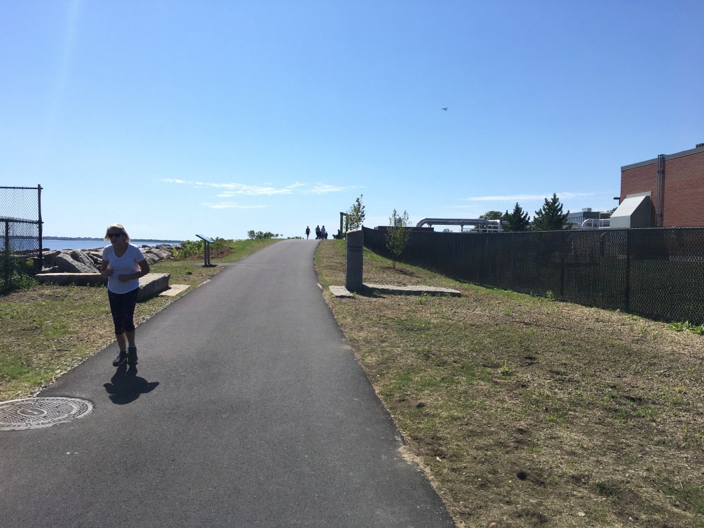
“Connect Downtown” aims to extend the Southwest Corridor that runs from Forest Hills to Back Bay and connects Jamaica Plain and Roxbury to the South End. While that path currently ends in the South End, the city would like to connect it into and across downtown Boston with new high-quality bikeways and improved pedestrian routes.
At last night’s open house, the first of three the city is hosting this month, planners debuted 11 design options, all of which aim to enhance safety and access for people who walk and bike downtown.
Much of the study area focuses on streets around the Boston Common and Public Garden, both of which are surrounded by roads that have three to four lanes of traffic, and have seen a high number of crashes.
Kathleen Onufer works downtown and says it was hard to walk in and take a look at the city’s crash map, which shows just how vulnerable pedestrians and cyclists are.
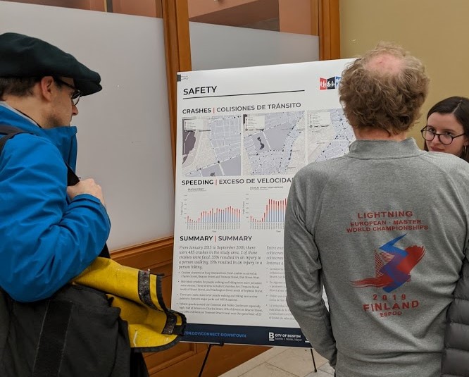
Onufer is excited to see some bolder, transformative designs that would make everyone feel safe to walk and bike. “Downtown needs bike infrastructure that everyone can ride on – including beginners, not just already-comfortable cyclists,” she said.
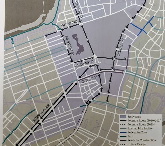
Of the 11 designs presented, some were described as more feasible than others. In all designs, Columbus Avenue and the streets surrounding the Public Garden had some form of protected bike routes, while other designs would require removing large swaths of parking, full redesigns of intersections, and removing major streets (such as Columbus Avenue) as a through route for vehicle traffic.
While the designs shared by city staff were preliminary, all included separated bike lanes with vertical separation, and in some areas, such as at bus stops, they included elevated bike lanes (Streetsblog will provide a link to the city’s conceptual plans as soon as they are posted on the city’s website; in the meantime, a representative example of one of the options – “2-A” – is pictured below, and a close-up of option “1-D” is at the top of this article).
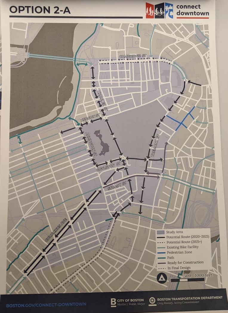
In addition to providing different routes, the design options also provide what Stefanie Seskin, the city’s Director of Active Transportation, described as a family of ideas in which bikes can travel with the flow of traffic, bi-directionally, and a combination of one-way and two-way.
Seskin shared that the first phase of the project, expected to be implemented in late summer 2020, will focus on first controlling speeds and improving crosswalks at key intersections that have a high crash history, high pedestrian volume, or that the community has voiced concern over.
The city continues to collect community feedback and develop designs. There will be two more open houses in the month of March in addition to office hours through the first of July.
Meeting information:
Connect Downtown Open House #2
Where: Hill House, 127 Mt. Vernon Street, Beacon Hill (3 blocks south from the Charles/MGH Red Line station)
When: March 11, 2020, 6-8 p.m.
Connect Downtown Open House #3
Where: Boston Public Library Orientation Room, 230 Dartmouth Street (take the Green Line to the Copley station)
When: March 14, 2020, 1-3 p.m.

Read More:
Streetsblog has migrated to a new comment system. New commenters can register directly in the comments section of any article. Returning commenters: your previous comments and display name have been preserved, but you'll need to reclaim your account by clicking "Forgot your password?" on the sign-in form, entering your email, and following the verification link to set a new password — this is required because passwords could not be carried over during the migration. For questions, contact tips@streetsblog.org.