MassGeneral Expansion Plans Include Space for New Blue Line Station
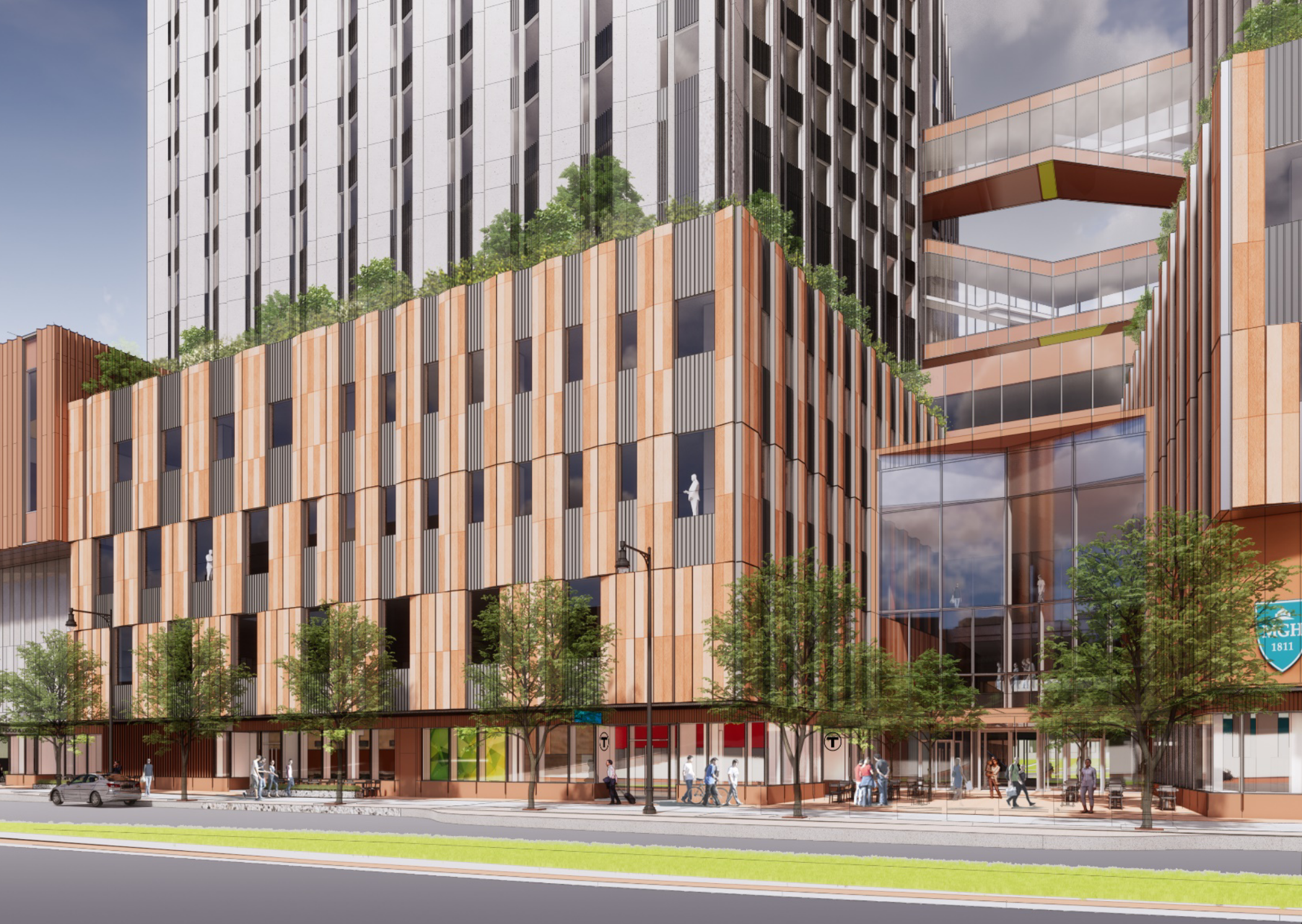
A rendering of the proposed MassGeneral Hospital expansion project shows a proposed new MBTA station entrance – part of the proposed Red-Blue Connector project – on the new building’s ground floor. Courtesy of the BPDA.
Newly-released expansion plans for MassGeneral Hospital would include space for a new Blue Line station entrance on Cambridge Street near the Charles/MGH Red Line station – a sign that the MBTA's long-delayed "red-blue connector" project could be gaining momentum.
In a draft environmental impact report that was filed with the Boston Planning and Development Agency (BPDA) on Thursday, MassGeneral outlined its plans to tear down an existing parking garage and several other buildings between Cambridge, Blossom, North Grove, and Parkman Streets in order to build a pair of towers with roughly one million square feet of space over a new subterranean parking garage.
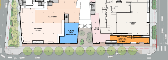
"Space will be reserved in the building for use by the MBTA for a future station to be part of the proposed Red-Blue Line Connector," according to the filing. "The ground level station entrance will be on the west side of the Cambridge Street building entry, and space will be provided on the two levels below grade for future stairs and elevators to access the platform levels. The space will be fitted out as part of the future MBTA project."
The new station access point would be located about 500 feet east of the existing Charles/MGH station entrance – a distance that's slightly longer than the length of a Blue Line train platform.
The Blue Line currently ends at Bowdoin station, 1,600 feet to the east, but transit advocates have long called for the state to extend its tracks to the Red Line's Charles/MGH station.
Currently, the Blue Line is the only subway line that does not have a direct connection to the Red Line, which means that its riders still need to make a time-consuming double-transfer through crowded downtown stations to get to South Station or Cambridge.
A quarter of a century ago, Massachusetts promised environmentalists that the connection would be built by 2010 to mitigate air pollution impacts from the “Big Dig” highway expansion.
There are other signs that the state may finally be getting serious about meeting that commitment: earlier this month, MBTA officials discussed their new capital budget proposal, which included a $15 million line-item for "planning funds to extend the Blue Line to Charles/MGH."
In an email to Streetsblog, Joe Pesaturo, an MBTA spokesperson, wrote that the MBTA has been collaborating with MassGeneral to incorporate a potential new station into their building project.
Pesaturo added that the $15 million in the T's proposed capital budget "would go toward either design or environmental review work, but it is not enough to fund all of the design and environmental work that would be necessary."
Read More:
Stay in touch
Sign up for our free newsletter