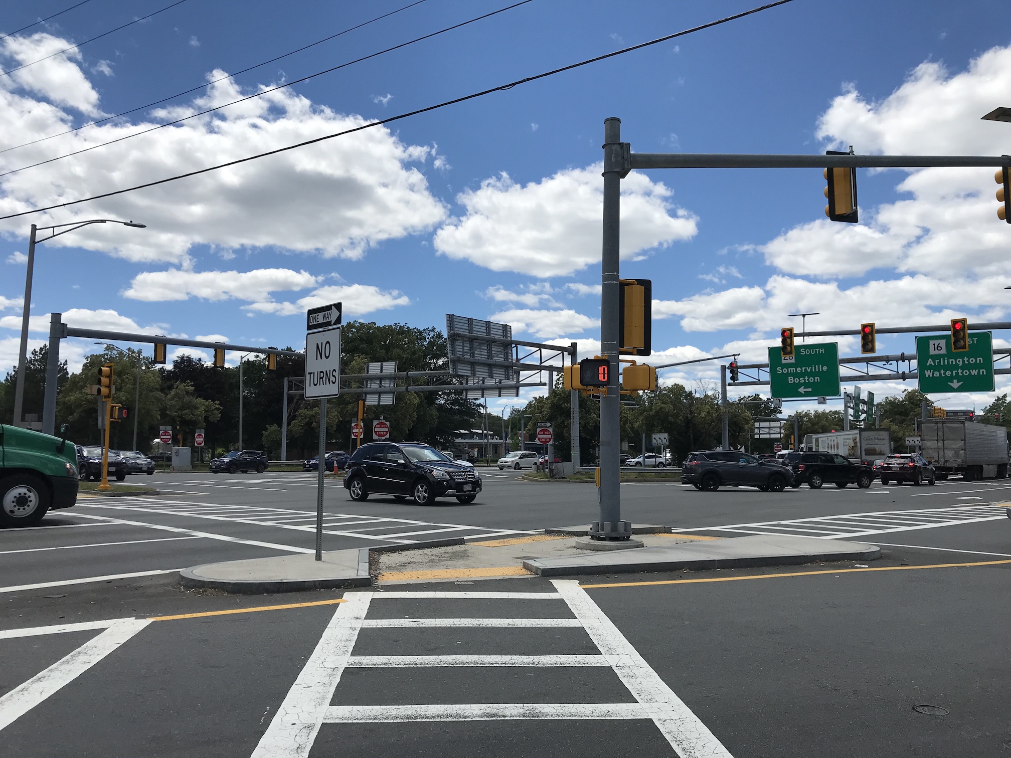
On Wednesday afternoon, a working group meeting for MassDOT's Wellington Circle redesign study got a first look at the state's conceptual alternatives for cleaning up the tangled knot of highways that snarls traffic and blocks foot traffic in Medford near a busy MBTA Orange Line station.
MassDOT and project consultants from McMahon Associates have prepared short- and long-term concepts that aim to simplify the complicated intersection, restore parkland (the three highways that meet in the circle are technically "parkways" under the jurisdiction of the Department of Conservation and Recreation), and improve access for pedestrians, and people on bikes.
Those concepts are still being refined, but on Wednesday, a working group of municipal leaders, neighbors, and other stakeholders got to see them for the first time, and offer their feedback.
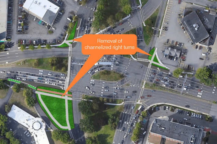
For "short-term" interventions, the project team is proposing several changes that would simplify the intersections with relatively minor changes. Removing right-turn slip lanes at three of the intersection's four corners, for instance, would offer significant benefits to bikes and pedestrians and reduce the number of conflicts from merging vehicles, while also recovering a significant amount of parkland that's currently buried beneath asphalt:
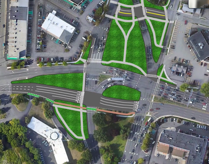
Other shorter-term projects could include the removal of northbound left-turn lanes from the middle of the intersection (relatively few drivers use these, according to MassDOT's data), and relocating traffic from Middlesex Ave. and 9th Street to a pair of smaller new intersections to the north:
In the longer term, MassDOT would rebuild the central intersection of the Fellsway, Revere Beach Parkway, and Mystic River Parkway entirely.
Before the pandemic, almost 9,000 cars an hour traveled through Wellington Circle during the afternoon rush hours – more than twice as much traffic as Sullivan Square in Boston. Efforts like the Silver Line Extension study are underway to reduce that volume of traffic, but the project's planners still expect that this will be an extremely busy intersection.
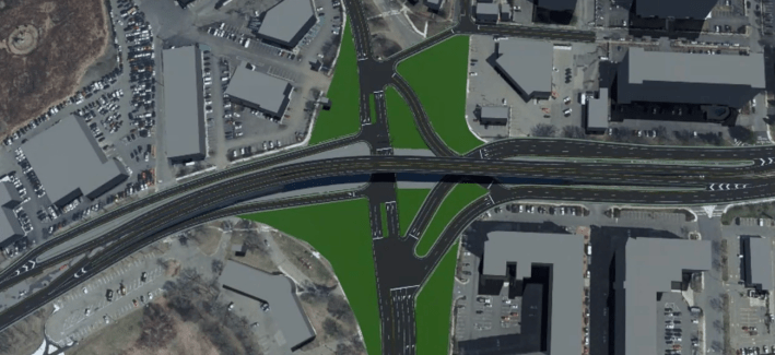
One possibility being considered, which was unpopular among working group members at Wednesday's meeting, would build a new a highway overpass to carry through-running traffic between the Mystic Valley and Revere Beach parkways:
Working group member Alicia Hunt, Director of Planning, Development, and Sustainability for the City of Medford, told the study team that she was "disappointed to see the overpass idea."
Jeff Buxbaum, a representative from WalkMedford, agreed. "There's no way anyone's going to accept that... We're taking down overpasses, we're not putting them up in situations like this."
The study team also shared two similar at-grade alternatives, both of which incorporate the concept of a "quadrant roadway," which essentially separates turning traffic to a new junction away from the main intersection.
"You're able to redirect those heavy-volume connections out of that main intersection and shift them off to a separate intersection, so that individually, each intersection can be simplified," explained Gary McNaughton, a project consultant from McMahon Associates:
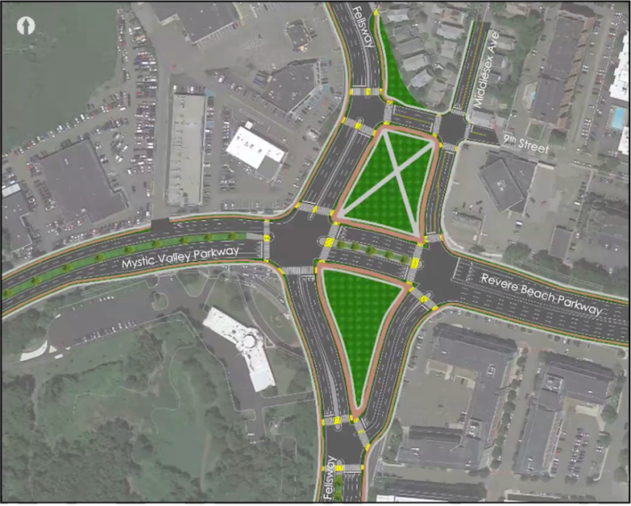
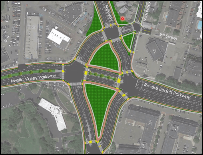
The at-grade alternatives got a warmer reception from the working group, but many members still expressed a desire to see less asphalt and fewer lanes through the intersection.
Working group member Doug Carr, representing the NAACP's Mystic Valley Branch, said that MassDOT's at-grade concepts "just seem so complicated. I was hoping for something that would be simpler, both for the pedestrian and for the vehicle operator... this just looks like a lot of spaghetti on the plan."
With the Orange Line nearby and significant new transit-oriented development happening in the neighborhood, study consultants agree that more trips through Wellington Circle could be made on foot, on transit, or by bike, if the area were easier to navigate and if better connections were available.
"Everything that's been developed was based off of pre-pandemic traffic volumes," said McNaughton, the project consultant. "One of our big next steps is to figure out those future traffic volumes, to look at what long-term impacts will happen from changes in travel patterns as well as mode shift and growth and things in the area... we will be taking that into consideration as we advance these concepts."
Previously on StreetsblogMASS:
