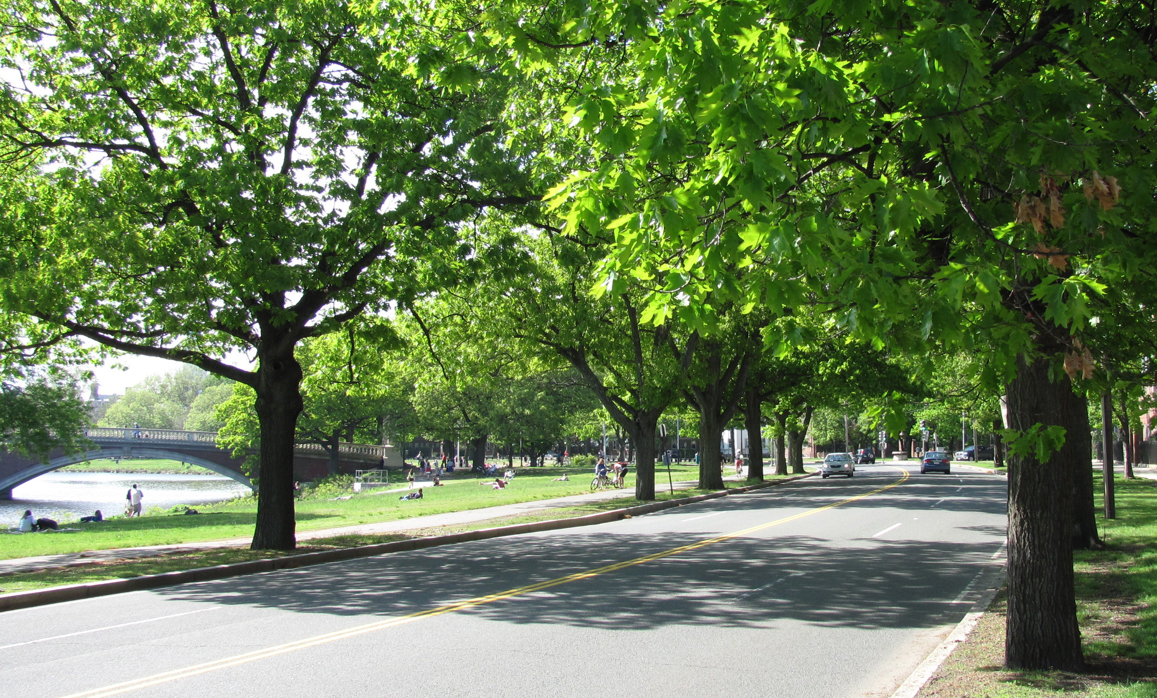
The state's Department of Conservation and Recreation (DCR) has filed permitting documents for a modest road diet on a 0.8-mile segment of Memorial Drive near Harvard Square.
In an Environmental Notification Form (ENF) filed with the Massachusetts Executive Office of Energy and Environmental Affairs (which is also DCR's parent agency), the DCR writes that they are
"proposing to construct multi- use paths and parkland improvements along an approximately 0.8-mile section of Memorial Drive from Eliot Bridge east to the intersection of Memorial Drive and John F. Kennedy Street. DCR will implement a 'road diet' along this section of Memorial Drive reducing the existing four lane section (two lanes each way) to one thru travel lane in each direction, thereby providing an opportunity to reallocate a portion of the existing paved roadway to multi-use paths and parkland uses."
The proposal is a scaled-back version of a proposal DCR presented in the spring of 2019. DCR's proposed “Memorial Drive Phase 3” project would have rebuilt approximately 2.3 miles of roadway along with new bike and pedestrian paths between the Eliot and B.U. Bridges.
That project, too, would have reduced the number of lanes on Memorial Drive west of JFK Street. But during public hearings for that project, DCR faced stiff criticism for its plan to retain four lanes for motor vehicle traffic on the busier, more crowded segment of Memorial Drive east and south of JFK Street.
That design would have left little room for the thousands of bike riders and pedestrians who use Memorial Drive between the Harvard campus and the B.U. Bridge. On some segments, those users would have been forced to share a single 12-foot-wide path along the Charles River embankment, in close proximity to a high-speed roadway.
Related:
From June 2019: State's Memorial Drive Concept Conserves Cambridge Waterfront... for Cars
During the pandemic, DCR put those plans on hold, and announced that it would reboot its planning process under two separate design contracts.
But there was little news about those new designs until Monday, when former Cambridge City Councilor Jan Devereux broke the news about the new project filing in the Cambridge Day. Devereux wrote that the new plans "took many by surprise, including members of the City Council and other elected officials."
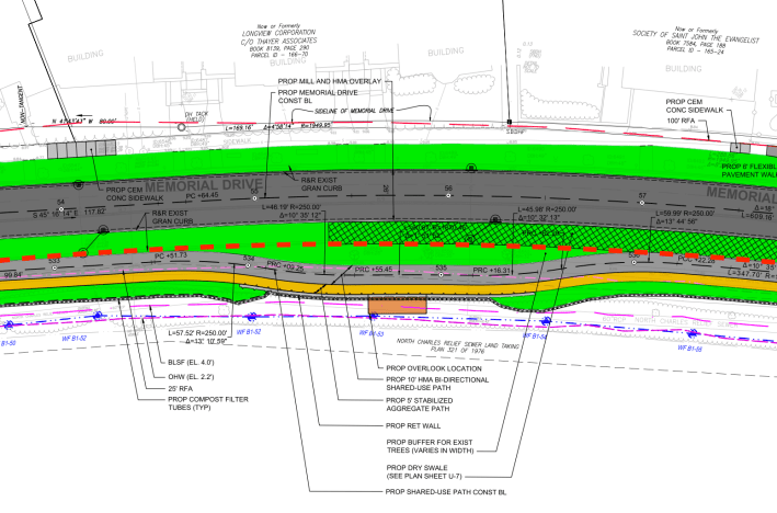
The latest proposal, as described in the ENF, would reconstruct a 0.8-mile length of Memorial Drive and its multi-use pathways between the Eliot Bridge and the Anderson Bridge (JFK Street).
For most of the project area, the project would reduce the width of Memorial Drive to convert it from a four-lane highway to a two-lane street, and convert some of the current roadway's asphalt to more room for more greenspace and new shared-use pathways:
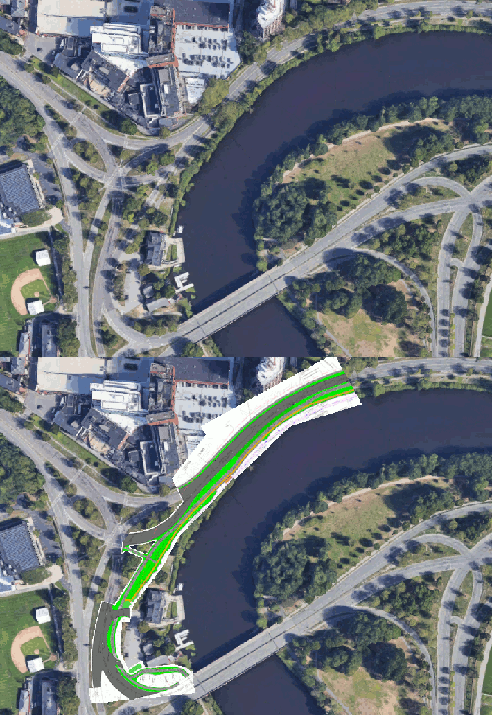
The project would also simplify the complex intersection of Memorial Drive and Gerry's Landing Road by eliminating a northbound right-turn slip lane from the Eliot Bridge to Memorial Drive:
But unlike the proposal discussed in 2019, the latest plan for Memorial Drive wouldn't make any changes in the busier segment east and south of the Anderson Bridge and JFK Street, which sees significantly more car, bike, and foot traffic.
At a virtual public hearing on the ENF on Tuesday afternoon, DCR's Director of Green Transportation, Dan Driscoll, described the more crowded segment of Memorial Drive east of the Anderson Bridge, including the intersections with River Street and Western Ave., as "really complicated pieces of transportation work that in some ways were getting in the way of doing what we really wanted to do, which is to make these facilities much safer for all users."
DCR's "Memorial Drive Phase 3" project is intended to complement “phase 1” and “phase 2” projects, finished in 2004 and 2016, respectively, that improved the park's multi-use pathways and restored riparian habitat along the Charles River east of the B.U. Bridge.
But those new paths currently end abruptly at the DeWolfe Boathouse, where bicyclists and pedestrians must choose between sharing a crowded, broken sidewalk or merging with cars and trucks on a chaotic traffic circle. The existing Paul Dudley White path between the B.U. Bridge and Eliot Bridge is in poor condition and does not meet MassDOT's design standards for shared-use pathways.
At Tuesday's hearing, Driscoll said that "there will be a 'phase 4' which will look at the rest of the pathway" in that gap.
Driscoll also said that DCR is considering another project to redesign the Memorial Drive intersections with River Street, Western Ave., and the B.U. rotary, pending an analysis of potential transportation impacts from the Allston/I-90 project across the river.
Those projects "currently aren't in our funding or capital plan, but they will happen, I would assume, in the next 2 to 5 years," Driscoll added.
The ENF indicates that the reconstruction of the 0.8-mile segment of Memorial Drive between Eliot and Anderson Bridges would go under construction in 2024, but on Tuesday, Driscoll indicated that some work could begin in the fall of 2023.
