MassDOT Starts Planning New Car-Free Crossing of the Charles River Next to Museum of Science
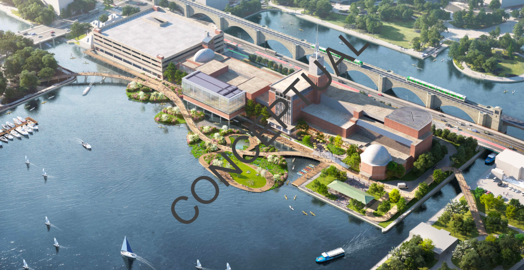
MassDOT officials say that they’re in the “early development stage” for planning a new car-free crossing of the Charles River from Leverett Circle in Boston to Land Boulevard in Cambridge, based on a conceptual proposal from the Museum of Science.
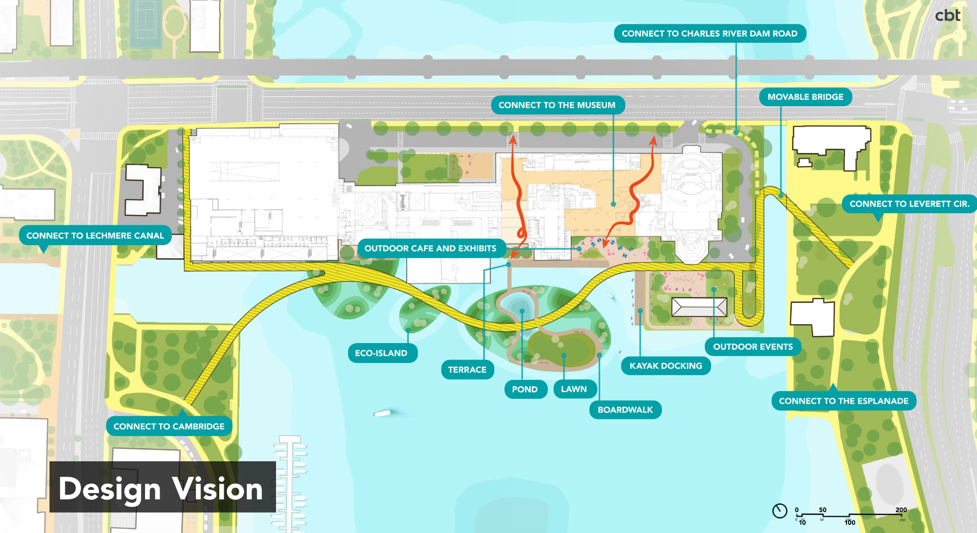
“This project will construct an off-road shared use path with a movable bridge, on the west side of the Museum of Science, connecting the Boston and Cambridge sides of the Charles River,” MassDOT press officials told StreetsblogMASS. “The bridge will provide improved safety and mobility for pedestrians and cyclists, and the movable bridge design will allow marine traffic to transit the river.”
Currently, the site of the museum is a gap in the Dr. Paul Dudley White network of off-street pathways for bike and pedestrian traffic along both banks of the riverfront.
In 2019, MassDOT repaved and reconfigured the lane layout of Charles River Dam Road in front of the museum to add flexpost-separated bike lanes after a dump truck driver struck and killed Meng Jin, a Boston University graduate student, at the intersection with Museum Way.
But because of constraints in the width of the small drawbridge over the Charles River locks, those bike lanes are relatively narrow, and in close proximity to heavy and frequently high-speed motor vehicle traffic.
In 2022, the Museum of Science won a $209,427 grant from the federal Economic Development Administration to develop a concept study to improve bike and pedestrian access between the museum and the riverbanks on either side.
That study, completed in December 2023, envisioned “two new bridges, a movable bridge on the Boston side spanning the historic dam locks, and one on the Cambridge side, spanning the mouth of the Lechmere Canal,” connected with “landscaping and recreational elements in the form of islands, or ‘stepping-stones,’ that provide native ecology benefits and a direct connection to the environment (the Charles River) for educational opportunities.”
Tim Ritchie, the museum’s president, told StreetsblogMASS on Wednesday that “it is very much a community project, and we’re playing the role of convener and catalyst. We wanted to ask, how can we make a better connection between Boston and Cambridge that’s safe and beautiful?”
This spring, MassDOT added the project to its project database (project #614025).
MassDOT officials told StreetsblogMASS that the agency “will initiate project scoping and stakeholder engagement, as well as work to identify a funding source for construction. From there, the agency will establish a timeline to reach full build out of the project.”
The museum’s 2023 concept study estimated that its proposal could cost around $302 million, including design costs and contingency funds.
However, Ritchie stressed that the design is likely to evolve and adapt to financial and engineering limitations as the project advances.

Read More:
Streetsblog has migrated to a new comment system. New commenters can register directly in the comments section of any article. Returning commenters: your previous comments and display name have been preserved, but you'll need to reclaim your account by clicking "Forgot your password?" on the sign-in form, entering your email, and following the verification link to set a new password — this is required because passwords could not be carried over during the migration. For questions, contact tips@streetsblog.org.