New BPL Exhibit Showcases A History of Boston Through Its Transit Maps
A new exhibit at the Leventhal Map & Education Center at the Boston Public Library traces the past 400 years of the Boston region’s growth with dozens of historic transit maps and guidebooks.
In Getting Around Town: Four Centuries of Mapping Boston In Transit, curators from the Boston Public Library have teamed up with Steven Beaucher, the author of the recent book Boston in Transit and the owner of WardMaps in Cambridge.
Many of the items in the exhibition come from Beaucher’s extensive private collection of maps and guidebooks.
“This (exhibition) takes cartographic and navigational devices to tell this story of how Boston grew as a city and how we evolved in how we get around,” Beaucher told StreetsblogMASS.
These maps don’t just reflect how the city used to look: they’re also a reflection of what technologies were available, and how those technologies shaped residents’ perceptions of the region.
The earliest maps, from the 17th and 18th centuries, focused on the navigable waterways around the city and its islands, and frequently highlighted the city’s three-peaked hill (today known as Beacon Hill, but then known as the “Trimountaine” for which Tremont Street is named) as a navigational landmark.
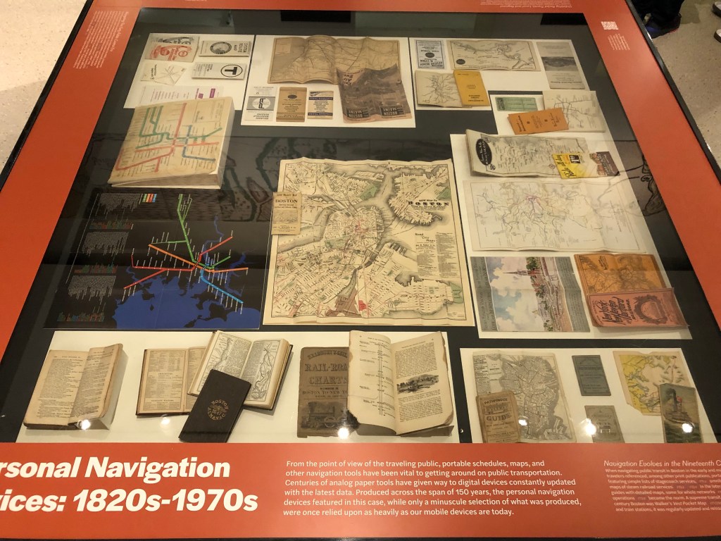
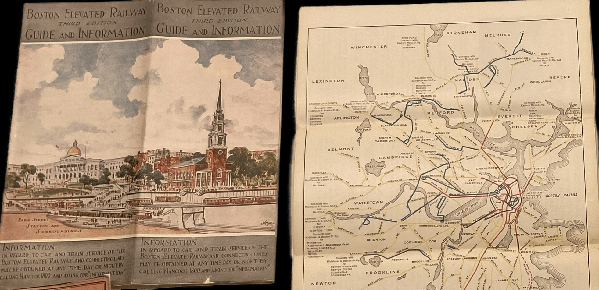
As you walk through the exhibition, these nautical charts give way to timetables for stagecoaches and steam railways, then streetcar maps, where, by the early 20th century, you can recognize the rough outlines of today’s MBTA rapid transit maps:
Another highlight of the exhibition is a collection of maps that illustrate unbuilt plans for Boston’s transit system.
A 1926 map from the Massachusetts Division of Metropolitan Planning’s “Report on Improved Transportation Facilities in the Metropolitan District” envisioned ideas that remain on transit advocates’ wish-lists nearly a century later, including a new rapid transit connection to Chelsea, an upgraded Fairmount Line, and a regional rail connection between South and North Station:
As we know in hindsight, these ambitious visions never came to light, as governments poured billions of dollars into highway projects instead and white residents abandoned the city to take advantage of subsidized home mortgages in car-oriented suburbs.
“A lot of these historic maps illuminate modern-day mobility issues,” says Garrett Dash Nelson, the President and Head Curator of the Leventhal Map and Education Center. “We want people to think, this isn’t just about the past, but about building a more inclusive transit system for the future.”
Getting Around Town: Four Centuries of Mapping Boston In Transit is free, and will be on display at the central Boston Public Library, next to the Copley Green Line station, through April 27, 2024. Click here for visiting hours.
A digital version of the exhibition is also available on the Leventhal Map and Education Center website.

Read More:
Streetsblog has migrated to a new comment system. New commenters can register directly in the comments section of any article. Returning commenters: your previous comments and display name have been preserved, but you'll need to reclaim your account by clicking "Forgot your password?" on the sign-in form, entering your email, and following the verification link to set a new password — this is required because passwords could not be carried over during the migration. For questions, contact tips@streetsblog.org.