New T Map Highlights New ‘Frequent-Service’ Bus Routes
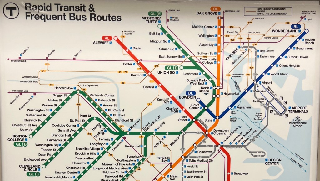
Earlier this week, Reddit user r/SupremeLeaderC spotted a brand-new MBTA subway map on the Green Line – one that illustrates the T’s new “frequent-service” bus routes in Malden, Everett, and Revere.
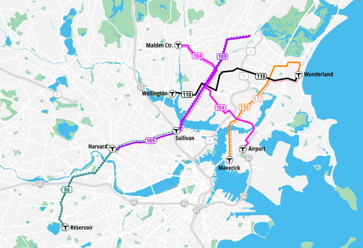
The new routes are crowded into the extreme upper-right corner, in a part of the map that was mostly blank in the map’s last edition. Though it occupies a relatively small part of the map, this region represents an area of roughly 12 square miles where a quarter-million people live.
A legend between the Orange and Blue lines highlights the new routes as “Bus Network Redesign Phase 1 – Effective December 2024.”
In another notable change, the Silver Line bus routes are now depicted in a thinner line on the official MBTA map.
The Silver Line mostly operates in curbside bus lanes or mixed traffic, except for a few segments of dedicated transitways in Chelsea and the Seaport.
Previous editions depicted the Silver Line in the same style as the subway and light rail lines, which gave visitors the impression that the Silver Line was another rapid-transit line (it is not).
Giving buses their own lanes was a unique street design when the Silver Line opened in 2001, and back then, it may have been unusual enough to merit a special graphic treatment on the T’s map.
But more recently, the T has been rolling out out similar or better bus infrastructure on many other bus routes throughout the region, making the Silver Line less unique.
Streetsblog has migrated to a new comment system. New commenters can register directly in the comments section of any article. Returning commenters: your previous comments and display name have been preserved, but you'll need to reclaim your account by clicking "Forgot your password?" on the sign-in form, entering your email, and following the verification link to set a new password — this is required because passwords could not be carried over during the migration. For questions, contact tips@streetsblog.org.