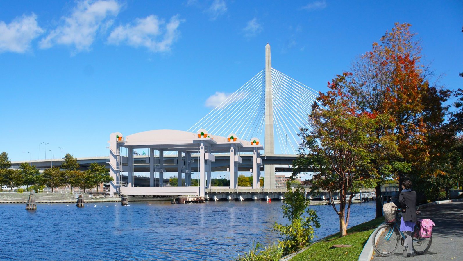
Last week, the MBTA released a draft environmental assessment for its Draw One Bridge replacement project. The document reveals key details about the agency's plans to replace the century-old railroad bridge next to North Station.
The Draw 1 bridge carries over 11 million rail passengers a year, according to MBTA estimates, on the Haverhill line, Newburyport/Rockport line, Lowell line, the Fitchburg line, and the Amtrak Downeaster.
The MBTA is planning to replace the existing 4-track drawbridge with a more reliable replacement bridge that would carry 6 tracks and support increased regional rail service by opening up additional boarding platforms inside North Station.
In September, the T received a $472 million federal grant for the $1.2 billion project.
An 8-year construction project
According to the project's environmental filings, the construction project "is expected to last approximately eight years, beginning in 2026, and be completed in 2034."
However, the project consists of three independently-operating drawbridges – a West Bridge, the Center Bridge, and the East Bridge. The first of these, the West Bridge, could start carrying trains before the end of the decade.
According to the proposed construction phasing plan, workers will build those trio of new bridges sequentially, demolishing sections of the old bridge as they go.
During the first three years of construction, workers would work on building the West Bridge just upstream from the existing bridge, while trains continue to use the existing tracks.
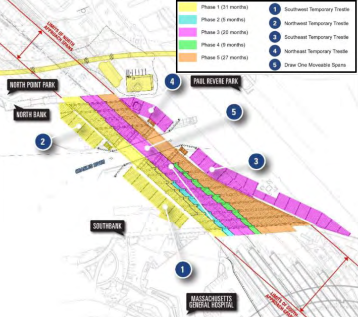
Then, in the next two years, some train traffic would move onto the new West Bridge while workers demolish part of the old bridge and build the new Center Bridge.
In the final three years of construction, trains would use the new West and Center bridges while workers demolish the remainder of the old bridge and replace it with the new East Bridge.
The environmental assessment says that "four tracks across the Charles River would remain in operation at all times" to limit service disruptions to riders.
North Bank Bridge closures planned
During the first three years of construction, the project will also impose closures on the North Bank Bridge, which carries bike and pedestrian traffic between Cambridge and Charlestown.
The new track layout associated with the new drawbridges will require the T to relocate several of the North Bank Bridge's support piers, and raise the bridge by one foot.
This work will require "multiple closures of the North Bank Bridge for up to two weeks at a time. The total duration of anticipated closures is approximately 30 days," according to the T's environmental permitting documents.
The documents add that the T will coordinate with the Massachusetts Department of Conservation and Recreation to provide a detour between Paul Revere Park and North Point Park in Cambridge.
But the documents provide no details about what that detour might entail. The only other possible routes across the MBTA tracks on the north bank of the Charles River are the Interstate 93 connector ramps to the Tobin Bridge, where bike and pedestrian traffic are prohibited, and the Gilmore Bridge, which is about half a mile to the northwest.
No electric wires – for now
Unlike the tracks leading into South Station, the new Draw One bridge isn't being designed to include overhead wires to power the MBTA's planned electric trains.
But the design also doesn't preclude those plans.
"The new bridge structures accommodate future electrification of the rail lines by
providing sufficient vertical clearance for fixed catenary when the bridge spans are fully open," according to the environmental assessment.
