Eyes On the Street: A New Path Connects Two Villages In Newton
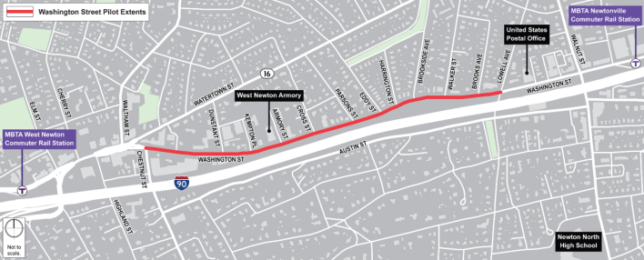
This summer, the City of Newton is testing a new configuration for Washington Street that aims to make it safer and more pleasant to walk or bike between West Newton and Newtonville.
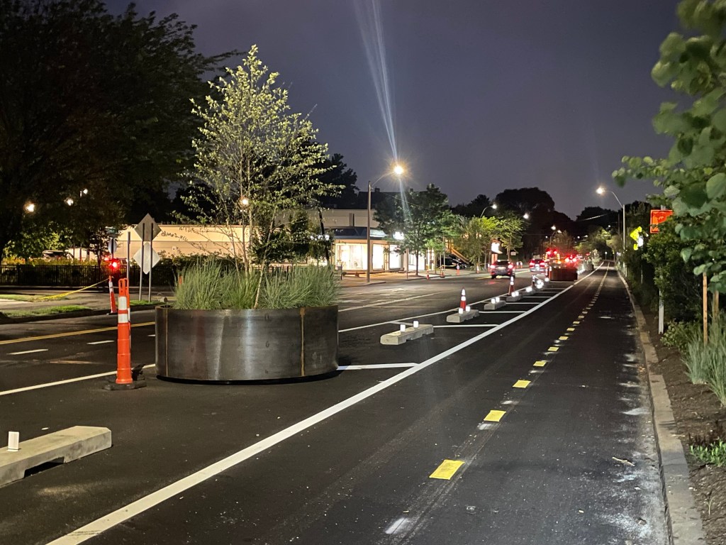
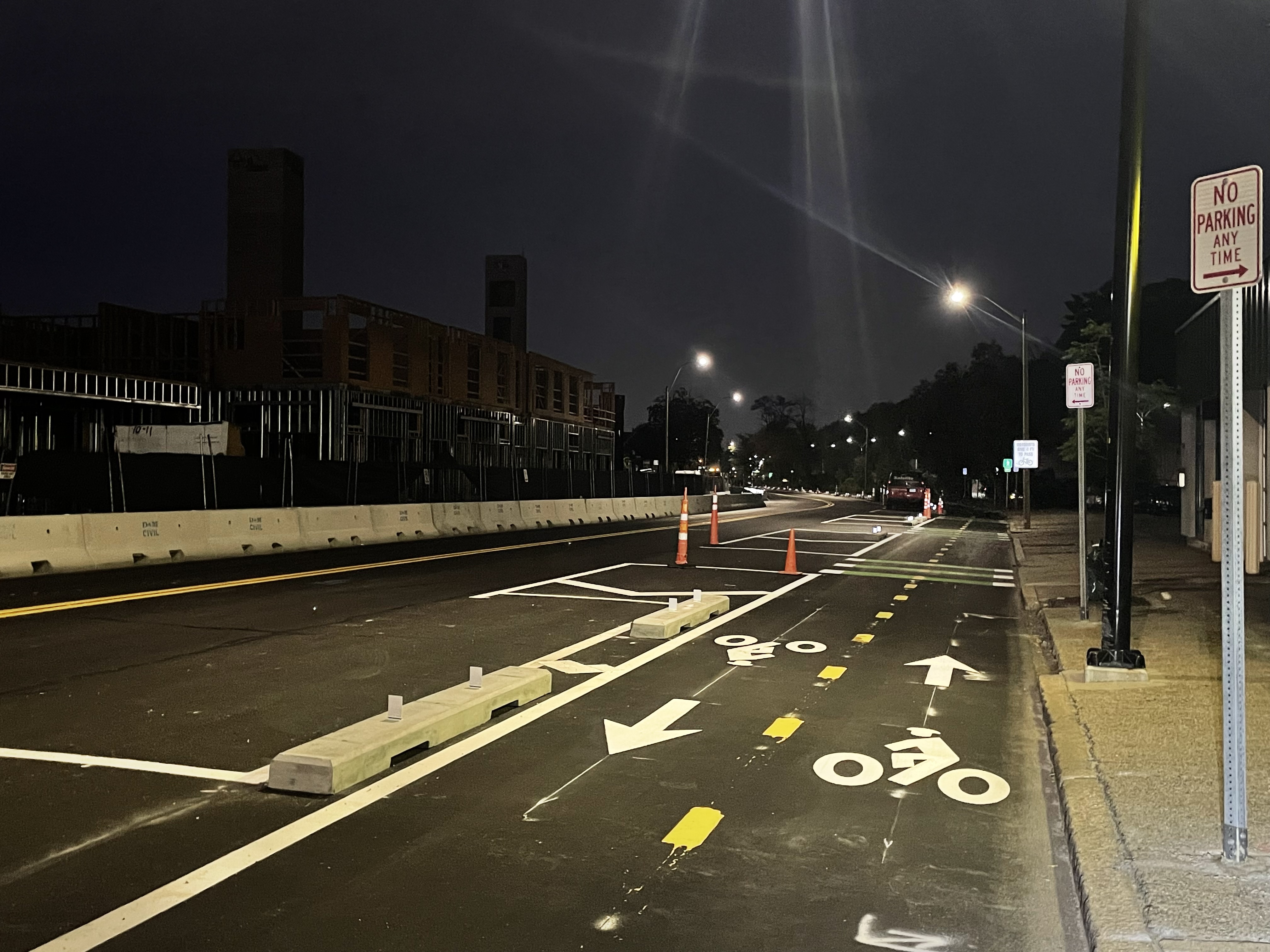
The city recently repaved Washington Street, which runs alongside the Worcester Line tracks and the Massachusetts Turnpike, and added new concrete barriers and large planters along the southern edge of the roadway to create a protected two-way pathway.
The project will also create several new, shortened crosswalks to connect the path to several residential neighborhood streets to the north.
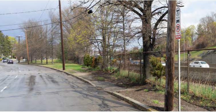
In its former configuration, Washington Street had been a four-lane speedway, with a well-worn dirt track on the southern side of the street in lieu of a sidewalk:
The new configuration, which the city is calling a “pilot” project, has been in planning since 2023.
By reducing the number of motorized traffic lanes, the project will also considerably reduce the crossing distance for pedestrians, including drivers who park on the southern side of the street.
In addition to the new path, the project has also planted dozens of new trees along Washington Street, both along the edge of the roadway, and in large new planters that provide physical protection between the new path and the motorized traffic lanes (pictured above).
Some additional work still remains to be done, including the installation of modular islands for crosswalks and MBTA bus stops.
‘Safe for everyone’
Because it’s the most direct route between the villages of West Newton and Newtonville, which are about a mile apart, city officials have been working to improve bike and pedestrian conditions on Washington Street for several years now.
In 2019, Newton adopted a “vision plan” for Washington Street that envisioned new housing and mixed-use development around a more pedestrian-friendly street.
“Washington Street will be safe for everyone,” the plan promised.
Another section of the plan noted that “over and over again, community members have expressed that walking along most of Washington Street could be so much better.”
In 2020, during the Covid-19 pandemic, the city briefly tried out a single paint-only bike lane in place of on-street parking on the southern (eastbound) side of Washington Street.
But that project did little to calm high-speed traffic on the four-lane roadway. The city removed the painted bike lane in October 2020, and started planning the current, more comprehensive traffic-calming project in 2023.

Read More:
Streetsblog has migrated to a new comment system. New commenters can register directly in the comments section of any article. Returning commenters: your previous comments and display name have been preserved, but you'll need to reclaim your account by clicking "Forgot your password?" on the sign-in form, entering your email, and following the verification link to set a new password — this is required because passwords could not be carried over during the migration. For questions, contact tips@streetsblog.org.