Boston Plans Separation, Traffic Calming For White-Knuckle Allston Bike Lanes
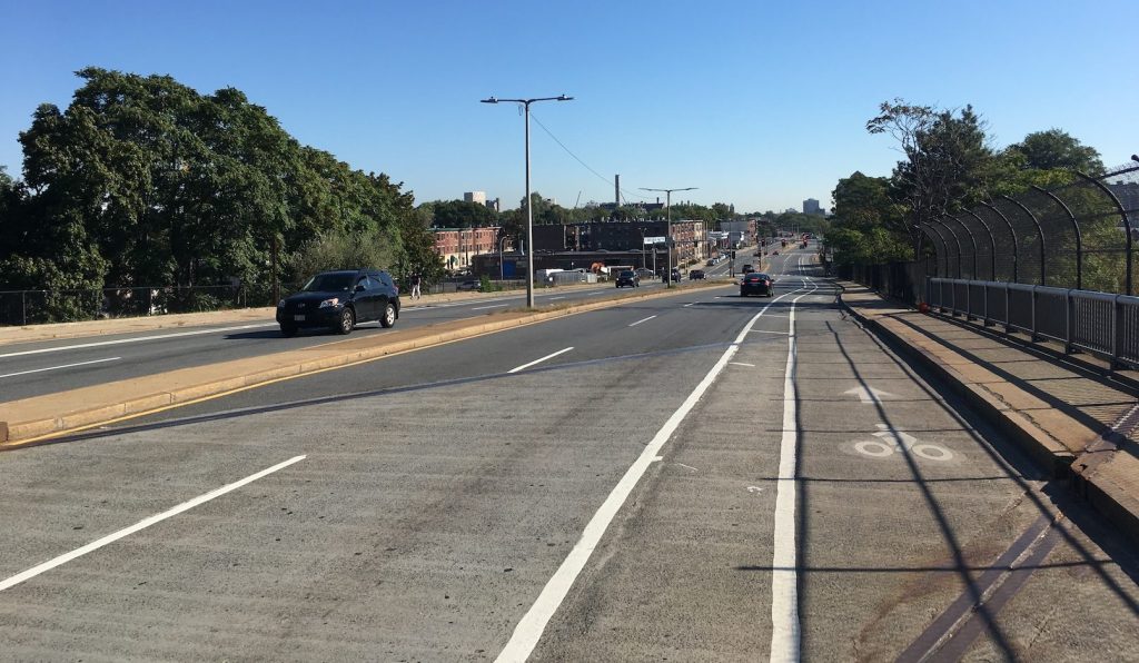
The Boston Transportation Department is planning “near-term” changes to Cambridge Street in Allston between Harvard Avenue and the Charles River, where paint-only bike lanes currently guide cyclists through a series of intimidating merges with speeding vehicles headed to and from the Massachusetts Turnpike.
In an open house last Tuesday, staff from the Boston Transportation Department presented sketch plans of the project, which would generally add new flexposts to the existing bike lanes and shorten crossing distances for bikes and pedestrians at side street intersections along the corridor.
The project would make more significant changes to the Massachusetts Turnpike on-ramp, where two lanes of traffic currently merge across an unprotected eastbound bike lane, with no crosswalk for pedestrians:
The proposed project would reduce the ramp to one lane where it diverges from Cambridge Street, add a physical buffer for the bike lane, and build an ADA-accessible, high-visibility crosswalk (click the image to view a larger version):
Harry Mattison, a safer streets advocate who lives in the neighborhood and bikes on Cambridge Street “many times a week,” attended the city’s open house last week and greeted the plans with enthusiasm.
“The change to the on-ramp is great,” said Mattison in a phone interview last week. “Making it narrower will really change the dynamics there to make it much safer. Senator Brownsberger and a whole bunch for neighbors have been asking for these changes for a long time.”
The project is being designed for short-term implementation, with more permanent and robust safety improvements anticipated to be built when the state undertakes a major realignment of the Massachusetts Turnpike through the neighborhood.
The Boston Transportation Department expects to construct the project in 2020.

Read More:
Streetsblog has migrated to a new comment system. New commenters can register directly in the comments section of any article. Returning commenters: your previous comments and display name have been preserved, but you'll need to reclaim your account by clicking "Forgot your password?" on the sign-in form, entering your email, and following the verification link to set a new password — this is required because passwords could not be carried over during the migration. For questions, contact tips@streetsblog.org.