Exploring Boston’s Unbuilt Highways
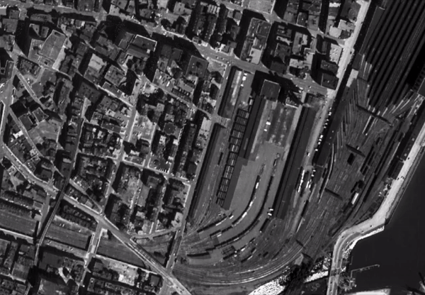
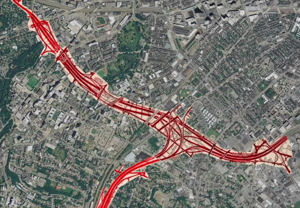
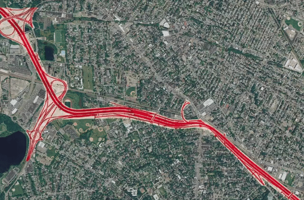
Imagine a version of greater Boston where ten-lane expressways slice through Cambridgeport and Jamaica Plain, a freeway trench has replaced the Muddy River parkland through the Fenway, and a ten-story-high stack of interchange ramps looms over Nubian Square.
As dystopian as that may sound to modern ears, that was the vision for the future that Boston’s political and business establishment dearly wanted to build to build in the mid-twentieth century.
The story of the grassroots movement that stopped some of those planned highways is chronicled in People Before Highways by Dr. Karilyn Crockett, a Lecturer in Public Policy & Urban Planning at MIT. Dr. Crockett will join us in an online discussion of her book on June 18, and it’s not too late to RSVP to join us.
One of the most remarkable details of Dr. Crockett’s book is how little anyone knew about the Commonwealth’s plans to destroy their neighborhoods for the benefit of suburban commuters.
In one of Dr. Crockett’s interviews, a former resident, Tunney Lee, recalled how most of his neighbors along Hudson Street in Chinatown learned about the state’s plans for the Central Artery in the 1950s:
“When the turnpike took that part of Hudson Street, people got letters. The owners got letters in the mailbox saying your property is now owned by the Massachusetts Turnpike Authority. Your rent is $50/month, please pay . . . And if you want a quick settlement we’ll give you the assessed value. If you don’t, you go to court and we’ll see you in court. I had these people come to me with these letters and say, ‘What do I do with this? What should I do?’”
The destruction of Chinatown for the Central Artery was a loss that ultimately informed later anti-highway movements: activists learned that one of the most effective ways to mobilize neighborhood opposition was simply to inform residents of the highway-builders’ plans, with maps that detailed exactly where their highways were being planned, before bulldozers and eminent domain letters arrived. In another interview with Dr. Crockett, anti-highway activist Jerry Riordan recalls:
“They’d take a map, a street map of the town. Not a Rand McNally map but something you could get down at the planning department in the town that showed streets and houses on the lot. A high-detail map showing this intersection, and then they’d either draw on the map or draw on the slide—I’m not too sure—a Magic Marker to show where the [highway] corridor was gonna go. That was very effective . . . And the neighbors would see and say, ‘What, that damn thing is going to be close to me!’ It was very effective in getting people [involved].”
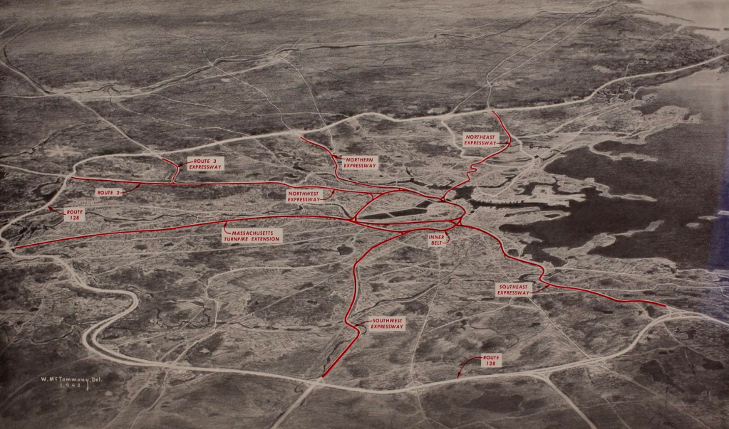
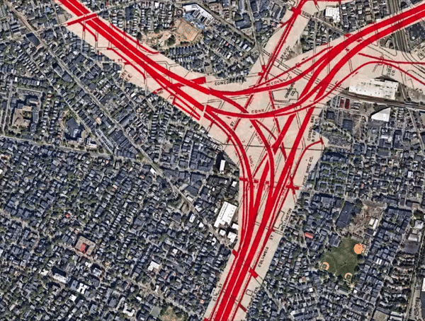
On the MapJunction.com website, created by GIS developer Bill Warner, it’s possible to explore the details of the state’s 1962 freeway plans without an overhead projector and markers (ironically enough, Warner created MapJunction.com on behalf of the Boston Redevelopment Authority, which had been major proponent of the highway proposals in the 1960s).
An electronic copy of the 1962 plan document is also available for reading on archive.org.
The following animations, derived from the MapJunction site, illustrate a few of the more audacious elements of the state’s highway plans:
Want to learn more about the Inner Belt and the grassroots movement that stopped it from being built? RSVP to join us for an online book discussion of Dr. Karilyn Crockett’s People Before Highways next Thursday, June 18.

Streetsblog has migrated to a new comment system. New commenters can register directly in the comments section of any article. Returning commenters: your previous comments and display name have been preserved, but you'll need to reclaim your account by clicking "Forgot your password?" on the sign-in form, entering your email, and following the verification link to set a new password — this is required because passwords could not be carried over during the migration. For questions, contact tips@streetsblog.org.