Boston’s New Climate Plan Is At Odds With Boston’s New Transportation Policies
Boston’s new climate “action plan” calls on the city to reduce car traffic, expand bus lanes to improve transit ridership, and to redesign streets citywide to promote walking, biking, and safer vehicle speeds.
But these are all initiatives that have either been cancelled or put on hold since Mayor Wu’s re-election campaign began last year.
“Boston is working to transform how people and goods move to build a safer, more connected city,” claims the city’s new climate plan. “By expanding access to reliable and affordable transportation options, redesigning streets to prioritize walking and biking safety, and facilitating the transition to electric vehicles, Boston aims to create a transportation system that works for everyone.”
The plan lays out six key strategies for reducing tailpipe pollution in the city, most of which are focused on improving transit service and encouraging more trips on foot and by bike.
These strategies reflect strong empirical evidence that redesigning streets to favor pedestrian safety, bike paths, and bus lanes reduce traffic and improve travel times for everyone.
However, progress on these initiatives has stalled in the wake of a secretive “30-day review” of the city’s transportation policies that Mayor Wu initiated during her reelection campaign last year.
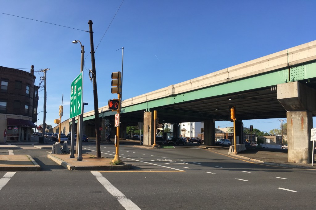
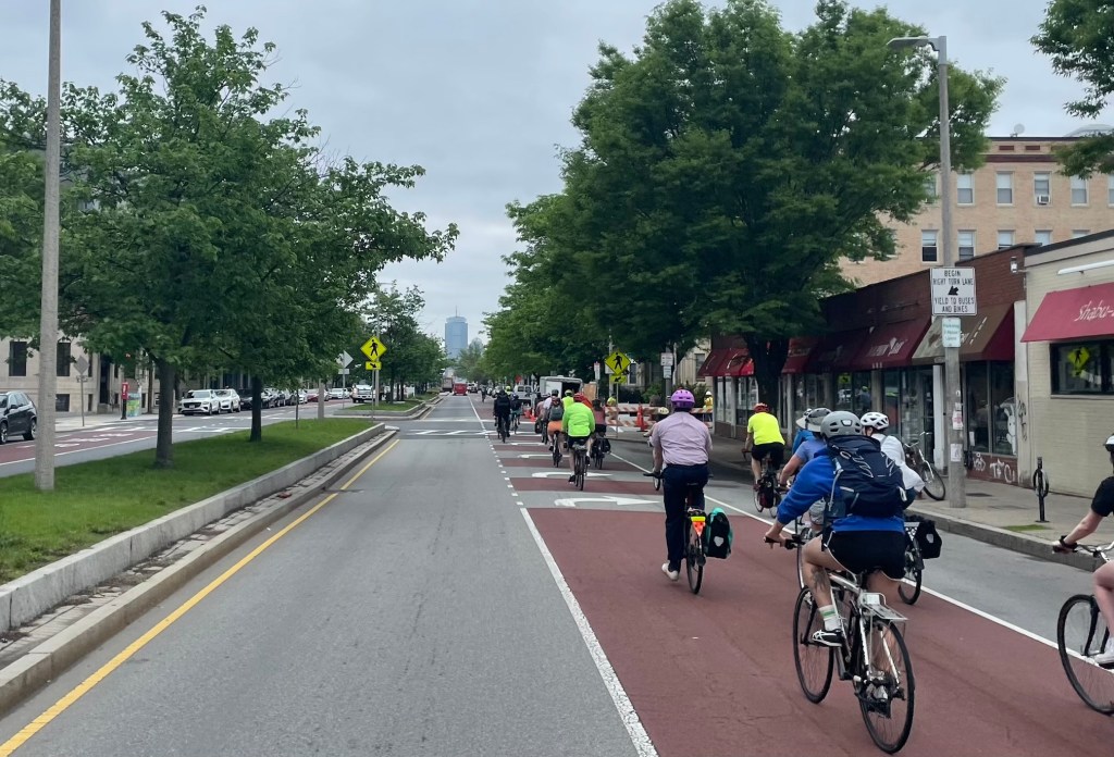
In the past year, the city has in fact has removed dedicated bus lanes on several high-ridership routes – on Boylston Street in Back Bay (which benefitted Route 39 and the Logan Express) and on North Washington Street in the North End (a bus lane that benefitted thousands of riders on the 111 to Chelsea and the 92/93 routes to Charlestown).
Meanwhile, MBTA bus service in Boston has gotten measurably worse. Today, nine out of the 10 slowest bus routes in the MBTA system pass through Mattapan and Roxbury, Boston’s most densely populated Black neighborhoods.
Traffic is the problem
While roads and highways are by far the biggest source of climate pollution statewide, in Boston, they come in second place to buildings that burn oil and methane gas for heating and cooling.
That’s partly because the city has considerably more buildings than other parts of the state, but it’s also because Boston residents are more likely to walk, bike, and use public transit.
Still, motor vehicles in Boston account for 31 percent of the city’s climate pollution.
And while the city has limited options for forcing landlords to pay for energy-efficient building upgrades, it has much more direct control over the transportation and housing policies that determine how much gasoline people burn.
The city’s methodology for measuring tailpipe emissions also comes with a big asterisk. “The inventory captures the emissions from the estimated Vehicle Miles Traveled (VMT) inside the City” (emphasis added) according to the city’s inventory report.
Imagine someone who burns a gallon of gas driving their car every day from Andover to Boston. That daily commute spews about 20 pounds of climate-heating pollutants into our air, but the city’s greenhouse gas inventory will only count the 2 pounds that the car produces at the very end of its journey, within the city’s limits.
Multiply that hypothetical example times 300,000 – the number of people who work in the City of Boston and live more than 10 miles away, according to U.S. Census data – and the footprint of Boston’s traffic-subsidizing transportation policies becomes significantly bigger.
Pavement = heat
The new climate plan also devotes considerable attention to some of the deadliest impacts of a warming climate: heat and flooding.
Both of these problems are exacerbated considerably on Boston’s streets and parking lots, where asphalt absorbs heat and prevents rainfall from being absorbed into the ground.
Boston has taken a few tentative steps to replace asphalt with new “green infrastructure” gardens that can absorb stormwater runoff and add more greenery to streets.
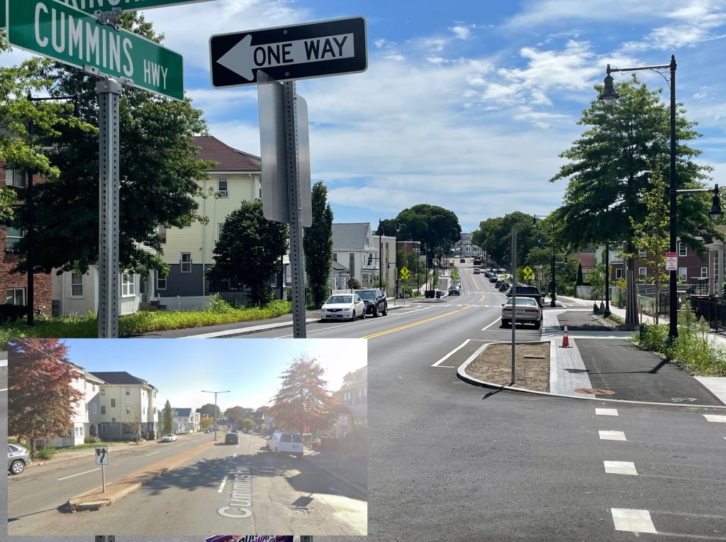
The city’s reconstruction of Cummins Highway in Mattapan, for instance, is dramatically reducing the amount of asphalt in the neighborhood, by replacing redundant car lanes with new gardens and tree plantings.
The new climate plan calls on the city to “scale up GI (green infrastructure) across neighborhoods to reduce flooding, improve water quality, lower urban heat, and support equitable access to green space.”
The Cummins Highway project was conceived during the previous administration of Mayor Marty Walsh and went under construction during Mayor Wu’s first term. A similar, but considerably smaller redesign of several adjacent city blocks in the Seaport neighborhood is getting under construction this year.
But since her reelection last year, the city has throttled the project development pipeline for additional projects like these.
Since Mayor Wu’s reelection, numerous planned street redesign projects have been put on pause or been cancelled altogether.

Read More:
Streetsblog has migrated to a new comment system. New commenters can register directly in the comments section of any article. Returning commenters: your previous comments and display name have been preserved, but you'll need to reclaim your account by clicking "Forgot your password?" on the sign-in form, entering your email, and following the verification link to set a new password — this is required because passwords could not be carried over during the migration. For questions, contact tips@streetsblog.org.