Several construction projects scheduled to begin construction in the coming year in Boston's Fort Point neighborhood will widen sidewalks and connect the neighborhood's emerging network of protected bike lanes.
On November 16, city officials from Boston's Public Works and Transportation Departments shared their final plans for reconstructing Congress Street in Fort Point, between Fort Point Channel and the Boston Wharf Road, in a virtual public hearing (watch the recording here).
"All of our efforts that we've made have been to try to bring your vision of Congress Street to life. We heard that you wanted us to prioritize wider sidewalks, to improve pedestrian spaces, to provide space for sidewalk cafes, but also to provide bicycle lanes to provide access for different modes of transportation," said Jeffrey Alexis, a civil engineer at Boston's Public Works Department, at the virtual public hearing.
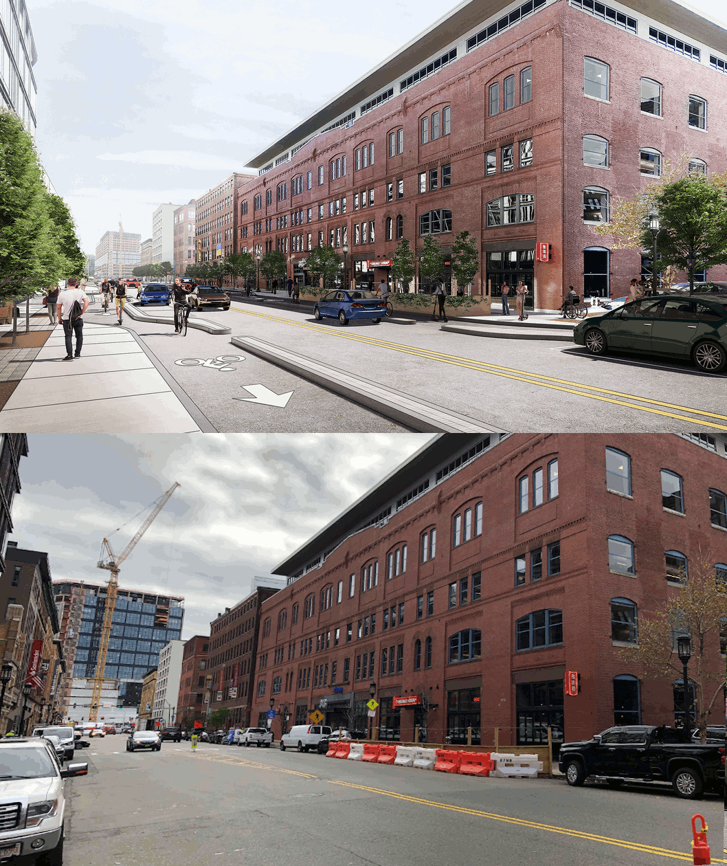
The city's proposed design (illustrated above) would widen sidewalks substantially along most of the street, and add curb-separated bike lanes on both sides of the street. The widened sidewalks would also create space for the city to plant over three dozen new trees as part of the project (this segment of Congress Street currently only has eight trees, and the city plans to preserve those trees during construction).
When it's complete, curbside parking will be relegated to just a handful of designated spaces along the new street.
"In regards to parking, it wasn't really prioritized as part of this project, as we wanted to focus more on sidewalk space as well as the bicycle accommodations," said Alexis.
He noted that new ADA-accessible parking spaces would be designated on nearby side streets.
The design would also install raised crosswalks across Sleeper Street, Farnsworth Street, and Stillings Street where those streets intersect with Congress.

The project spans from Fort Point Channel to Boston Wharf Road, where several large new high-rise buildings are under construction as part of the Seaport Square development, which will include a public stairway to connect Congress Street to the elevated Summer Street viaduct.
Those projects will implement additional changes to the streets in the neighborhood in the year to come.
East of Boston Wharf Road, Congress Street today is a wide, four- to five-lane roadway controlled by MassDOT (between Boston Wharf Road and B Street) and MassPort (between B and D Streets).
A City of Boston official told StreetsblogMASS that the city is collaborating with MassDOT and the Seaport Square developers for further safety improvements to that MassDOT-controlled segment of Congress Street, as well as to Boston Wharf Road itself.
Those designs "are not yet final," according to the BTD spokesperson, but will include "bike facilities on Boston Wharf Road between Seaport Boulevard and Congress" and will continue one block south of Congress Street on West Service Road to Pastene Alley.
The BTD official added that designs for the block of Congress Street through the Seaport Square development, between Boston Wharf Road and Pier 4 Boulevard, "include a wide, planted median similar to Seaport Boulevard, and a wide midblock, signal-controlled crossing aligned with the stairs to and from Summer Street."
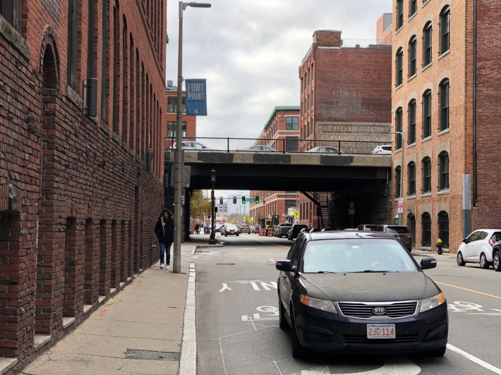
Finally, as part of the city's Congress Street project, the city also plans to widen sidewalks on A Street between Congress and Melcher Streets, where existing sidewalks (pictured below) are so narrow that they are impassible for people in wheelchairs:
