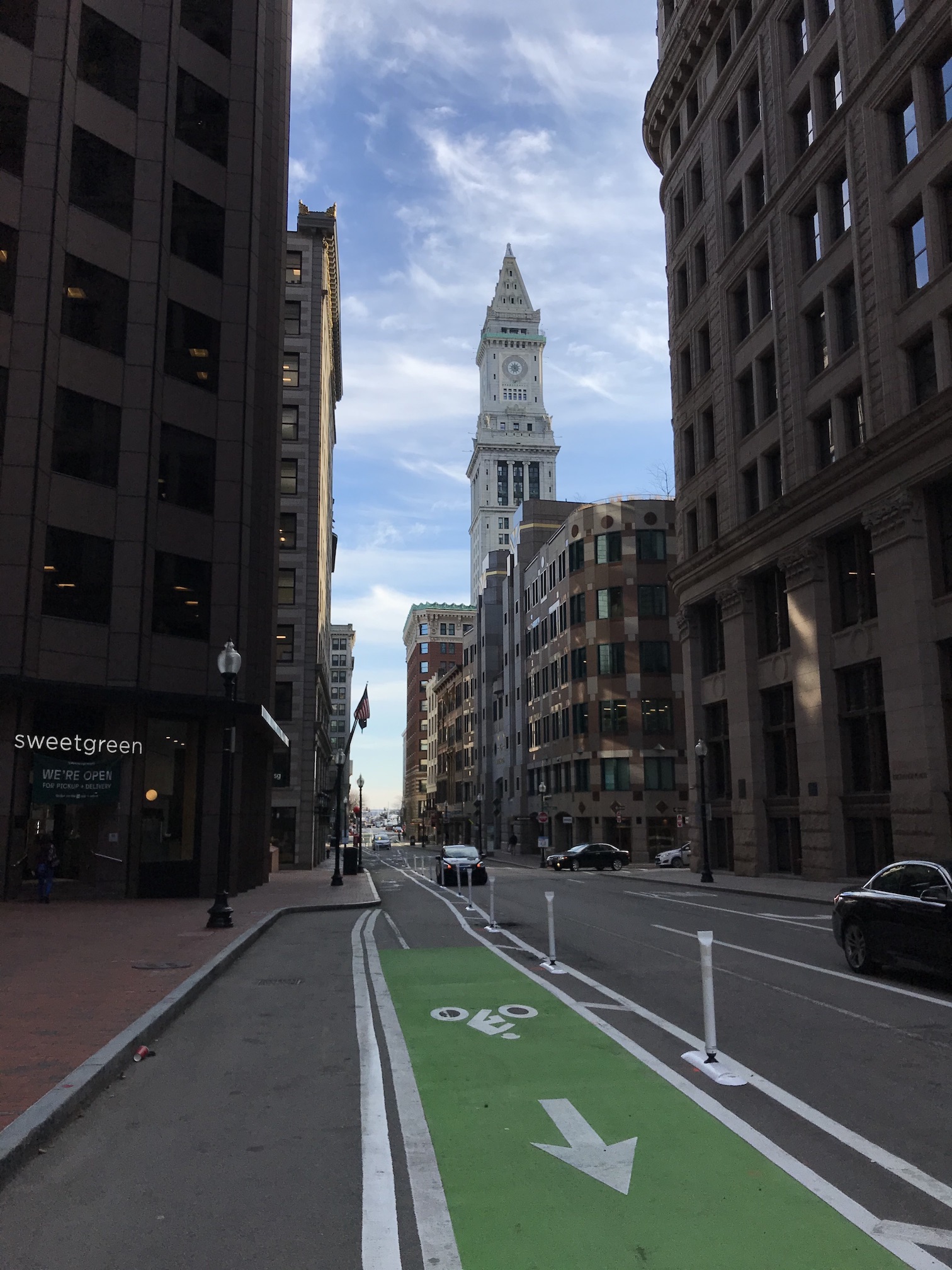
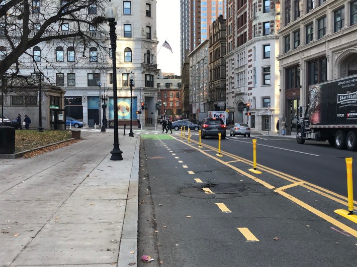
The State St. protected bike lane and the Custom House Tower in downtown Boston.
In the past week, Boston Transportation Department crews have installed new flexposts to delineate the city's new "Connect Downtown" bikeway project, which fills in crucial gaps in the city's bike infrastructure network to link the city's downtown office buildings with major bike routes to outlying neighborhoods.
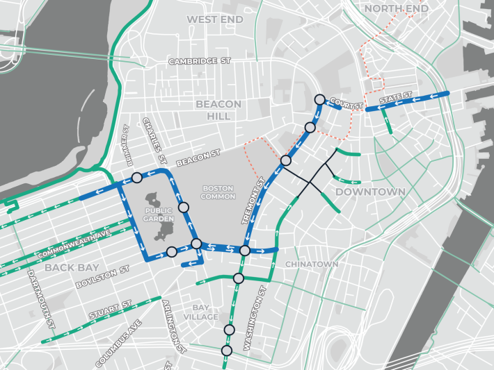
A map of downtown Boston's new protected bike lane network (highlighted in the thick blue lines) and its connections to existing bike lanes and paths (in green). Circles highlight intersections where the city also reprogrammed traffic lights to give pedestrians more frequent walk signals.A map of downtown Boston's new protected bike lane network (highlighted in the thick blue lines) and its connections to existing bike lanes and paths (in green). Circles highlight intersections where the project enabled additional timing improvements for pedestrian crossing signals.
"This has been a big effort from the city and a key goal of GoBoston 2030, making it more comfortable and more possible for people to choose cycling as a mode of travel," said Boston's Chief of Streets, Chris Osgood, during a virtual press event on Wednesday. "We've been able to build out a set of bike lanes that serve as a hub for the bike network that courses into Boston's downtown."
The GoBoston 2030 plan includes an aspirational target to cut citywide car traffic in half – a goal that was later embraced in the city's climate action plan – in part by quadrupling the the percentage of Bostonians who commute by bike, from 2 percent to 8 percent, within the next decade.
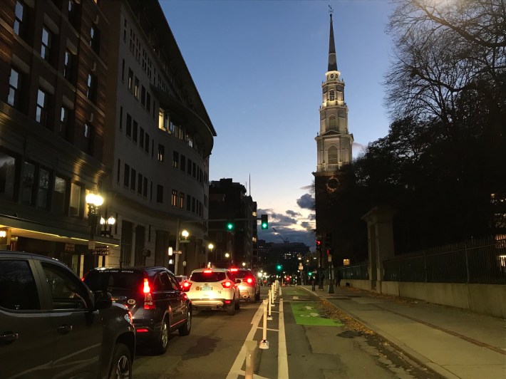
Below is our photo tour of downtown's newly improved streets, starting from Government Center, then heading southwest along the Boston Common and looping around the Public Garden:
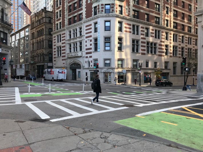
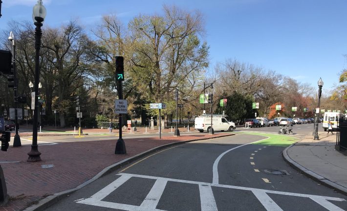
Two new flexpost-protected bike lanes intersect at Boylston and Tremont, outside the Boylston Green Line station entrance. To the left, the Boylston Street protected bike lane continues into Chinatown to meet the Washington Street protected lane, and to the right, the Tremont Street bike lane continues a few more blocks to the I-90 overpass. Because there is no longer any right-turning traffic from Tremont to Boylston, pedestrians like this one now get an extra walk signal whenever the Tremont St. light is green.Two bike lanes intersect at Boylston and Tremont, outside the Boylston Green Line station entrance. The city has replaced the westbound motor vehicle lane on Boylston with a new two-way cycletrack that carries bike traffic between Back Bay and Chinatown.
Another view of the Boylston and Tremont intersection from Boylston Street. This new two-way protected cycletrack on Boylston St. connects the new one-way protected bike lanes on Tremont and Washington Streets with the Columbus Avenue and Charles River Esplanade bike routes to the west.A two-way protected bike lane on Boylston St. connects the protected bike lanes on Tremont and Washington Streets with the Columbus Avenue and Charles Street bikeways.
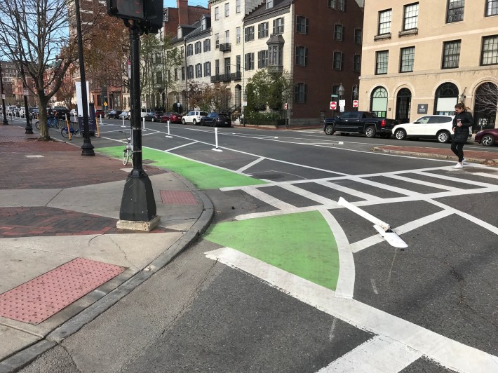
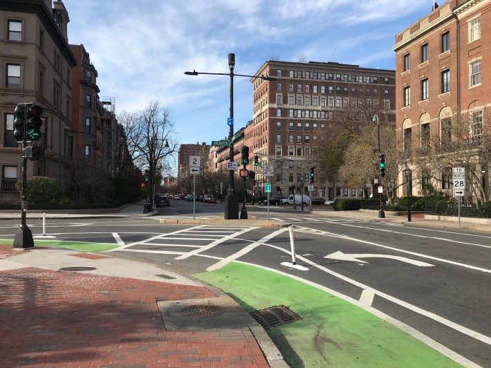
On the western edge of the Boston Common, Boylston Street's two-way cycletrack has taken over a former slip lane. From here, bike traffic can turn right onto Charles Street toward the Charles River Esplanade and the Commonwealth Avenue bike lanes, or turn left along a short contraflow bike lane to ride into Park Plaza towards the Columbus Avenue bike route.At the west side of the Boston Common, Boylston Street's two-way cycletrack has taken over a former motor vehicle slip lane into Charles Street, pictured here in November of 2020. A proposed new project would eliminate this asphalt to provide more direct bike and pedestrian crossings through the intersection and create a new gateway to the Boston Common.
The new Charles St. protected bike lane, looking north, pictured on Nov. 17, 2020.The Charles St. protected bike lane, pictured on Nov. 17, 2020.
At least one driver had already run over one of the project's new flexposts at the corner of Charles and Beacon St., at the northeast corner of the Public Garden, just days after its installation.As seen in this photo, taken on November 17, A driver had already run over one of the project's new flexposts at the corner of Charles and Beacon St., at the northeast corner of the Public Garden, just days after installation.
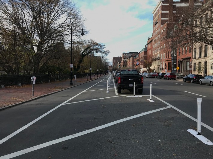
The Beacon St. protected bike along the northern edge of the Public Garden, looking west from Charles Street.The Beacon St. protected bike next to the Public Garden, looking west from Charles Street.
The Beacon St. protected bike lane where it turns onto Arlington St. at the northwestern corner of the Public Garden. In the background is the intersection with Mugar Way, where the Charles River Esplanade can be accessed via the Fiedler Footbridge.The Beacon St. protected bike lane, where it turns onto Arlington St. at the northwestern corner of the Public Garden.
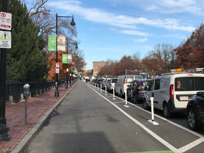
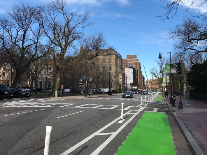
The new Arlington St. protected bike lane, looking back towards Beacon Street, with the Commonwealth Ave. mall to the left.The Arlington St. protected bike lane, looking back towards the Commonwealth Ave. mall.
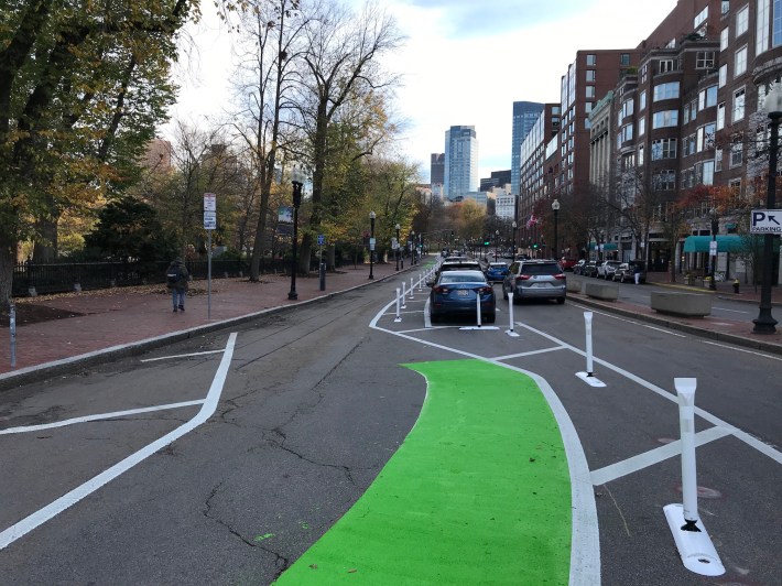
The Boylston St. protected bike lane along the southern edge of the Public Garden, looking east towards downtown.The Boylston St. protected bike lane along the southern edge of the Public Garden.