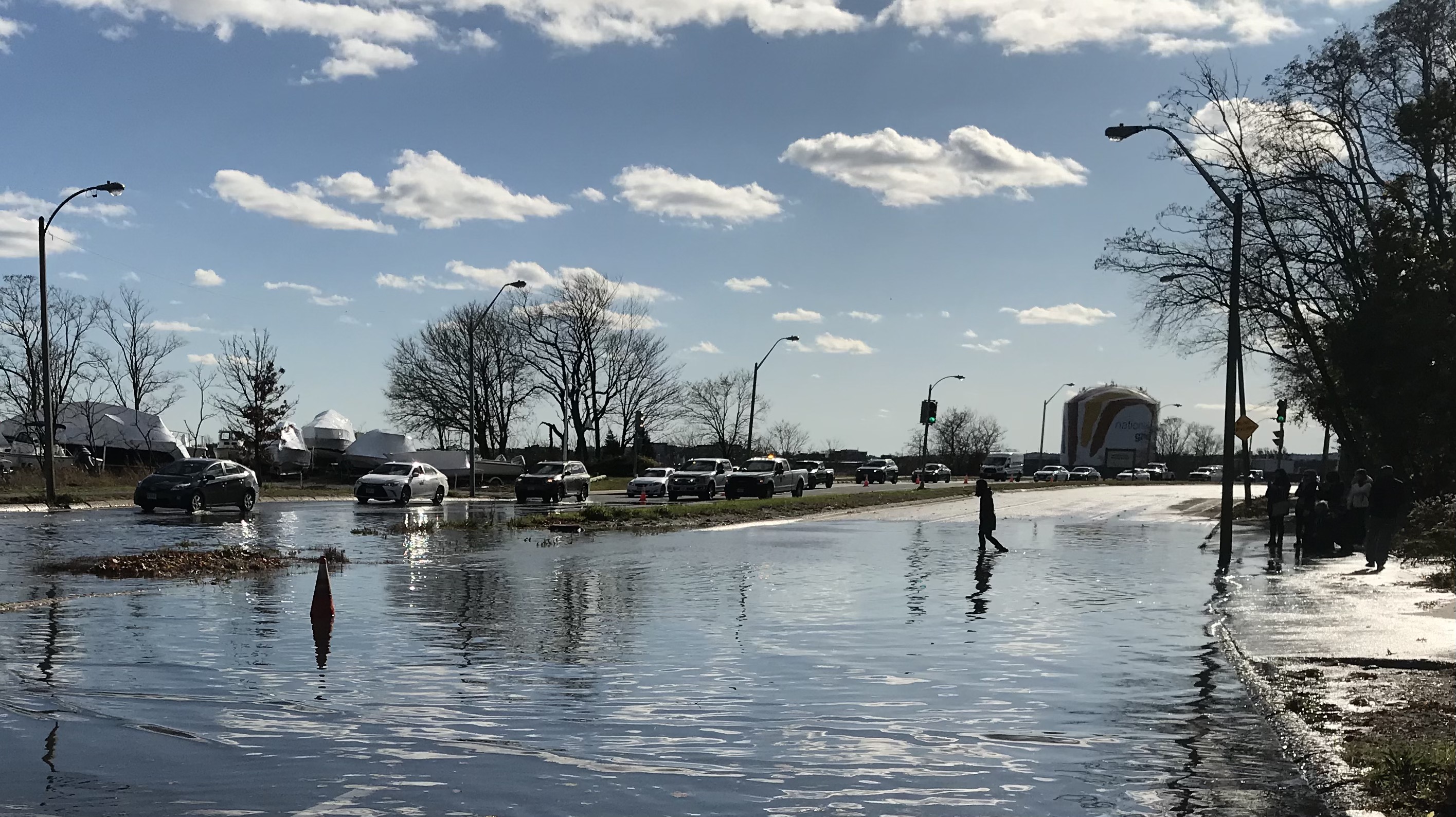
A crowded field of local and state agencies will collaborate on yet another plan for redesigning Morrissey Boulevard, the crumbling and frequently flooded highway that divides Dorchester neighborhoods from the Boston Harbor waterfront.
On Thursday, the City of Boston, Boston Planning & Development Agency (BPDA), Massachusetts Department of Transportation (MassDOT), Executive Office of Energy and Environmental Affairs (EEA), and Department of Conservation and Recreation (DCR) announced a new joint planning effort to "evaluate and recommend transportation and infrastructure improvements" with goals that include improved mobility for pedestrians, bikes, transit riders, and motorists, and a more resilient waterfront that can better protect low-lying Dorchester neighborhoods from storm surges and rising tides.
"The results of this study will lead to near-term improvements and long-lasting solutions that will protect and support this neighborhood, its residents, and its businesses for generations to come," promised Mayor Marty J. Walsh in a press statement.
If that promise sounds familiar, it might be because there have been several other planning initiatives in recent years with similarly big ambitions for Morrissey Boulevard – ambitions that, for want of funding, political will, and coordination among different bureaucracies, have so far failed to make the leap into reality.
DCR initiated one redesign study for Morrissey Boulevard in 2015, and shared conceptual designs in the summer of 2017.
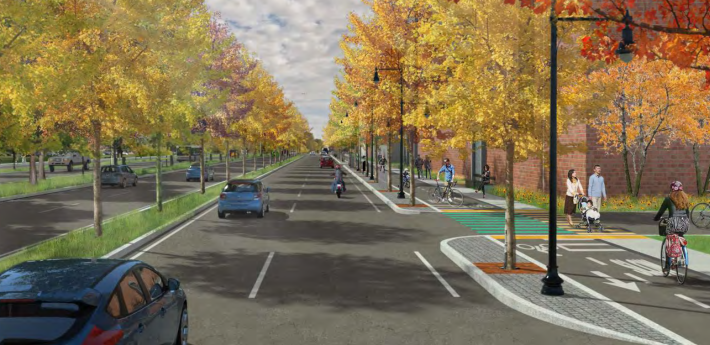
Those plans called for reducing the overall footprint of the roadway (generally reducing the highway’s width from three lanes in each direction to two), adding curb-protected bikeways, and raising the elevation of the roadway’s lowest areas to avoid tidal flooding:

But Mayor Walsh, who regularly uses Morrissey Boulevard for his commute, pushed back against the plan to remove car lanes, and the plan went nowhere.
Then, in 2020, the Walsh administration published its own “Climate Ready Dorchester” plan, which warned that a major storm surge could turn Morrissey Boulevard into a freeway for floodwaters to flow into surrounding neighborhoods, spreading as far inland as the South End and Roxbury.
To avoid that, the plan proposed that the boulevard and its surroundings should be redesigned to promote better bike and pedestrian access while raising it to an elevation of at least 16 feet above the North American Vertical Datum (NAVD 88) sea level – roughly six feet above the current roadway.
Finally, private developers are drawing up their own schemes for the area. The largest proposal, Dorchester Bay City, envisions 1,700 new apartments plus 4 million square feet of office and lab space on the former Bayside Expo Center site at the northern end of Morrissey Boulevard.
In a press release, the BPDA said that the new study would attempt to reconcile the recommendations of the 2015 DCR plan with the more recent "mobility, equity, and resiliency goals" adopted by the City of Boston.
"The study will prioritize infrastructure designs that meet the City and Commonwealth’s net-zero emissions targets, including maximizing opportunities for sustainable transportation such as walking, bicycling, and transit use," according to the press statement.
The new study will kick off its public outreach in the coming months, and is expected to last about a year.


