Editor's note: a longer version of this article originally appeared on Cherston's personal website, Bicycle Exploring At the Frontier, and is republished with permission.
I more or less stumbled on the newly connected Coastal Trail system by accident while exploring Newburyport, and it’s some of the best bicycle exploring I’ve done in Massachusetts. The network’s newest extensions are so fresh that you won’t even find them yet on Google Maps or on OpenStreetMaps.
These trails bring visitors through quaint towns, art displays, riverfront, beachfront, forest, marsh, countryside, and encounters with friendly locals. Below is an overview map that I’ve taken from the Coastal Trail system website, and then highlighted key routes I’ll talk about in yellow:
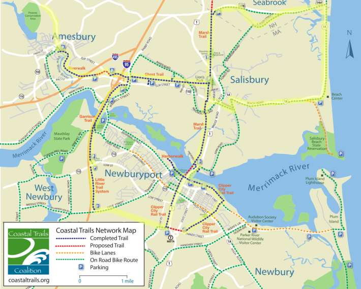
Three chunks of this trail network have opened since the pandemic began:
- The Marsh Trail between Salisbury, MA and Seabrook NH
- Clipper City Rail Trail along the Merrimack Riverfront
- I-95 underpasses that connect the Ghost Trail to downtown Amesbury
To give you a feeling on mileage/times at play here:
- The Clipper City Rail Trail is a ~5 mile loop and can probably be done in 30–45 minutes due to crowds.
- An out-and-back from the Newburyport MBTA station to Amesbury is around 15 miles round trip (~1.5 hours)
- A full exploration in the area including Salisbury and Seabrook, NH beyond Amesbury could probably start getting up to 30 miles
- For 30+ miles, look into some of my suggestions at the end of this page.
But why not just go for it! See what calls your attention in the moment and don’t wed yourself to a plan.
Newburyport trains from Boston’s North Station leave every two hours on weekends, and every 60 to 90 minutes on weekdays. The trip takes 1 hour, and if you’re lucky, your train will have a bike car.
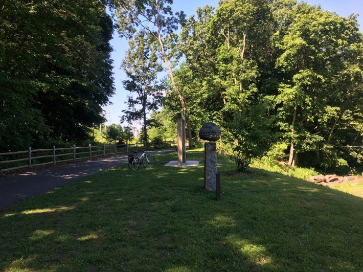
The Clipper City trail literally starts directly on the north side of the Newburyport train platform. You’ll immediately be greeted by a pristine, art-lined path, which feeds you into downtown Newburyport and the harbor:
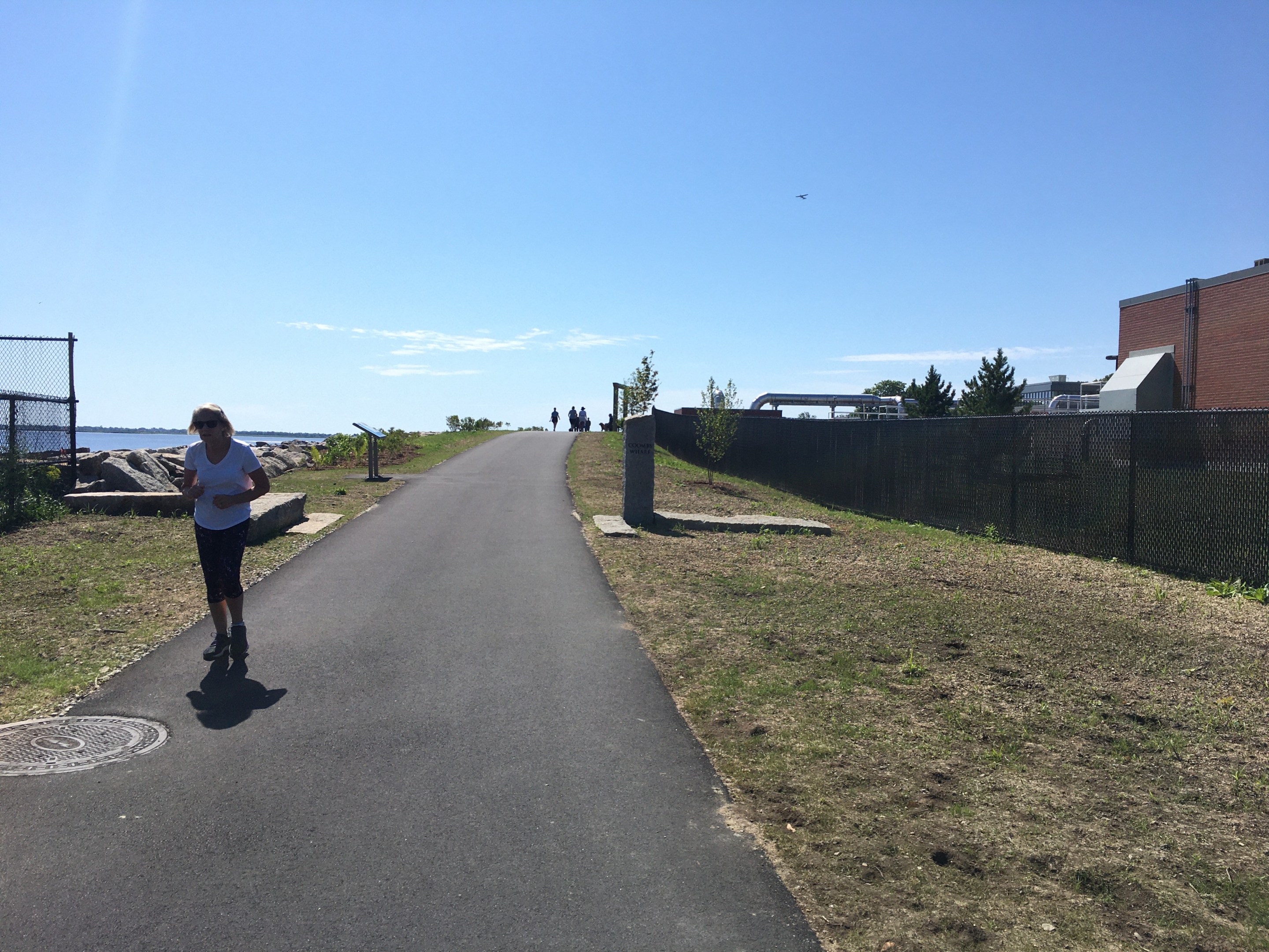
A brand new Clipper City Rail trail extension along Newburyport’s waterfront (pictured at the top of this article) opened a few weeks ago, in early June 2021. To get there, just swing a right once you get to the waterfront from the MBTA stop.
East of downtown Newburyport, the trail swings inland, back towards the train station. There is a small section of the trail that is not built yet, so it doesn’t quite make a full loop, but the city is currently designing a new separated path that will run alongside Parker Street, across the Route 1 traffic circle, and back to the station.
Just before or just after doing the Clipper City loop, you’ll definitely want to check out downtown Newburyport. The main streets are hard to miss, but the are some other spots in town slightly off the main streets — Oldies Marketplace (an enormous warehouse-sized antique shop), the Sunday morning farmers market with live music (at the Tannery Marketplace courtyard), and the Tannery Marketplace itself, a former mill converted into cozy and trendy bookshops/eateries.
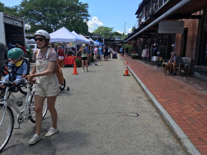
One awesome perk of Newburyport is its friendliness to vegan/vegetarian diets. Metzy’s Cantina right at the MBTA and Revitalive in the Tannery are two examples, among others.
When you’re ready to get out of the town and into the woods, cross over the Merrimack bridge right in town by following the coastal trail northwest, via Route 1. This is a lame part of the journey with cars racing and a bunch of signs indicating to walk bikes along a narrow sidewalk. There is a larger shoulder at the second half of the bridge that you can opt for, and also an interesting indication that an abandoned bridge right next door might one day become part of the rail trail:
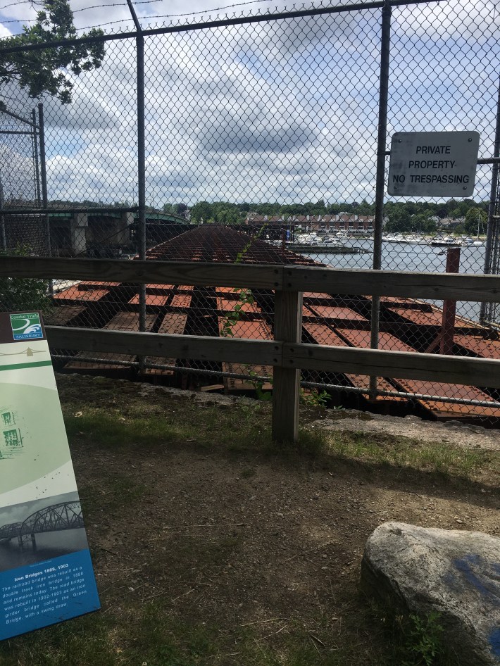
As you are crossing the bridge, keep on the lookout for a bike sign pointing you to a hard right turn, where you will be free from car madness and dropped into quiet marshland and woods. It’ll be hard to believe you were in a vibrant town center only minutes earlier.
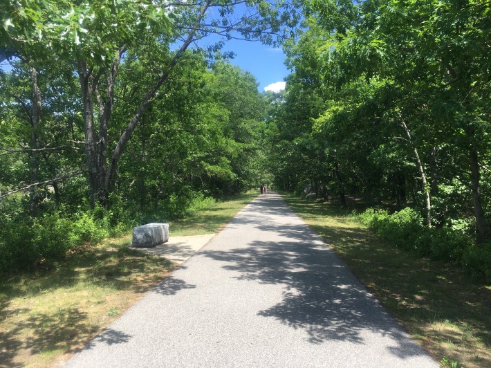
This is the Marsh Trail, which extends about 3.5 miles through Salisbury before the pavement runs out at the state line and ends at state route 286 in Seabrook, NH.
There are a few ways to get to New Hampshire via commuter rail and bike, and this trail is the newest kid on the block. New Hampshire has a plan to eventually extend this trail to Portsmouth (and preliminary work on the Hampton, NH to Portsmouth, NH section just began in April), but for now, your only options to venture into the Granite State involve riding on roads.
It’s possible to get to Salisbury beach from here if you’re willing to tolerate the traffic on state route 286. South Main Street does let you bypass most of the busier highway, but there’s no avoiding the last mile across the salt marsh. Fortunately, there is a big shoulder on this last stretch and beautiful views, but cars were going 50 to 70 mph.
Entering into the Salisbury coast, you’ll be getting a totally different vibe than Newburyport. Lobster bar, a fireworks store, and lots of cars.
If you loop down 1A south, you’ll find that classic old-timey fries/pizza/arcades vibe at the main Salisbury Beach entrance, and a lot more activity on the beach itself:
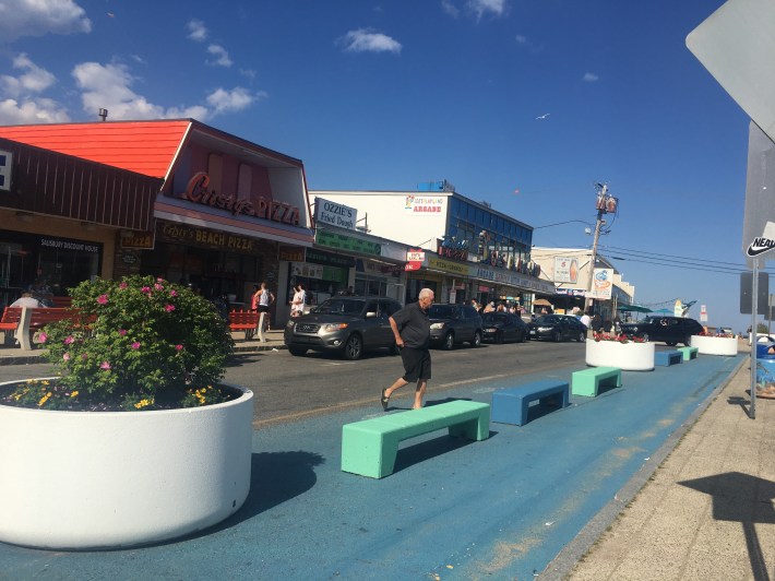
After hanging on the beach and reading from a book called Deep Play By Diane Ackerman (relevant!), I decided to go check out Amesbury. This requires getting back to Salisbury center, either by backtracking to the Marsh Trail or via a considerably more stressful route on Beach Road into Salisbury center.
From there, you can pick up the Ghost Trail, an awesome dirt path through the woods.
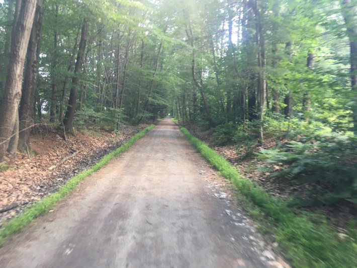
Keep on going and you’ll eventually link up with the Amesbury Riverwalk trail, via some brand new underpasses beneath I-95 (kudos to all who negotiated and found funding for this project):
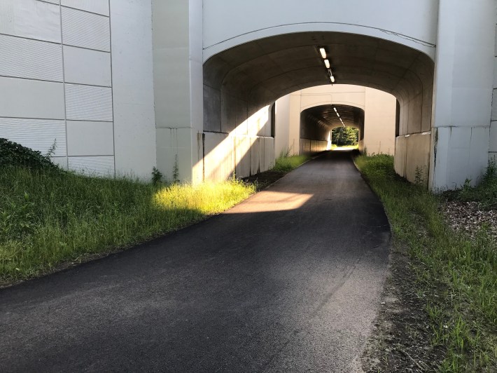
There is one small gap in this trail west of the highway. The Ghost Trail ends at an oversized crosswalk on Elm Street, and continues as the Amesbury Riverwalk from the back of a McDonalds parking lot a short distance to the west. It was pretty exciting for me to find it back there — a secret place to duck back into the woods where you’d really not expect to find one, hiding among all the muggles' shops at the strip mall.
I made the mistake of sidewalk riding along state route 110 for a few blocks to make this connection, then turning into the shopping mall. But I think turning right onto Elm Street would probably make for a more peaceful connection. Plus, I saw some construction happening on Elm St. as of late June 2021— maybe a better connection is being built as we speak?
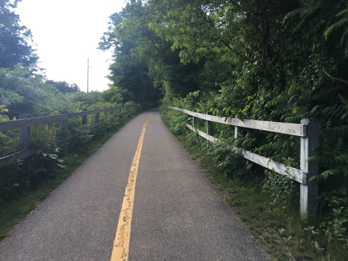
At last, the path lets out in Amesbury. I had no idea what to expect, and was delighted by Amesbury, with its river flowing through town, restaurants built into an old textile mill courtyard, and cheerful people I chatted with in town.
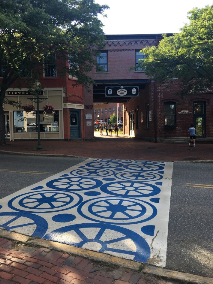
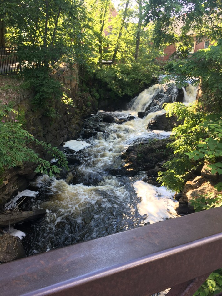
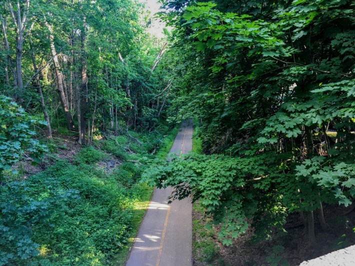
Beyond Amesbury is a wonderland (unpictured — choose your own adventure!). The roads thin out as you cross over into New Hampshire, and on the majority of roads out there you’ll now only see a car every minute or two. At this point it feels like full blown countryside, and I’ve only explored a little bit. The Heron Pond farm has a cute farmstand as you head out of Amesbury.
Sooner or later you might want to make it back to Newburyport – or maybe you’ll be clever and pick up the Amtrak Downeaster from Exeter, NH or Haverhill, MA.
In any case, one way to get back to Newburyport is via the Garrison trail, a genuine bicycle highway — imagine adding a lane to I95 exclusively for bicycles, and separated by a wall. I made my way back along the Amesbury Riverwalk trail, then hit a hard right to catch the Garrison trail.
You'll need to cross a major road lined with stripmalls at a designated crosswalk, but still there were very obviously some recent (as of June 2021) improvements connecting the Amesbury Riverwalk trail to the Garrison trail.
I wondered briefly what pollution I was breathing in next to 95, but still thought it was an interesting concept, since highways tend to connect key places. Plus there is a scenic view over the bridge, and more possible adventures exploring adjacent forests and a state park.
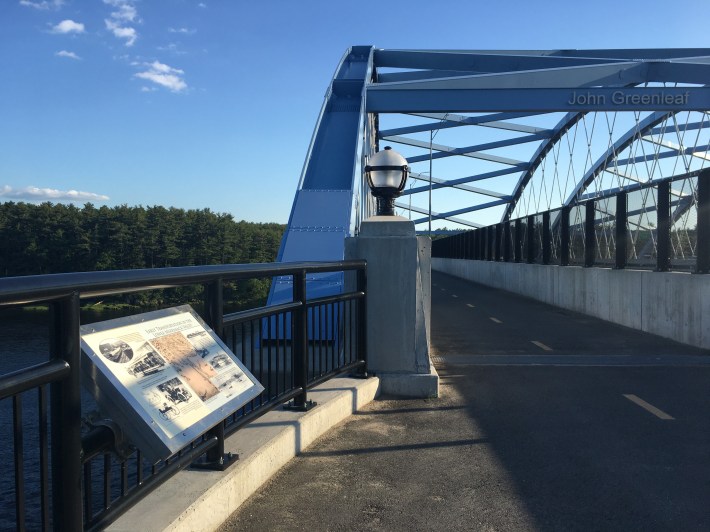
The Garrison Trail spits you out to a truly enormous parking lot, an intercity bus depot and park-and-ride. Traverse the parking lot, cross Route 113 at a crosswalk, and you’ll be fed into the Little River trail system (unpictured). I missed this the first time around, but it’s cool, bicycle friendly, and lots of walking paths are also connected to the main artery.
Those trails will take you to Hale Street, and from there, some gentle road riding along Hale and Malcolm Hoyt Drive will bring you back to the MBTA stop, complete with a nearby brewery, Metrorock climbing gym, and that Metzy’s mexican restaurant I mentioned earlier.
When I set out on this journey, I had no specific route in mind, and no idea that so much improvement had happened within the last year. I was totally lucky, and only pieced together the maps and websites after the fact. Crucially, part of the feeling of exploration and liberation comes from not having too specific of a route or a plan, just a vague sense of the area you are exploring, taking some joy from whatever the route reveals to you. Even mundanity takes on life in this heightened sensory state — the banal becomes uncanny. So rather than plan out too specific of a route, why not just hop on the train, ride off the platform, and follow your nose.
During the week, Juliana Cherston is a PhD student in science and engineering at the MIT Media Lab. She says that “A crucial aspect of my job is to cultivate comfort at the frontier of knowledge. An experiment might be stubborn for months on end, and it’s not clear whether there’s just a faulty cable somewhere or whether the entire premise is flawed. How can I practice joy, play, and wonder in these moments, even when deadlines and expectations are piled on top? Bike exploration is basically a physical arena to practice the same psychological process that I strive to nurture in the laboratory. Isolated on routes that sometimes defy modern maps, there is a freedom and playfulness that emerges in face of the unknown. It’s an intensity of sensory experience steeped in the cultivation of self trust, an antidote to anxiety whether in the lab or on the roads.” Read more of her explorations on Medium or on her personal website.
