Travel Guide: Wayland’s Aqueducts and the New Cochituate Rail Trail
I initially stumbled on the Cochituate Rail Trail in Framingham by chance last year. Since then, two substantial bridges over major roadways were craned in, and earlier this fall, the trail’s new extension into Natick Center officially opened to the public.
It is now possible to ride a very enjoyable route from Boston to Natick that’s 90 percent on off-road paths, a perfect choice for some late-autumn riding. This post will show you how to connect the Cochituate Trail with the Mass. Central Rail Trail (MCRT) and the Charles River bike path, offering you the chance to explore Waltham, Wayland, and parts of Framingham on your way. There is also a variation using the commuter rail to get to the MCRT if you’re looking for a trip with fewer miles.
Getting to the start of the Mass Central Rail Trail in Weston
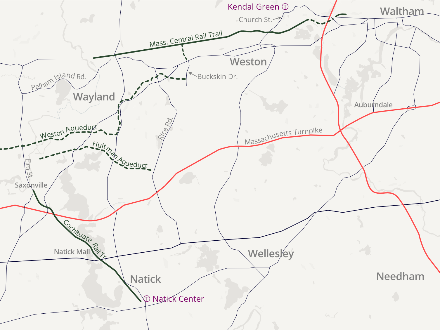
A great way to get to the Cochituate Rail Trail is via the Mass Central Rail Trail’s Wayside section, which opened in December 2019 and connects Weston and Wayland.
The start of the trail is near the Weston-Waltham city line, around 10 miles from Cambridge, or 13 miles from downtown Boston.
Accessing the MCRT-Wayside by bicycle
To do the full ride by bicycle, pick up the Charles River bike path in Boston and follow it west through both Watertown and Waltham to the Prospect Street bridge, just beyond Waltham Center.
From there, navigate a short ~1.5 mile gap to the MCRT through Waltham’s city streets. The most direct option is to walk or ride up Prospect Street to Route 117 (Main Street), then follow of Main Street west until you come to the intersection with Stow Street/Spencer Street, which will be on your left just before Main Street passes over I-95.
Follow Spencer Street to the end, and you will find a secret, unmarked bridge overpass across I-95 that feeds you directly into the MCRT.
Prospect and Main Street have heavy traffic, but there are some calmer alternatives available. For instance, you can bypass most of Route 117 by using the quieter maze of residential streets just south of it.
Or, just north of 117, you can ride west over an abandoned railway that ends in a very brief paved bike path near Hillside Road.
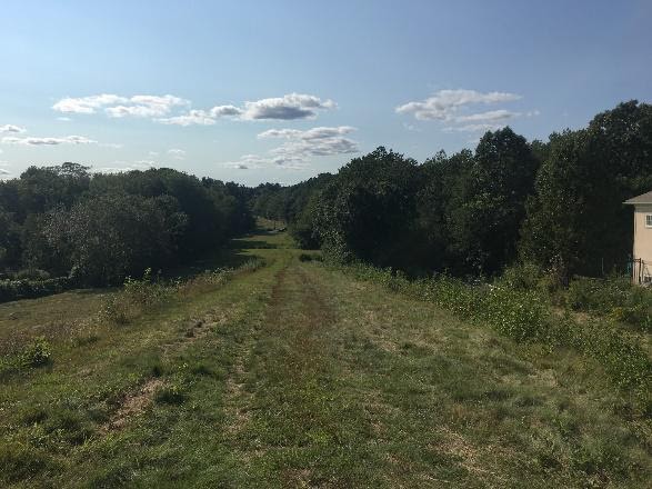
This railroad bed will eventually be a formal part of the MCRT, connecting to the planned Belmont Community Path to the east. As of this fall, the City of Waltham was working on construction drawings for a project that will upgrade a 2.7 mile section of this railway into a paved shared-use pathway. For now, riding over these tracks is a bumpy option, and wider tires are recommended.
Accessing the MCRT-Wayside by Commuter Rail
Your second option for getting there is to take the Fitchburg Line to the Kendal Green stop, then bike about 5 minutes south along Church Street in Weston to pick up the MCRT about a quarter of the way along the path.
For people venturing from the Cambridge/Somerville area, you can catch the Fitchburg line from Porter Square, so there’s no need to trek into Boston.
Riding the Mass. Central Rail Trail through Weston
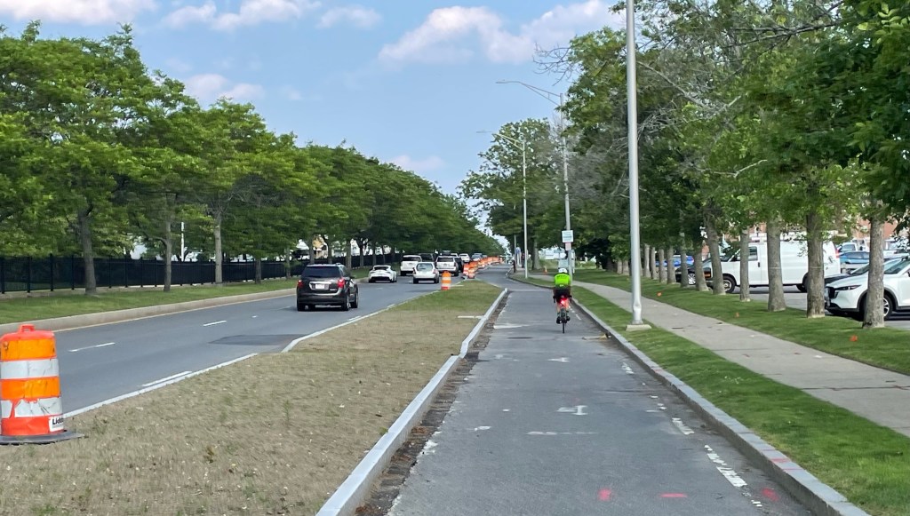
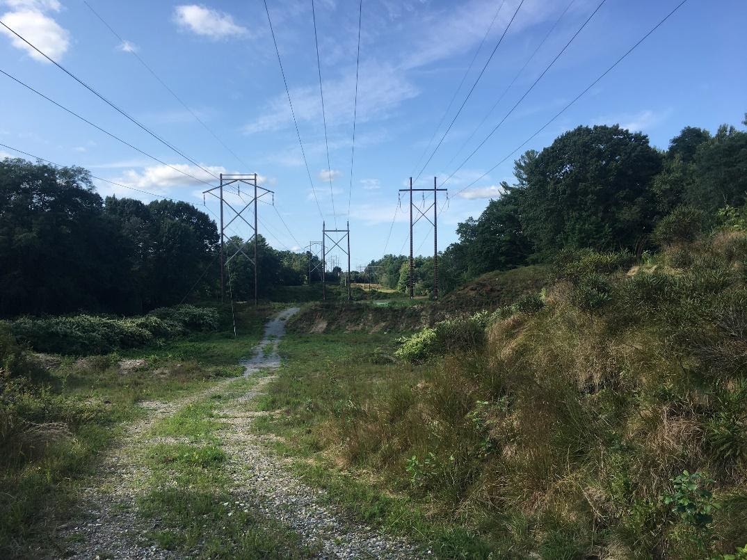
Enjoy this newly paved (as of 2019) 5-mile section of the MCRT, which follows a power line trail through a natural landscape. It’s not nearly as traffic heavy as the Minuteman, so you’ll have a lot of breathing room.
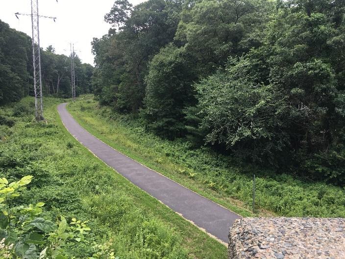
The trail crosses the entire town of Weston into Wayland center, at which point the trail switches to a packed-dirt surface for the last short connection to an outdoor shopping mall.
Connecting to the Cochituate Rail Trail
By Roadway:
From the western end of the MCRT, there are a few ways to make the 4- to 5-mile connection between Wayland Center and Saxonville (the northern terminus of the Cochituate Rail Trail).
Your most straightforward option is to cross the Boston Post Road and cut through the parking lot of Russell’s Garden Center, then pick up the very quiet and scenic Pelham Island Road (which is very relaxed: you might see people walking in the roadway).
Pass by a scenic lake and the entrance to a nature park, and eventually you’ll hit Landham Rd., which becomes Elm Street when you cross the line into Framingham. It’s a more traffic-heavy road, but a tolerable sidewalk is available.
It’s 2.3 miles from Pelham Island Road to Saxonville, where the Cochituate Rail Trail begins.
Connection by Trails:
If you want to get creative in making this connection, explore the rich trail network in the area. Check out the OpenStreetMap Cycle Map for the most detailed overview of your options. In particular, both the Weston and Hultman Aqueduct trails are worth checking out.
A caveat: most of these trails are unpaved and unimproved, so you might want to bring a bike with thicker tires, and be ready to encounter mud if it’s rained recently.
Saxonville & the Cochituate Rail Trail
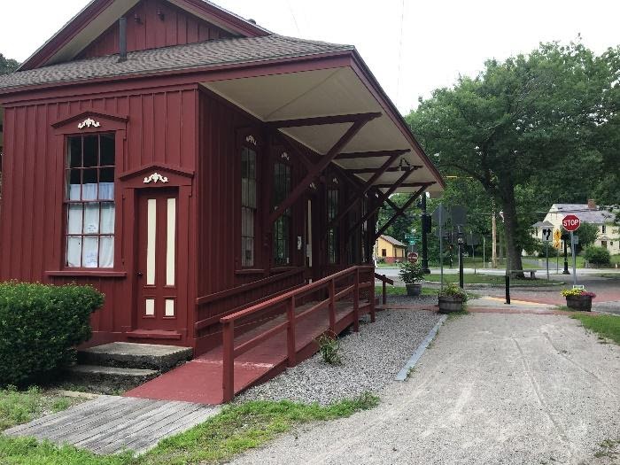
Saxonville doesn’t have too much going on, but it’s a good spot to pause. Check out the picturesque old mill and dam at the center of town, and grab lunch at Green Leaf, or coffee at Saxonville Mills Cafe.
From Saxonville, pick up the Cochituate Rail Trail on the east side of Elm Street on the other side of the Sudbury River.
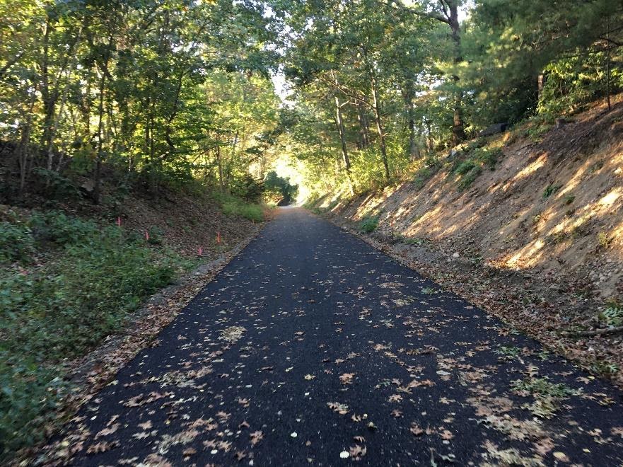
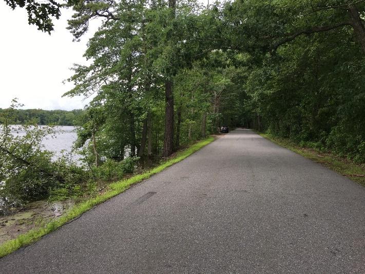
Once you’re on the Cochituate Rail Trail, it’s smooth sailing into Natick. The Framingham section of this trail has been around for a while, but everything from Route 30 south opened this year.

Enjoy the bridges, which carry you over Route 30 and Route 9, the shoreline of Lake Cochituate, and the short Wonderbread Spur trail that leads to the Natick Mall.
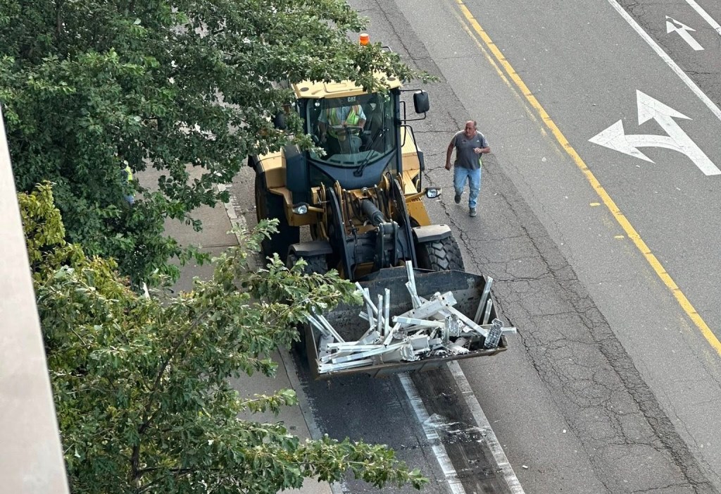
In Natick Center, the last segment of trail is still under construction while the MBTA builds a brand-new station. Eventually, the town plans to have a direct trail-to-transit connection.
For now, it’s just a few blocks on relatively quiet streets into the town center, where you can catch a Worcester Line train back into South Station in Boston.
During the week, Juliana Cherston is a PhD student in science and engineering at the MIT Media Lab. She says that “A crucial aspect of my job is to cultivate comfort at the frontier of knowledge. An experiment might be stubborn for months on end, and it’s not clear whether there’s just a faulty cable somewhere or whether the entire premise is flawed. How can I practice joy, play, and wonder in these moments, even when deadlines and expectations are piled on top? Bike exploration is basically a physical arena to practice the same psychological process that I strive to nurture in the laboratory. Isolated on routes that sometimes defy modern maps, there is a freedom and playfulness that emerges in face of the unknown. It’s an intensity of sensory experience steeped in the cultivation of self trust, an antidote to anxiety whether in the lab or on the roads.” Read more of her explorations on Medium or on her personal website.
Streetsblog has migrated to a new comment system. New commenters can register directly in the comments section of any article. Returning commenters: your previous comments and display name have been preserved, but you'll need to reclaim your account by clicking "Forgot your password?" on the sign-in form, entering your email, and following the verification link to set a new password — this is required because passwords could not be carried over during the migration. For questions, contact tips@streetsblog.org.