Two New Trail Links Open, Connecting Greenways North of Boston
After suffering through long delays during the pandemic, two new trail connections have opened to bike and pedestrian traffic this spring: the Charlestown Seawall trail connection between Draw 7 Park in Somerville and Alford Street in Boston, and the new Watertown-Cambridge Greenway, which connects the Alewife Red Line station to Watertown Square.
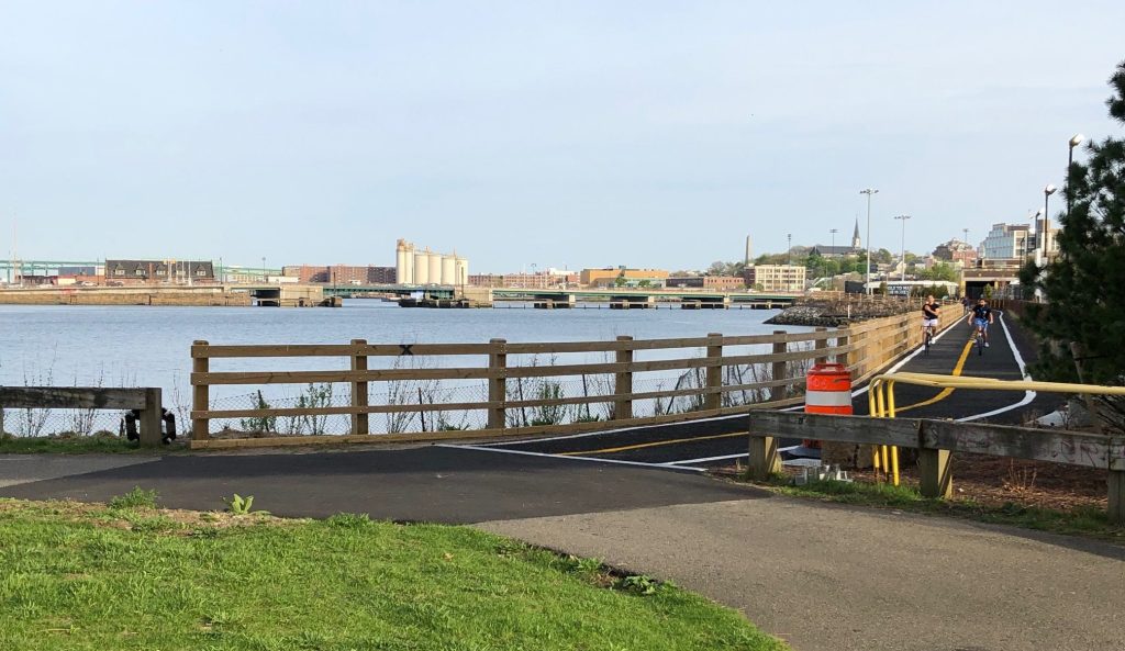
The new Charlestown Seawall Trail

After months of waiting, a new riverfront path has finally opened to connect the Assembly neighborhood in Somerville with Sullivan Square in Boston. The new path offers a scenic direct connection from the Sullivan Square area to the Assembly neighborhood in Somerville, and connects to an existing network of riverfront paths that extends into Medford.
While I was checking it out last Thursday evening, I ran into Kate Adams, a StreetsblogMASS reader who told me that “this project is doubly exciting for me as I have been commuting through this area for 16 years, and I work in climate change and public health.”
I met Adams near the Sullivan Square traffic circle, where we were both trying to figure out the best way to get to the new trail. Getting on the new path from the southern side, in Boston, is tricky for bicycle users, since the path starts on the north side of Alford Street, and there’s no crosswalk at the riverbank.
Ultimately, we opted to ride very slowly on the Alford Street sidewalk to get to the path from the traffic circle.
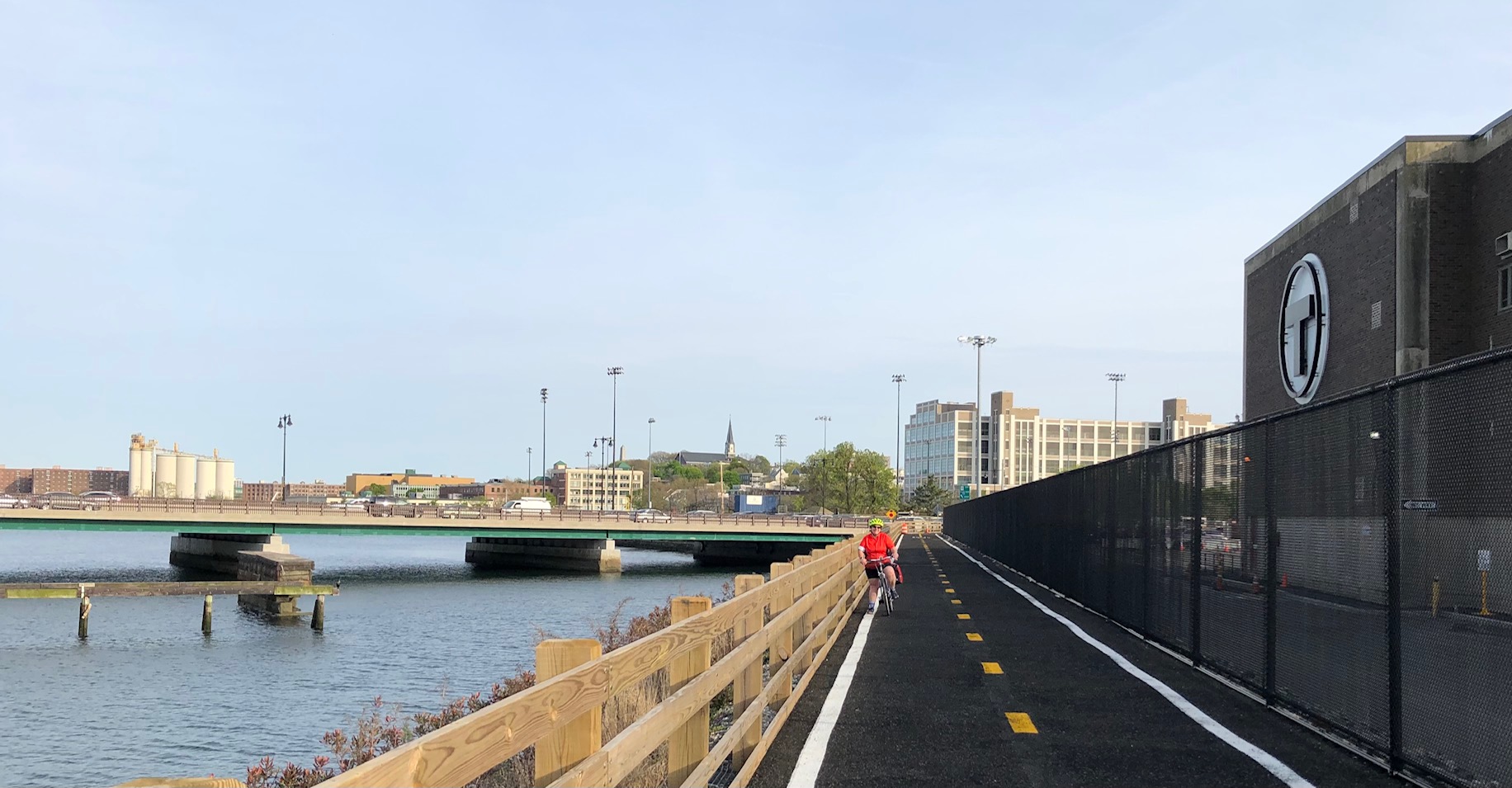
Accessing the path is considerably easier from the Somerville side: it connects directly into the existing riverbank paths in Draw 7 Park (pictured at the top of this article) next to the Assembly Orange Line station. The planned Mystic River bike and pedestrian bridge to Everett will someday land near this location, too.
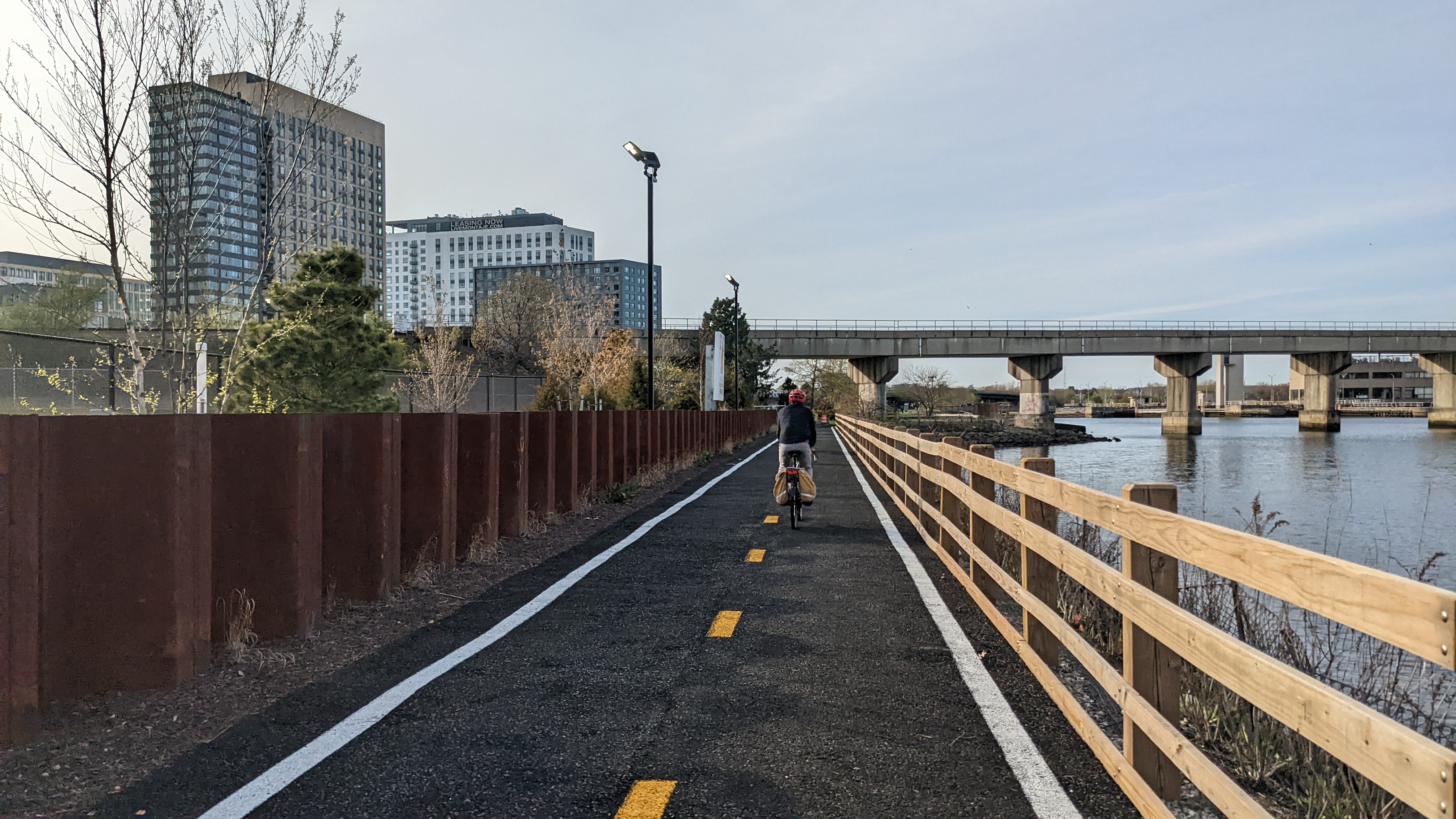
From Draw 7 Park, I continued my bike ride upriver to the Mystic Valley Parkway, where the riverfront path currently ends (plans are in the works to fill in a mile-long trail gap there to create a continuous path along the riverbank into downtown Medford and Arlington).
Then I cut west across the intimidating off-ramps to Mystic Avenue, through Powder House Circle, and on to the Alewife Red Line station via Somerville’s Community Path. From there, if you can grit your teeth for a noisy and noxious half-mile trip alongside the traffic of Alewife Brook Parkway, you’ll eventually reach:
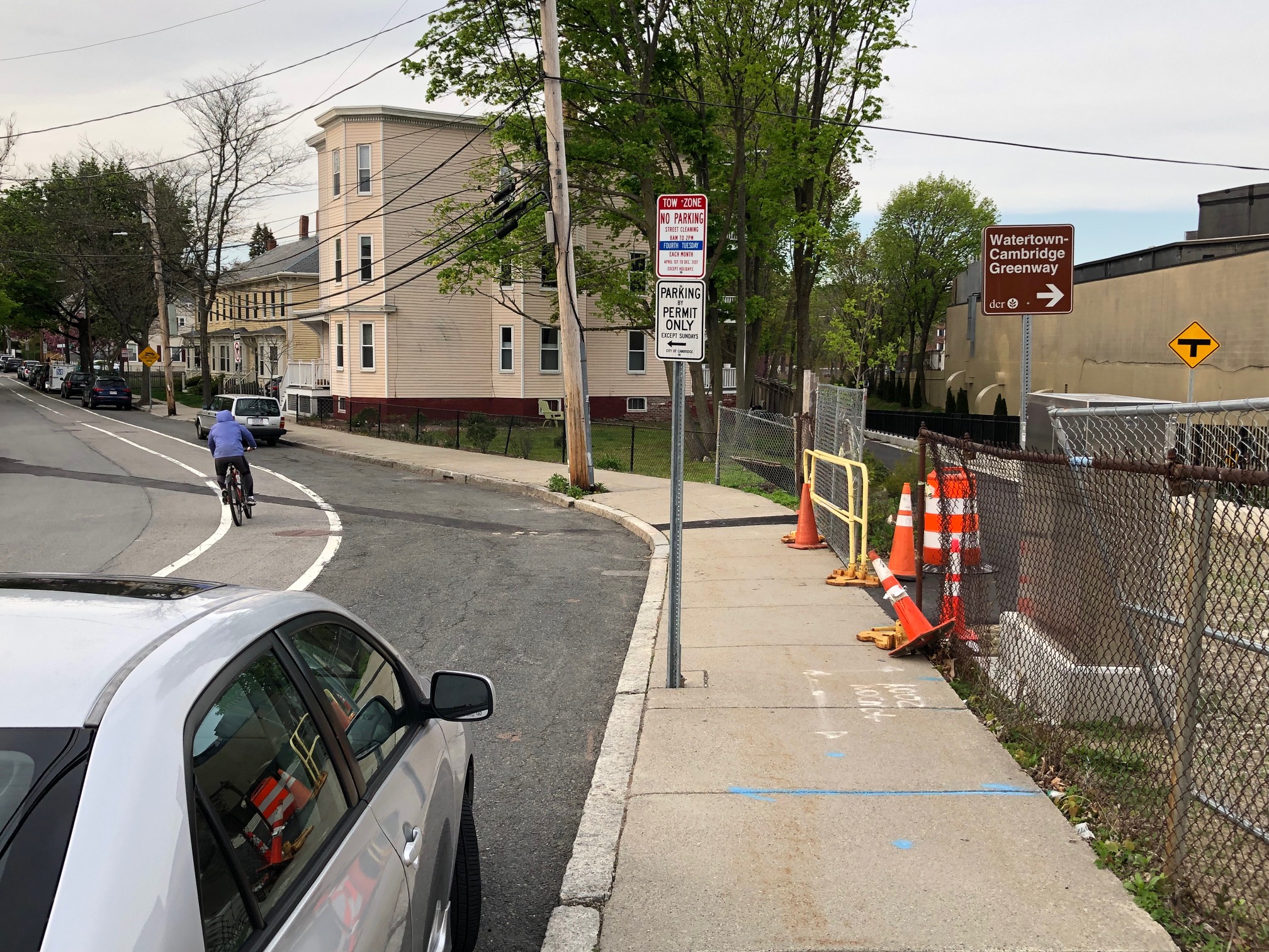
The new Watertown-Cambridge Greenway
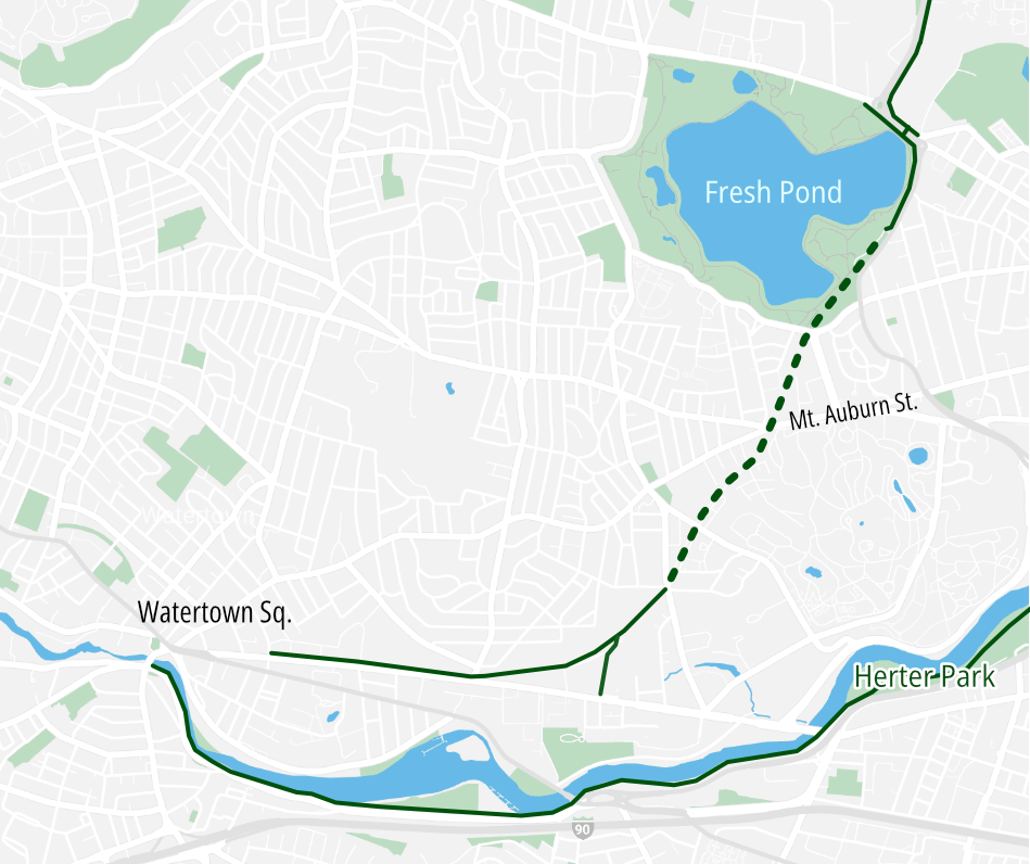
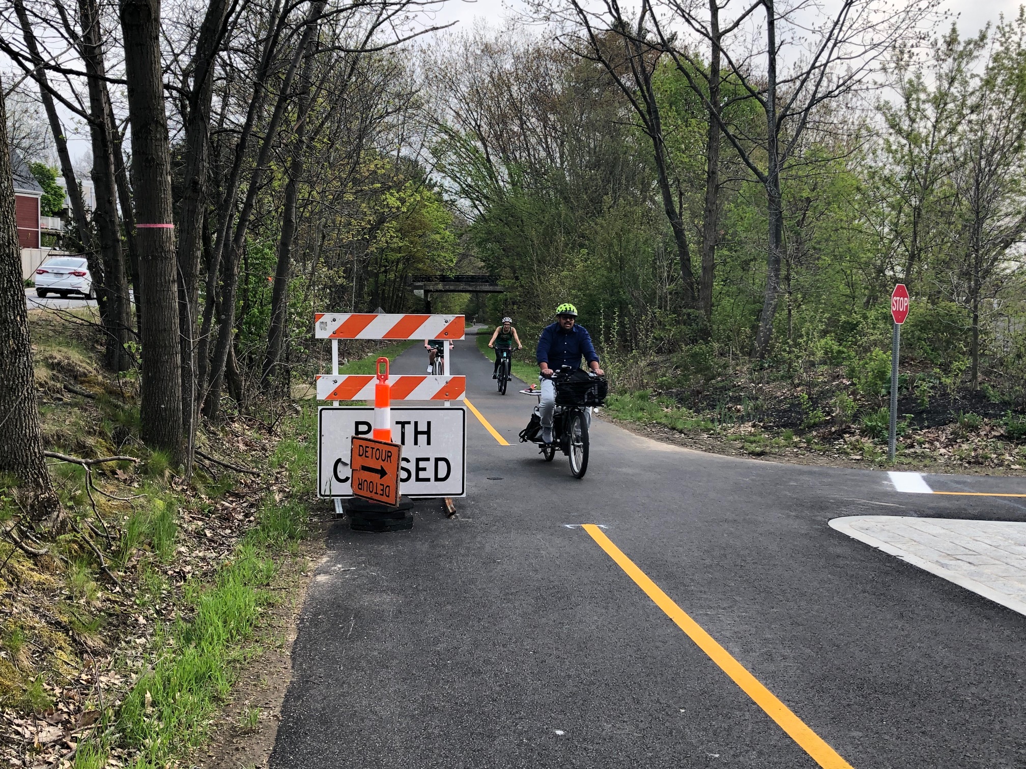
This is another trail project that saw delays during the pandemic, but has been more or less open for use for several months now. There are still some piles of construction cones and fencing materials at certain points along the trail, but the work looks more or less complete, and last Thursday, dozens of joggers, walkers, and bike-riders were out to enjoy it.
Besides offering a lovely ride through the woods near Fresh Pond, the new trail also connects to several practical destinations to enable errand-running by bike. Near Mount Auburn Street, the new path runs directly next to the Star Market, and near the trail’s southern end in Watertown, a trail spur connects to the Watertown Mall and the Arsenal Yards shopping centers.

Streetsblog has migrated to a new comment system. New commenters can register directly in the comments section of any article. Returning commenters: your previous comments and display name have been preserved, but you'll need to reclaim your account by clicking "Forgot your password?" on the sign-in form, entering your email, and following the verification link to set a new password — this is required because passwords could not be carried over during the migration. For questions, contact tips@streetsblog.org.