Skip to content

See MassDOT’s Early Designs for a New Car-Free Bridge Over the Pike in Allston
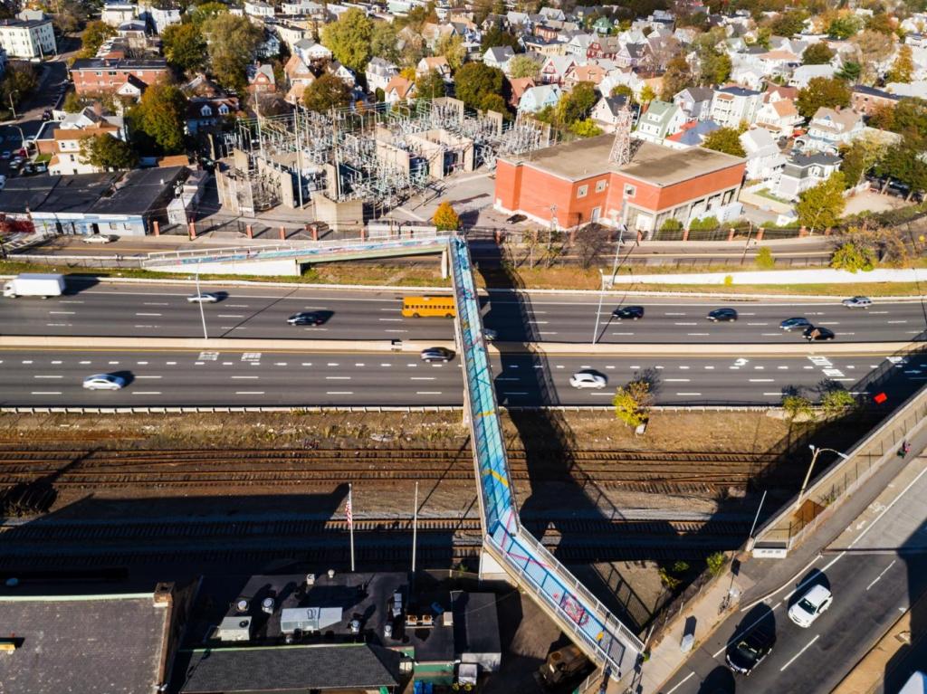
As part of MassDOT's Allston Multimodal Project, Allston's Franklin Street footbridge will be replaced with a new car-free overpass that meets ADA standards and offers a smoother connection into the surrounding neighborhoods.
An aerial photo of a brightly-colored footbridge across an eight-lane highway in Boston's Allston neighborhood.
The Franklin Street footbridge in Allston, pictured in 2017 when its deck was painted for the "Chroma Line" public art project. Photo courtesy of @abovesummit.

On Tuesday evening, MassDOT officials shared their conceptual designs for a new dedicated bike and pedestrian bridge over Interstate 90 near Franklin Street in Allston, a planned component of the planned Allston Multimodal Project.

An existing pedestrian overpass near Franklin Street already carries a substantial amount of bike and foot traffic over the Turnpike; according to the City of Boston’s bike traffic data, roughly one in three vehicles on Franklin Street north of the Turnpike is a bicycle on any given day.

But that bridge dates to a time before the Americans with Disabilities Act, and its steep ramps are generally inaccessible to wheelchair users (and make for leg-burning climbs for people on bikes). The southern end of the bridge also dumps bike riders onto a broken sidewalk on Cambridge Street, next to a crowded five-lane intersection that currently has no protected space for bike traffic.

As part of MassDOT’s Allston Multimodal Project, that old bridge will be replaced with a new car-free overpass that meets ADA standards and offers a smoother connection into the surrounding neighborhoods.

MassDOT presented its early plans for the new bridge during a virtual meeting of the Allston Multimodal Project’s task force on Tuesday evening. Etty Padmodipoetro, an architect working for MassDOT, presented four design options for the task force’s consideration.

The first option would mimic the route of the existing bridge, albeit with longer, gentler ramps:
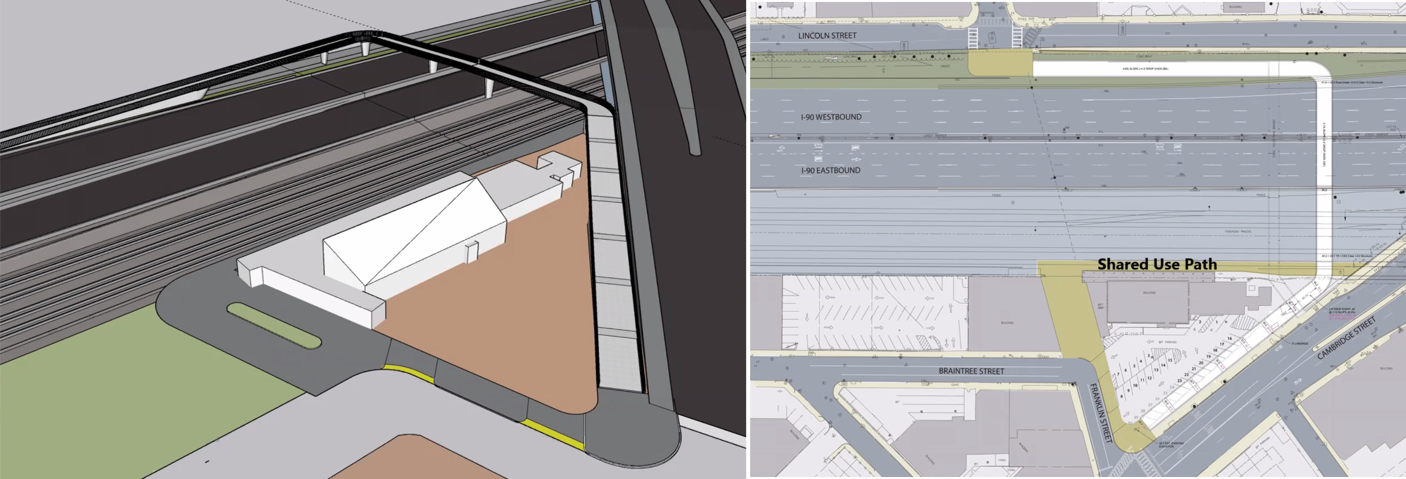
A rendering of a bridge next to a plan view. This "ramp" design, referred to as Option 1, would feature a long ramp parallel to Cambridge Street next to the old Regina Pizzaria building, then would turn north to cross above I-90, then turn at a right angle west to descend via another ramp to the intersection of Lincoln and Franklin Street.
Option 1 would mimic the location of the existing Franklin Street bridge, but with longer, ADA-accessible ramps on either end. Courtesy of MassDOT.

The other three options would hew closer to the route of the original Franklin Street, which was obliterated during the Turnpike’s construction. All these options include a hairpin ramp to connect Franklin Street to the new bridge on the north side of the Turnpike, where there is more limited space:
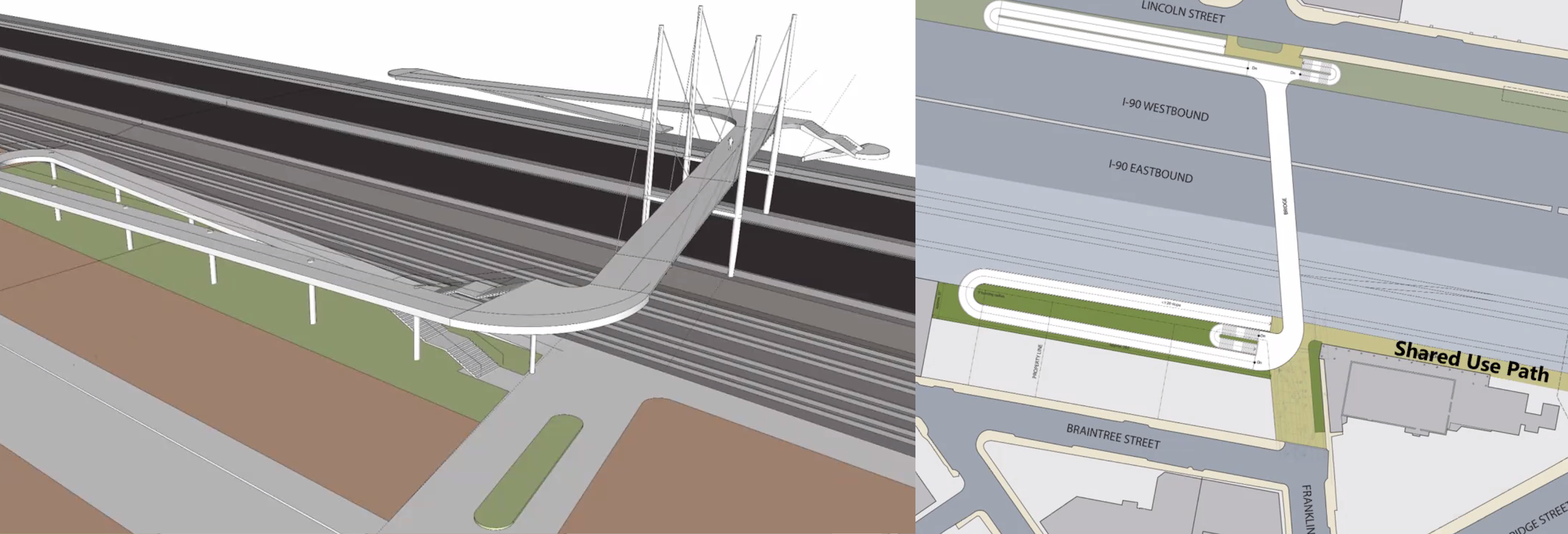
A rendering of a bridge next to a plan view. This "single loop" design, referred to as Option 2, would install two hairpin-turn ramps, paired with staircases, on either side of the Turnpike to carry bike and pedestrian traffic from the street level up to the elevated bridge, which would follow the historic path of Franklin Street. The rendering shows the bridge itself suspended from cables anchored to two pairs of high piers that rise above the bridge deck and are anchored on either side of Interstate 90’s eastbound lanes.
Option 2, the “single loop” design, would install two hairpin ramps on either side of the Turnpike to connect both ends of Franklin Street. Courtesy of MassDOT.
A rendering of a bridge next to a plan view. This "zigzag" design, referred to as Option 3, would install a hairpin-turn ramp and staircase on the north side of the Turnpike, between Lincoln Street and the westbound Turnpike lanes, and a more meandering ramp with three gentler hairpin turns paired with a staircase on the south side, to carry bike and pedestrian traffic from the street level up to the elevated bridge. The bridge itself which would follow the historic path of Franklin Street across the Turnpike. The rendering shows the bridge itself suspended from cables anchored to two pairs of high piers that rise above the bridge deck and are anchored on either side of Interstate 90’s eastbound lanes.
Option 3, the “zigzag” design, would connect bike and pedestrian traffic from the street level to the overpass via a more compact ramp with three hairpin turns on the south side of I-90. Courtesy of MassDOT.
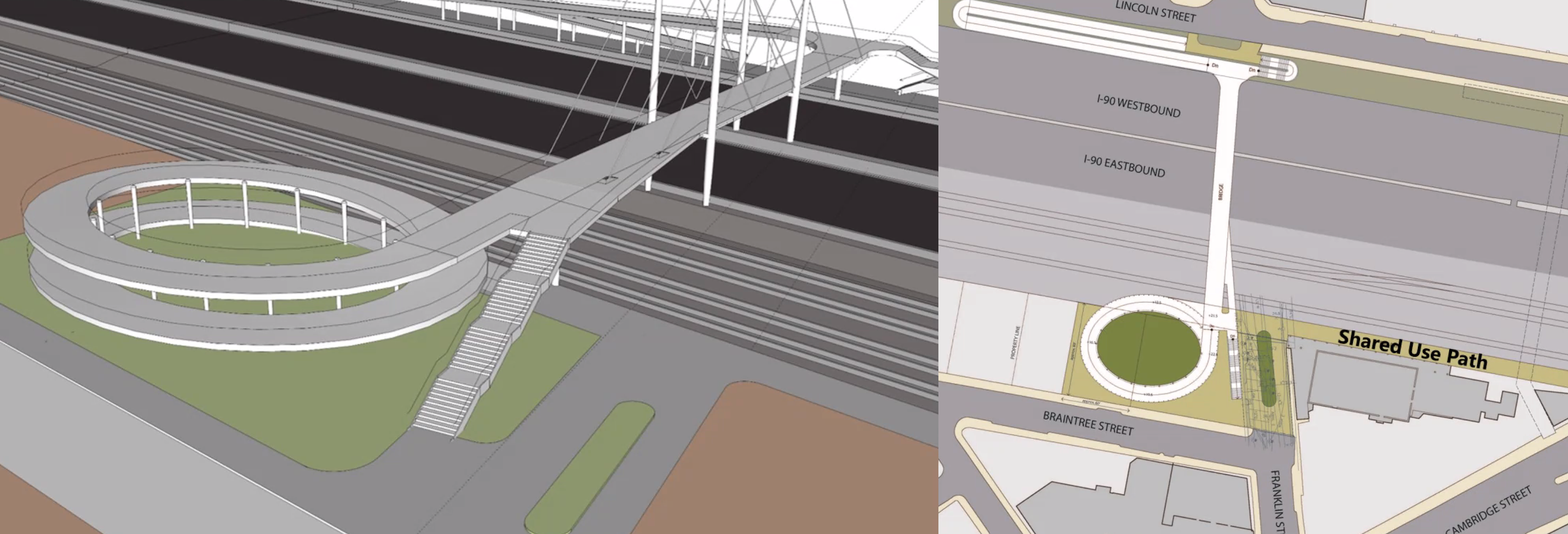
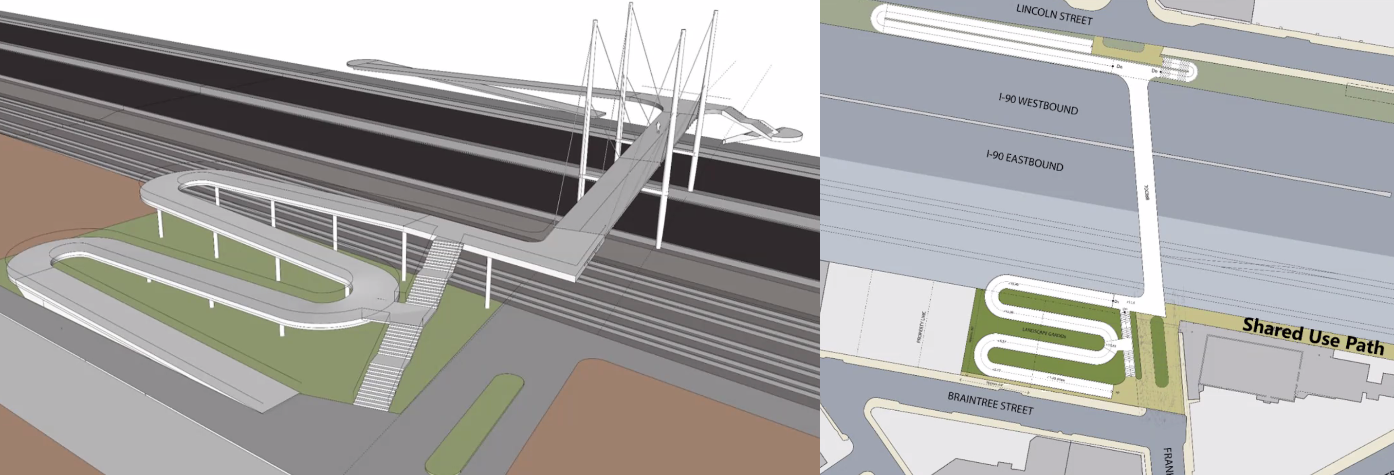
A rendering of a bridge next to a plan view. This "spiral" design, referred to as Option 4, would install a hairpin-turn ramp and staircase on the north side of the Turnpike, between Lincoln Street and the westbound Turnpike lanes, and a circular spiral ramp paired with a staircase on the south side, to carry bike and pedestrian traffic from the street level up to the elevated bridge. The bridge itself which would follow the historic path of Franklin Street across the Turnpike. The rendering shows the bridge itself suspended from cables anchored to two pairs of high piers that rise above the bridge deck and are anchored on either side of Interstate 90’s eastbound lanes.
Option 4, the “spiral” design, would elevate bike and pedestrian traffic from Franklin Street to the overpass via a wide circular ramp on the south side of I-90. Courtesy of MassDOT.

All three of these options would require the demolition of an existing two-story brick building at the corner of Braintree and Franklin Street, although the “single loop” design would leave room for potential new development along Braintree Street.

Padmodipoetro noted that the third and fourth options would create a more visible public plaza at the bridge’s southern entrance, with space for shade tree plantings between the ramps leading up to the new bridge.

“In the spiral (design), it’s actually quite wide, so you could plant the interior and make it nice and green,” said Padmodipoetro.

MassDOT project planners also revealed that the larger Allston Multimodal Project has been updated to accommodate a new shared-use pathway that would run eastward along the commuter rail tracks from the new bridge’s southern landing to the new West Station and Agganis Way, where another bike and pedestrian bridge is being planned to connect the Boston University campus to the Charles riverfront.

Photo of Christian MilNeil
Christian has edited StreetsblogMASS since its founding in spring 2019. Before that, he was a data reporter for the Portland Press Herald in Maine. Got tips? Send them to me via Signal, the encrypted messaging app, at 207-310-0728.

Read More:

Streetsblog has migrated to a new comment system. New commenters can register directly in the comments section of any article. Returning commenters: your previous comments and display name have been preserved, but you'll need to reclaim your account by clicking "Forgot your password?" on the sign-in form, entering your email, and following the verification link to set a new password — this is required because passwords could not be carried over during the migration. For questions, contact tips@streetsblog.org.

More from Streetsblog Massachusetts

McGrath Highway’s Makeover: Two New Bridges Coming to Somerville

July 28, 2026

Eyes On the Street: A Greener, Calmer Cummins Highway

July 27, 2026

Mayor Wu Outlines a New Street Safety Agenda in the Wake of Louisa Gag’s Killing

July 24, 2026

Boston City Councilors File Legislation to Improve Transportation Department Accountability

July 24, 2026

Friday’s Headlines’ Own Goal

July 24, 2026
See all posts