City of Springfield Wins $15 Million to Improve Street Safety Citywide
A new federal grant program that was created under the 2021 Bipartisan Infrastructure Law will award $15 million to the City of Springfield to improve safety on 10 high-traffic streets and at 15 intersections across the city.
The funding will come from the new federal Safe Streets and Roads for All discretionary grant program, which was established with $5 billion in funding over a 5-year period in the 2021 Bipartisan Infrastructure Law.
In a press statement celebrating the new program, the National Association of City Transportation Officials (NACTO) wrote that “Safe Streets and Roads for All unlocks federal dollars to fund some of the most effective safety interventions on streets – small-scale investments deployed at scale – that were previously inaccessible to communities without strong local funding sources.”
This year, for its first round of grants, the program is primarily funding “action plans” to help local and regional governments plan and prioritize safety improvements.
Those action plans are a prerequisite for local governments to be eligible for the program’s implementation grants, which would fund actual construction on street safety improvements.

Betsy Johnson, a safety advocate and volunteer with WalkBikeSpringfield, credits MassDOT for helping the city jump ahead of other applicants by fast-tracking an action plan before the grant application deadline.
“Springfield was going to put in for money to do the road safety plan, which is the first step,” Johnson told StreetsblogMASS in a phone conversation on Wednesday. “But MassDOT said ‘No, Springfield, you need this money now, you’ve got an over-the-top crash rate. We’ll hire the consultant who will in 30 days come up with a road safety plan for you, so you can go ahead and apply for the implementation money.'”
Johnson is hopeful that the federal funding can fast-track projects that the city has already identified as priorities in its complete streets plan.
According to a grant award announcement released today from the U.S. Department of Transportation, Springfield’s grant funding “will implement systemic safety countermeasures at approximately 15 intersections and 10 corridors in the City of Springfield that have a disproportionately high number of fatal and serious injury crashes. These systemic interventions include intersection and signal improvements, pedestrian and cyclist enhancements—such as crosswalk improvements, sidewalk upgrades, lighting, and ADA improvements—roadway conspicuity treatments, and intersection/corridor speed management treatments.“
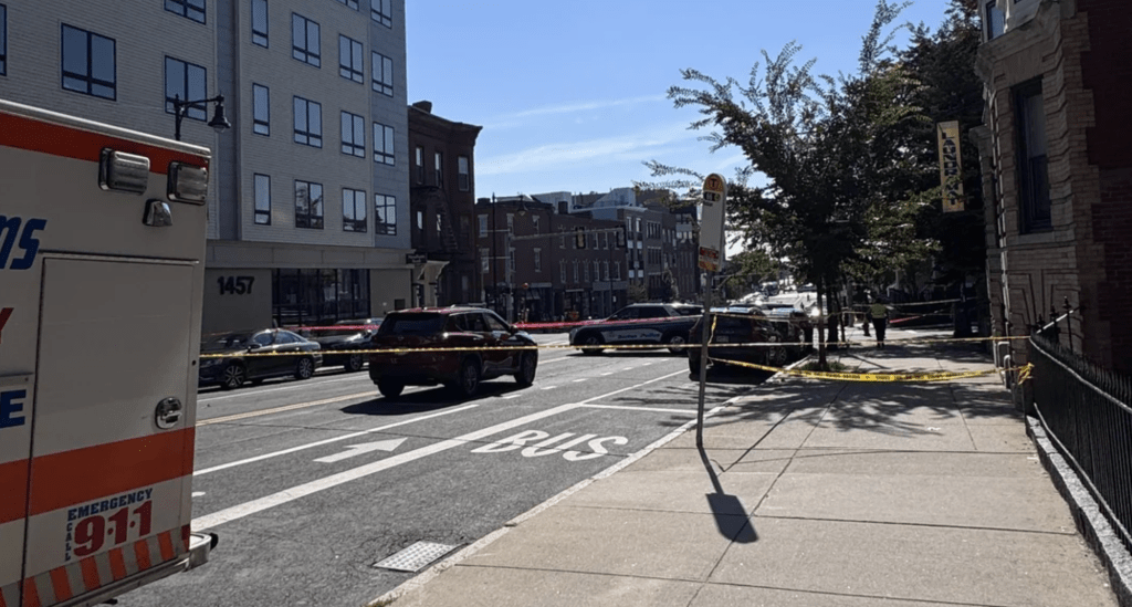
As we’ve reported here previously, Springfield is one of the Commonwealth’s most dangerous cities for traffic violence, according to statewide crash statistics.
The City of Boston also won a $9 million Safe Streets and Roads for All grant to “improve safety at approximately nine intersections in five distinct neighborhoods, the majority of which are underserved communities where residents face high safety risks on local streets.”
A map accompanying the project description highlights the intersections of Stuart and Tremont Streets and Kneeland and Washington Streets in downtown Boston (two adjacent intersections in the theater district), Dorchester Ave. and Boston Street in Andrew Square, two intersections on Blue Hill Avenue, at American Legion Highway and at Columbia Road, and Bennington and Saratoga Streets in East Boston, among others.
15 local and regional governments in Massachusetts – including the cities of Worcester, Somerville, and Salem, and regional planning commissions for the Boston region, the Merrimack Valley, Berkshire County, and Cape Cod – also won funding to prepare their own action plans to be eligible for construction funds from the program in future years.
MassDOT has a similar state-level program to plan and implement street safety projects – the Complete Streets funding program. MassDOT will spread about $12 million for 31 small-scale safety and accessibility projects across the entire Commonwealth this year.

Read More:
Streetsblog has migrated to a new comment system. New commenters can register directly in the comments section of any article. Returning commenters: your previous comments and display name have been preserved, but you'll need to reclaim your account by clicking "Forgot your password?" on the sign-in form, entering your email, and following the verification link to set a new password — this is required because passwords could not be carried over during the migration. For questions, contact tips@streetsblog.org.