MassDOT Releases ‘Priority Trails Network’ Map
From a MassDOT press release
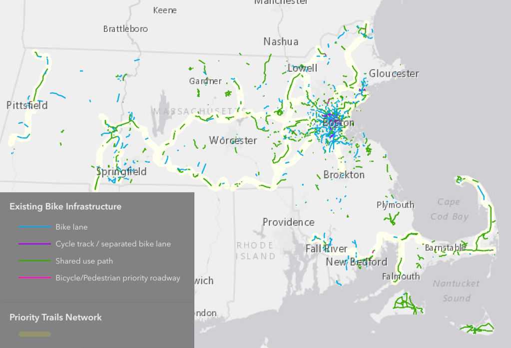
The Massachusetts Trails Team (MassTrails), an interagency collaboration between the state’s Department of Conservation and Recreation (DCR), MassDOT, and municipalities, has published a new interactive Priority Trails Network vision map for current and future shared-use path projects throughout the Commonwealth.
The map offers a centralized inventory of key rail trail projects that will help support an envisioned comprehensive statewide transportation trail network.
That inventory includes approximately 320 miles of trails that have been constructed and are in use, 24 trails currently under construction, and another 60 miles of proposed paths that have been funded but not yet constructed.
Additionally, the map lists priority shared-use path project locations that either have been proposed for consideration or will be pursued for funding and development to help address key gaps in the network.
“MassDOT is pleased to make available this new interactive priority map to highlight shared-use paths that are open to the public, currently under construction, or are newly identified areas for consideration in communities throughout the Commonwealth,” said Transportation Secretary and CEO Gina Fiandaca. “These paths are an important part of the travel network in the state and provide residents with safe, accessible and convenient routes whether people are traveling for fun or for work.”
The interactive map can be found at https://www.mass.gov/guides/masstrails-priority-trails-network-vision, and allows users to click on any segment to view trail name, municipality and MassDOT Project Information page, if applicable. The map includes paved, ADA-accessible shared-use paths, most of which are off-road rail trails or greenways.
Where off-road facilities do not exist, high-comfort on-road infrastructure is proposed such as separated bike lanes with sidewalks or side paths.
Since 2019, numerous MassTrails grants have focused on extending and connecting existing trails to one another, with the ultimate goal of having all trails statewide connect to this envisioned network.
Streetsblog has migrated to a new comment system. New commenters can register directly in the comments section of any article. Returning commenters: your previous comments and display name have been preserved, but you'll need to reclaim your account by clicking "Forgot your password?" on the sign-in form, entering your email, and following the verification link to set a new password — this is required because passwords could not be carried over during the migration. For questions, contact tips@streetsblog.org.