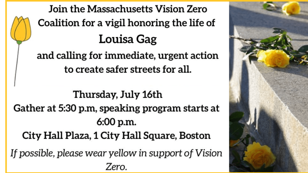
Boston’s Next Bus Rapid Transit Line Would Link Downtown, Sullivan Square Before the End of This Decade
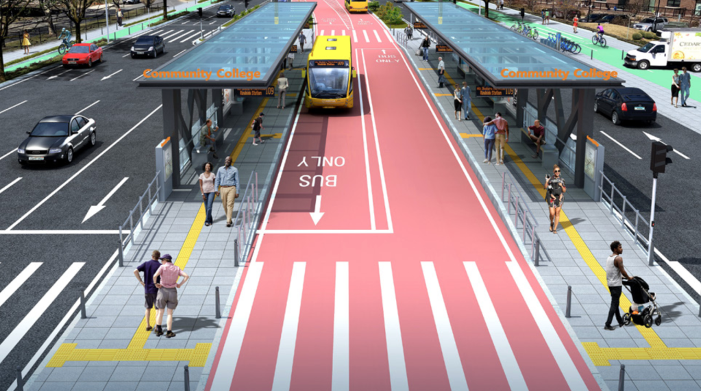
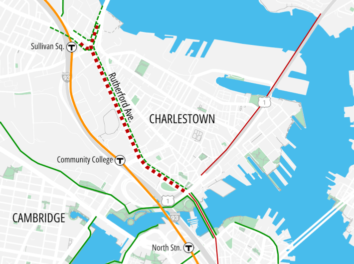
An updated new design for Rutherford Avenue would set aside space for a dedicated center-running busway through Boston’s Charlestown neighborhood and eliminate highway-style underpasses through Sullivan Square.
Last month, Boston Chief of Streets Jascha Franklin-Hodge presented the City of Boston’s new concept to a meeting of the Boston Region Metropolitan Planning Organization (watch the video recording here).
The city’s latest plans would also eliminate the highway underpasses that run under Sullivan Square and Austin Street.
In place of the daunting highway rotary that occupies Sullivan Square today, the city aims to build a grid of new surface streets, many of which will include dedicated bus lanes and separated bike paths.
The blocks between those new streets could potentially host new transit-oriented development for a neighborhood that’s currently blighted with huge parking lots.
The city’s proposed project would also create new protected bikeways through Sullivan Square and along the Rutherford Avenue corridor to connect existing off-street path networks along the Mystic River to the new North Washington Street bridge and the Paul Dudley White bike paths along the Charles River.
New transitway anticipates demand from new development
Developers are already making big plans for the empty and underutilized lots that lie between Rutherford Avenue and Interstate 93. Planners recently approved a 503-unit apartment building on Mystic Avenue just north of Sullivan Square, and the City of Boston is working with another developer to build 686 new homes, many of them reserved for lower-income households, in the Community College parking lots south of Austin Street.
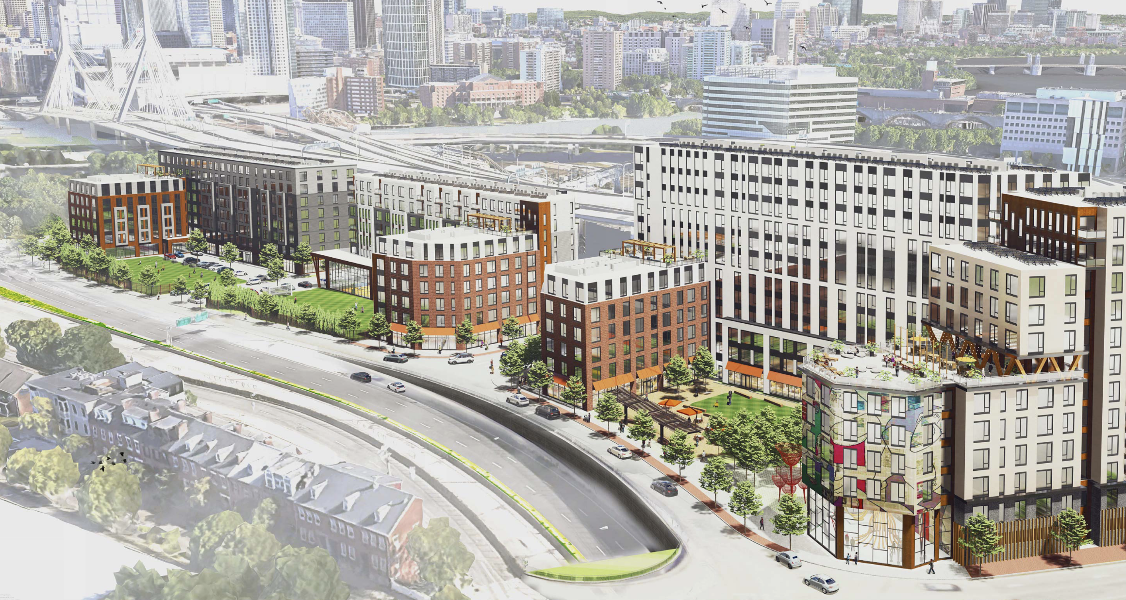
Other developers are planning additional high-rise lab buildings for the blocks south of Sullivan Square.
“We have quite a bit of development on tap for the corridor, particularly on the western side of Rutherford Avenue. Through the city’s Plan: Charlestown we anticipate many thousands of units of housing, and millions of square feet of development happening here. We know there’s going to be strong demand for connectivity,” said Franklin-Hodge.
To improve the street’s capacity to move more people, the city plans to replace some of the existing highway’s lanes with two dedicated bus lanes and new bus stations in the middle of Rutherford Avenue – similar to the new Columbus Avenue busway in Roxbury.
While no MBTA bus routes currently use Rutherford Avenue end-to-end, the busway would benefit several existing and planned routes, including the 111 and the 109.
In the longer term, as new buildings bring more riders into the neighborhood and nearby areas, like lower Broadway in Everett, the City of Boston hopes to create a new bus rapid transit route that Sullivan Square and downtown Boston.
The MBTA’s ongoing Silver Line Extension study identified Rutherford Avenue as a likely link for potential new bus rapid transit lines between Everett and Kendall Square or downtown Boston.
“It is difficult for the MBTA to make service commitments or do planning more than a few years out for what kinds of new services might exist. When we think about a design for this project, we’re thinking 50 years into the future,” said Franklin-Hodge. “What kind of transportation needs will exist then?”
Construction could begin in 2027
Franklin-Hodge told the Boston MPO meeting that the city hopes to have a final concept design ready by February. The city would then develop more refined plans in hopes of starting construction in early 2027.
But that schedule presumes that there won’t be any further meddling with the project’s design – which, given its history, isn’t a sure bet.
Plans to rebuild Rutherford Avenue and turn it into a more pedestrian-friendly boulevard have been in the works for over a decade. When the project was first proposed in 2011 , a number of Charlestown residents actually wanted the state to maintain Rutherford in more or less its current form, with ten lanes of traffic.
During Mayor Walsh’s administration, another proposed design would have added a protected bike path and some new bus lanes, but it would not have included a dedicated bus transitway.
Walsh’s administration also wanted to retain highway underpasses at Austin Street and through Sullivan Square, albeit with fewer lanes, to allow through-running vehicles to drive through the corridor at high speeds without stopping.
When we last reported on the project in 2021, planners estimated that that version of the project would break ground by 2023.

Read More:
Streetsblog has migrated to a new comment system. New commenters can register directly in the comments section of any article. Returning commenters: your previous comments and display name have been preserved, but you'll need to reclaim your account by clicking "Forgot your password?" on the sign-in form, entering your email, and following the verification link to set a new password — this is required because passwords could not be carried over during the migration. For questions, contact tips@streetsblog.org.