Eyes On the Street: Sneckdown City
Last week’s storm implemented thousands of “sneckdowns” (“snow neckdowns”) on virtually every street in the Commonwealth. The piles of snow have been a hassle for pedestrians, but they’ve also been slowing down traffic and forcing drivers to be more careful on newly-narrowed roadways.
Earlier this week, we asked our readers to send in photos of “sneckdowns” in their neighborhoods.
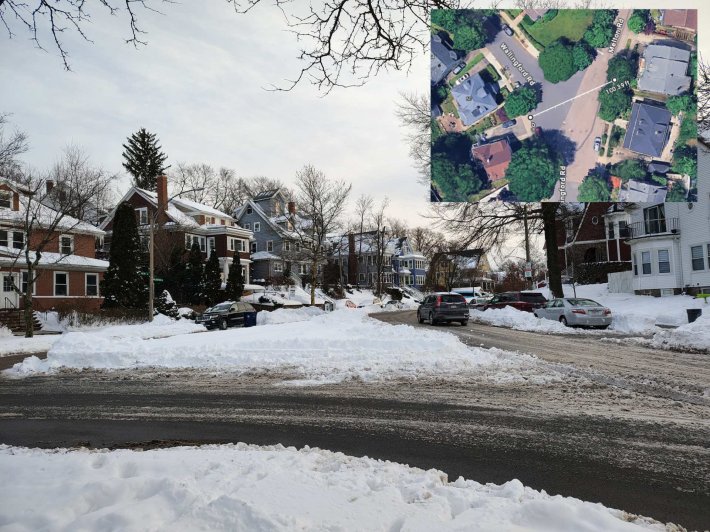
One reader sent in this photo from the corner of Melton Road and Wallingford Road in Brighton. A massive wedge of untouched snow in the middle of this Y-shaped intersection suggests that the City of Boston could swap out a field of asphalt for a nice new neighborhood park:
We also got lots of photos from the unusually wide streets around the West End in downtown Boston.
This is an area where mid-century urban renewal projects destroyed a thriving neighborhood – but at least it gave the city a lot of empty space where it can pile up snow.
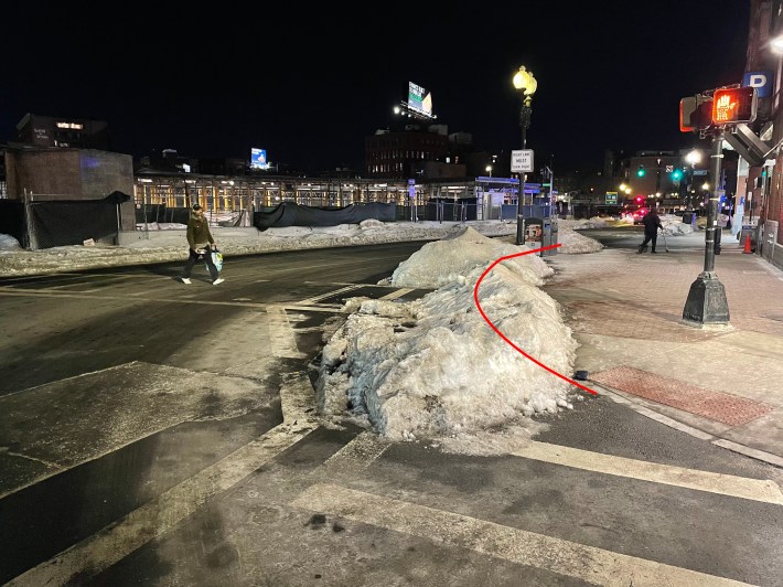
Here’s the corner of Congress and new Sudbury Street outside the Boston Public Market, with a red line to show the approximate location of the buried curb:
And here’s the off-ramp from Storrow Drive to Martha Road near the Science Park Green Line station, pictured on the evening of Feb. 3, eight days after the snowstorm:
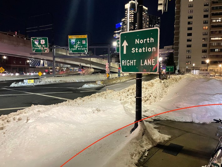
Snow piles are apparently not liable for “block the box” violations.
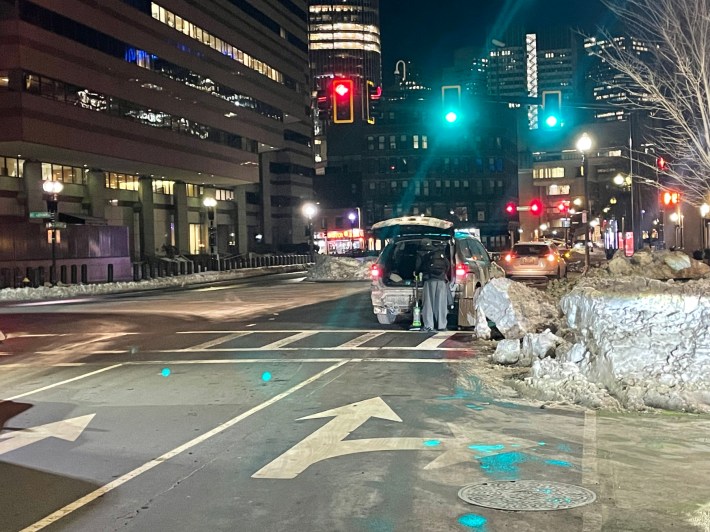
A few blocks away, outside the western entrance to North Station, another week-old sneckdown suggests that Lomasney Way might not really need to be six lanes wide:
Reader Sam Ellington sent us these photos of a massive sneckdown where the Paul Dudley White Path crosses the end of the Arsenal Street Bridge at Soldier’s Field Road:
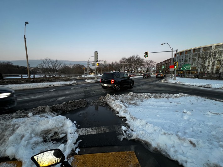
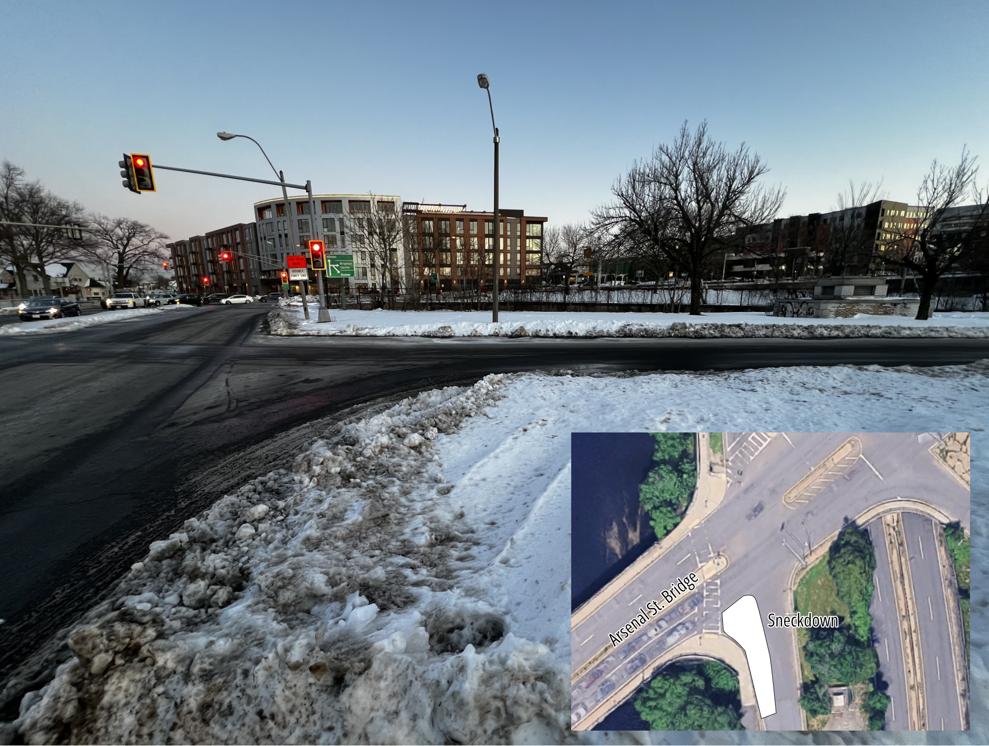
This one is noteworthy because the unnecessarily wide highway ramps squeeze the riverfront bike and jogging path into a narrow, crowded pinch point here. DCR’s plow drivers seem to understand that the agency could create a lot more green space for bikes and pedestrians at this intersection.
We found a similar situation on the other side of Allston, at the intersection of Western Ave. and Soldier’s Field Road on the Harvard campus:
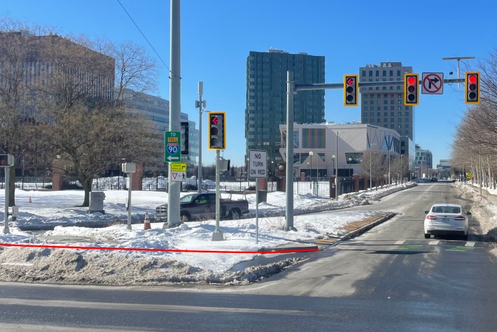
An aerial view of this intersection confirms that there’s a lot of wasted space eating into Harvard University’s real estate schemes for the neighborhood. On the north side of the intersection, the eastbound Soldier’s Field Road surface road is only 2 lanes and about 25 feet wide.
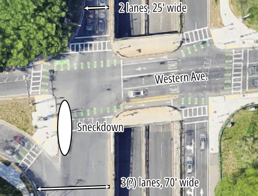
But south of the traffic light, the same roadway bloats to a width of over 70 feet with three poorly-marked lanes.

Read More:
Streetsblog has migrated to a new comment system. New commenters can register directly in the comments section of any article. Returning commenters: your previous comments and display name have been preserved, but you'll need to reclaim your account by clicking "Forgot your password?" on the sign-in form, entering your email, and following the verification link to set a new password — this is required because passwords could not be carried over during the migration. For questions, contact tips@streetsblog.org.