Driver Kills 15-Year-Old Boy In Franklin
A driver struck and killed a 15-year-old boy who had been riding his bike on King Street in Franklin on Tuesday afternoon, according to the Franklin Police Department.
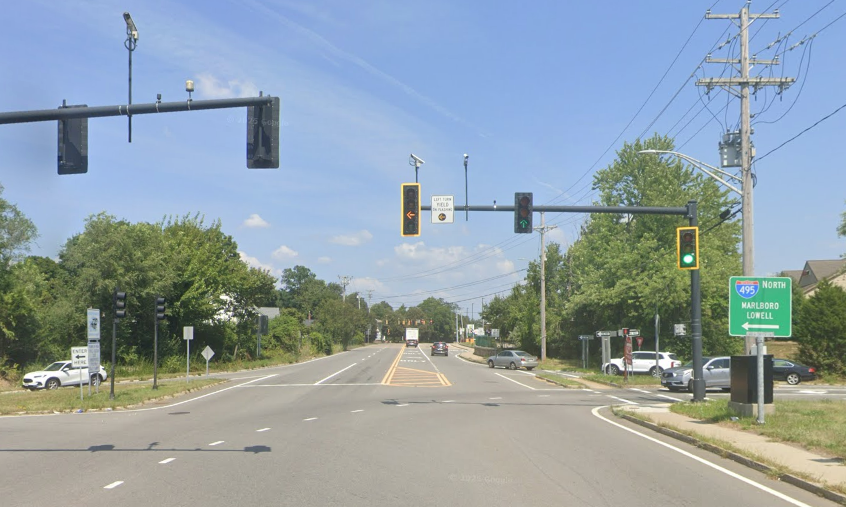
The homicide occurred on King Street near its intersection with the Interstate 495 northbound off-ramp, about a mile south of Franklin’s town center, according to an update that the Franklin Police Department posted to their Facebook page on Tuesday evening.
First responders from the Franklin police and fire departments reportedly attempted life-saving measures before transporting the victim to UMass Memorial Medical Center, where he was subsequently pronounced dead.
The victim has been identified only as a 15-year-old Franklin resident.
Franklin police reported that the suspect in the homicide remained at the scene of the killing and was cooperative with investigators, but did not identify the suspect.
The Franklin Police Department added that the homicide remains under investigation by local and state police.
StreetsblogMASS has reached out to the Norfolk District Attorney’s Office to inquire if the suspect is in custody, or is being arraigned on any criminal charges. This story will be updated when they respond.
King Street in Franklin runs generally north-to-south through the southeast side of Franklin. For most of its length, it is a two-lane roadway through residential neighborhoods, with sidewalks and a striped shoulder that can be used as a bike lane.
But as King Street approaches the highway interchange with Interstate 495, it becomes a much wider, more dangerous street with four to five lanes of traffic.
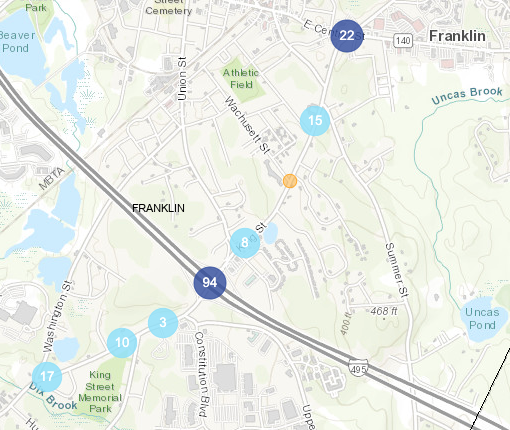
MassDOT’s official crash database records a total of 171 crashes, including 42 injury-causing crashes, along the entire 2.2-mile length of King Street since the beginning of 2021.
However, more than half of those crashes occurred in the short one-third of a mile distance around the Interstate 495 on- and off-ramps, where King Street bloats to a five- and six-lane cross-section.

Read More:
Streetsblog has migrated to a new comment system. New commenters can register directly in the comments section of any article. Returning commenters: your previous comments and display name have been preserved, but you'll need to reclaim your account by clicking "Forgot your password?" on the sign-in form, entering your email, and following the verification link to set a new password — this is required because passwords could not be carried over during the migration. For questions, contact tips@streetsblog.org.