Can Waltham and Weston Transform Aging Office Parks Into A Transit-Oriented Neighborhood?
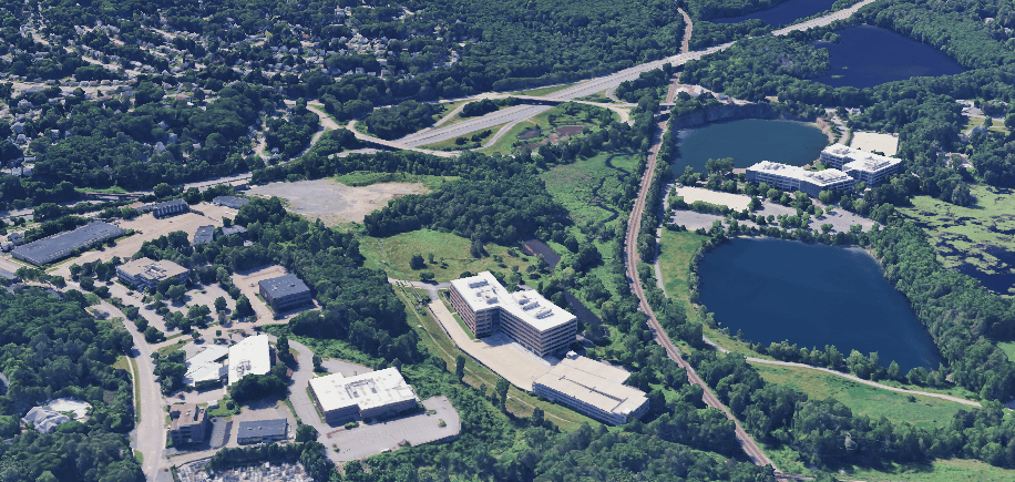
In the 1950s, Massachusetts built Route 128, one of its first limited-access highways, and set off a frenzy of suburban development enabled by taxpayer-subsidized expressways.
Today, many of the 20th-century office parks that line the highway are struggling, with dated architecture and a workforce that would prefer to work from home than waste time in suburban traffic.
Now, a major landlord of those cubicle farms – BXP, formerly known as Boston Properties – is making plans to transform some office parks into new residential districts linked to the MBTA and the Mass. Central Rail Trail.
“We’re concerned that long-term, if nothing happens on this (office) park, that it just kind of continues to fade away from a value and occupancy standpoint,” Keir Evans, a BXP executive, told the Waltham City Council at a rezoning hearing on June 8th, 2026.
“So we look at the residential and the other lifestyle and retail uses that we want to introduce up here as kind of like an adrenaline injection to revitalize the park,” Evans continued.
To make it work, the company will need to overcome the challenges posed by the area’s massive, life-threatening highways and dearth of public transit options.
To that end, the developers and local governments are collaborating on plans for new streets, new transit facilities, and new paths that could connect the Mass. Central Rail Trail.
New housing, enabled by MBTA zoning
BXP is planning to redevelop two large properties it owns that straddle the Waltham-Weston border and the MBTA’s Fitchburg Line railroad tracks (the company’s press office did not respond to our inquiries for this story, but their employees have testified at length about their plans in public meetings).
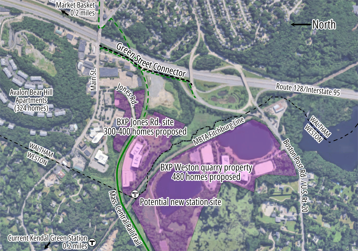
On the Weston side, BXP has received local approvals for a three-phase project to build 480 new homes on an abandoned quarry that’s currently home to the Weston Corporate Center, a 350,000 square-foot office building built in 2010.
Weston’s Town Meeting rezoned that site in fall 2025 in order to comply with the state’s MBTA Communities Act. The state law requires Weston, one of the state’s wealthiest communities, to create new multifamily zoning districts where 750 new homes could theoretically be built. The Weston Corporate Center site, the largest of four MBTA zoning districts in Weston, would satisfy nearly two-thirds of the town’s legal obligation.
Immediately to the north, on the other side of the Fitchburg Line tracks in Waltham, BXP won city zoning approvals this summer to build an additional 300 to 400 homes on a smaller site at the end of Jones Road, along the Mass. Central Rail Trail (MCRT).
A new regional rail station
To serve all those new households, BXP is partnering with the MBTA to plan a possible new Fitchburg Line station on the Waltham-Weston city line, adjacent to the rail trail.
The conceptual plan is documented in an April 2026 a memorandum of understanding between BXP and the MBTA.
The memo calls for a station with accessible boarding platforms on both sides of the tracks, a new bus station on the Waltham side at the end of Jones Road, and a new pedestrian bridge over the Fitchburg Line to connect the two platforms.
The new station would replace the existing Kendal Green stop, located about half a mile away in a neighborhood of single-family homes in Weston.
Kendal Green consists of a single asphalt platform and a small parking lot. It is not ADA-accessible, and it is not busy: it saw an average of 130 daily boardings in 2024.
The memorandum between BXP and the T declares that a new station, adjacent to both of BXP’s planned housing developments, would have “the potential for significant ridership growth in both directions.”
However, the memo also makes it clear that the project would primarily be BXP’s responsibility.
“The MBTA is making no financial commitment to the new intermodal station, and BXP has committed to providing various forms of assistance and resources for the design, permitting, financing and construction,” the memo declares.
Once an early-stage design is complete, the T will host public hearings for the project.
New streets and links to the Mass. Central Rail Trail
The Mass. Central Rail Trail (MCRT) is another important transportation amenity for the neighborhood. The trail today ends at Jones Road, next to a BXP-owned office park, with a half-mile gap to the Waltham segment of the MCRT, which begins just north of Main Street on the other side of 128.
The Department of Conservation and Recreation (DCR), which manages the MCRT, is working on design plans to fill that gap with a new trail segment.
However, according to the agency’s website, “the timeline is undetermined due to the status of the major planned roadway infrastructure at Green Street, Stow Street, and Route 117” (Waltham’s Main Street).
In the meantime, many pedestrians and bicyclists are using the unimproved, publicly-owned right-of-way to get across Route 128 via the abandoned railroad bridge.
That unofficial route will soon become impassible, because the City of Waltham is about to begin construction on a new street that will run parallel to Route 128 and connect Main Street with the large Route 20 rotary interchange.
The blueprints for the new Green Street, produced by VHB, a private consulting firm, generally call for three lanes for motor vehicles (one northbound and two southbound) alongside a new 10-foot-wide shared use path along the western curb, between Main Street and the Route 20 rotary interchange.
That new path would connect Waltham’s Main Street to the north to a new crosswalk at the end of the Route 128 southbound off-ramp towards Route 20 in Weston.
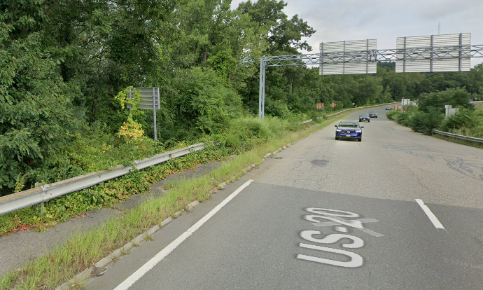
From there, brave pedestrians could continue on some very broken and overgrown sidewalks next to the highway ramps to access Route 20/Boston Post Road in Weston to the south or, to the east, the Weston Street neighborhood and Brandeis University campus in Waltham.
The project will also install new traffic signals at the southern end of the new connector, where the new Green Street would intersect with the rotary (see plans below).
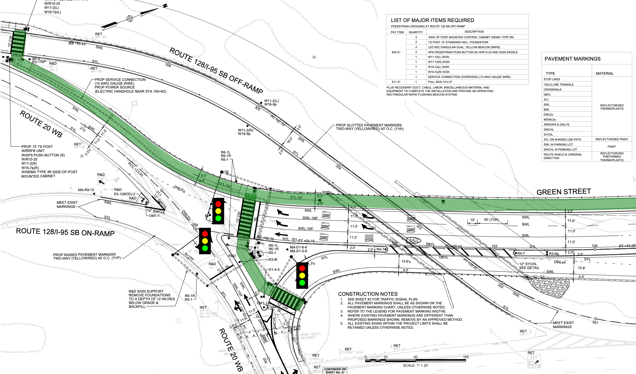
Notably, VHB’s plans do not include a crosswalk where the MCRT right-of-way intersects with the new street. That could complicate future plans to continue the trail onto the existing railroad bridge over Route 128.
At a June 18 Traffic Commission hearing for the project, Waltham City Clerk Joe Vizard urged project designers to be “more aware of pedestrian access in this area.”
“We’re building a new neighborhood for the first time in I don’t know how many years. I mean, the size of the neighborhood we’re building, we’re completely changing the feel of that area,” warned Vizard.
Rob Nagi, a project engineer who was presenting the plans to the Traffic Commission on behalf of VHB, responded that “I’d like to think we addressed it. I just don’t know. There’s 400 pages of design drawings and I’m not the designer of record.”

Streetsblog has migrated to a new comment system. New commenters can register directly in the comments section of any article. Returning commenters: your previous comments and display name have been preserved, but you'll need to reclaim your account by clicking "Forgot your password?" on the sign-in form, entering your email, and following the verification link to set a new password — this is required because passwords could not be carried over during the migration. For questions, contact tips@streetsblog.org.