City of Boston staff are proposing to expand pedestrian space into on-street parking areas, build pop-up bike lanes, expand waiting areas at busy bus stops, and close some residential streets to through traffic in a wide-ranging strategy to support car-free mobility in a new era of physical distancing.
City officials discussed these strategies and several others during a Boston city council hearing held Tuesday evening to discuss “changes for safe streets during the COVID-19 pandemic and for continued safe mobility throughout a transition to fuller economic activity.”
Jacob Wessel, Public Realm Director for the City of Boston, presented some of the new street design concepts that the city is considering, along with some prospective locations:
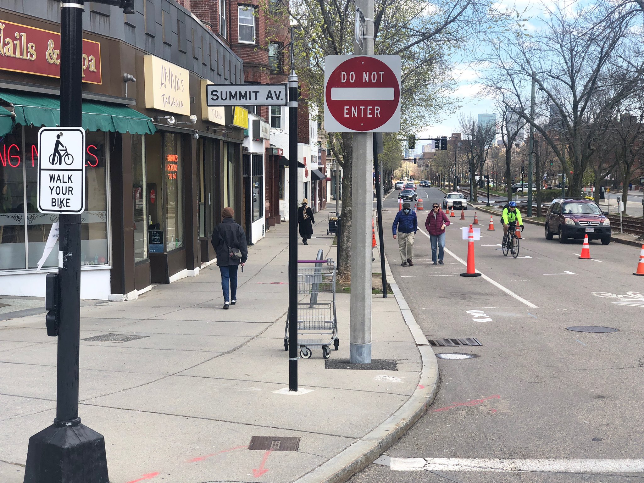
- Following the Town of Brookline's lead, Boston will allow small business districts to convert little-used on-street parking areas into additional pedestrian space to facilitate safe passage between sidewalk users.Wessel said that this approach would be ideal for "streets with parking on either side with very narrow sidewalks." Main Street districts like Centre Street in Jamaica Plain, Washington St. in Codman Square, and Meridian Street were mentioned as candidate locations for this treatment.
- City staff are also examining potential locations to open lightly-used residential streets to more walkers and bike riders by limiting through traffic.Wessel stressed that "this is not a big open street event where you would have police staffing, but something that (would use) simple barriers and signage and traffic control devices placed at either end of a street."
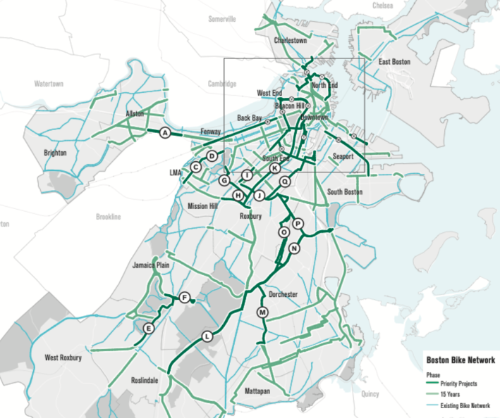
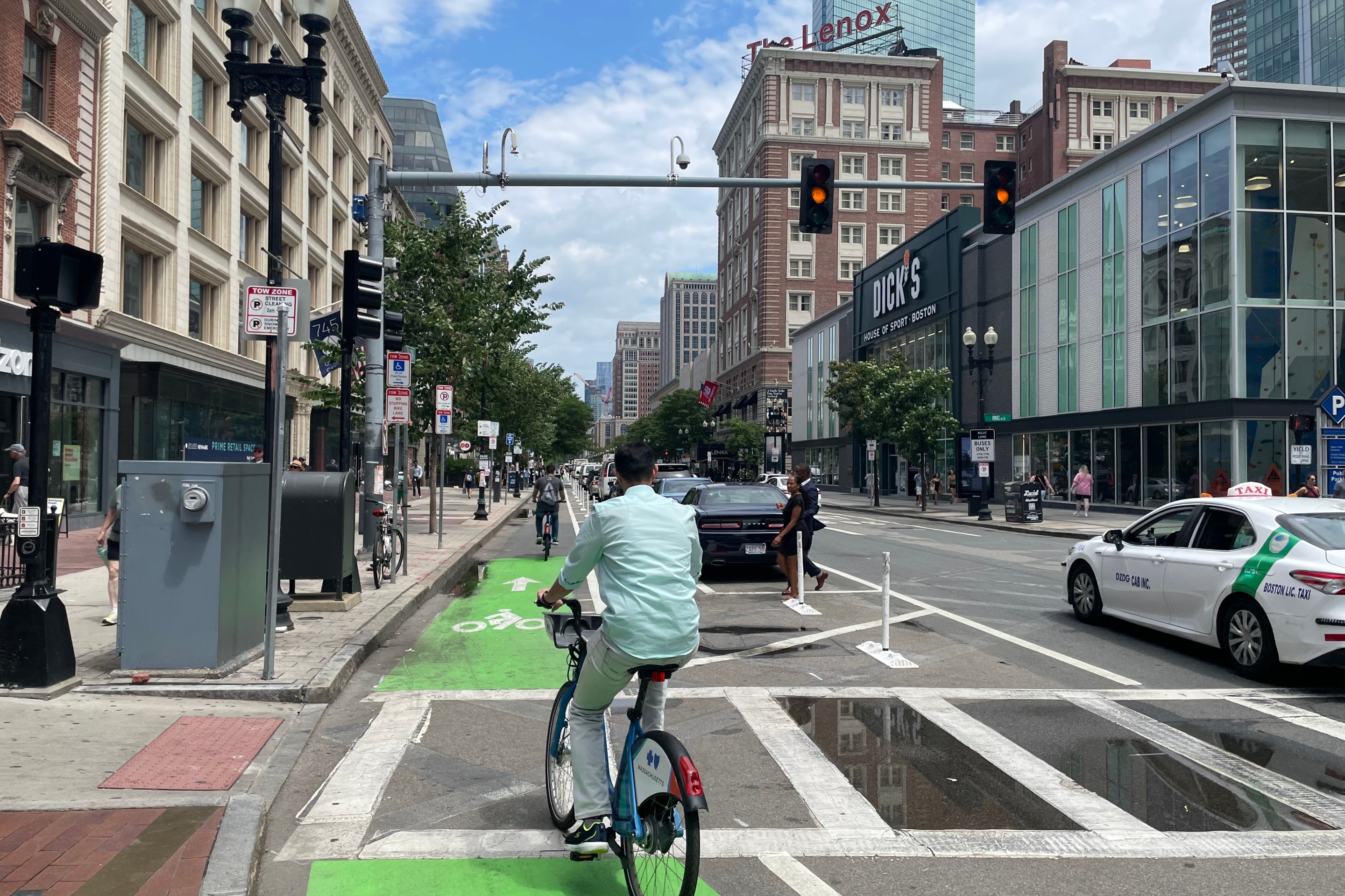
The BTD also wants to "drastically expedite" projects identified the city's planned network of protected bike lanes and paths (pictured at right). The city plans to delineate new "pop-up" bike lanes along key routes with cones or orange construction barrels.
In a slide deck accompanying Wessel's presentation, Commonwealth Avenue between the B.U. Bridge and Kenmore Square, Columbus Ave. in the South End, and Malcolm X Blvd. in Roxbury were all mentioned as potential locations for new bikeways.
"This (builds on) a lot of planning that we have already done at the BTD," said Wessel. "We have identified certain corridors that are in need of important cycling connections, and so this would also help essential workers and folks who are unable or unwilling to take public transit to try using bikes."
In identifying potential locations for these initiatives, "our fundamental focus is on health care workers and essential service personnel," said Vineet Gupta, Director of Planning for the Boston Transportation Department. "Programs that we are implementing focus on those first, but continue to look ahead" to anticipate the return of traffic during the phased reopening of the state's economy.
Gupta also said that the agency would seek community feedback, but that "this is going to be a faster process from what we normally have – normally community processes can take a very long time."
The short-term, reversible nature of the city's proposed strategies could let the city test and revise new street designs quickly.
"The pilot is the process," said Stacy Thompson, executive director of the LivableStreets Alliance, during the public testimony portion of the hearing (disclosure: Thompson is also a StreetsblogMASS board officer). "The Washington Street bus lane pilot in Roslindale was successful in part because we just got some signs out, we put cones out, we tested it and we surveyed after. There was not a single public meeting, but the public was engaged."
City Councilors at the hearing sounded enthusiastic for the city to get started, and in several cases they suggested additional ideas of their own.
"We'll be starting implementation later this month, and we'll be phasing in these improvements over the next several months depending on how the COVID-19 situation evolves," said Gupta. "It's something that the Mayor has asked us to start implementing as soon as possible."
