Photos: Green Line Extension Marks Halfway Point to Completion
On Thursday, Governor Charlie Baker, Lieutenant Governor Karyn Polito, Transportation Secretary and MassDOT CEO Stephanie Pollack, MBTA General Manager Steve Poftak, and other state officials toured the Green Line Extension construction site and announced that the project was 50 percent complete, and on schedule to open by the end of 2021.
Meanwhile, your Streetsblog editor skipped the press event and instead took a bike ride to document what a half-finished light rail line looks like.
The Green Line Extension will eventually extend to College Avenue in Medford at the Tufts University Campus, but I started my tour at Ball Square, the penultimate stop, where the foundations are being laid for a new station just over the Medford city line. According to MBTA plans, one station entrance will descend from the Broadway overpass in Somerville, just to the right of this photograph’s vantage point; a second access point will approach the platforms from Boston Avenue in Medford, visible on the left edge of this photo:
(click any photo in this post to enlarge)
The Green Line’s contractors also recently opened the new Broadway overpass, which carries a pair of new buffered bike lanes into Ball Square:
Continuing south, foundations are also being laid for the new Magoun Square station platforms, which will be accessed via an elevated walkway from the Lowell Street overpass. According to the MBTA’s plans, the new Green Line tracks will straddle the station platform, visible below:
Just east of Lowell Street and the Magoun Square station, the Somerville Communty Path, the local segment of the Mass. Central Rail Trail, meets the future Green Line.
As part of the Green Line Extension project, that path will be extended from Lowell Street to the new Lechmere station, where developers have already built another segment of pathway to the Charles River (more on that below).
At the Gilman Square station, the Community Path will cross School Street above the Green Line tracks, and continue along the top of a retaining wall behind the new Somerville High School, which is also under construction (at right in the photo below). Somerville is also in the process of planning for new transit-oriented development with new streets and civic plazas for the vacant land at the left edge of this photo:
At this point in my bike tour, it became considerably more difficult to follow the future Green Line Extension on my bike, because just east of Gilman Square, the future Green Line parallels the McGrath Highway, a major barrier to bike riders and pedestrians in East Somerville.
According to plans posted on the Commonwealth’s website, East Somerville’s Green Line station will have one entrance that will only be accessible from the Community Path, a long 500 foot walk from Washington Street.
Without the Community Path, the station area is completely inaccessible, so, in lieu of a photograph, here’s a photo mosaic of the station plans overlaid on a Google Map aerial view of the station area:
A few blocks to the east, another McGrath Highway overpass offers this view of the new Green Line’s other branch, which will follow the Fitchburg Line commuter rail tracks to Union Square. Also visible here against the skyline is the high truss that will carry the Community Path over the tracks:
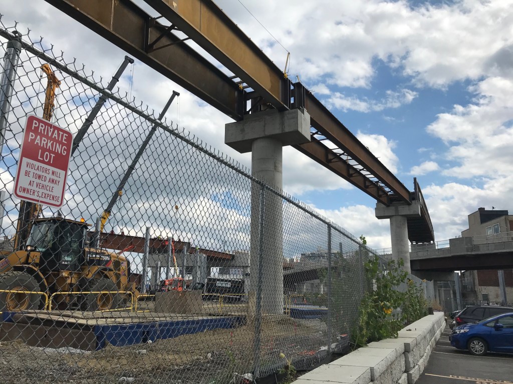
Crossing the city line into Cambridge, the two branches of the new Green Line will join together and run over a new Lechmere viaduct:
Nearby, I was pleasantly surprised to find that the developers of the Cambridge Crossing project have already built a significant section of the new Community Path, which is open for riding all the way from the future Lechmere station area to North Point Park on the Charles River waterfront:

Read More:
Streetsblog has migrated to a new comment system. New commenters can register directly in the comments section of any article. Returning commenters: your previous comments and display name have been preserved, but you'll need to reclaim your account by clicking "Forgot your password?" on the sign-in form, entering your email, and following the verification link to set a new password — this is required because passwords could not be carried over during the migration. For questions, contact tips@streetsblog.org.