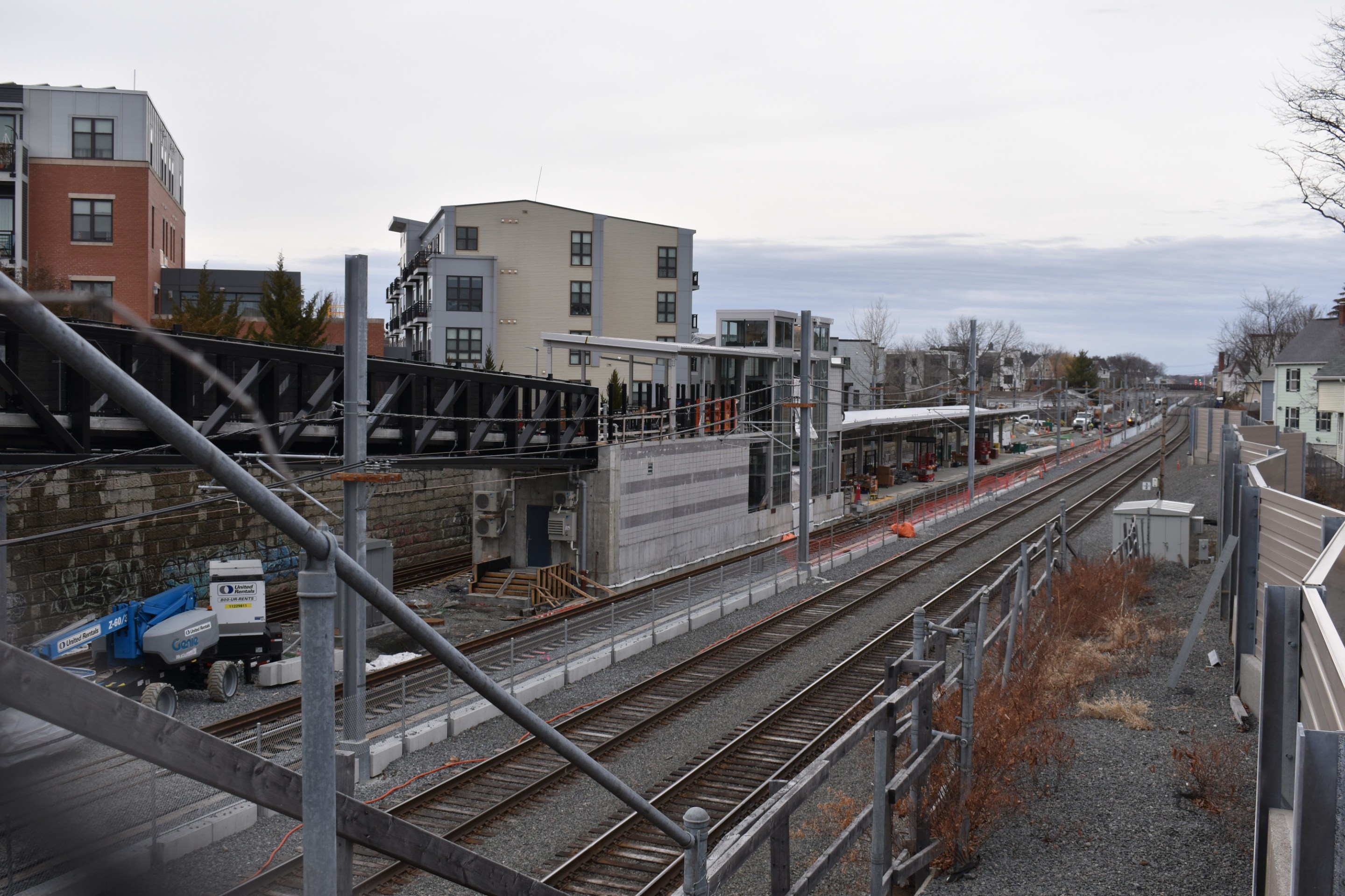
The new Magoun Square Green Line station under construction, seen from Lowell Street. This station is on the longer Medford branch of the Green Line Extension, which is expected to open later this year.
It won't be open until the longer Medford branch of the Green Line Extension opens for passengers later this year, but the new Community Path Extension in Somerville is beginning to look like a usable trail, with new light fixtures and a base layer of pavement in place.
We took a few photos of the project during last week's mild weather:
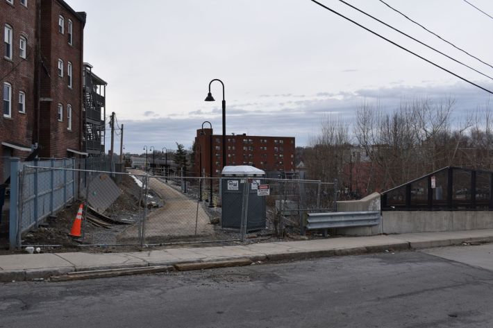
The under-construction Community Path Extension pictured from near Lowell Street, where the Community Path currently ends. From here, the new path will continue 2 miles to the Lechmere Green Line station.The under-construction Community Path Extension pictured from near Lowell Street, where the Community Path currently ends. From here, the new path will continue 2 miles to the Lechmere Green Line station.
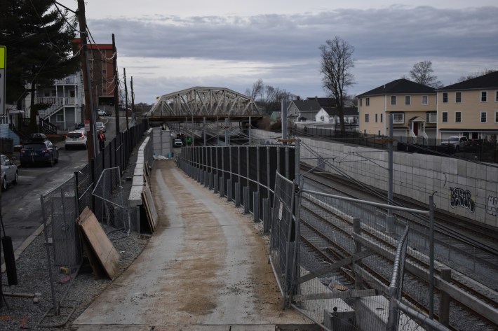
Light fixtures have been installed on many segments of the new Community Path. This is a view of the path construction looking west from Walnut Street, near Somerville's main library and high school. Between Walnut and Central Street, the path will cross city streets in crosswalks on an embankment above the Green Line tracks.Trail lighting has been installed on many segments of the new Community Path. This is a view of the path construction looking west from Walnut Street, near Somerville's main library. Between Walnut and Central Street, the path will cross city streets in crosswalks on an embankment above the Green Line tracks.
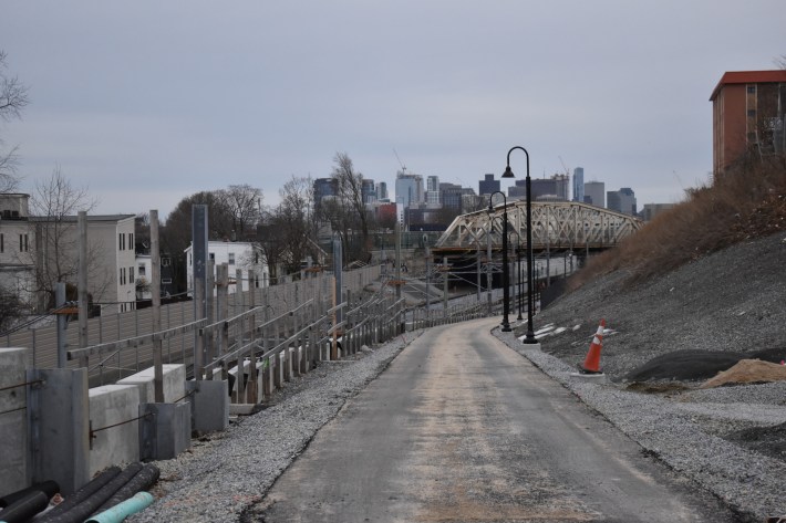
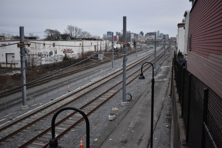
A view toward downtown Boston from the Walnut Street bridge. From here, the path descends to the level of the new Green Line tracks to pass beneath the McGrath Highway, visible in the distance.A view toward downtown Boston from the Walnut Street bridge. In the distance, the path descends to the level of the new Green Line tracks to pass beneath the McGrath Highway.
The Somerville Community Path connector ramp from Cross Street, looking northwest towards McGrath Highway, in East Somerville. The main path continues below the Cross Street bridge along the new Green Line Tracks.The Somerville Community Path connector ramp from Cross Street, looking north towards McGrath Highway, in East Somerville. The main path continues below the Cross Street bridge along the new Green Line Tracks.
A view of the Somerville Community Path under construction from the Cross Street overpass, looking south towards Washington Street and the East Somerville Green Line station.A view of the Somerville Community Path under construction from the Cross Street overpass, looking south towards Washington Street and the East Somerville Green Line station.
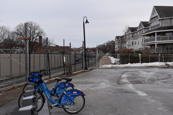
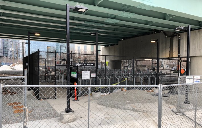
A new "pedal and park" bike parking area has been installed in the shelter of the new Lechmere Green Line station near the end of the Community Path extension. From here, an existing multi-use path continues along Morgan Avenue to North Point Park and the North Bank Bridge connection to Charlestown.A new "pedal and park" bike parking area has been installed in the shelter of the new Lechmere Green Line station near the end of the Community Path extension.
A city official acknowledges that the area is "a high threat" to pedestrian safety, but after 6 years of design work, the city still doesn't have a shovel-ready plan.
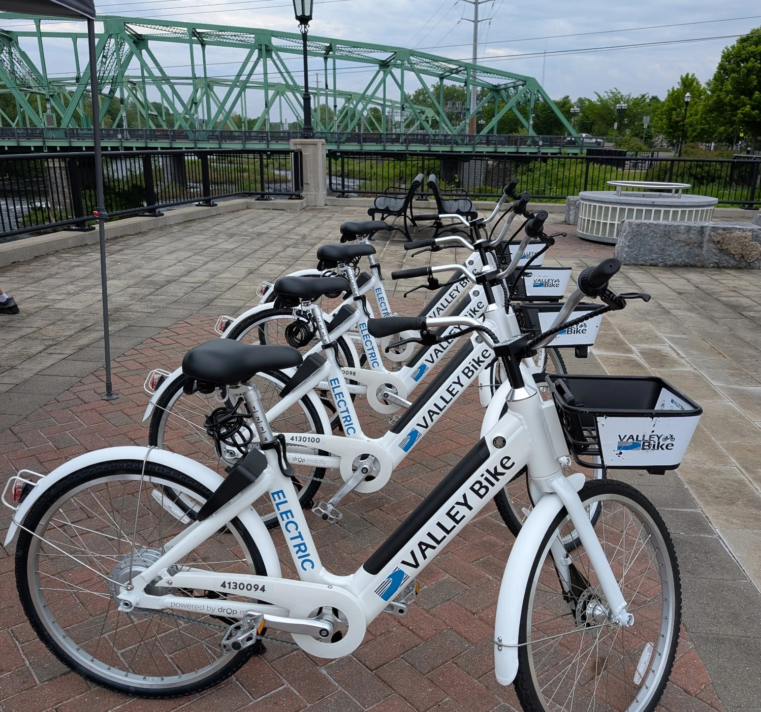
A new "Microtransit and Last Mile Transit Grant" program, funded with $10 million in Fair Share revenues from last year's supplemental state budget, will help cover operations costs and potential expansion of the ValleyBike regional bikesharing network in Hampshire and Hampden Counties.
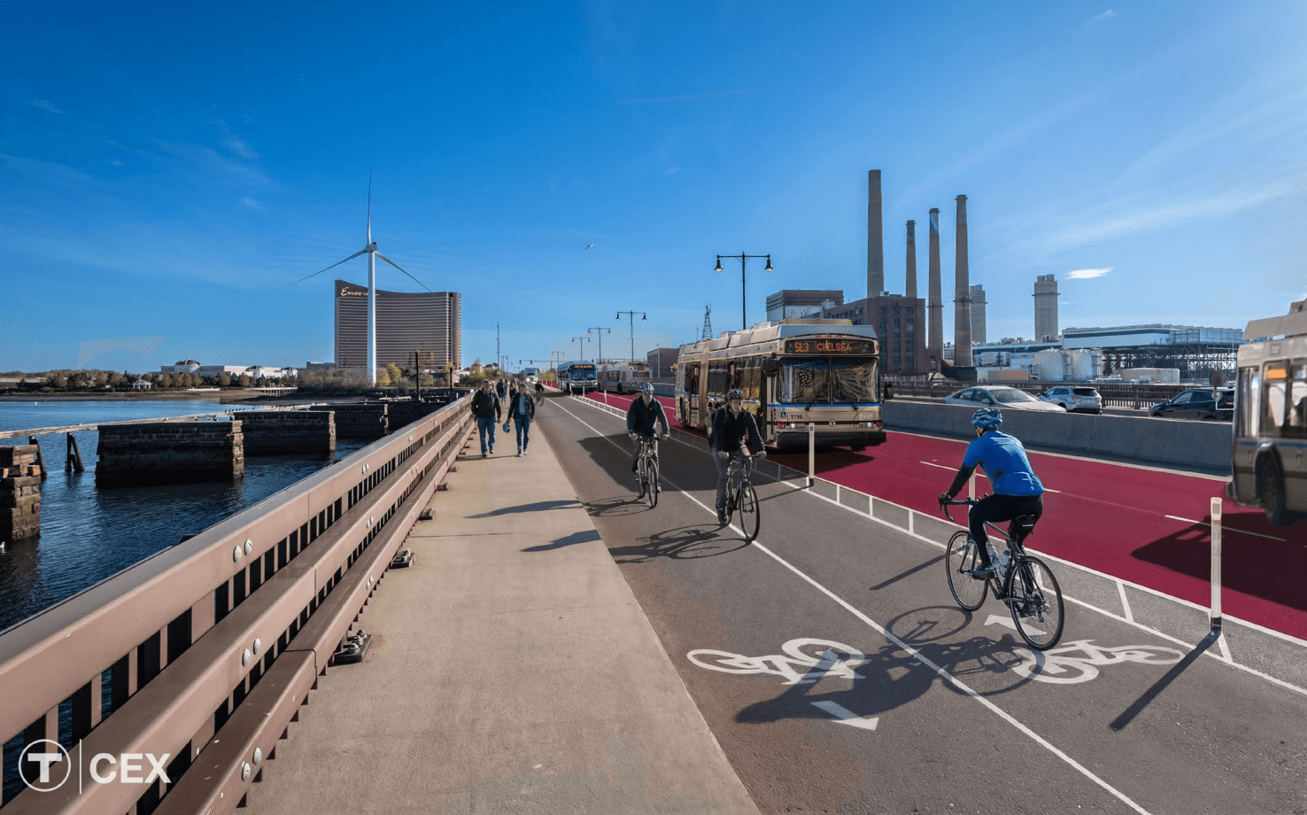
Because it would connect multiple destinations where transit demand is high, the T's models predict that an extended Silver Line would serve more than 15,000 additional daily bus riders.