Skip to Content
Streetsblog Massachusetts home
Log In
Trails

Waltham Begins Construction On 2.7-Mile Segment of Mass. Central Rail Trail

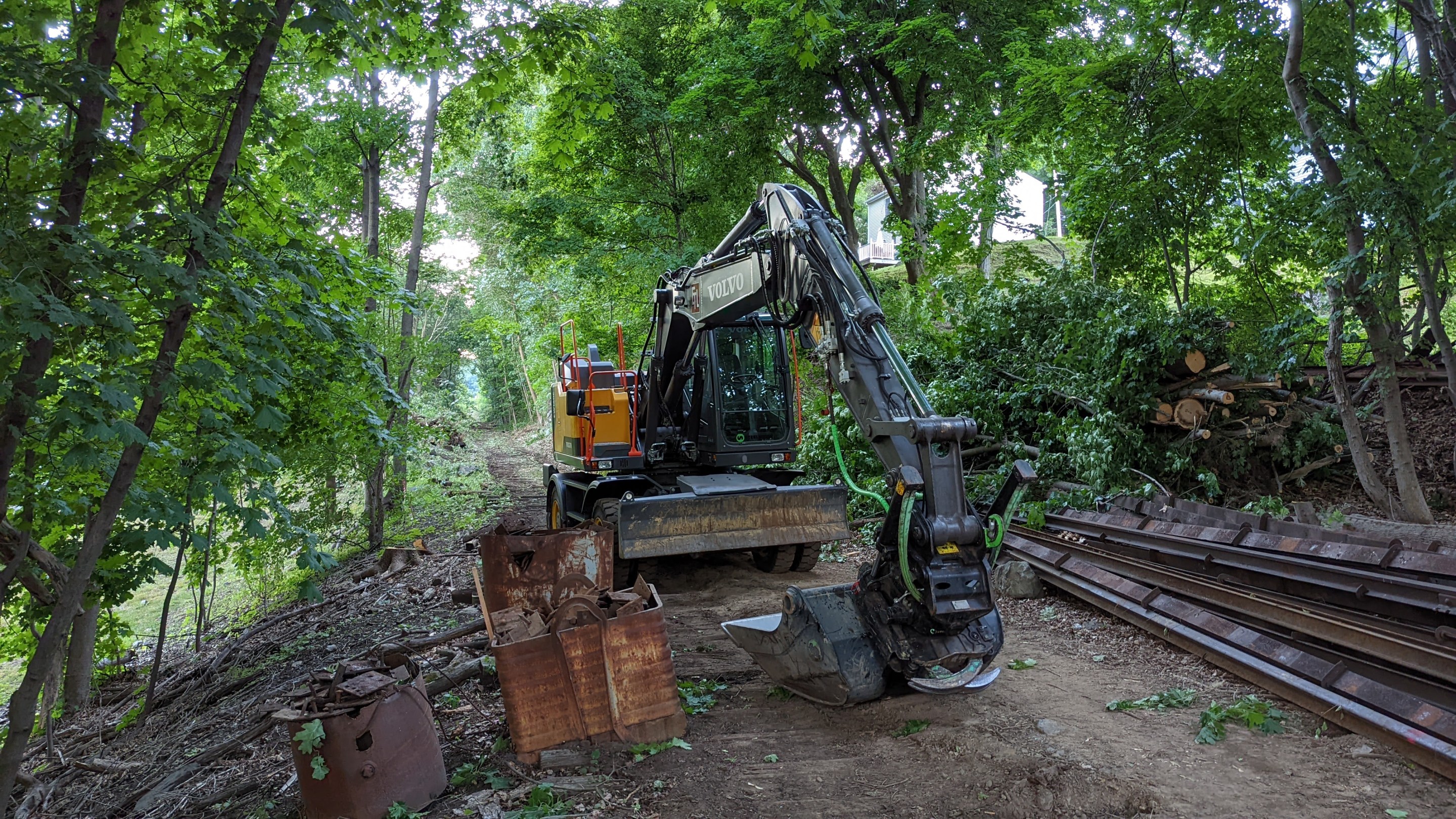
A backhoe rests on top of old railroad ties next to a pile of old rails along an abanoned railroad corridor surrounded by leafy trees.

Construction work is underway on the new Mass. Central Rail Trail corridor in Waltham. Photo by David Loutzenheiser.

The City of Waltham has started construction on a 2.7-mile segment of the Mass. Central Rail Trail that, when complete, will create an off-street, east-west route across most of the Watch City.

The project, known locally as the Wayside Trail, will upgrade the abandoned Mass. Central Railroad right-of-way, which skirts the north side of downtown Waltham on its path between Weston and Belmont, with a new paved shared-use pathway extending from the suburban office parks along Route 128 near the city's western boundary to Beaver Street near the campuses of Bentley University and the UMass College of Agriculture.

"Construction of the Waltham Wayside Trail has started and the city contractor ET&L and their subcontractors will be working within the Commonwealth of Massachusetts's right-of-way to complete this City project," according to a July 5 notice from the City of Waltham.

With the groundbreaking for this project, two major segments of the Mass. Central Rail Trail are currently under construction in the greater Boston region.
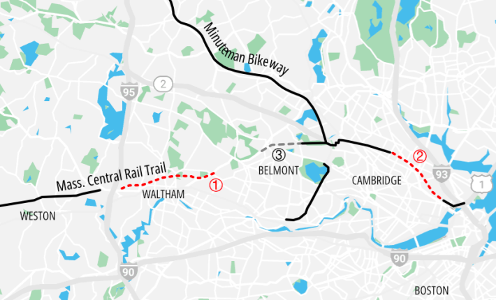
A map of the Mass. Central Rail Trail corridor from Weston to Boston, showing the connecting rail-trails like the Alewife-Watertown Greenway and the Minuteman Commuter Bikeway. Two projects, illustrated as red-dashed lines, will fill in major gaps in the east-west Mass. Central Rail Trail corridor between Waltham and Charlestown in Boston.
A map of Mass. Central Rail Trail projects in the greater Boston region as of July 2022. Solid black lines indicate existing off-street paths in the Mass. Central Rail Trail network; dotted red lines indicate projects currently under construction: (1), the Waltham Wayside Trail project, and (2), the Somerville Community Path, being built as part of the Green Line Extension project. The dashed gray line marked (3) in Belmont will be the first phase of the Belmont Community Path, which could go under construction in 2026.
A map of Mass. Central Rail Trail projects in the greater Boston region as of spring 2023. Solid black lines indicate existing off-street paths in the Mass. Central Rail Trail network; dotted red lines indicate projects currently under construction: (1), the Waltham Wayside Trail project, and (2), the Somerville Community Path, being built as part of the Green Line Extension project. The dashed gray line marked (3) in Belmont is the first phase of the Belmont Community Path, which could go under construction in 2026.

The other segment, the Somerville Community Path, is expected to open later this year after the completion of the Green Line Extension to create a continuous off-street path from the Belmont-Cambridge border to Paul Revere Park in Boston.

In between Waltham and Cambridge,  the Town of Belmont is currently designing the first phase of its own Mass. Central Rail Trail segment, a project that could begin construction in 2026.

And a short distance to the west in the suburb of Weston, a 4.5 mile segment of the Mass. Central/Wayside Trail, between the Boston Post Road in Wayland to the Fitchburg Line commuter rail tracks, opened in 2019.

A small gap will remain between Weston's section, which ends about half a mile west of Route 128,  and the current Waltham project, which will end one block east of the Route 128 highway. The Department of Conservation and Recreation is reportedly working on plans to fill that short gap; meanwhile, intrepid and able-bodied trail users can connect the two segments by using the abandoned railroad bridges over Route 128 and the MBTA Fitchburg Line (read Juliana Cherston's November 2021 travel guide for details).
Stay in touch

Sign up for our free newsletter

More from Streetsblog Massachusetts

State Officials Say Work to Improve Safety at Lethal Memorial Drive Crash Site Will Begin On Monday

The state's parks agency will reduce Memorial Drive's speed limit and create more space for the area's busy bike and pedestrian traffic.

October 4, 2024

Red Line’s Braintree Branch Reopens With 37 Fewer Slow Zones

By eliminating dozens of slow zones, the T expects the typical round-trip on this segment of the Red Line to run 24 minutes faster than it did a month ago.

September 30, 2024
See all posts